A water infrastructure in Southern France.
Pingyao Missun
2021
At the end of the 17th century (1662 – 1681), a French engineer, Pierre-Paul Riquet designed “one of the most extraordinary civil engineering achievements of the modern era”: Canal du Midi. It brings together the canal itself (240km), as well as the canals and gullies that feed it (120km in all). The canal is located in the Occitanie region in Southern France. The Canal’s original objective is to connect the Mediterranean Sea to the Atlantic Ocean without going through Spain, to develop trade under the reign of Louis XIV. The Canal combines technological innovation, architectural quality and the beauty of the landscapes, it becomes a reference structure, set precedents for many engineering feats.
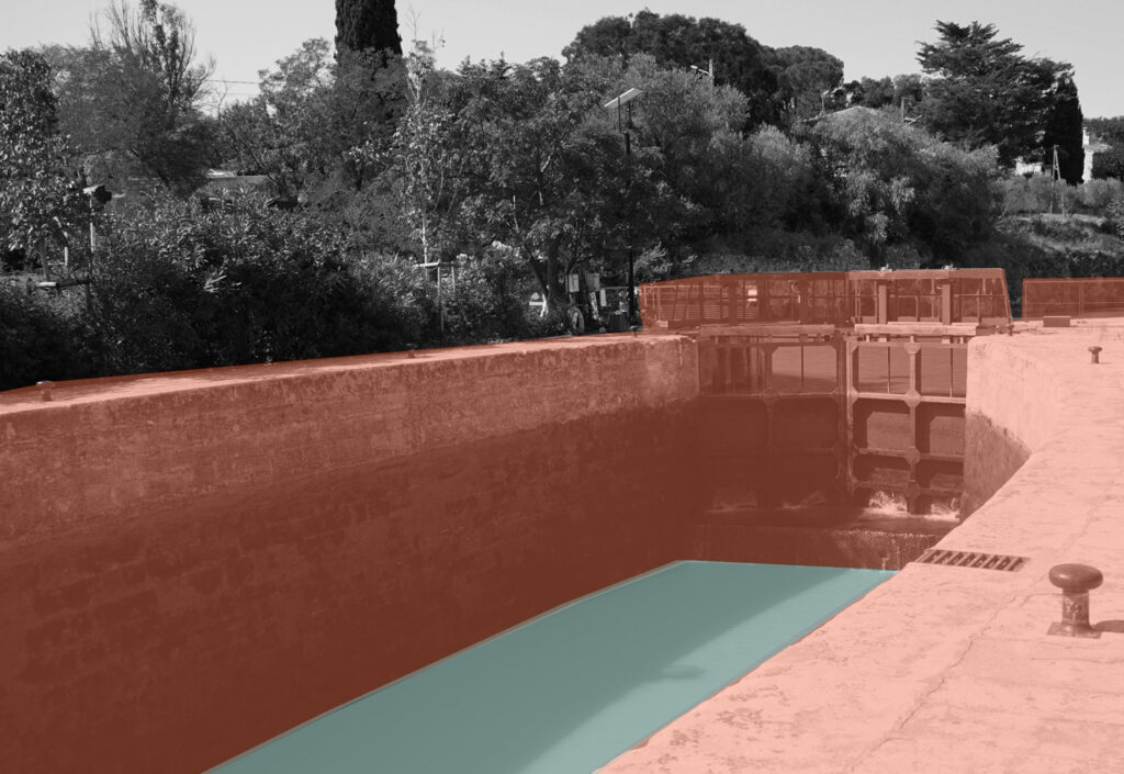
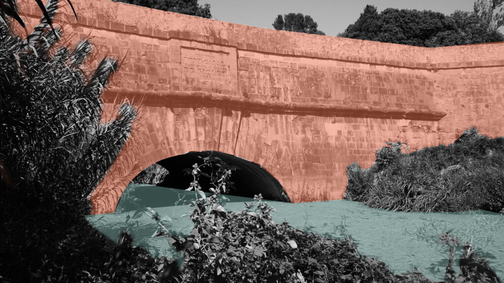
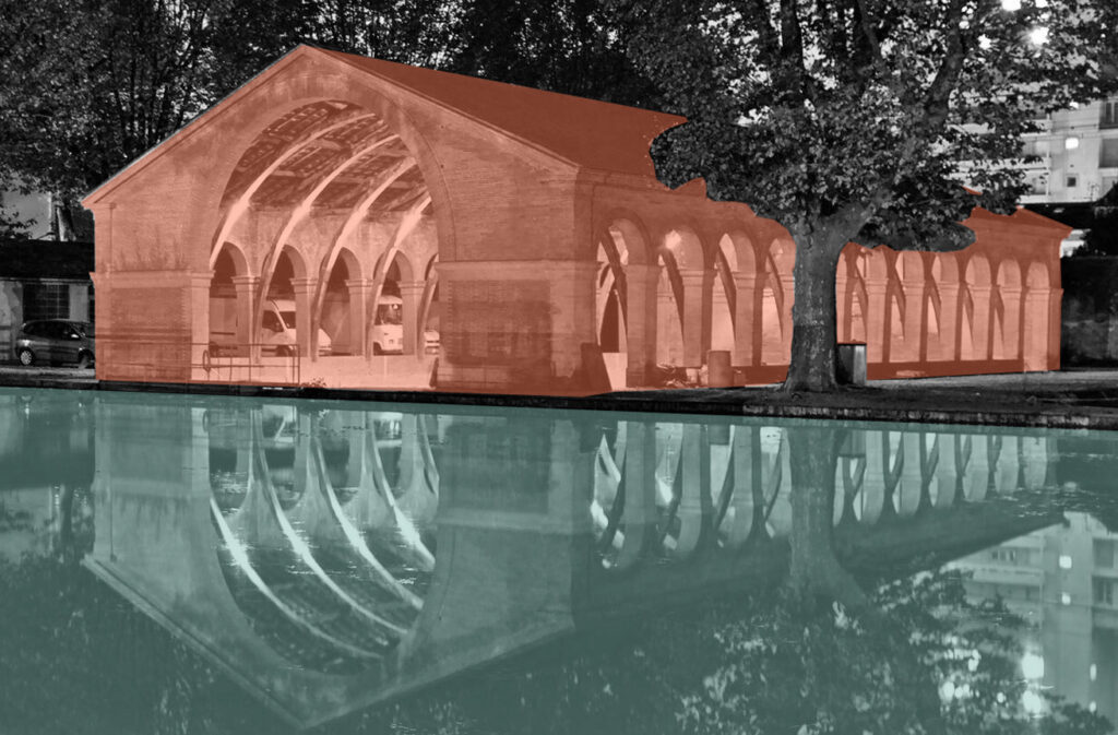
With 328 structures, the hydraulic works remark the “heavy engineering” of this truly unique canal, where nature forms a constantly delightful backdrop to all manner of staircase locks, aqueducts, siphons, spillways, feeders, dry docks, and a tunnel (10 dams, 63 active locks of the main route, 90 aqueducts and 14 canal bridges).
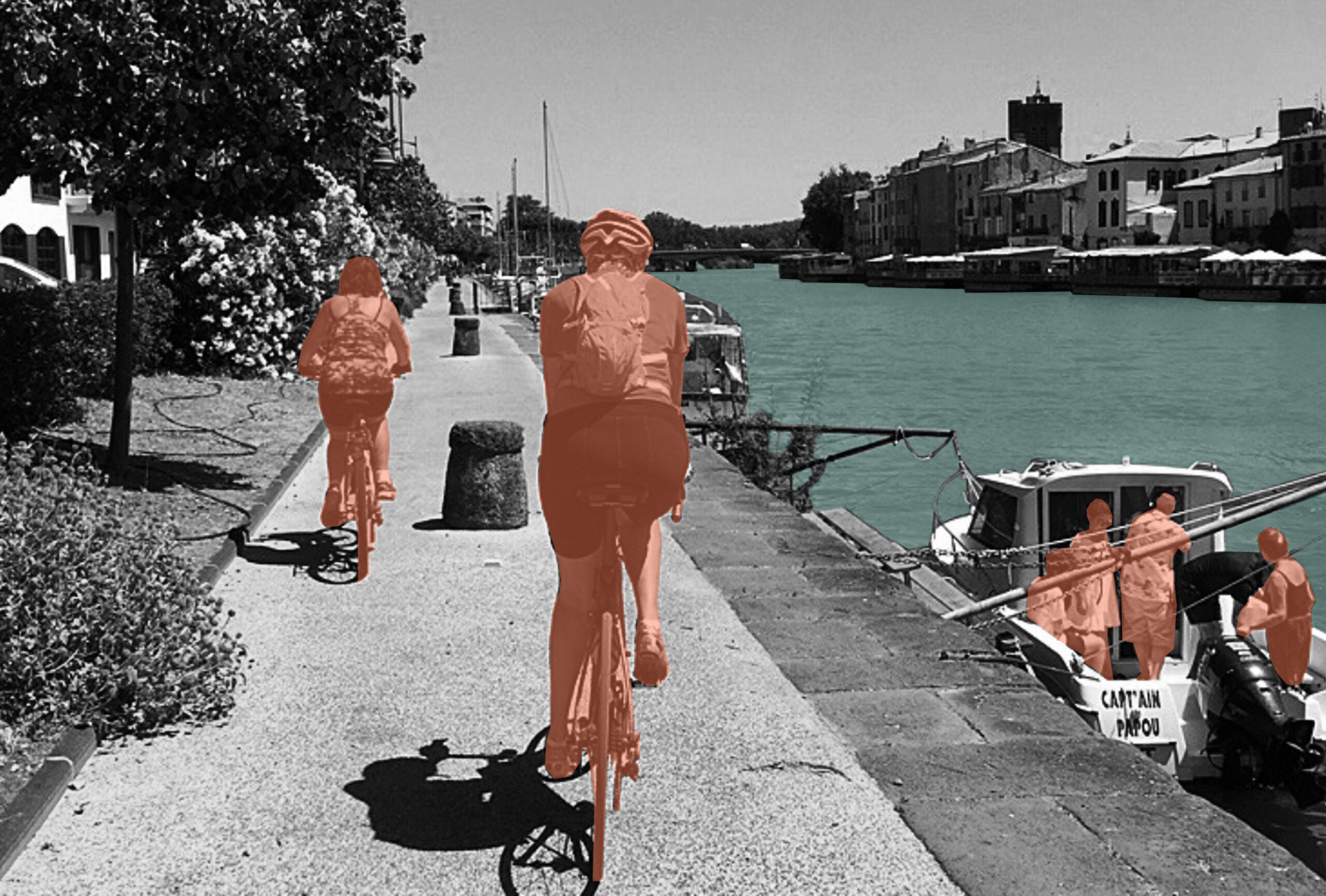
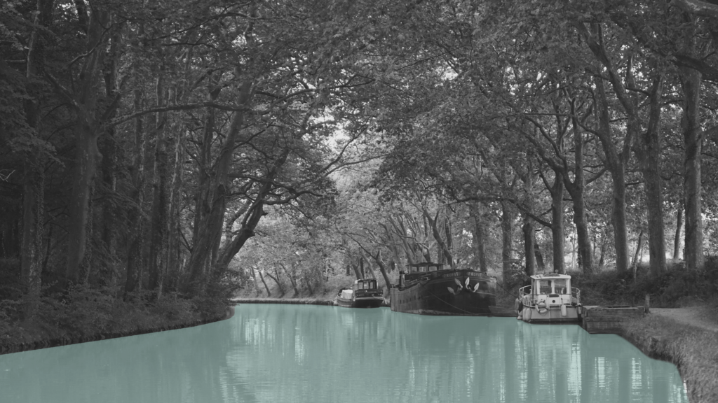
Traveling by boat then and now – the activities of crossing the lock and watching the lock in action: when boats enter into a lock, water is drained from the basin, or filled into it, allowing the boat to move on to the next section. Along the canal, some locks are flanked with cafes and gardens, while others are simpler in nature. For bikers, various locks serve as water distribution points and lock keepers are usually friendly and open to chatting.

The canal is a complex hydraulic structure, the first of its size to link two large hydrographic basins (Adour-Garonne and Rhône-Méditerranée), the majority of canals following the slope of a single valley.
The hydraulic management of the canal needs to take into account the changes in water needs and the availability of the resource during the year, in particular during the summer season, with the convergence of the most water withdrawals of peaks in traffic, agricultural withdrawals and the constraints of flows withdrawable from rivers.
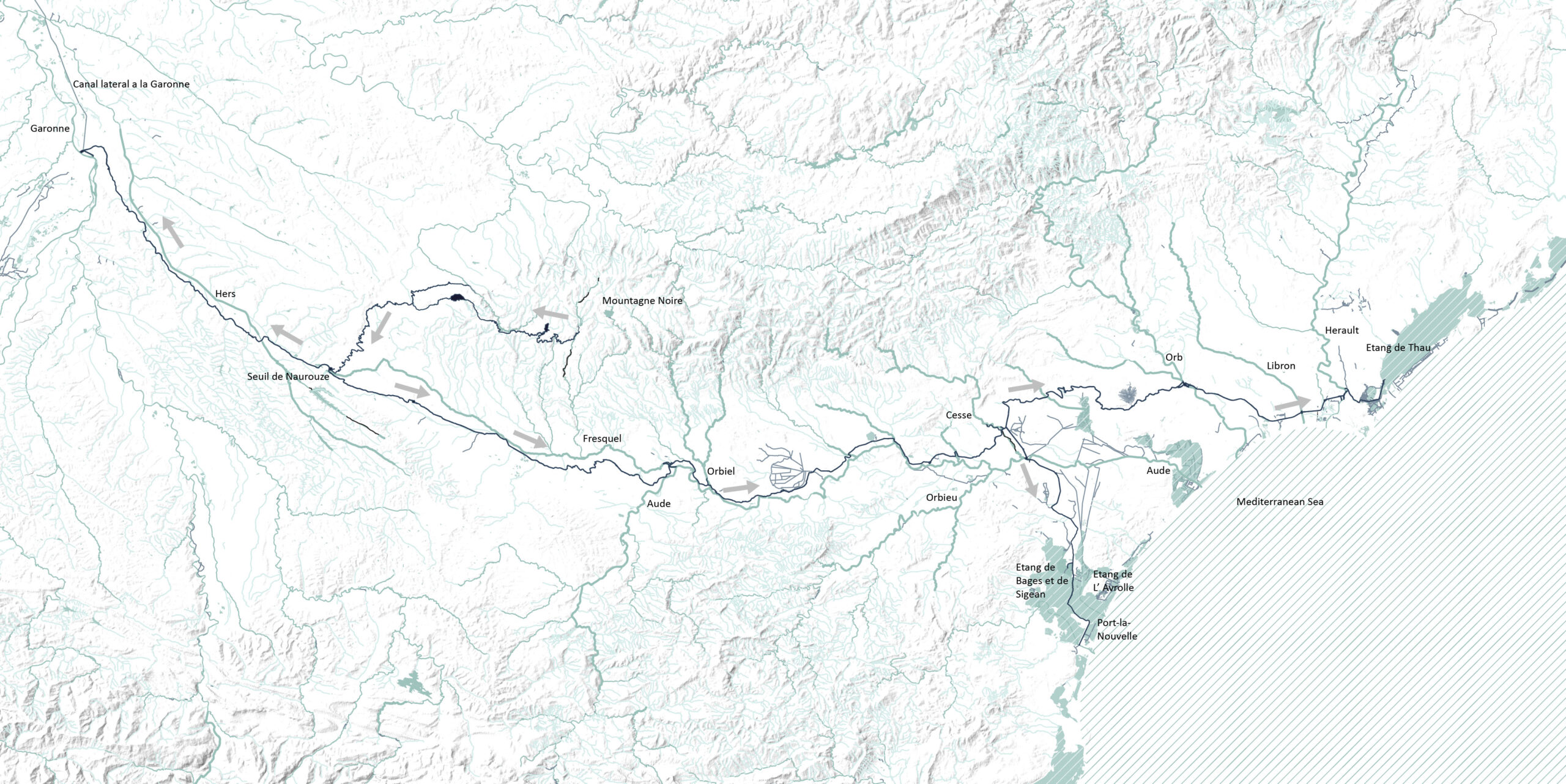
The canal du Midi has 360 km total route includes 278 km of canals and 82 km of supply system. The canal gets the water from the Montagnes Noires, the black mountains. The highest places of the watershed (threshold of Naurouze), the canal flows in two directions.
Circular Stories
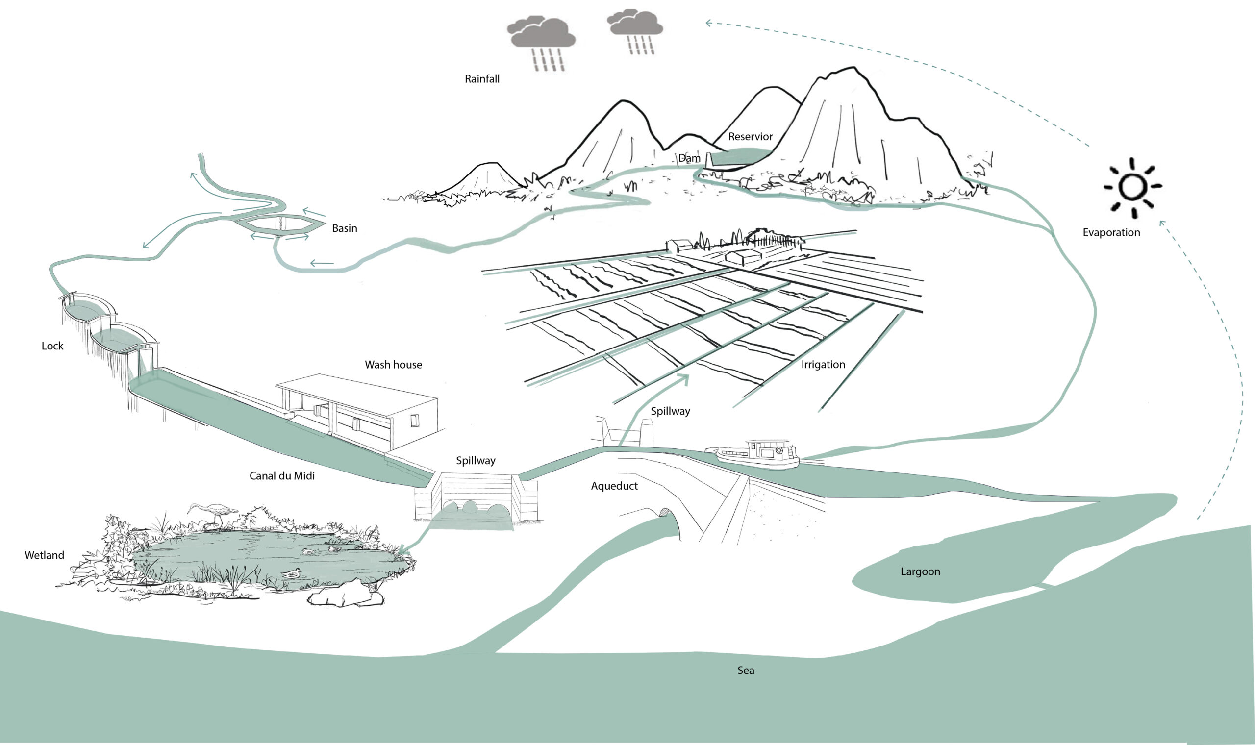
Thus, this diagram shows a process of how the water from the reservoir (rivers and streams with water from both rainfall and underground) be directed to the canal. Along with the routing, the water of the canal was exchanged with many watercourses and directed to agricultural land and wine-growing areas, run into lakes, marshes, and lagoons and finally ended up in the sea.
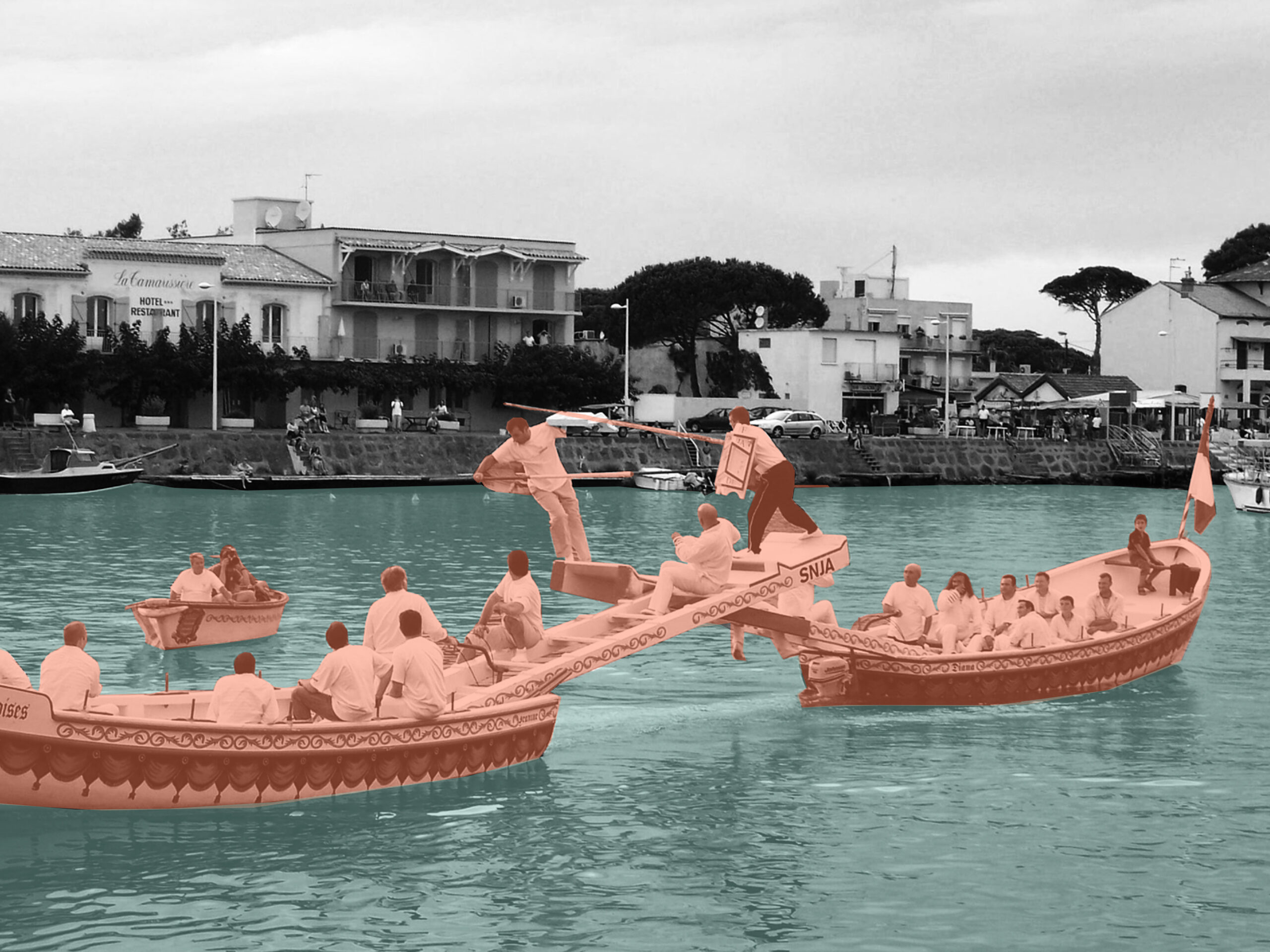
The canal itself is a habitat for some species, the saltwater marshes and lagoons are great habitats for many birds, aquatic and amphibian species also plants. The flowing water is also used by people for many activities such as washing clothes and cleaning, swimming in some water basin areas, and mostly, boating.