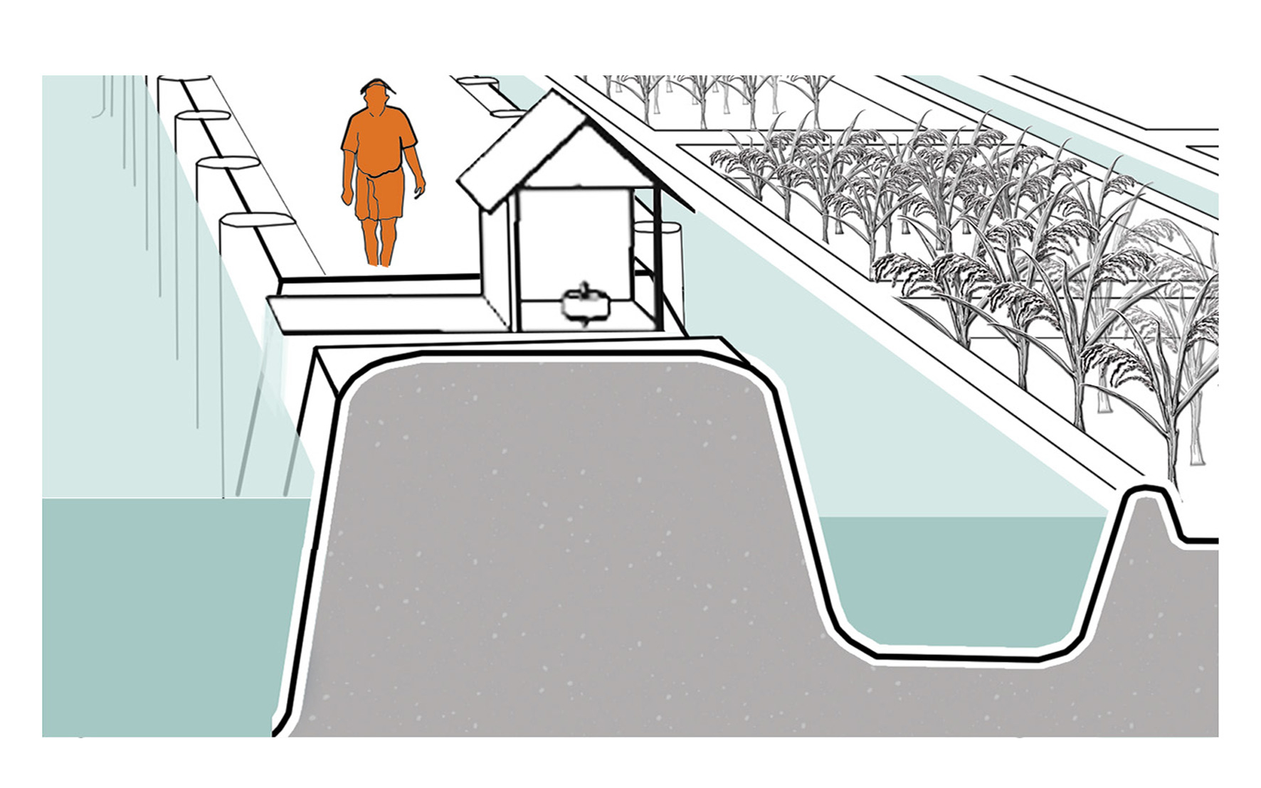
An indigenous technical device placed at the edge of the Kayalnilam for pumping water out from low-lying areas to the major canals or backwaters. It consists of a submerged brass vessel that sucks water out and is run by an electric motor kept inside the pump house. The sucked water flows out through a rectangular brass box.
Project: Kuttanad Kayalnilam Agrosystem, Kerala, India
Climate: Tropical monsoon
Year: 1880-1974 (a modified version is still in use)
Water type: Seasonal mixing of saline and freshwater
Landscape: Polder landscape in a deltaic basin
Altitude: -3 – +1.5 m.a.s.l
Soil condition: Sandy loam clay formed from riverine or lacustrine deposits
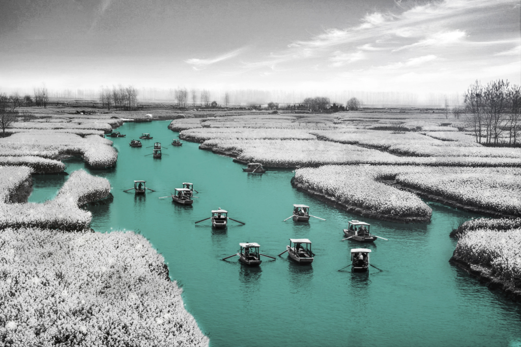
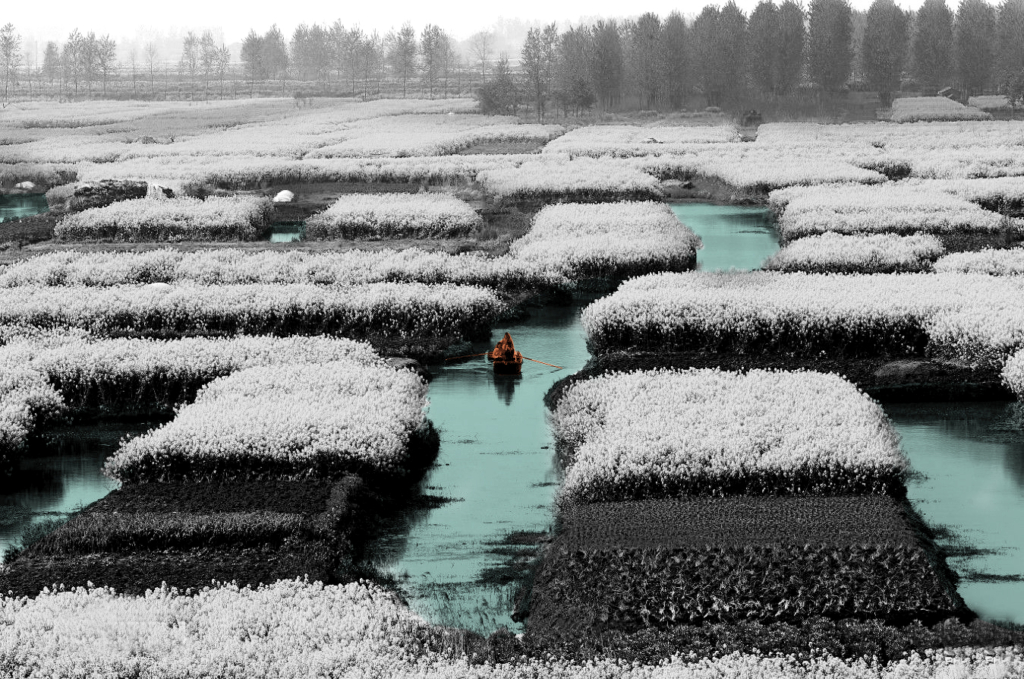
A traditional water-land utilization technique developed by Chinese ancestors.
Rapa Surajas 2019
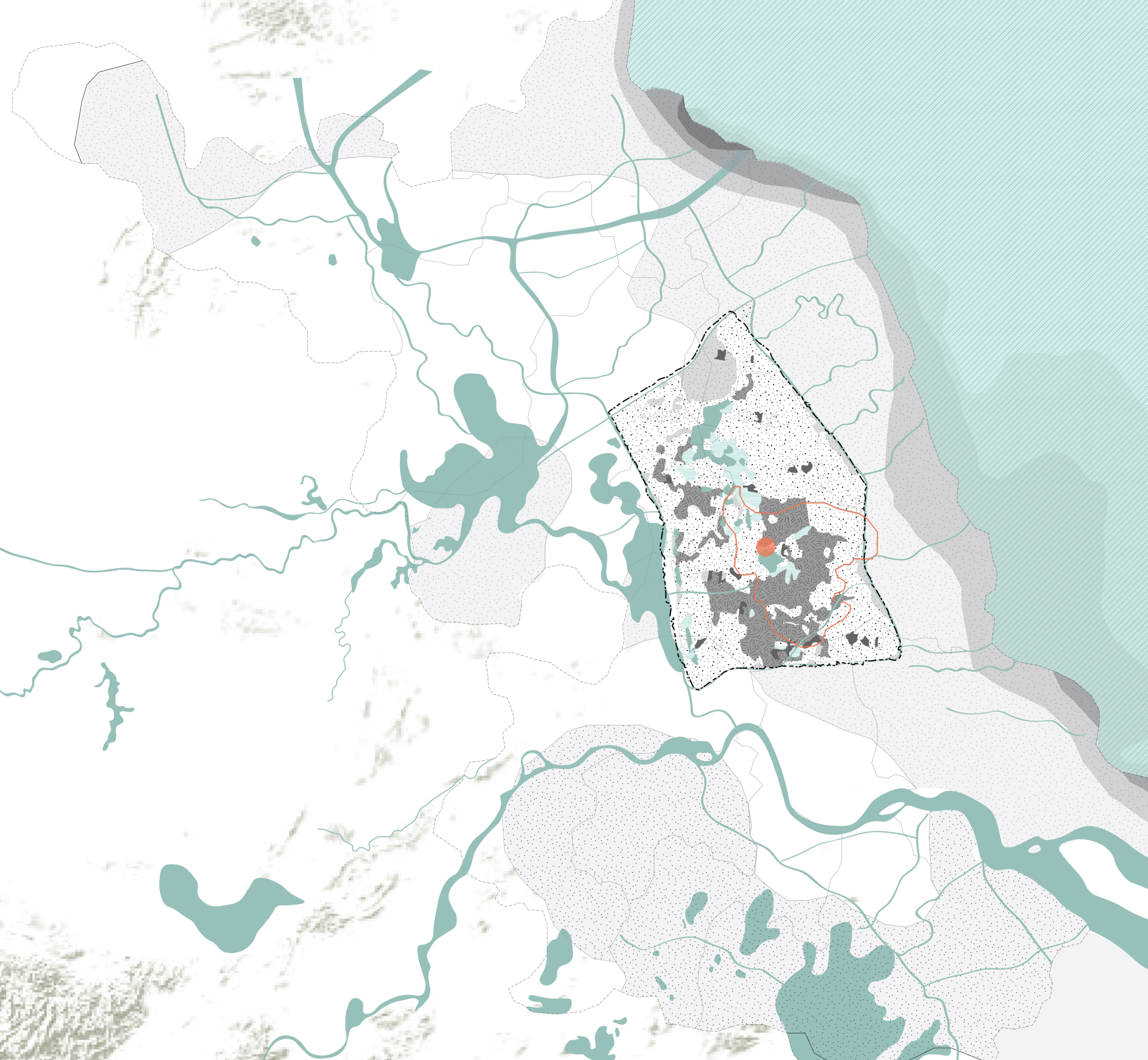
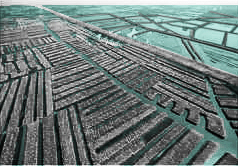
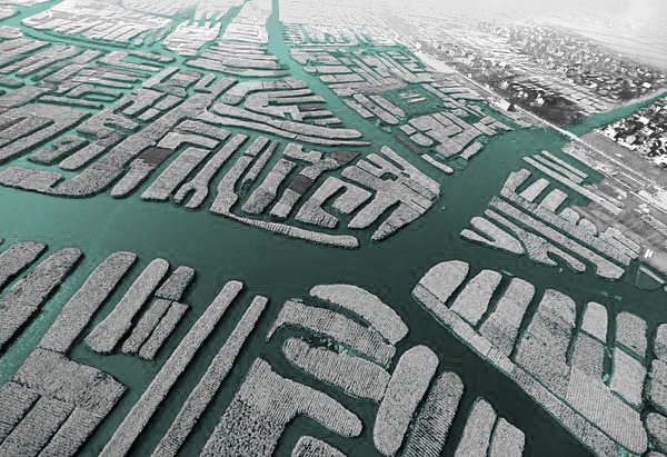
The map illustrates the landscape condition of the area which is located inside the Lixiahe plain. The geographical condition is a low-lying area surrounded by higher land as the borders. Lixiahe plain is highly influenced by the rivers and the Yellow Sea since it is a deltaic area with an average height of 2.5 meters above sea level. The development of the Yellow river brought various types of soil and sedimentation to the area, and this led to the changed of the ecological condition of the wetland.
Landscape condition is not the only factor that triggered the Chinese ancestor to invent the raised field, but the sociological condition was also a significant aspect. Xinghua is located in the area surrounded by major rivers which were distinctively an important commercial trade area (Yanying etl., 2014). The population overgrew which led to massive food demand. This essential problem can only be solved by increasing the cultivable area (The People’s Government of Xinghua City ,2014).
As a consequence, Xinghua people began to explore the possibility to increase cultivable land. One of the potentials brought by the occurrence of the hygrophytes which began to grow in the area (The People’s Government of Xinghua City, 2014), this is the indicator of the fertile soil quality brought by the yellow river. Xinghua people began to dig the soil from the river and mounding the earth platform to create the floating farmland. It is when the raised field has begun to form.
Catchment map shows different type of soil and sedimentation brought by the Yellow River.
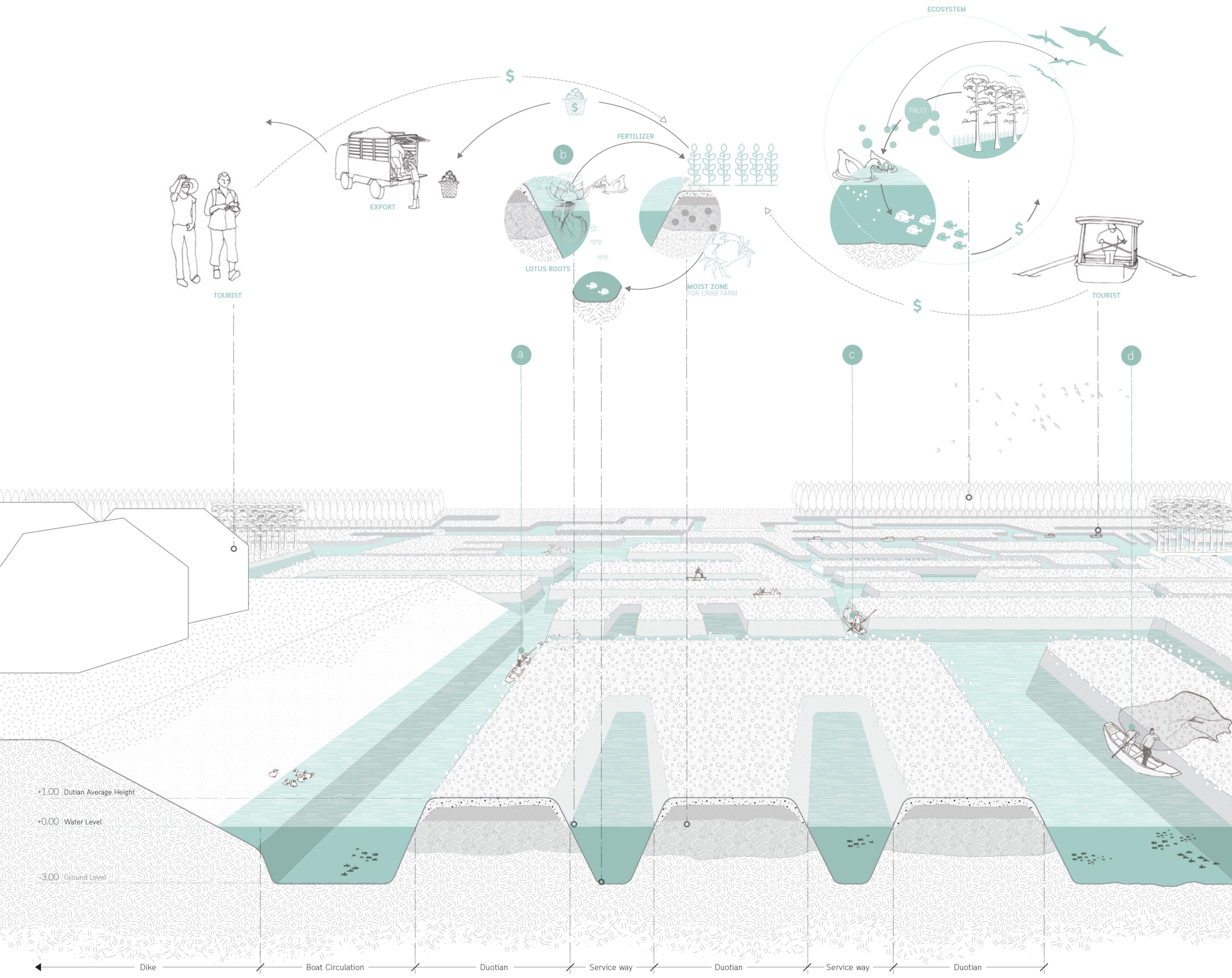
More than thousands of raised fields had been constructed to produce agricultural products for the community. It created a unique landscape pattern for the area. Xinghua became the important cultivated land and the Duotian-raised field also contributed to a flood control system of the area.
Although this technique has been applied in various areas all over the world, Xinghua Duotian is one of the few traditional systems which is still functional. Its long history and adaptability to the excessive water condition make Xinghua Duotian different from other raised field systems. It is recognized as an example of sustainability in agriculture (The People’s Government of Xinghua City, 2014).
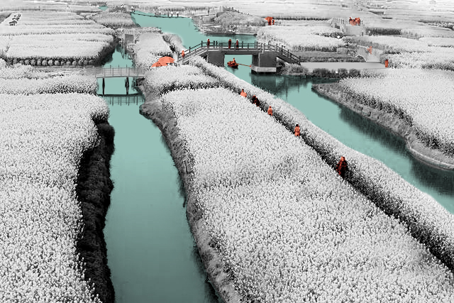
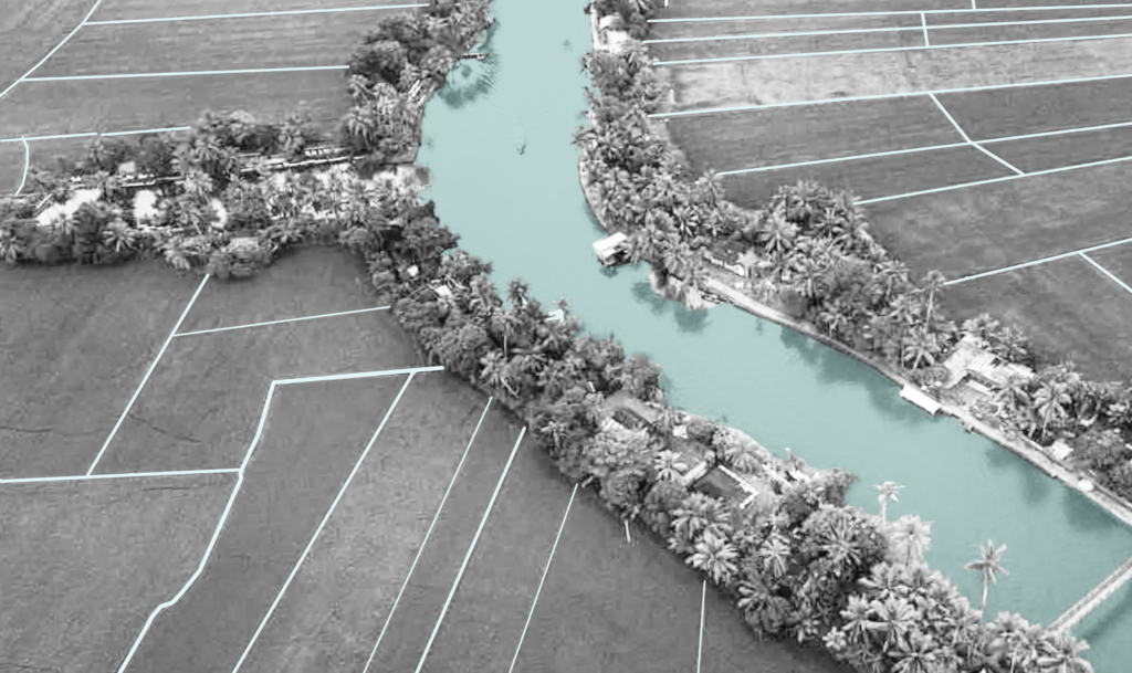
Tourist routes (top left); traditional way of watering vegetation (top right); forest Zone at the border of the area (middle left); the distinct differences between raise field pattern and traditional rice field (middle right); aerial view of the area and nearby settlement (bottom left); atmosphere of in the area (bottom right).
Circular Stories
The previous flood-prone area has been sustainably utilized by combining forestry, agriculture and aquaculture. The trees planted on the ridges provided fruits and food for the ducks, feeding fishes in the ditches, raising crabs and lobsters inside the soil of the raised field. The natural aqua-planting became a great source of food for birds and ducks while their roots acted as a high quality fertilizer (The People’s Government of Xinghua City, 2014). The new ecological network has contributed to the growth of the crops and created a remarkable landscape to attract a discrete number of tourists. The area is fully established, bringing considerable economic benefits while securing biodiversity and ecosystem services.
A traditional paddy farming system below sea level.
Naeema Ali 2020
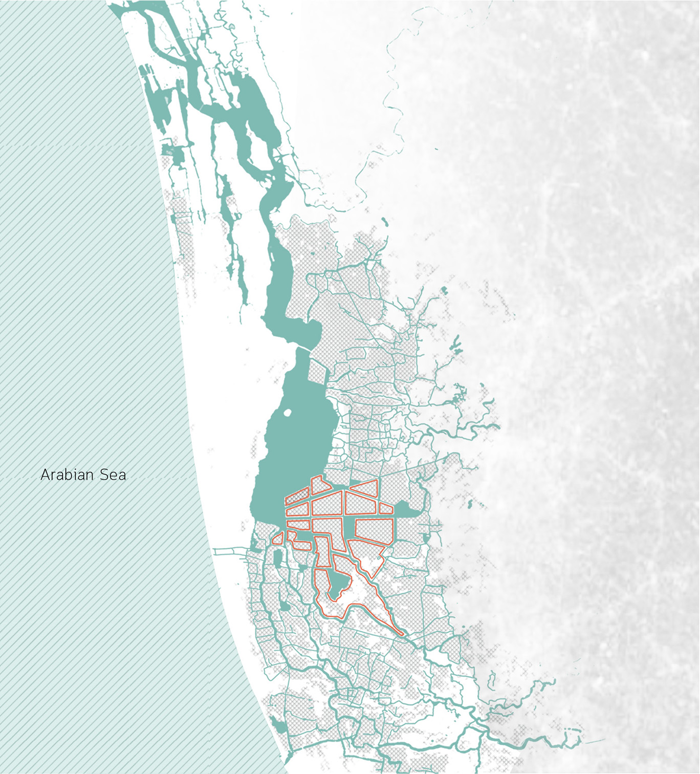
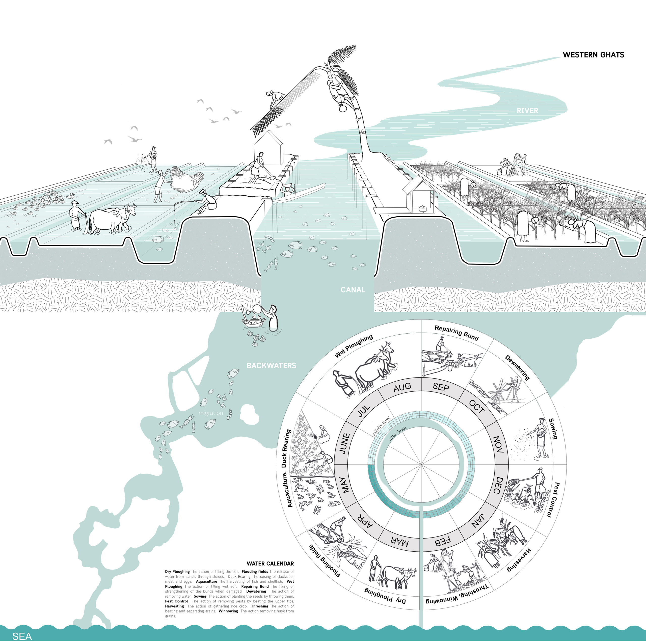
The birth of the cultural landscape was marked by the onset of the land reclamation process, locally known as “Kayalkuthu”. When the region encountered acute food shortage in the late 1800s, the virgin landscapes were considered as a gift from the backwaters and were brought to agricultural glory.
Kuttanad cultural landscape.
Here, water management was quintessentially a unit of the cultural expression of the site specific challenges faced by people, be in terms of topography, climate or social hierarchy. The low-lying landscape was subjugated for the benefit of men and women and how they did this narrates the legend behind the existing agricultural landscape of Kuttanad. These radical ingenuities tell us stories of how humans and nature exchanged roles between being makers and takers of the landscape.
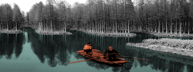
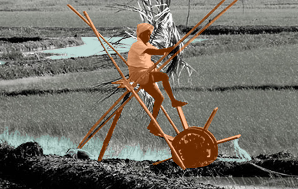
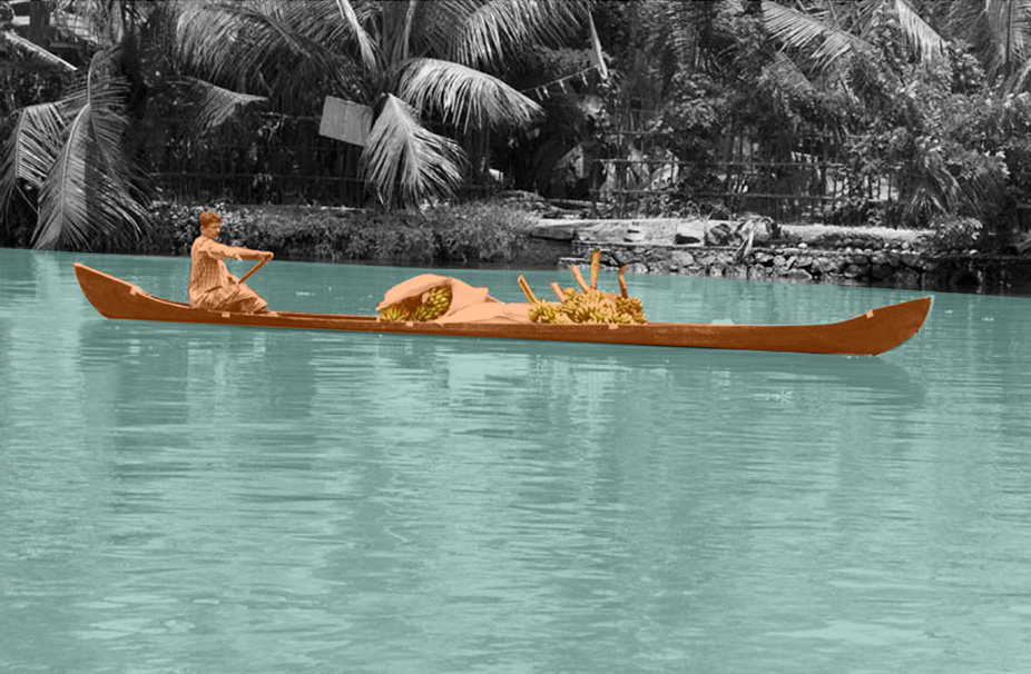
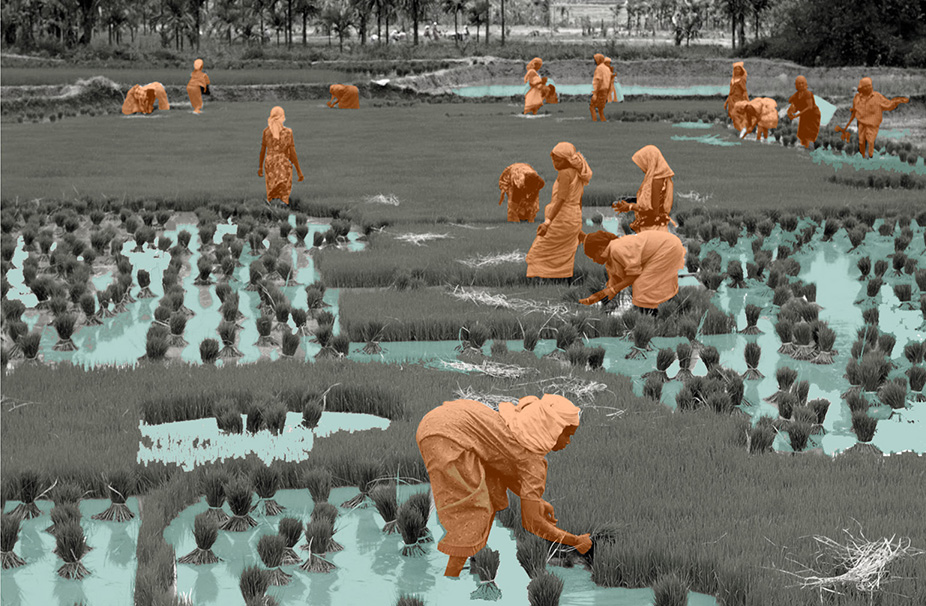
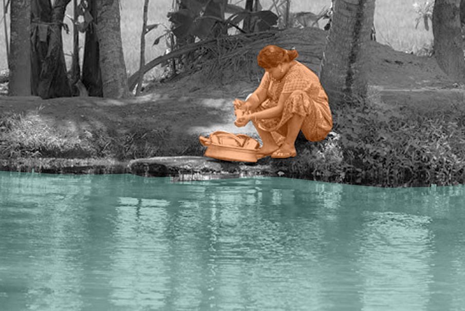
Clockwise. Farmer irrigating the field manually using a water wheel; female laborers harvesting paddy; man navigating through waterway in vallam, a canoe boat; lady washing utensils by the canal.
Circular Stories
The salt which came across as a curse sealing the fate of the farmers, however, was a blessing for the fishermen due to fish migration from the sea. Hence, the circle of life in Kuttanad was explicitly linked to this cycle of blessing and curse intermingling with the cycle of water and salt. Likewise, Kayalnilams also operated to optimize their performance within this spatio-temporal context specific to Kuttanad.
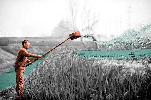
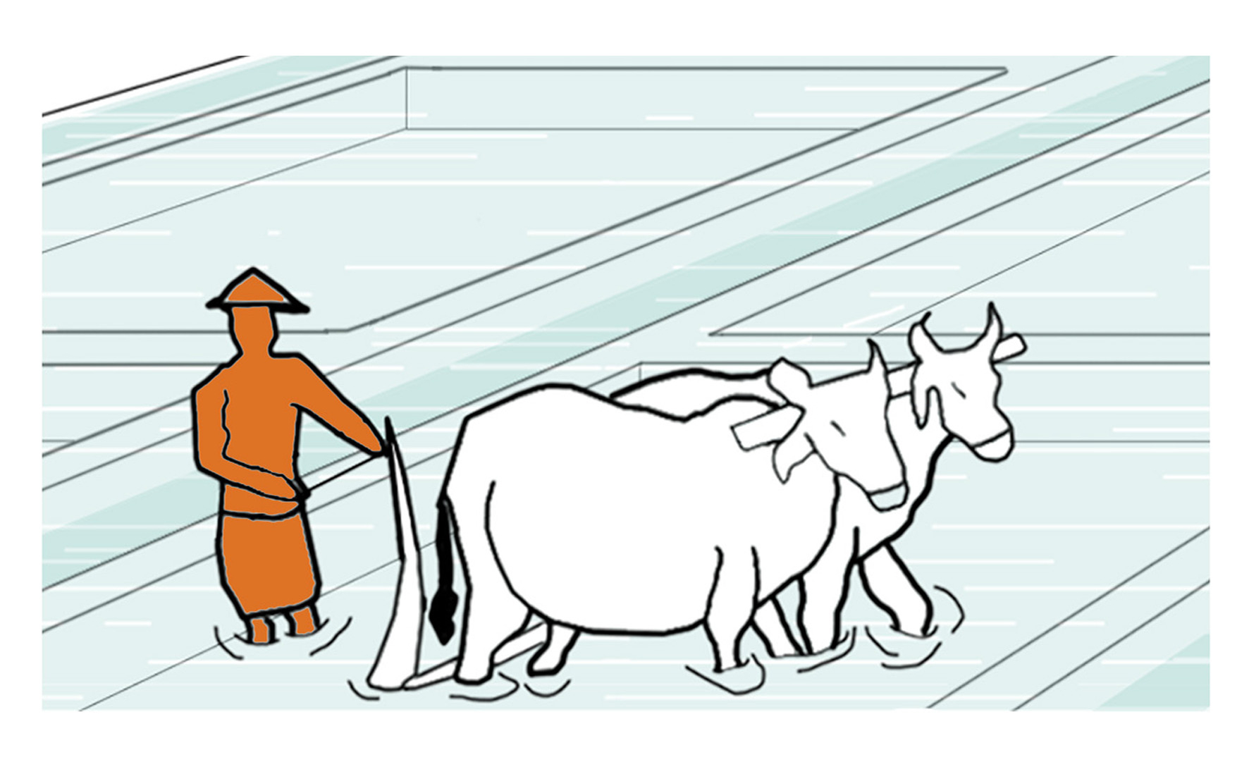
The action of turning up the earth when the fields are flooded with a plough that is made of locally available materials, like wood, in order to improve the workability of the soil. In the older days and even nowadays, some of the farmers employ cattle, like cows, to pull the plough manually.
Project Name: Kuttanad Kayalnilam Agrosystem, Kerala, India
Climate: Tropical monsoon
Year: 1880 – 1974 (a modified version still in use)
Water type: Seasonal mixing of saline and freshwater
Landscape type: Polder landscape in a deltaic basin
Meaning: Utilitarian landscape
Water Workers and Users: Farmers and fishermen
Soil: Sandy loam clay formed from riverine and lacustrine deposits