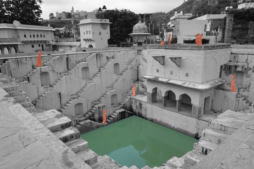
Stepwells of Jaipur

Atmosphere of the stepwells.

Exploring into the ancient water wisdom of Jaipur Rajasthan, India.

Anubhuti Chandna
2019

Jaipur is one of the first planned city of northern India based on the principles of “Shilpa Shastra”, in fact “Jaipur clearly represents a dramatic departure from extant medieval cities with its ordered, grid-like structure – broad streets, criss-crossing at right anglese, earmarked sites for buildings, palaces, havelis, temples and gardens, neighbourhoods designated for caste and occupation” (UNESCO, 2015).

During the planning of the city, special attention was given to the water supply system. With half of the city surrounded by the hills, the city took advantage of various rain catchment areas that were available for storage direct response to local geophysical conditions.
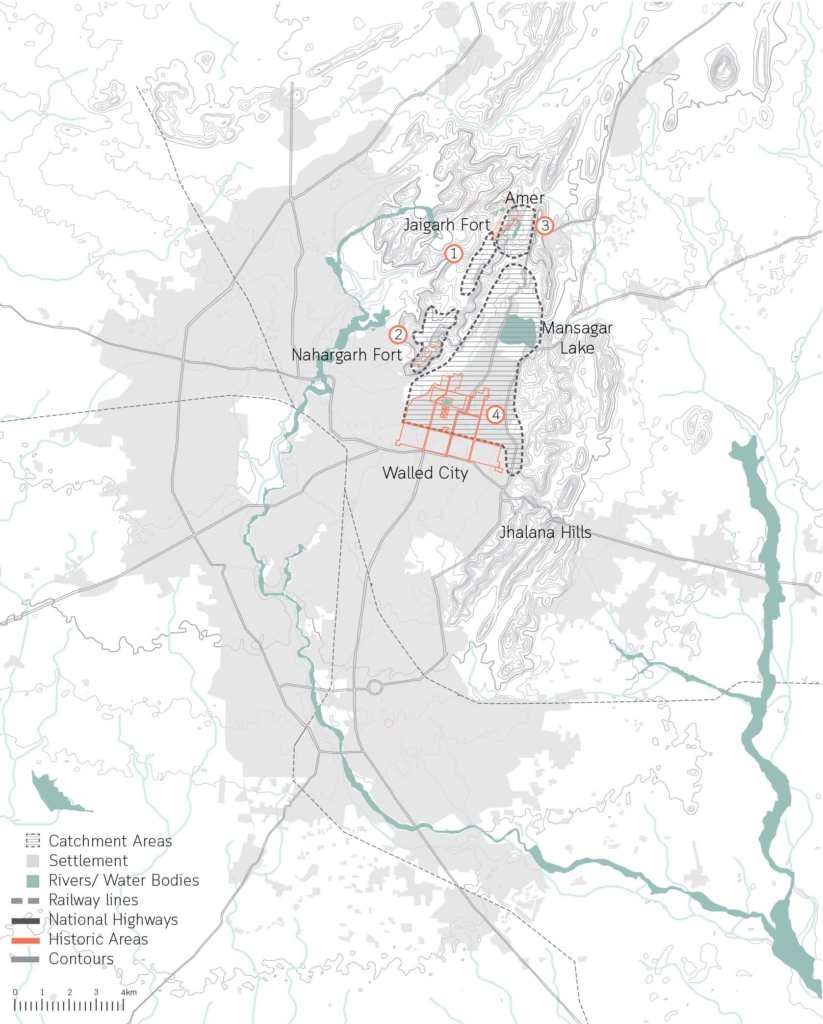
Catchment areas of the different systems in the city of Jaipur.

The ruler built 16 miles long canals from the nearby river streams and brought water to the city through aqueducts, As the city grew with increased demand for water, a dam across the river of Dhravyavati was constructed in 1844 along with a canal which runs east to west of the city, wide enough for 5-7 horsemen to ride abreast. This covered canal would then distribute the water through various channels and wells across the city and open at some places for direct access. However, after the construction of the metalled roads and new pipe system of supply, the canal got buried within the markets and its deep walls got filled up.

5 typologies of stepwells in Amber.

Water has a special significance in Hindu mythology, believed to be as a boundary between heaven and earth. For centuries, stepwells and stepped ponds, also known as Bavdis, Bawadis, Baolis or Vavs, have not just played a significant role in functioning as traditional water systems, serving the community through generations but also as hotspots of social, cultural and touristic interactions. “While various water structures such as tanks, cisterns, paved stairways along rivers (ghats) and cylindrical wells are found elsewhere in India, stepwells and stepped ponds are indigenous to semi-arid regions of Gujarat and Rajasthan” (Livingston & Beach, 2002).
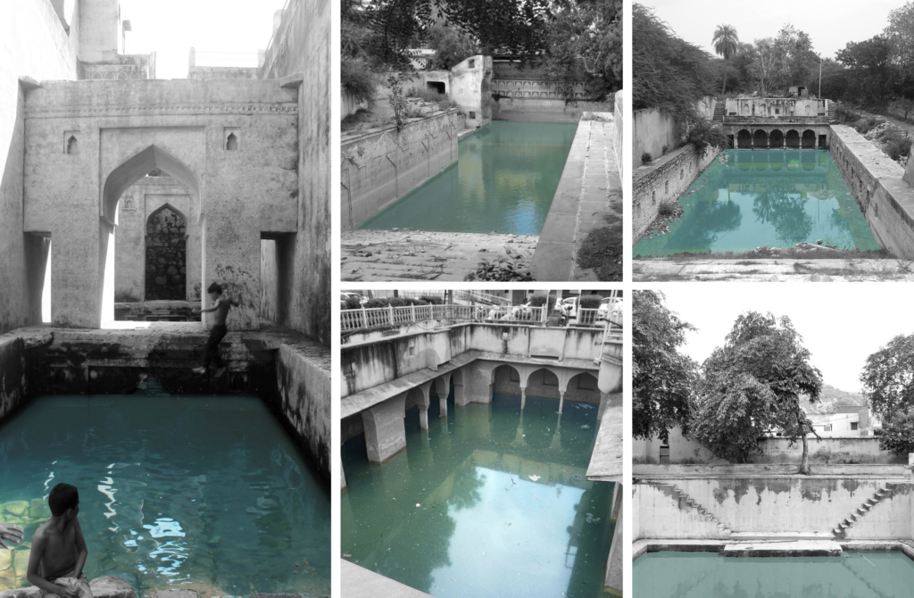
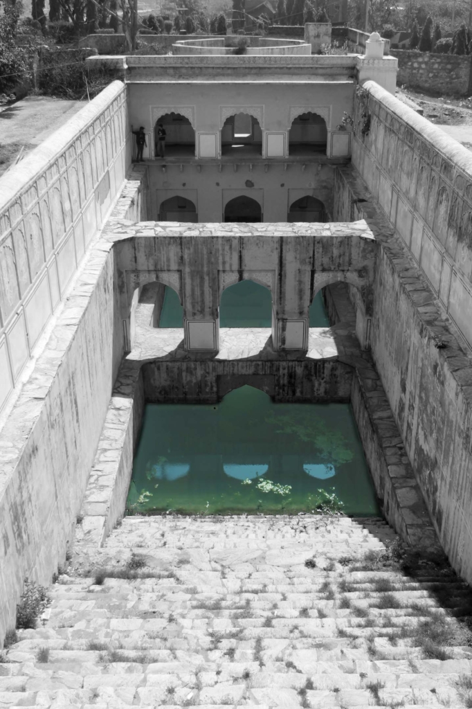
Clockwise. Typology 2, Cheela Bawadi; Typology 1, Atreya Bawadi; Typology 3, Sarai Bawadi; Typology 4, Bengali Baba ki Bawadi; Typology 5, Parshuram Dwar ki Bawadi.
Tattar ki Bawadi in Amber.

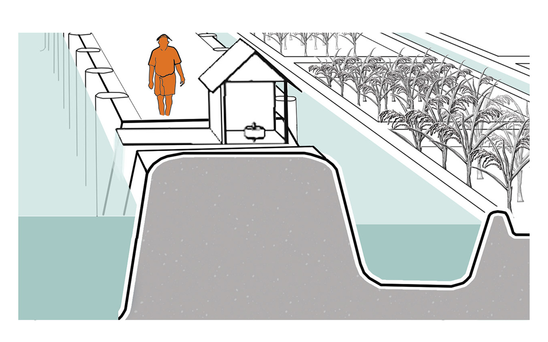
Dewatering motor

Dewatering station and motor

An indigenous technical device placed at the edge of the Kayalnilam for pumping water out from low-lying areas to the major canals or backwaters. It consists of a submerged brass vessel that sucks water out and is run by an electric motor kept inside the pump house. The sucked water flows out through a rectangular brass box.

  • Project: Kuttanad Kayalnilam Agrosystem, Kerala, India
  • Climate: Tropical monsoon
  • Year: 1880-1974 (a modified version is still in use)
  • Water type: Seasonal mixing of saline and freshwater
  • Landscape: Polder landscape in a deltaic basin
  • Altitude: -3 – +1.5 m.a.s.l
  • Soil condition: Sandy loam clay formed from riverine or lacustrine deposits
  • Material: Wood and Brass
  • Temporality: Seasonal
  • Form: Point
  • Use or Function: Pump water out

Kuttanad Kayalnilam Agrosystem

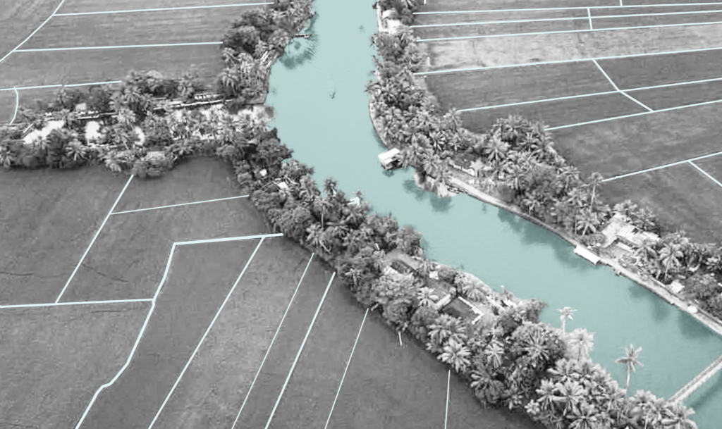
Aerial view of the agrosystem.

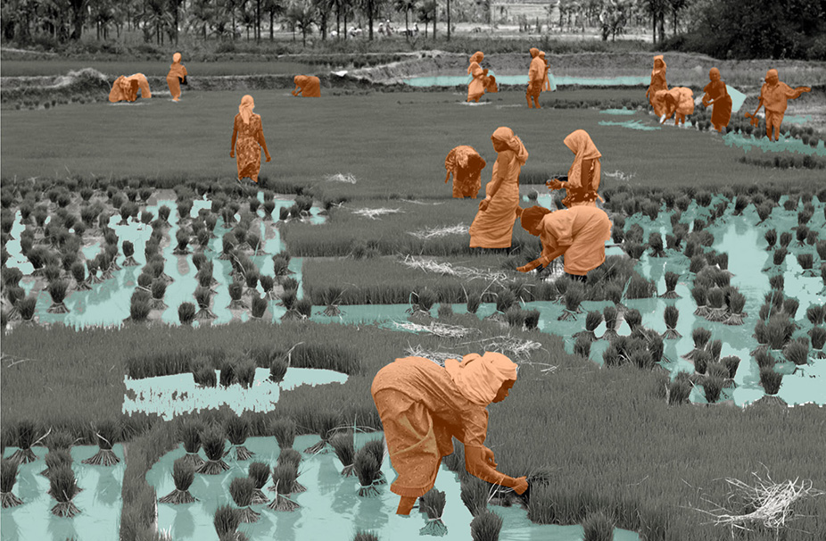
A traditional paddy farming system
below sea level.

Naeema Ali
2020

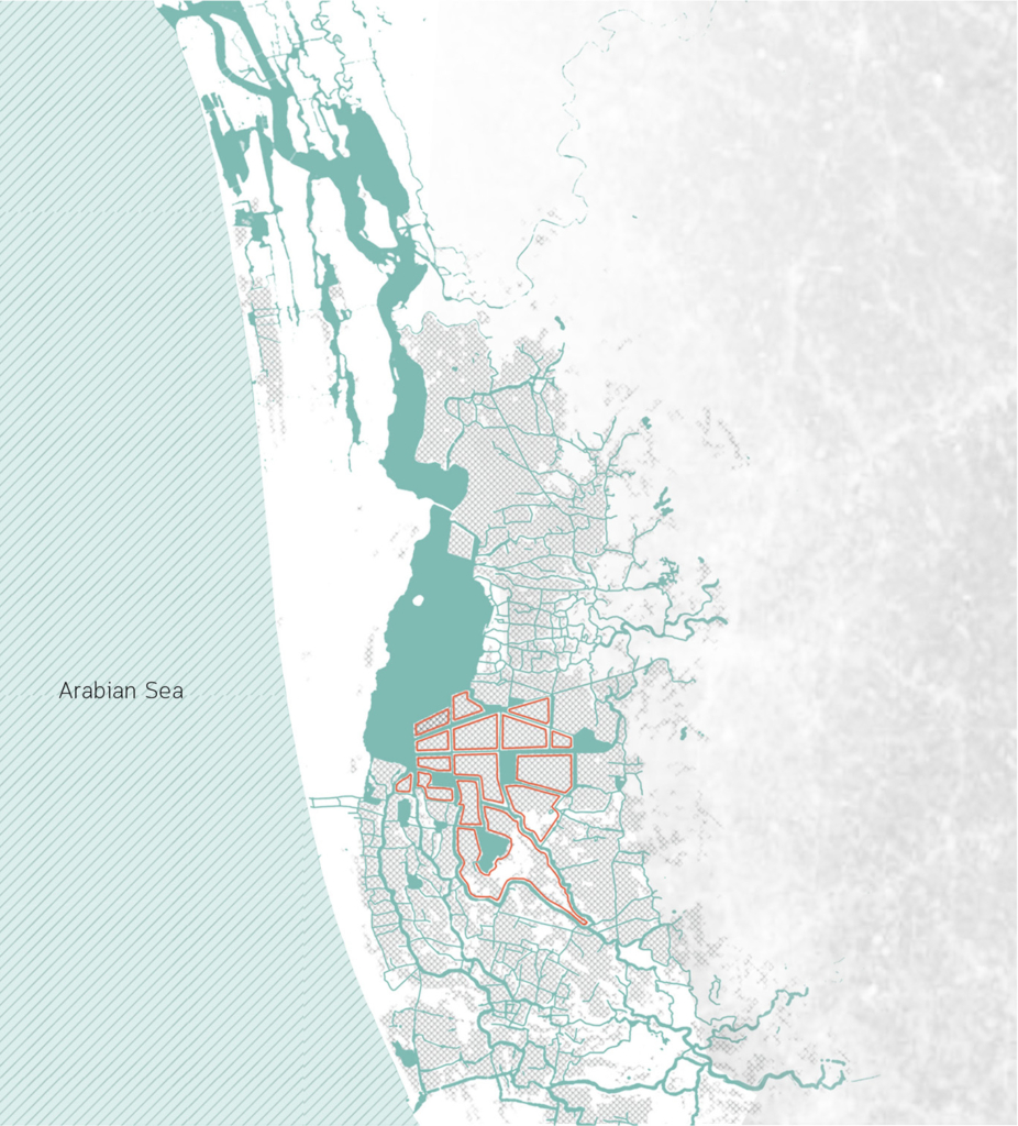
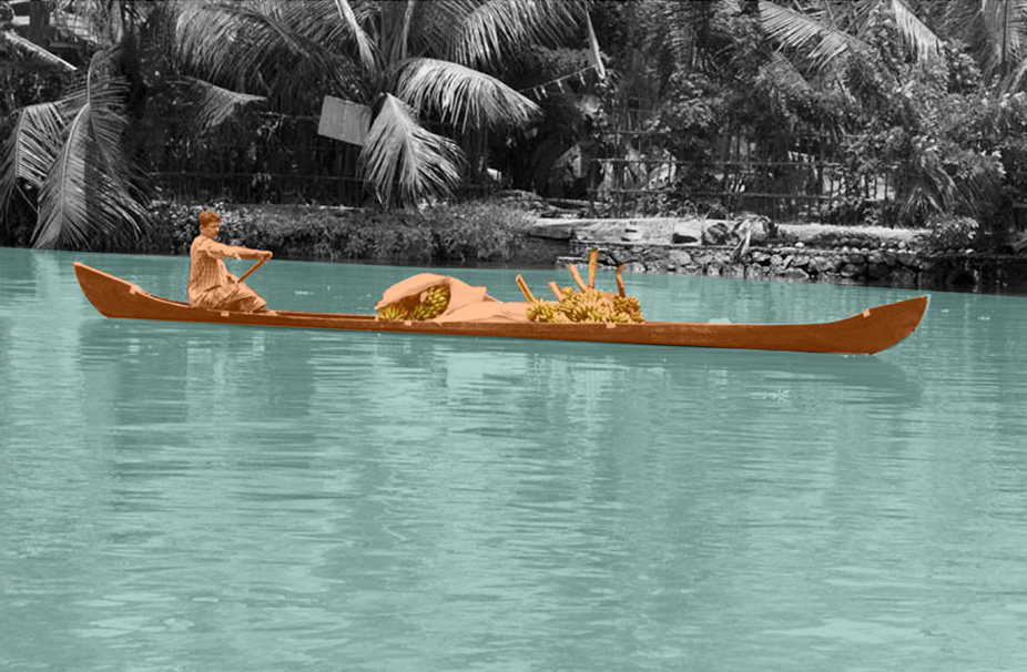
The birth of the cultural landscape was marked by the onset of the land reclamation process, locally known as “Kayalkuthu”. When the region encountered acute food shortage in the late 1800s, the virgin landscapes were considered as a gift from the backwaters and were brought to agricultural glory.

Kuttanad cultural landscape.

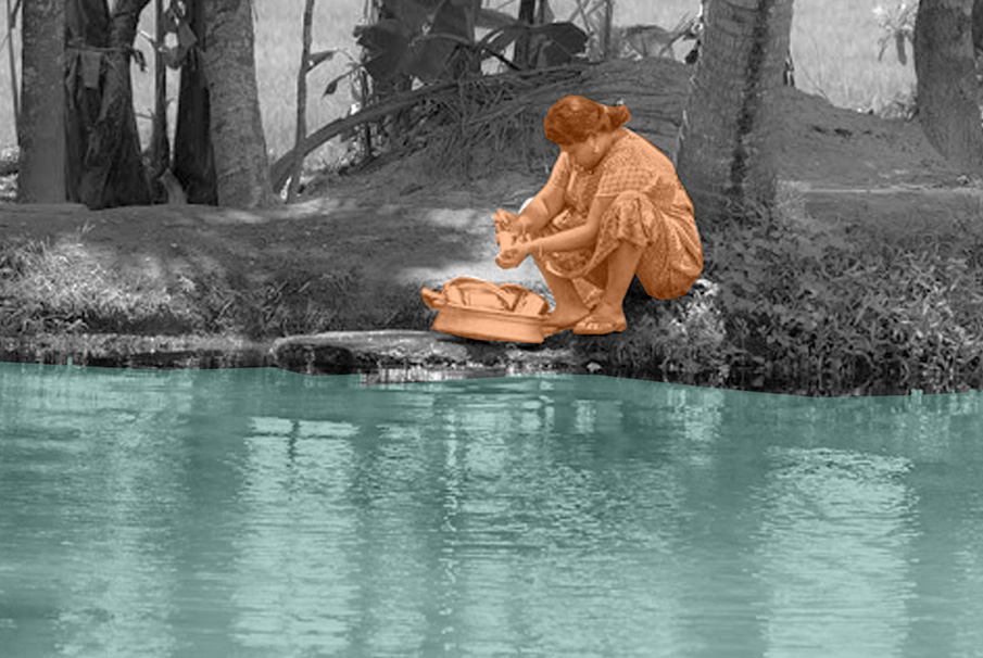
Here, water management was quintessentially a unit of the cultural expression of the site specific challenges faced by people, be in terms of topography, climate or social hierarchy. The low-lying landscape was subjugated for the benefit of men and women and how they did this narrates the legend behind the existing agricultural landscape of Kuttanad. These radical ingenuities tell us stories of how humans and nature exchanged roles between being makers and takers of the landscape.

Circular Stories

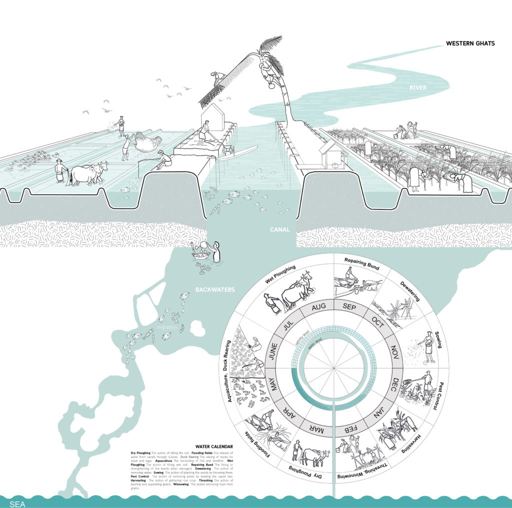
The salt which came across as a curse sealing the fate of the farmers, however, was a blessing for the fishermen due to fish migration from the sea. Hence, the circle of life in Kuttanad was explicitly linked to this cycle of blessing and curse intermingling with the cycle of water and salt. Likewise, Kayalnilams also operated to optimize their performance within this spatio-temporal context specific to Kuttanad.

Cyclical water system.

Delhi Sultanate Waterworks

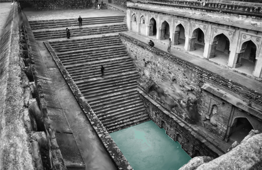
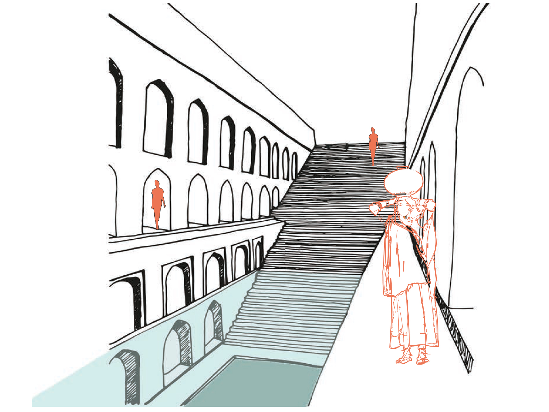
Typical Baoli stepwell atmosphere.

Ancient network of water harvesting
structures in Delhi, India.

Tanvi Gupta
2020

Delhi is located in the Northern part of India being continuously inhabited since the 6th century B.C. Through most of its history, Delhi has served as the capital of various kingdoms, most notably the Delhi Sultanate and Mughal empire. Two prominent features of the geography of Delhi are the Yamuna floodplains and the Delhi ridge.

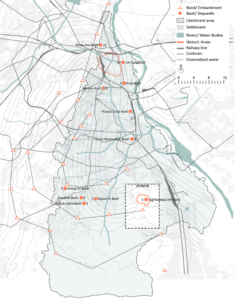
Delhiā€™s urban waterworks developed in early thirteenth century. They took the following main forms of hauz (water tank), baoli (stepwell) and bund (embankment). Collectively these small structures served the sultanate capitals of South Western Delhi. As with other ancient and medieval water systems, they were incremental and coordinated. Urban lakes, tanks and reservoirs were sited in gently sloping areas adjacent to hillside water control structures.

Bund network along Delhi Ridge.

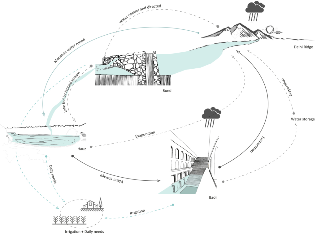
Delhi sultanate waterworks developed during the early 13th century. They took three main forms – the bund network (embankment), hauz (water tank), and baoli (stepwell). These reflect the main strategies of the Delhi Sultanate water works – the bund network helps in directing and capturing the runoff from the ridge, the hauz stores the surplus monsoon surface water runoff and recharges groundwater while the baolis tap into the shallow groundwater along with storing rainwater.

Circular Stories

Circularity of the Delhi Sultanate Waterworks system.

Delhi Sultanate waterworks or harvesting structures were well coordinated with one another, each structure supporting the existence of the other. The bunds, the royal tanks called hauz and the baoli storage structures aided water evaporation and condensation into the atmosphere which again would be captured in the ridge landscape during monsoon.

Today, these water structures lie in a dilapidated state with some having been restored for heritage and tourism purposes. Thus, it is important to learn from past methods of harvesting water to overcome the hydrological problems Delhi is facing today.

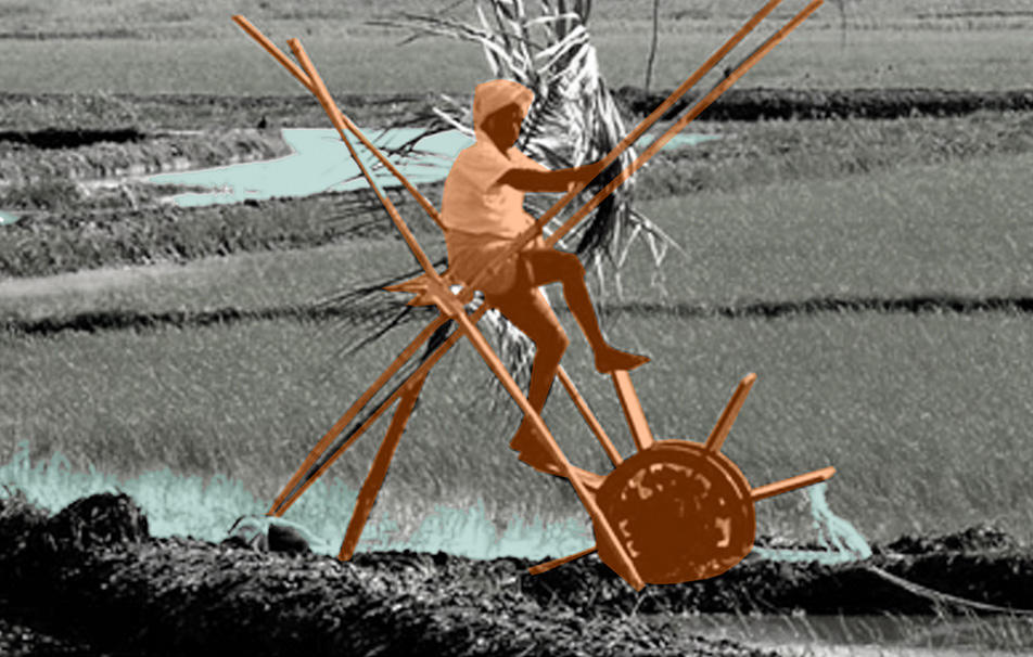
Wet ploughing

Wet ploughing

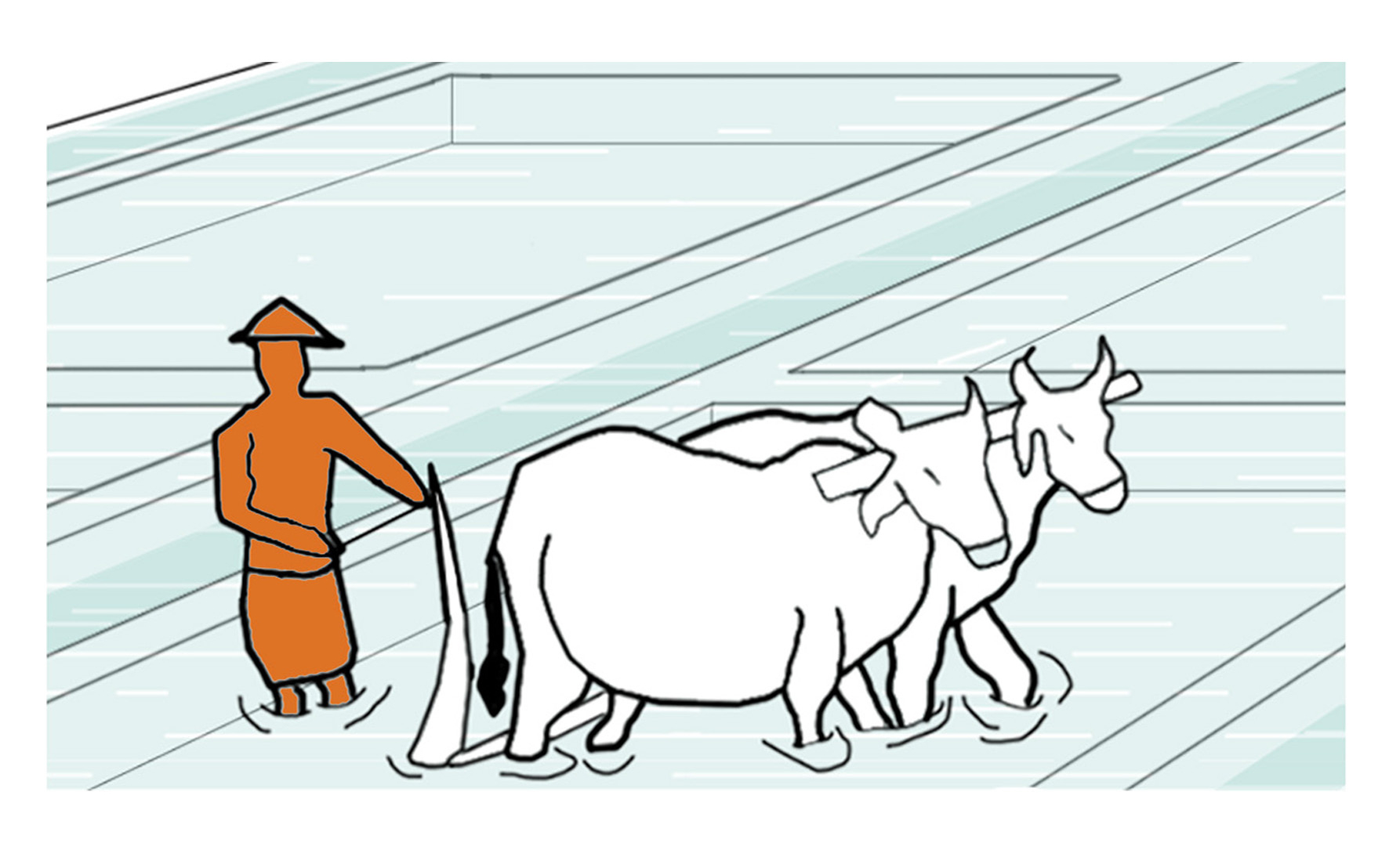
The action of turning up the earth when the fields are flooded with a plough that is made of locally available materials, like wood, in order to improve the workability of the soil. In the older days and even nowadays, some of the farmers employ cattle, like cows, to pull the plough manually.

  • Project Name: Kuttanad Kayalnilam Agrosystem, Kerala, India
  • Climate: Tropical monsoon
  • Year: 1880 – 1974 (a modified version still in use)
  • Water type: Seasonal mixing of saline and freshwater
  • Landscape type: Polder landscape in a deltaic basin
  • Meaning: Utilitarian landscape
  • Water Workers and Users: Farmers and fishermen
  • Soil: Sandy loam clay formed from riverine and lacustrine deposits
  • Material: Timber
  • Period: Seasonal
  • Use or function: Tilt wet soil

Baoli (water stories)

Baoli
Stepwell

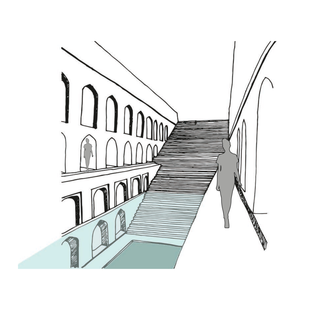
Rainwater and natural stormwater channels from Delhi ridge are stored in the ground and it is directly accessible to people by a flight of stairs. The narrow staircase is divided into three parts, which runs along the inner three walls of rectangular baoli.

  • Project Name: Delhi Sultanate Waterworks, Ancient network of water harvesting structures, Delhi, India
  • Climate: Overlap of humid subtropical and semi-arid
  • Year: 1206 A.D. – 1526 A.D.
  • Water type: Drinkable rainwater
  • Landscape type: Ridge landscape
  • Altitude: 220-230 m.a.s.l
  • Soil condition: Alluvium, Quartzitic ridge
  • Material: Delhi quartzite stone
  • Period: Fixed
  • Form: Surface
  • Use or function: Water harvesting

Bund

Bund
Embankment

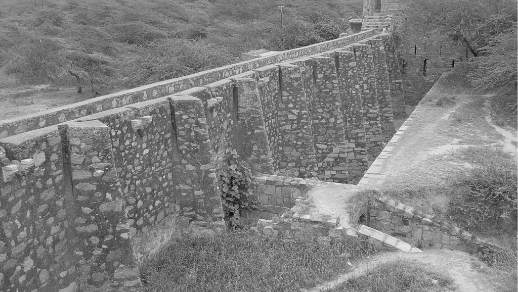
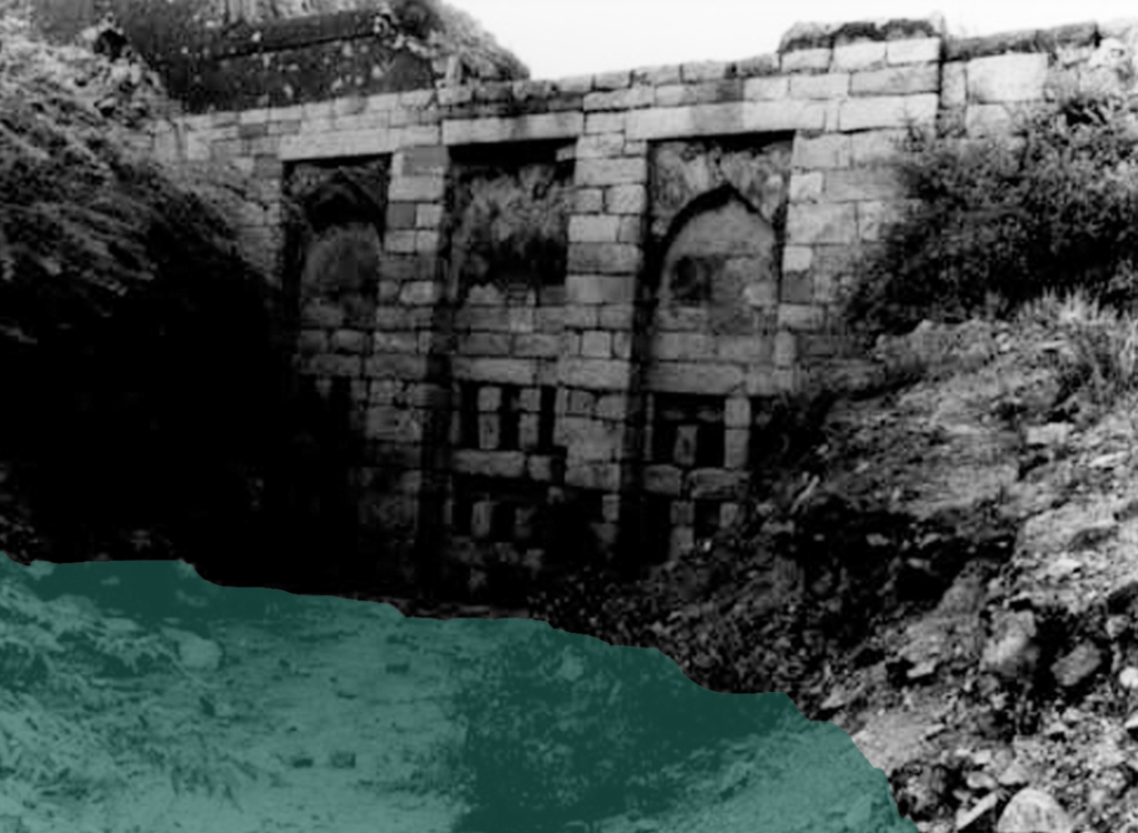
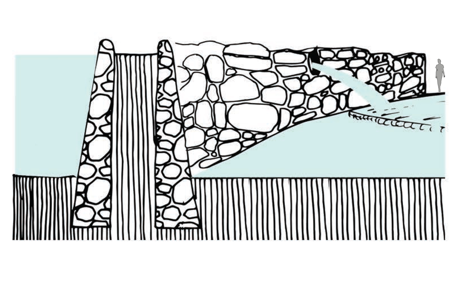
Water harvesting mud embankments restrain natural streams of stormwater runoff in its upper reaches and direct it for storage in hauz (lake) and baoli (stepwell).

  • Project Name: Delhi Sultanate Waterworks, Ancient network of water harvesting structures, Delhi, India
  • Climate: Overlap of humid subtropical and semi arid
  • Year: 1206 A.D. – 1526 A.D.
  • Water type: Drinkable rainwater
  • Landscape type: Ridge landscape
  • Altitude: 220-230 m.a.s.l
  • Soil condition: Alluvium, Quartzitic ridge
  • Material: Stone masonry
  • Period: Fixed
  • Form: Point
  • Use or function: Water directing

Baoli (water works)

Baoli
Stepwell

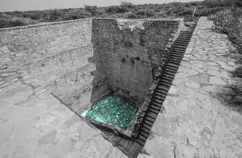
Rainwater and natural storm water channels from Delhi ridge is stored in ground and it is directly accessible to people by a flight of stairs. The narrow staircase is divided into three parts, which runs along inner three walls of rectangular baoli.

  • Project Name: Delhi Sultanate Waterworks, Ancient network of water harvesting struc-tures, Delhi, India
  • Climate: Overlap of humid subtropical and semi arid
  • Year: 1206 A.D. – 1526 A.D.
  • Water type: Drinkable rainwater
  • Landscape type: Ridge landscape
  • Altitude: 220-230 m.a.s.l
  • Soil condition: Alluvium, Quartzitic ridge
  • Material: Delhi quartzite stone
  • Period: Fixed
  • Form: Surface
  • Use or function: Water harvesting

Hauz

Hauz
Lake

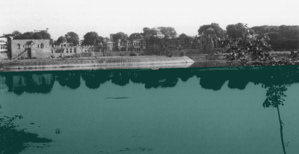
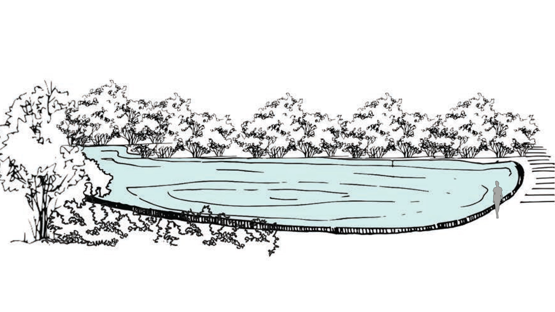
Water tanks which harvest rainwater and stormwater during monsoon season. Main function of the hauz was to collect rainwater over a large expanse of land.

  • Project Name: Delhi Sultanate Waterworks, Ancient network of water harvesting structures, Delhi, India
  • Climate: Overlap of humid subtropical and semi-arid
  • Year: 1206 A.D. – 1526 A.D.
  • Water type: Drinkable rainwater
  • Landscape type: Ridge landscape
  • Altitude: 220-230 m.a.s.l
  • Soil condition: Alluvium, Quartzitic ridge
  • Material: Excavated soil
  • Period: Fixed
  • Form: Surface
  • Use/ function: Water harvesting