Dujiangyan Irrigation System and Linpan

Dujiangyan upstream water system.

A large-scale water project built in ancient China and used up to now. It can be divided into two systems: the irrigation head and the irrigation water network.

Zhiyun Zhang
2023

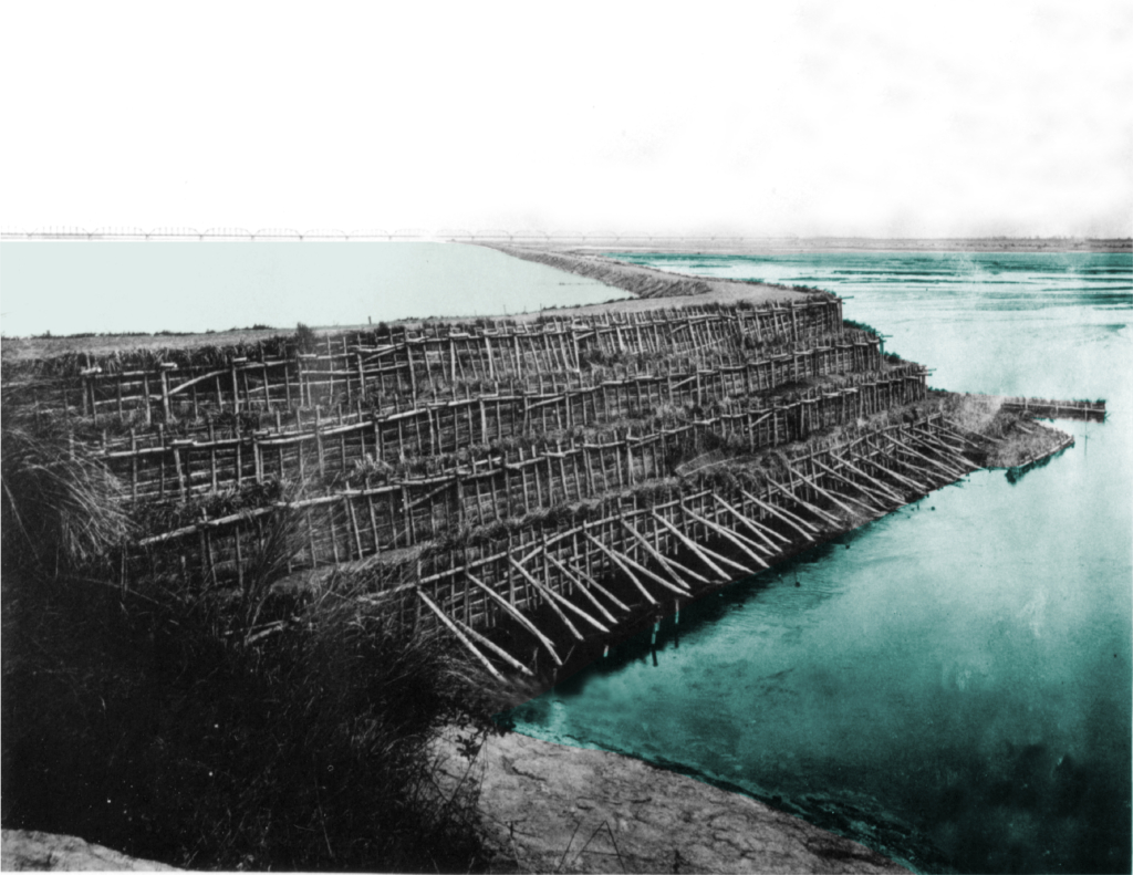
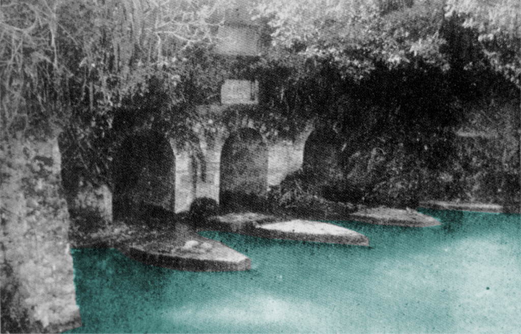
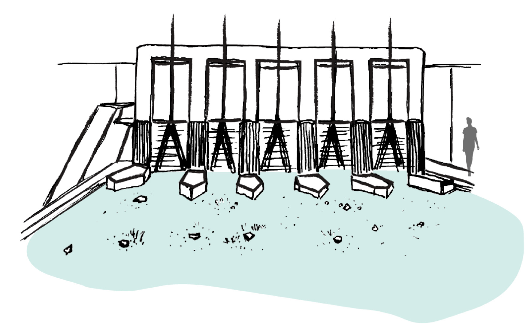
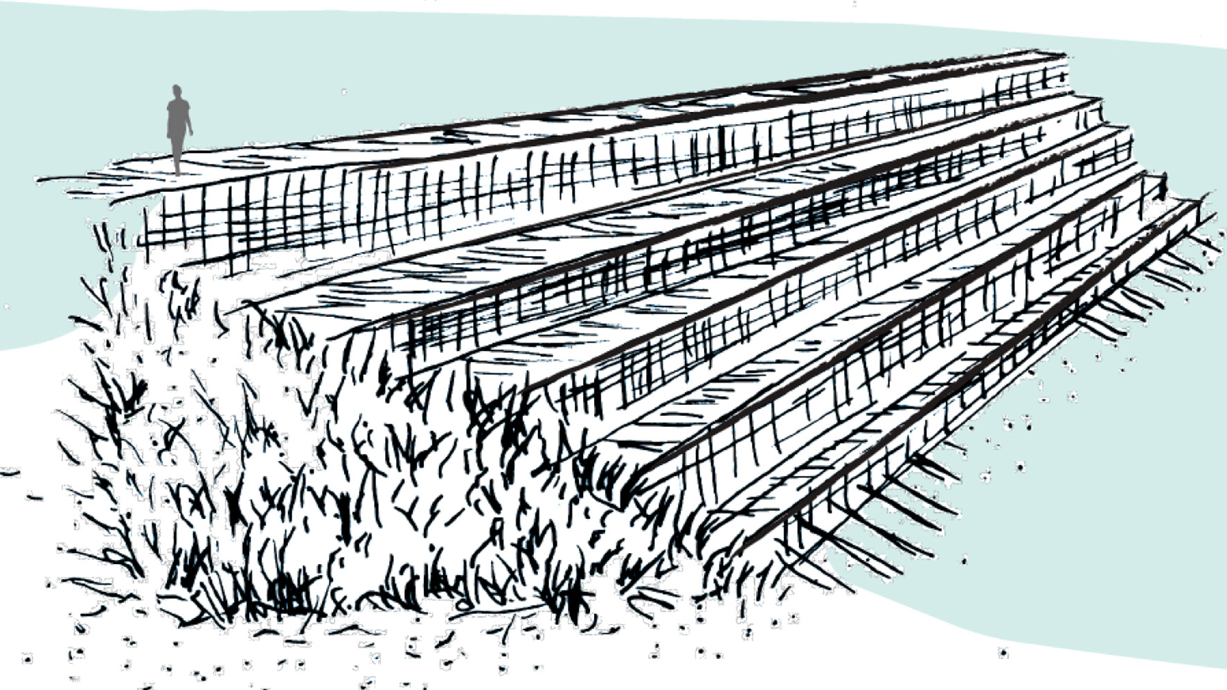
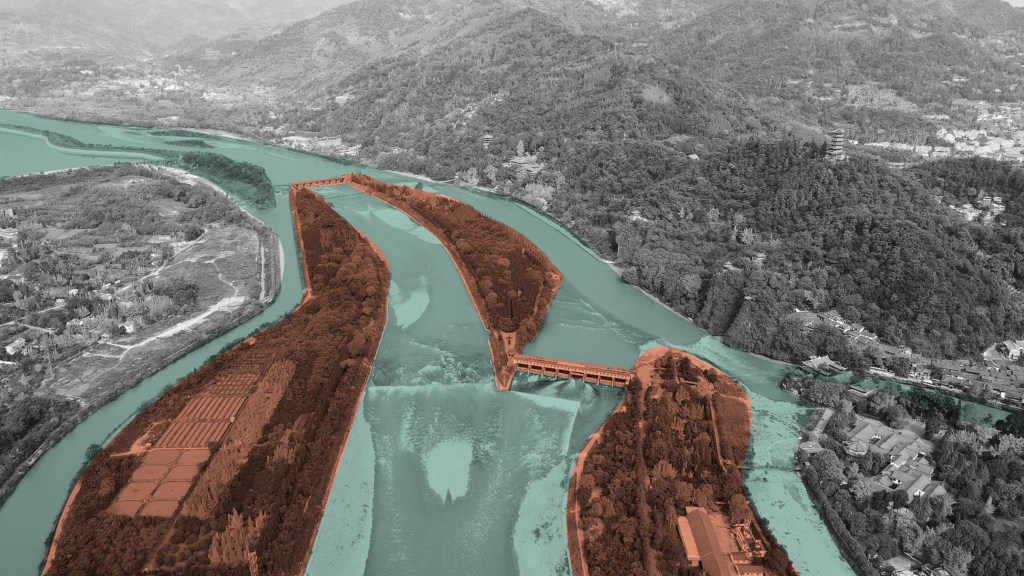
Dujiangyan system is a large-scale water conservancy project built in ancient China and sed up to now. It is located in the west of Dujiangyan City, Sichuan Province, 340 kilometres upstream of the Minjiang River. According to legend, Dujiangyan was built from about 256 BC to 251 BC. After successive renovations, it has played a huge role for more than two thousand years. Without destroying natural resources and by making full use of natural resources to serve human beings, the project turned harm into benefit and made a high degree of harmony among people, land and water, which is also a great “ecological project” in the world.

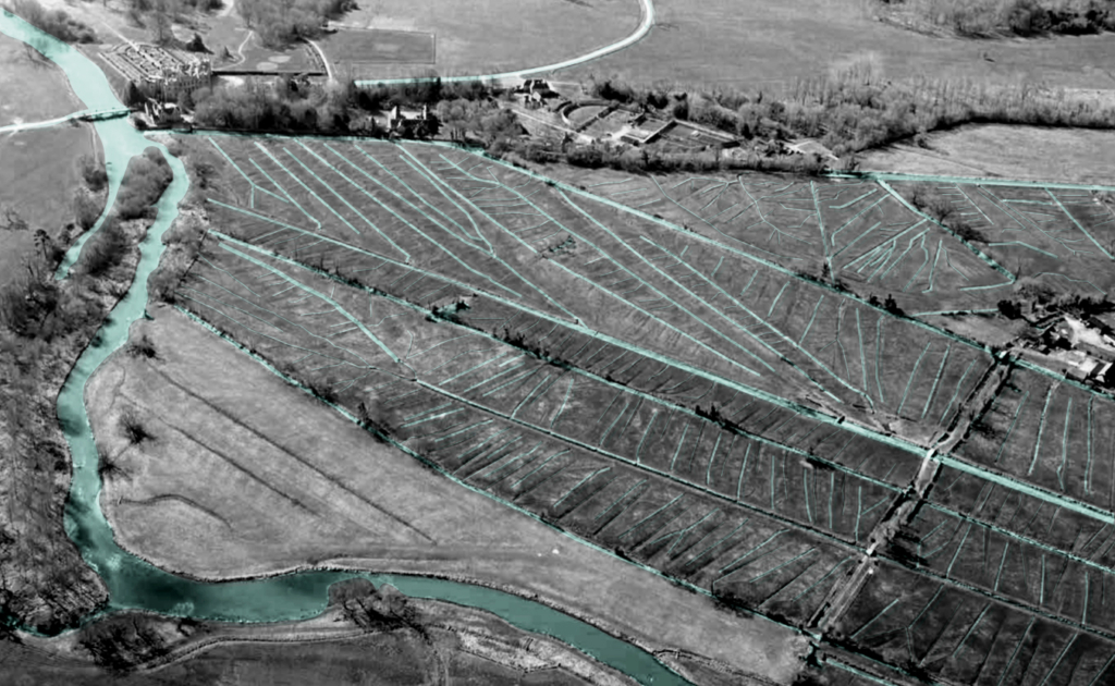
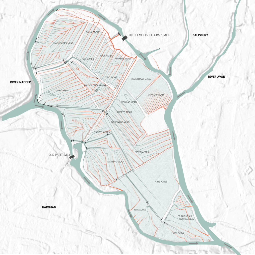
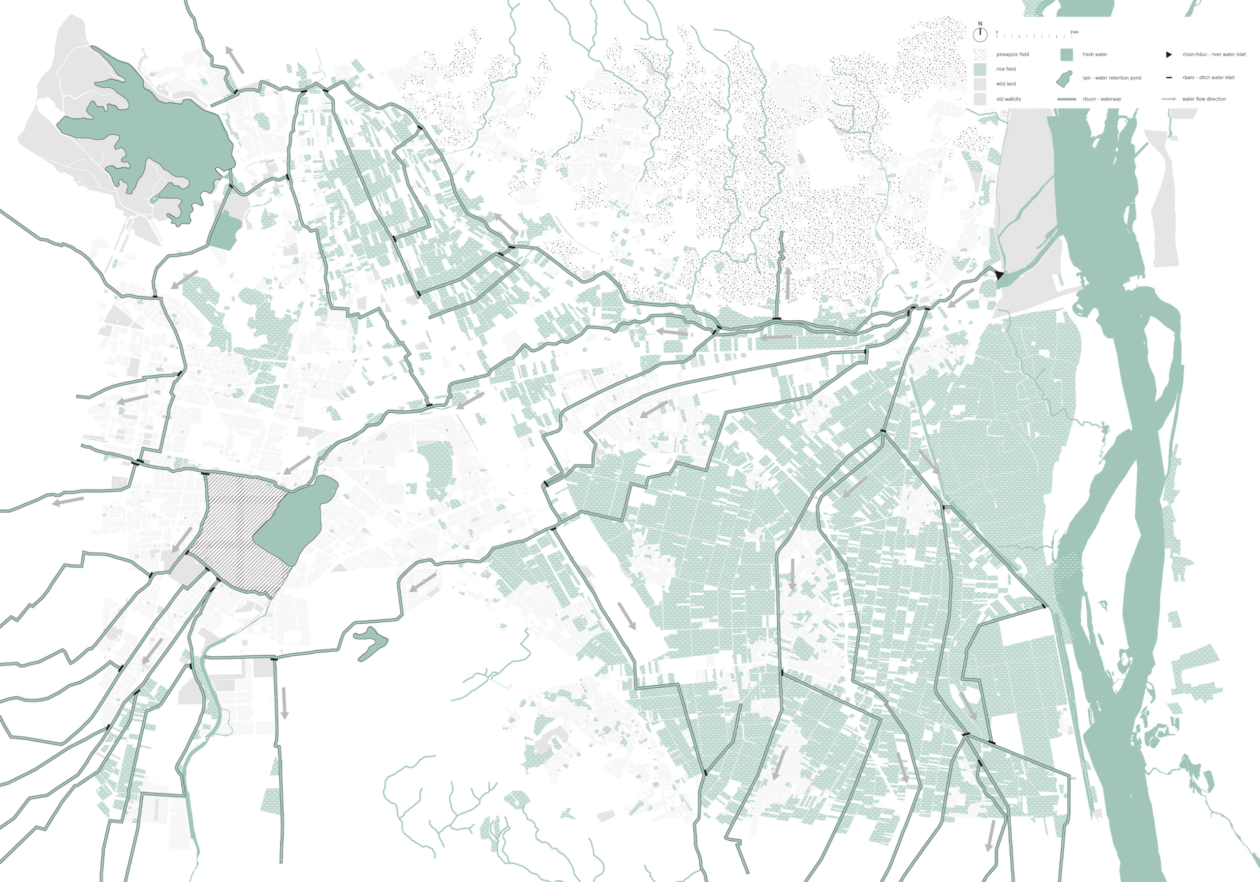
Seasonal rainfall makes the lower-reach places very dependent on the upstream Minjiang River water source. As a unique agricultural and rural landscape, Dujiangyan Project had a profound influence on the production and life of downstream residents, as well as the shaping of the Chengdu Plain in terms of spatial form. This downstream map shows the pattern and textures of the plain, which also explain the inner relationship between the water system, function, spatial form, etc.

Linpan pattern.

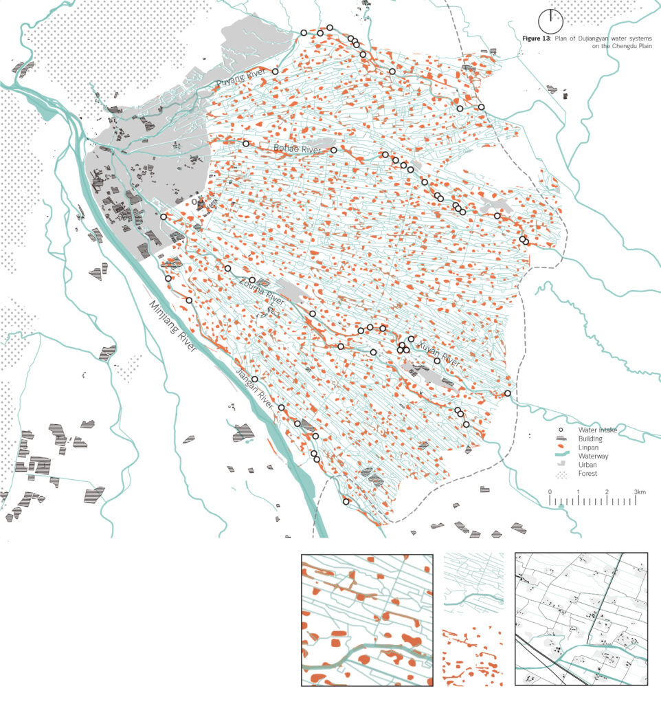
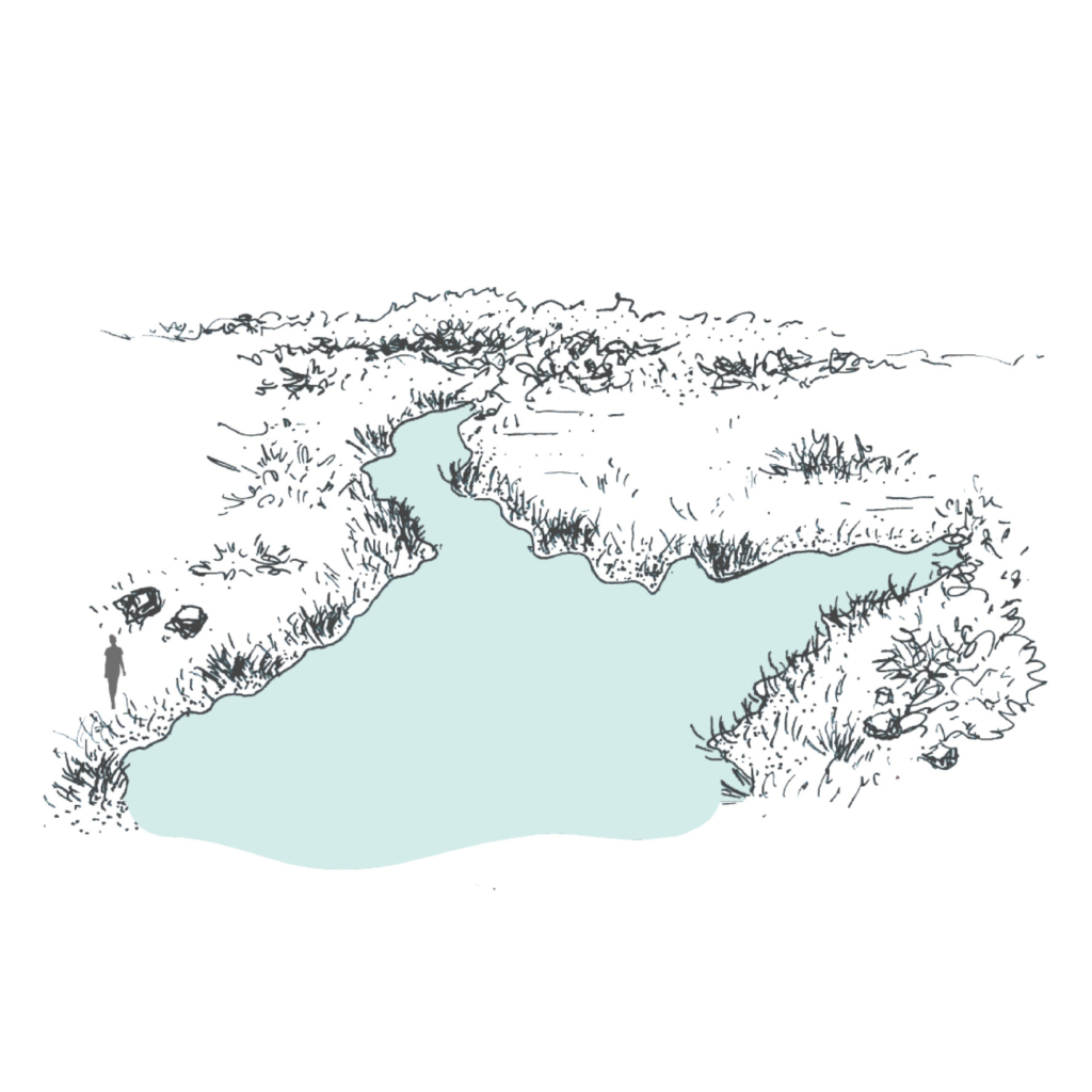
If we zoom in a little bit, the basic pattern of this plain will become more clear, which is consist of lines and blocks. The line is the waterway and the block is the Linpan settlement. It looks just like the blood structure of the human body, oxygen is transported to every cell structure through arteries, veins, and capillaries.

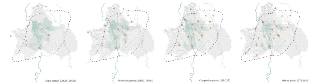
During the origin period, the embryonic form of the water system in the Chengdu Plain is emerging, however, the main rivers are in a disorderly radial pattern and changed frequently. The tributaries didn’t form fixed and stable waterways, bringing several floods and droughts.

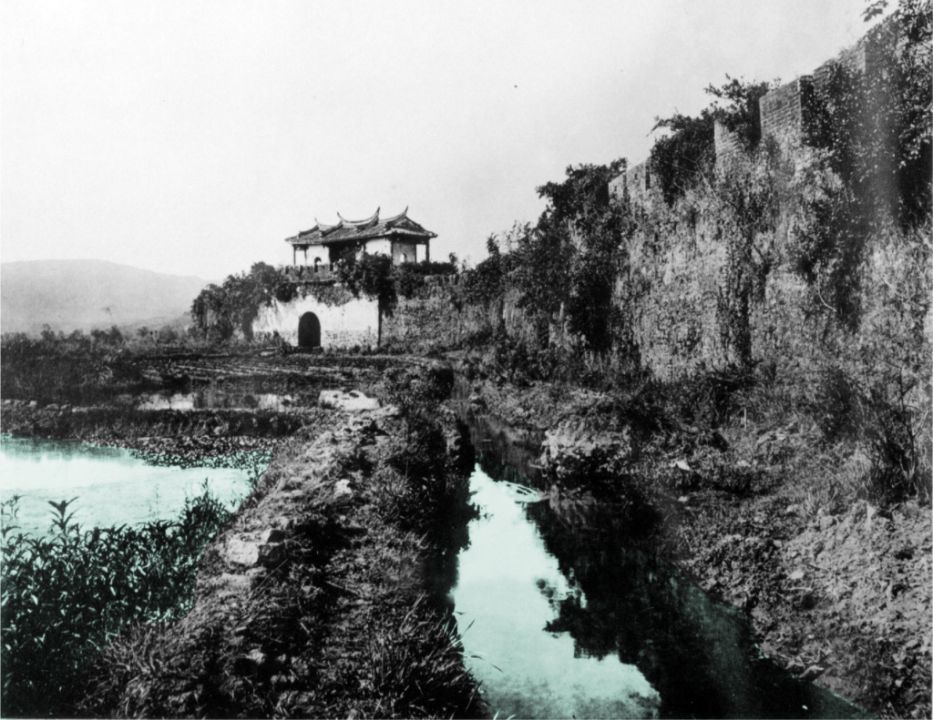
Since 260 BC, the construction of the Dujiangyan Water Conservancy Project completely changed the water control environment in the Chengdu Plain, significantly reducing flood frequency and severity, and improving agricultural irrigation efficiency. The water system in the Chengdu Plain mainly expands to the east, and the channels gradually became fixed and clear with the maintenance of residents. The overall shape of water systems gradually becomes a dendritic water network. The opening up of inner and outer rivers provided sufficient water resources for the construction and economic development of Chengdu City. With obvious transportation advantages, there was a rapid development of Chengdu’s urban economy and a dramatic change in town form and layout. According to the maps, the number and range of cities and towns increased significantly over time, while flooding, conversely, decreased with the gradual development of water systems.

Development of water systems and towns of Chengdu Plain from 5000BC to now.

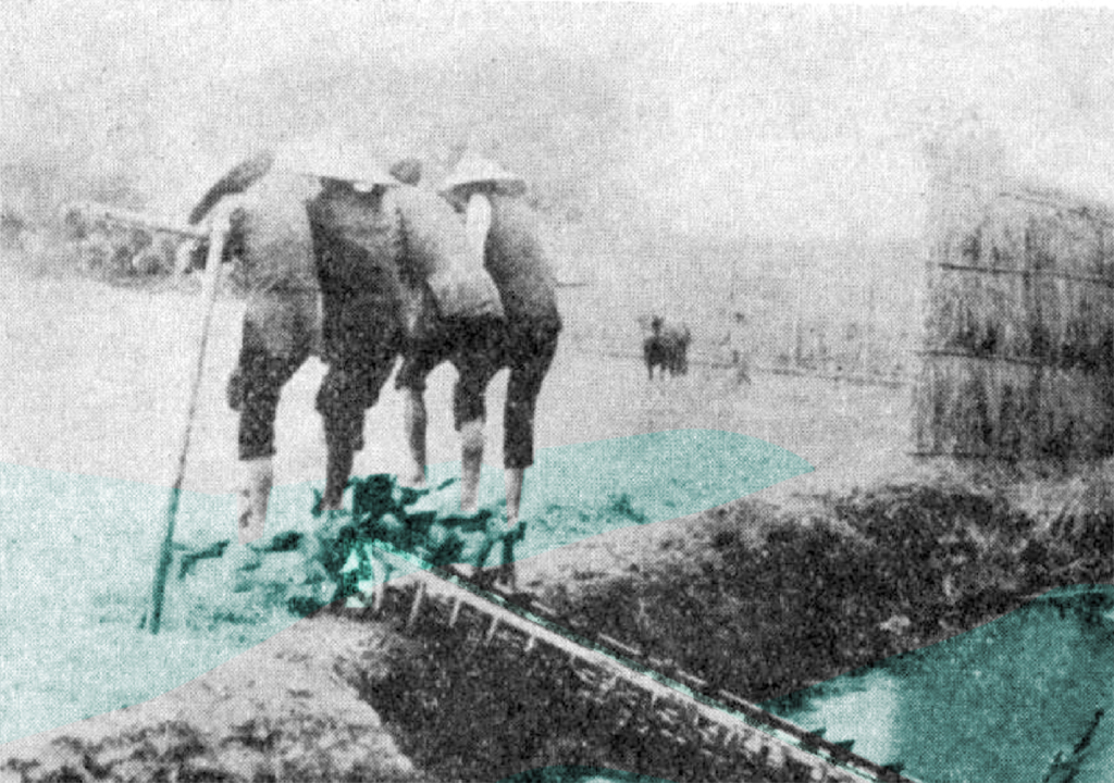
The human activities in the upper and lower reaches of Dujiangyan present different features because of having different main functions. At the head of the Dujiangyan Project, surrounded by green mountains and green waters, the superior ecological environment and historical sites make it a leisure and tourist attraction in addition to undertaking the function of water conservancy regulation.

Fish fry and rice are symbiotic, and they can be caught and marketed before the rice is harvested.

Circular Stories

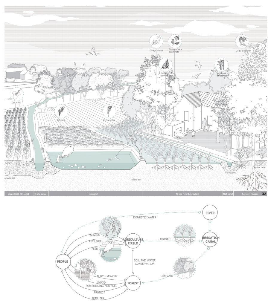
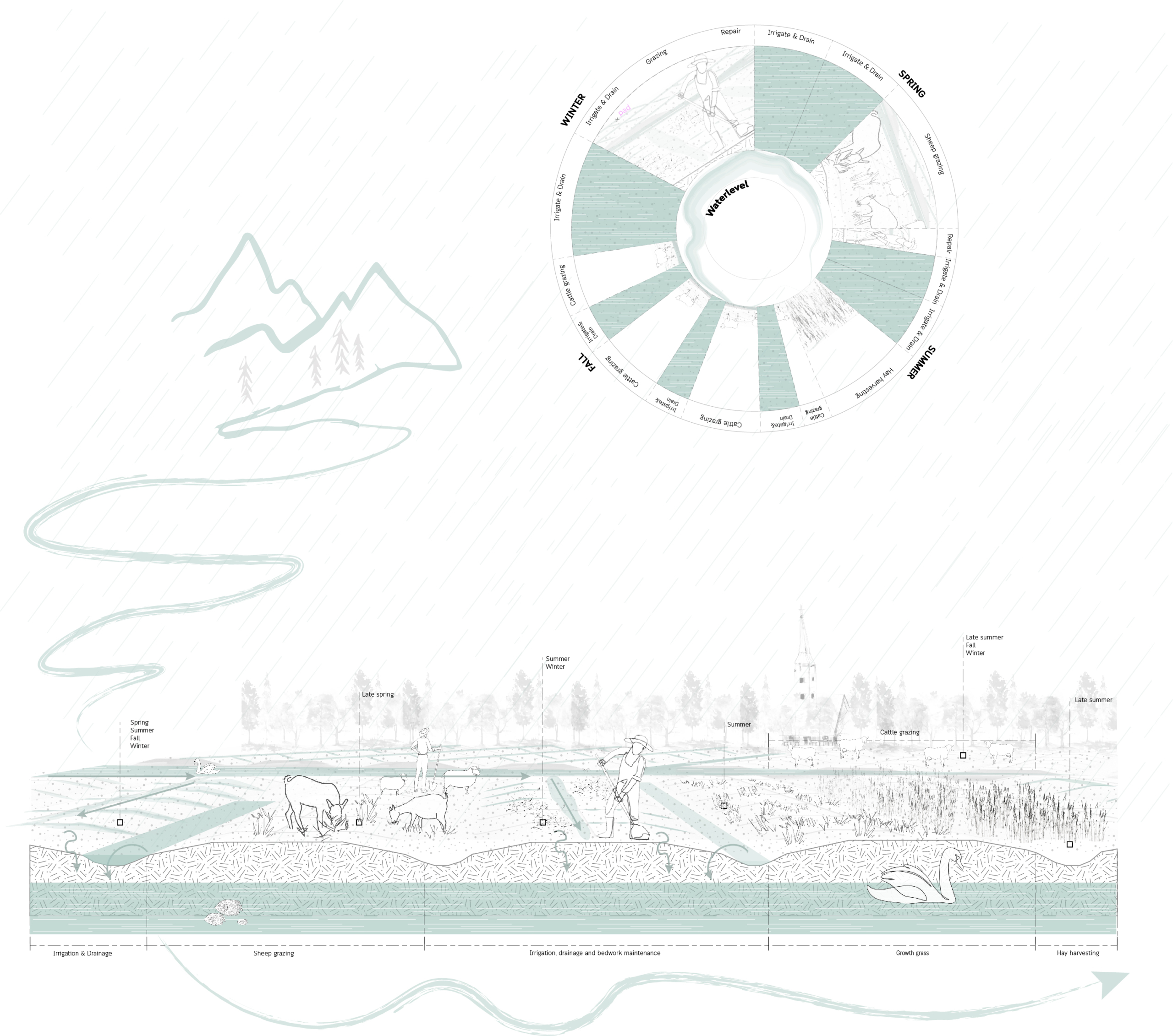
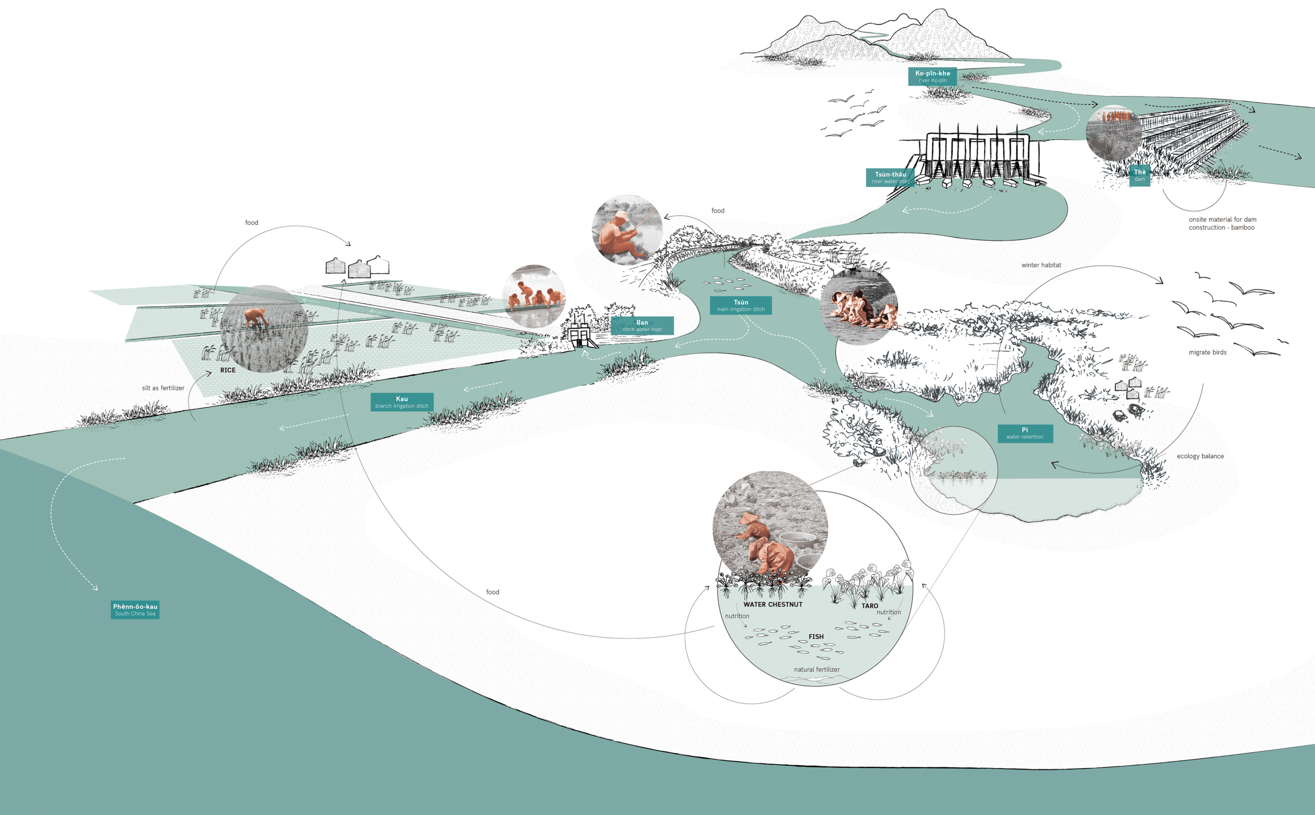
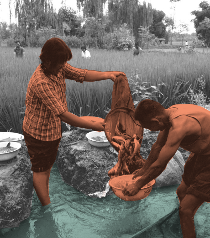
Linpans on the western Sichuan Plain consisting of the Dujiangyan irrigation system, agricultural production, and family-based lifestyle, is a spatial form that perfectly combines cultural symbols and usage values. It is a sustainable system that integrates the living, production and ecological environment of the Chengdu Plain. The ecological farming pattern is in harmony with the farming conditions, traditional farming methods and living needs of the western Sichuan Plain. The entire West Sichuan Plain irrigated by the Dujiangyan Project is a semi-artificial and semi-natural wetland ecosystem, providing habitat for birds and food base and living space for humans, while the symbiosis of human and forest in the Linpan continues to this day. These spontaneous ecological ways of living are worthy of human inheritance and development. Within the Linpan system, people, fields, water and forests are interdependent. For example, people use the wood of forests to make fires and build houses. The forest serves as a barrier and a place for people to rest. Human and livestock manure will in turn fertilize the forest. In this way, Linpan forms a whole circular system of energy, and material, (maybe emotion). People can live self-sufficiently in Linpan.

Linpan’s self-sufficient circulatory framework and circulatory system.

Harnam Water Meadows

Water Meadows during irrigation.

A pasture productive system in traditional English agriculture.

Farnoosh Bazrafkan
2021

The Harnham Water Meadows are located inland in the South-Western part of England. The water catchment area of
Harnham being a part of the county of Wiltshire. The rivers of this area are largely spring-fed and provide a stable flow
throughout the year. Along the floodplains of these rivers a series of (abondoned) water meadows can be found.
Water meadows are part of a well known irrigation system in England. The chalk valley landscapes of Wessex are an important county for water meadows because of the topsoil texture and slightly alkaline water they provide, elements that are needed for grass sward development.

The Harnham Water Meadows, as a remnant of the 17th-century farming revolution, form an important part of the historical English landscape. These floodplain meadows are altered in such a way as to control the flow of water in order to improve agricultural activities. Due to their common occurrence, water meadows are often regarded as semi-natural features in the landscape while in reality they are notably artificially constructed.

The water system plan including mills, hatches and aqueducts.

In more detail, in figure 17 it becomes evident that the two mills at Salisbury and Harnham are integrated into the water system and provide a raised water level upstream through impoundment. Then, the main carriages, controlled by
so-called hatches or sluice gates, allow the flow of water into the meadows. Eventually, river water would run along the tops of the constructed ridges so that water trickles through the grass at a depth of 25mm. The passage of water would return back into the river system via drains that lead to a tail drain back into the river Avon.

Circular Stories

Initially, water meadows were part of the English agricultural “Sheep-Corn System”. The meadows provided grass while the sheep grazing this grass provided fertilization, leading to better crops on surrounding arable fields. Within this agricultural system, “floated” watermeadows were used for irrigation in the winter or early in spring, bringing nutrients and oxygen into the soil. Typically, this caused the grass to start growing about one month earlier than un-floated floodplain meadows. Later in the season, during the summer when the soil was drying out, water meadows were re-watered so that (typically) two cuts of hay were taken and used to feed other animals – cattle and horses. The drowning of the meadows took place in a cyclical management system. Meadows were usually drowned
for a few days followed by drained for a few days (3-7 days). In mid-March when grass would reach a height of 150mm, sheep would graze the fields of the meadows. Towards the end of May, the sheep would be removed again, allowing the grass to produce hay crops. From June until the end of September dairy cattle grazed, causing problems for the meadow surface and water banks. The latter leads to bedwork maintenance during the end of the fall.

Tsùn – 圳

Tsùn – 圳
Irrigation ditch

An open waterway that provides clean fresh water for drinking and irrigational use. Small ones are called “Kau 溝”, big ones are called called “Tsùn 圳”.

  • Project: Ksôkong Tsùn Irrigation System, Taiwan
  • Climate: Tropical savanna climate with dry-winter characteristics
  • Year: proximity 1839
  • Water type: river water
  • Landscape type: river plain
  • Altitude: 0-20 m.a.s.l. (meters above sea level)
  • Soil condition: alluvial soil
  • Materials: excavated soil and rammed earth
  • Period: permanent
  • Form: a network of lines
  • Use or Function: water supply for agriculture

Pi – 陂

Pi – 陂
Water gate

Water gate that regulates water between irrigation ditches.

  • Project: Ksôkong Tsùn Irrigation System, Taiwan
  • Climate: Tropical savanna climate with dry-winter characteristics
  • Year: 1839
  • Water type: river water
  • Landscape type: river plain
  • Altitude: 0-20 m.a.s.l. (meters above sea level)
  • Soil condition: alluvial soil
  • Materials: brick, metal, wood
  • Period: permanent
  • Form: Point
  • Use or Function: control

Ksôkong Tsùn Irrigation System

Atmosphere of Kaoshiung canal system.

A traditional irrigation system that set the
the foundation of Kaohsiung City.

Man-Chuan Sandy Lin
2020

The growth of Kaohsiung is closely related to its irrigation system. The Ksôkong Tsùn irrigation system is a traditional water management and irrigation system used for the purpose of agriculture. The system dates back in 19th century and it has been claimed as municipal heritage site of the city of Kaohsiung.

Plan showing zoom in detail of Cao-Gong irrigation system.

The Ksôkong Tsùn irrigation system consists mainly four types of elements: dam, inlet, waterway, water retention pond.

Circular Stories

In Taiwan, the connection between land and people was once profound and unbreakable, especially in agricultural society before modernization.

Water from river Ko-pin-khe is obtained from a dam, regulated using inlets, to irrigate rice fields following natural topography and weaved an aquatic landscape. Besides the rice fields, water plants production such as taros and water chestnuts, were located in the water retention. This agriculture production, together with aquaculture, formed a circular system that supported one another. On the landscape, Ksô-kong irrigation system accommodated a variety of human activities. At the time people were close to water, scenes like women doing laundry and socializing by the water, children playing in the field, and men fishing on the edge of waterways were common on daily basis.

A story of circularity of a lifestyle that utilizes water resource as irrigation system in southern Taiwan.

Pān – 汴

Pān – 汴
Irrigation ditch water inlet

Water gate that regulates water between irrigation ditches.

  • Project: Ksôkong Tsùn Irrigation System, Taiwan
  • Climate: Tropical savanna climate with dry-winter characteristics
  • Year: 1839
  • Water type: river water
  • Landscape type: river plein
  • Altitude: 0-20 m.a.s.l. (meters above sea level)
  • Soil condition: alluvial soil
  • Materials: brick, metal, wood
  • Period: permanent
  • Form: Point
  • Use or Function: control

Tsùn-thâu – 圳頭

Tsùn-thâu – 圳頭
River water inlet

A gate element that can control the amount of irrigation water intake. In typhoon season, the gate can be closed to protect crops from flooding.

  • Project: Ksôkong Tsùn Irrigation System, Taiwan
  • Climate: Tropical savanna climate with dry-winter characteristics
  • Year: 1839
  • Water type: river water
  • Landscape type: river plain
  • Altitude: 0-20 m.a.s.l. (meters above sea level)
  • Soil condition: alluvial soil
  • Materials: brick, wood, metal
  • Period: permanent
  • Form: point
  • Use or Function: control

Thê – 堤

Thê – 堤
Dam

A linear obstacle built perpendicular to a river to guild and direct water to the river water inlet for irrigation ditch.

  • Project: Ksôkong Tsùn Irrigation System, Taiwan
  • Climate: Tropical savanna climate with dry-winter characteristics
  • Year: 1839
  • Water type: river water
  • Landscape type: river plain
  • Altitude: 0-20 m.a.s.l. (meters above sea level)
  • Soil condition: alluvial soil
  • Materials: bamboo, excavated earth
  • Period: proximity from every October until next July (re-built every October during the dry season and got flooded away during typhoon season.)
  • Form: Point
  • Use or Function: Direction