Water as a defence line comprised of a system of waterworks for inundating and military elements for troops.
Huadong Zhu 2019
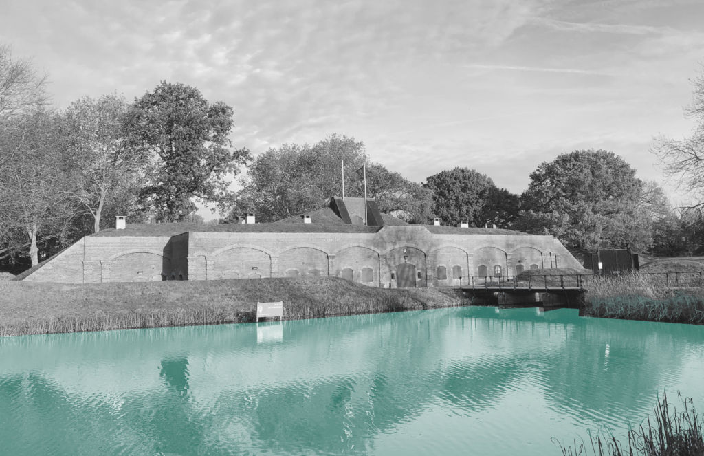
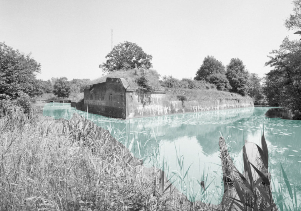
The New Dutch Waterline was built to defend Holland, the west part of the Netherlands and it is 85 km long. Large areas of agricultural land (polders) were flooded with a layer of approximately 40-60 cm of water- The traditional drainage system of the polder landscape was transformed into a 4 km wide defence line.
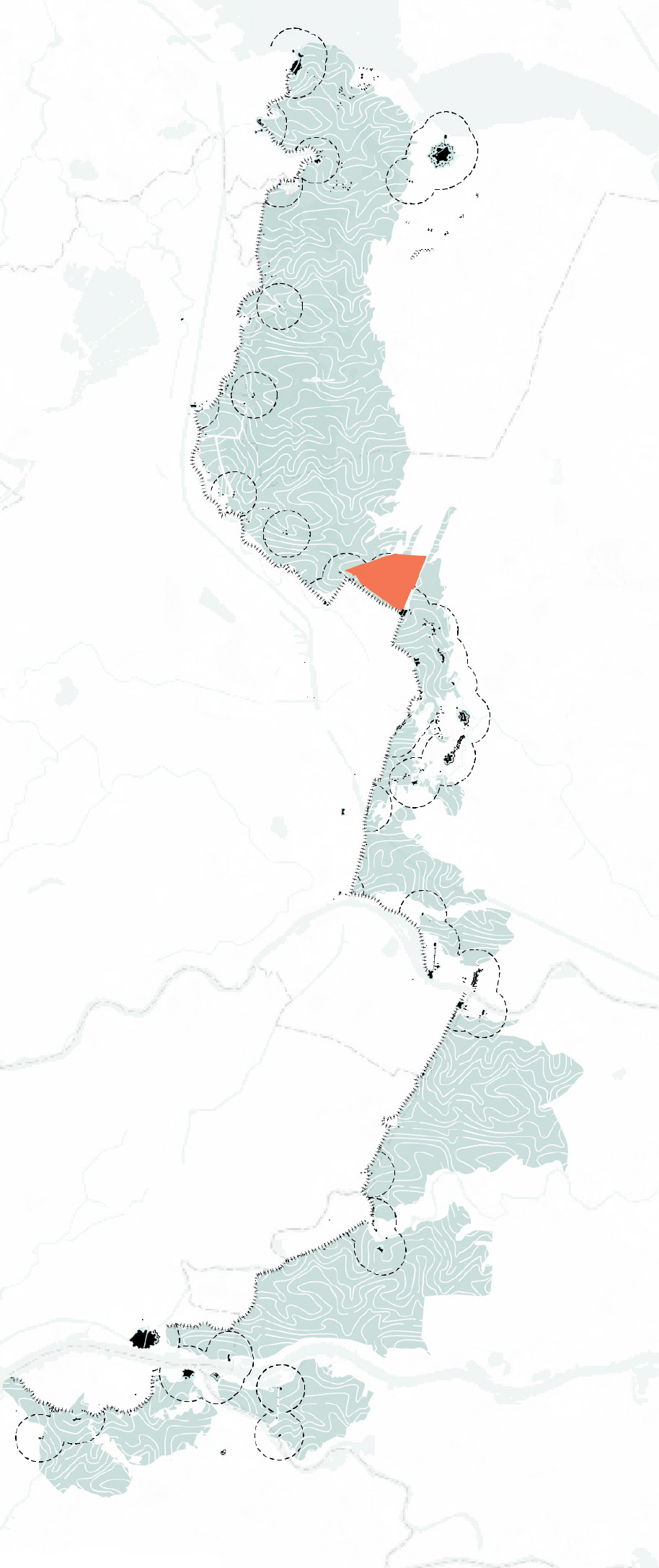
The New Dutch Waterline at regional scale.
Pumps and sluices guide the water out of the deep lying polders, in war-time the water could be directed into the polder. In a normal situation the water table is higher during winter. During a dry summer, water needs to be taken in from the boezem system. The boezem system is the discharge water network which brings the polder water from into the outer water. The whole water system can be set in motion by switching the pumping stations on and off or changing the direction of the water flow.
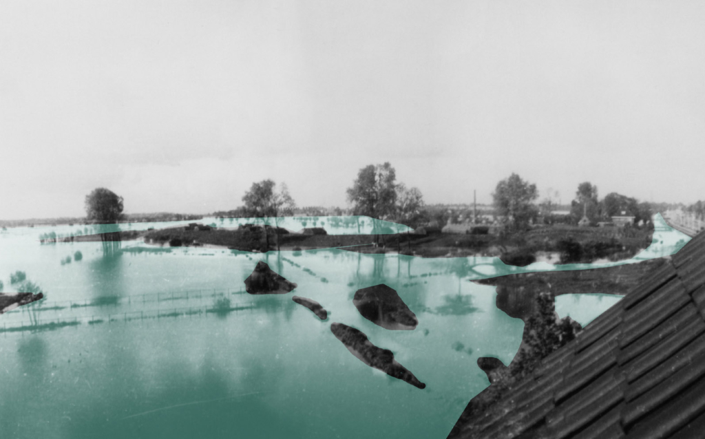
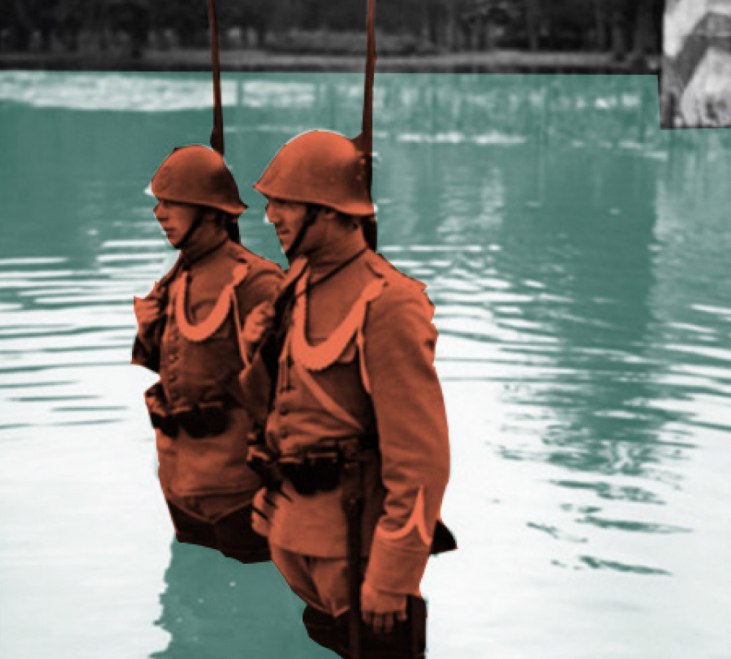
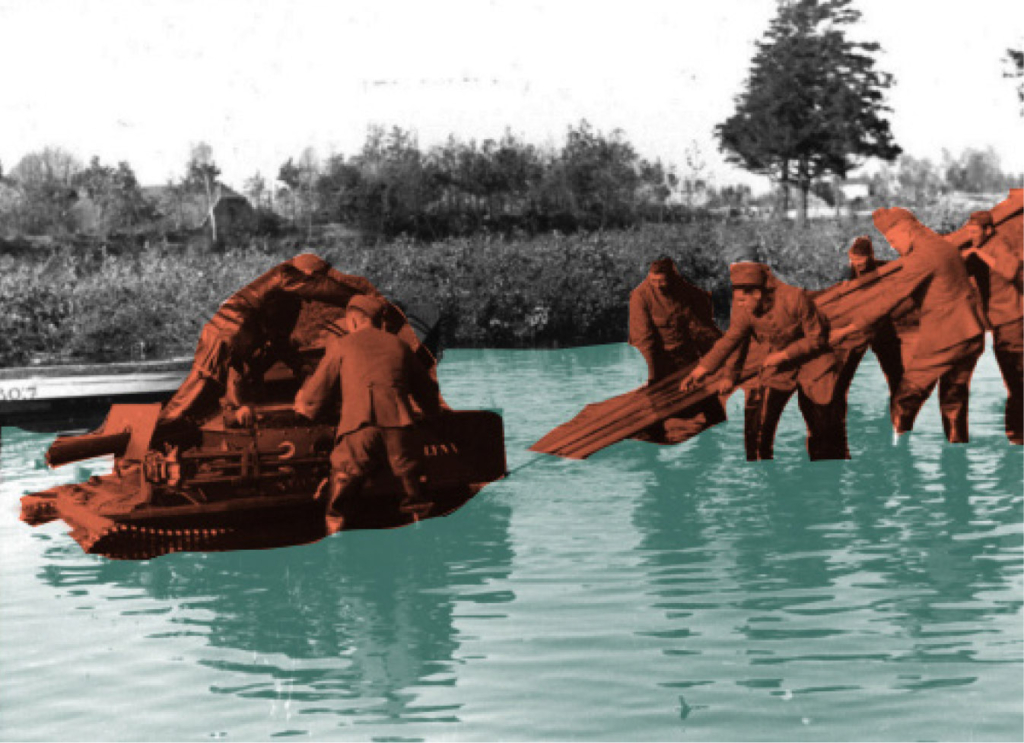
Left to right. Mill; Forts on the New Dutch Waterline; Inundation in 1945.
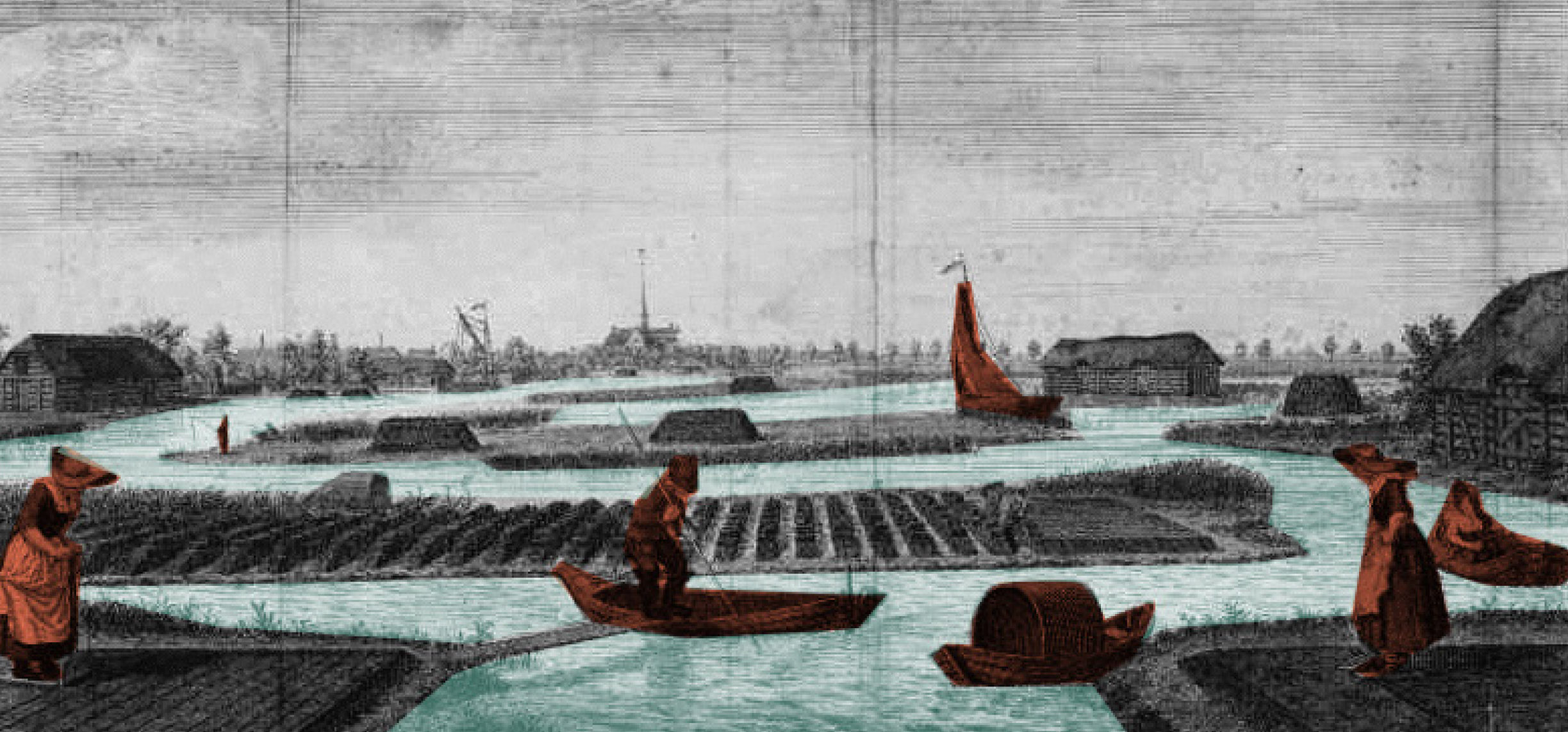
Normally the land is drained for agricultural use. After peat digging, used as fuel the land turned into a lake a became useless. By draining the inner lakes, new, deeper lake-bed polders were created. During the war period, the polders were transformed into lakes again and could not be crossed by enemies on foot or by horse.
Left to right. Dutch soldiers on guard; Operation of the waterline during exercise.Delving peat.
During normal times, the water is pumped out into the river, part of the boezem system. During war times, the waterworks can switch the direction and pump the water into the polder. Today they pump water into the polders during dry summers.
The existing water management in a polder is based on an independent managed water level. The system consisted of mills, later replaced by pumping stations and the sluices. The polders have different water levels. During the war the area was flooded polder by polder.
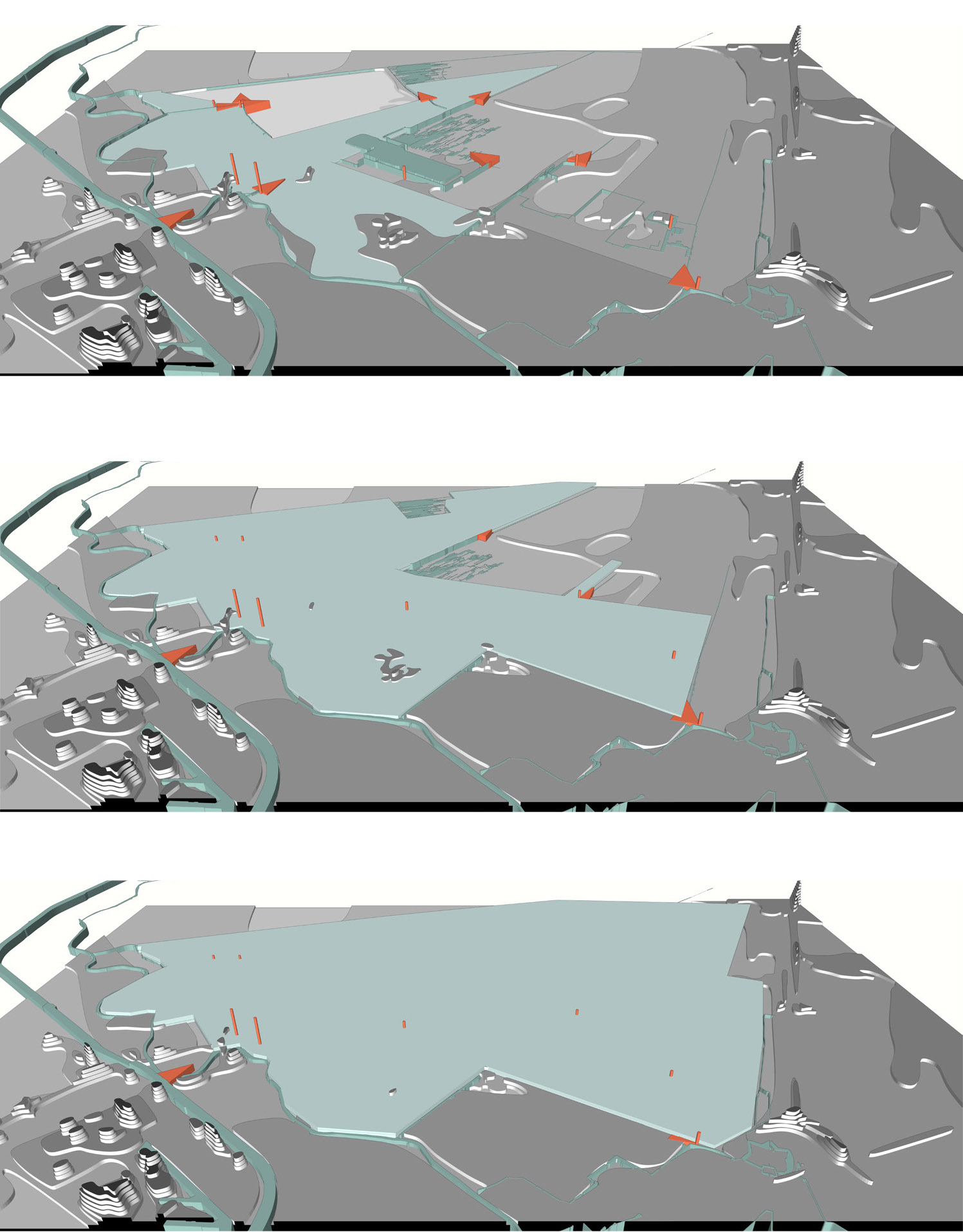
Top to bottom. Flood phase 1; Flood phase 2; Flood phase 3.
For the entire booklet of The New Dutch Waterline be so kind as to contact us through the form in the Contact section.
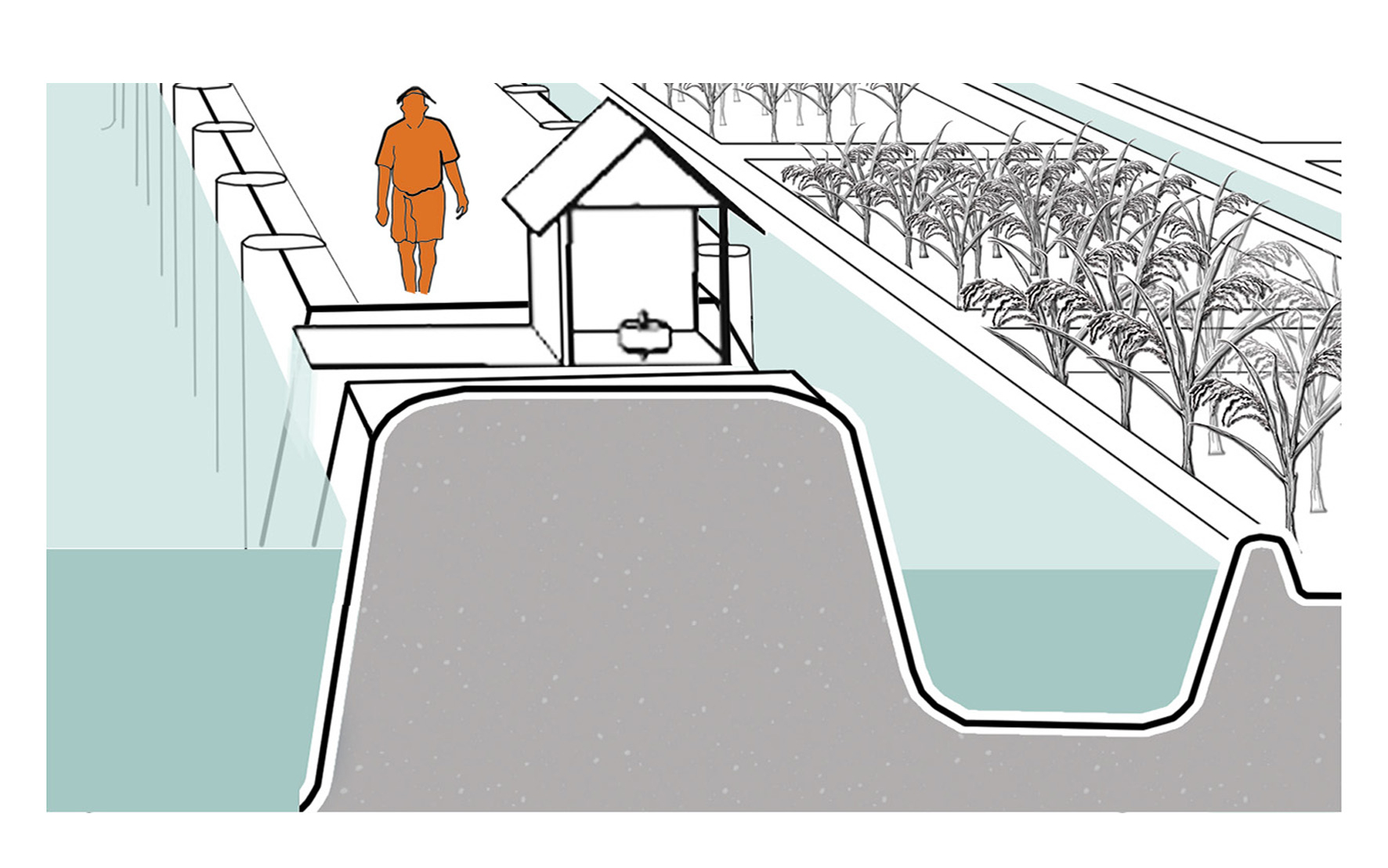
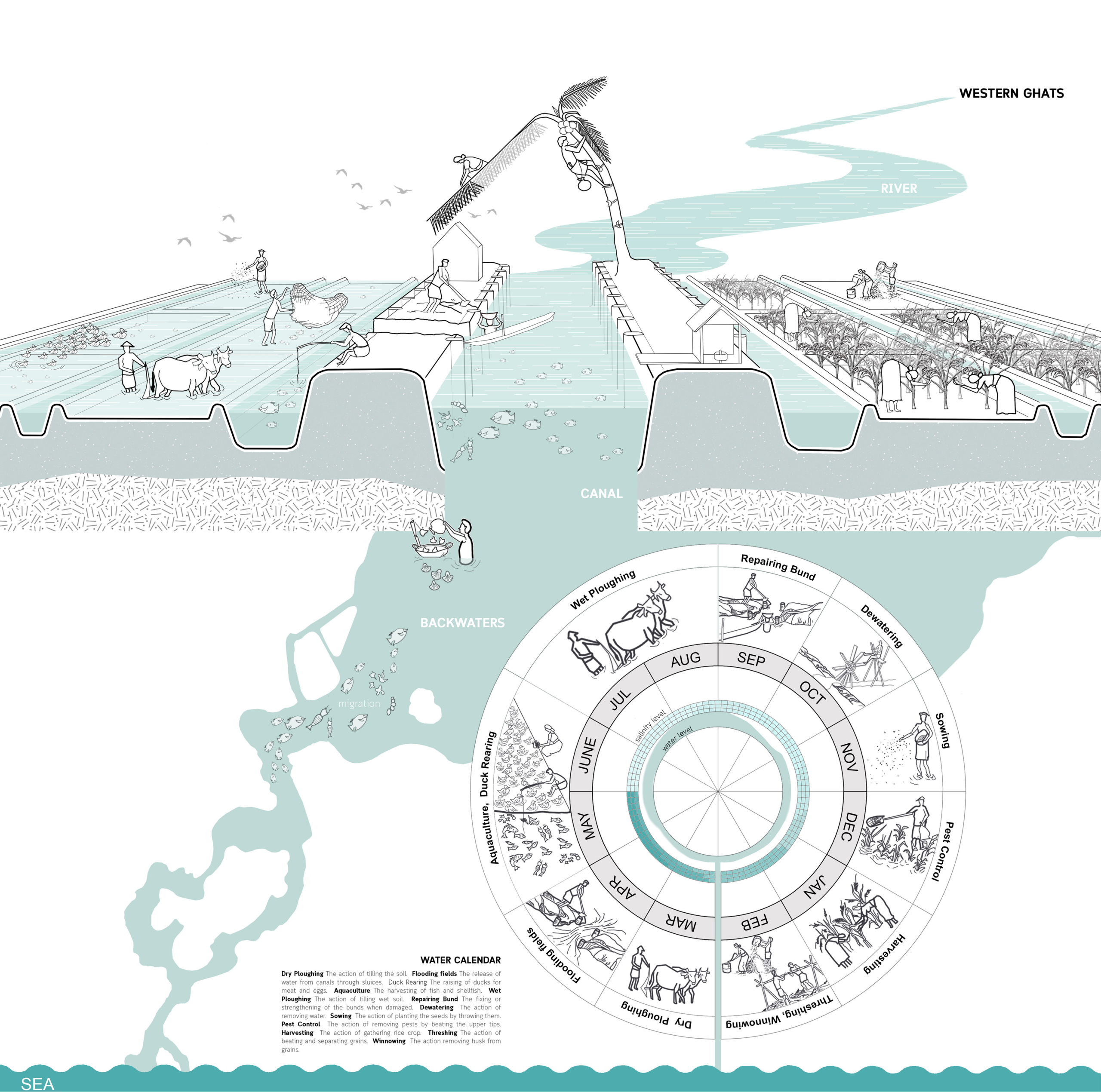
An indigenous technical device placed at the edge of the Kayalnilam for pumping water out from low-lying areas to the major canals or backwaters. It consists of a submerged brass vessel that sucks water out and is run by an electric motor kept inside the pump house. The sucked water flows out through a rectangular brass box.
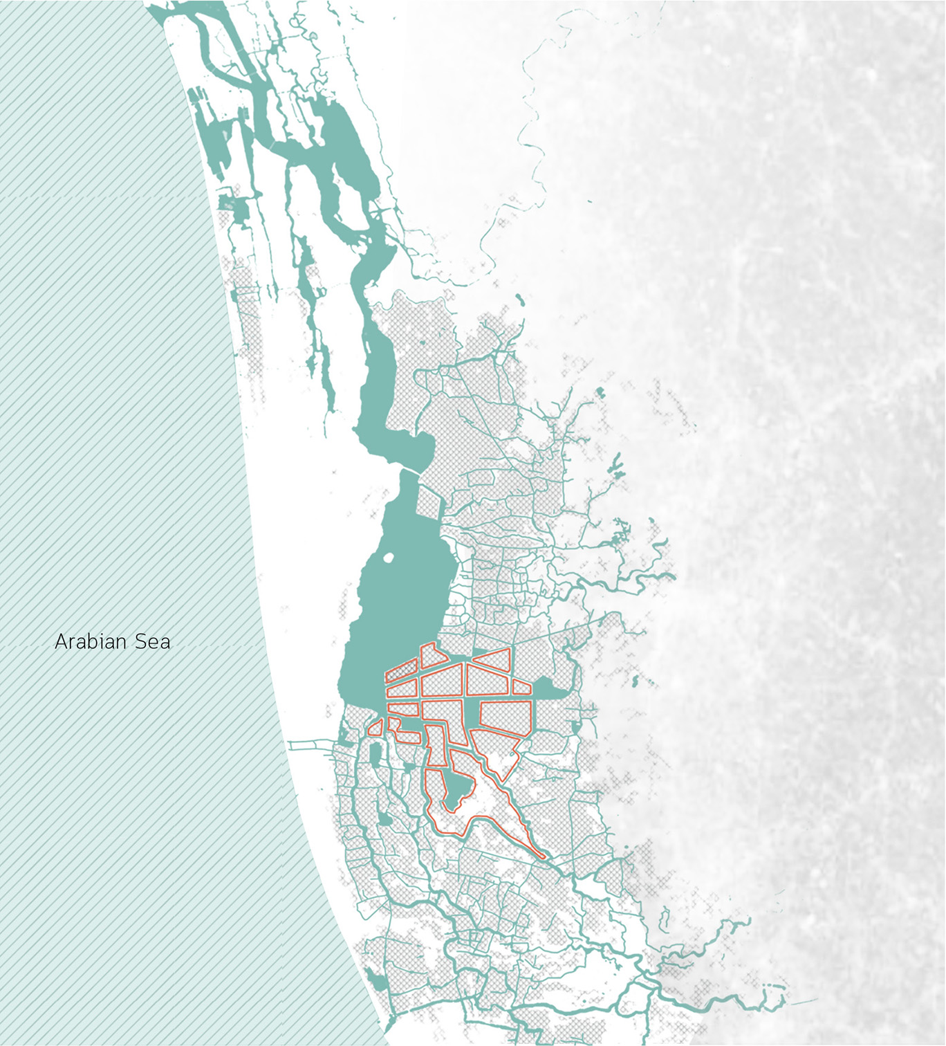
Project: Kuttanad Kayalnilam Agrosystem, Kerala, India
Climate: Tropical monsoon
Year: 1880-1974 (a modified version is still in use)
Water type: Seasonal mixing of saline and freshwater
Landscape: Polder landscape in a deltaic basin
Altitude: -3 – +1.5 m.a.s.l
Soil condition: Sandy loam clay formed from riverine or lacustrine deposits
A traditional paddy farming system below sea level.
Naeema Ali 2020
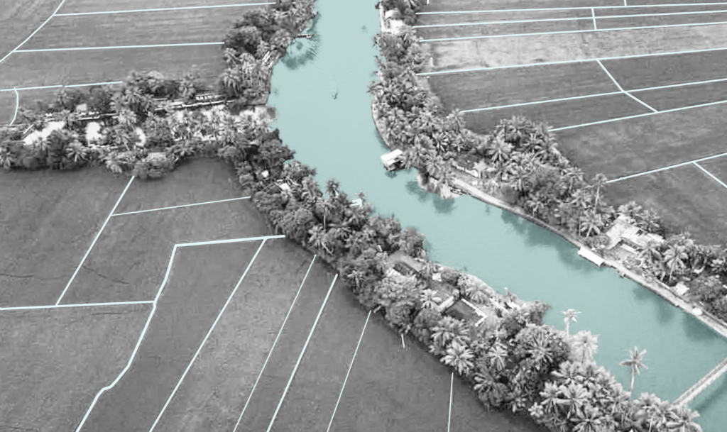
The birth of the cultural landscape was marked by the onset of the land reclamation process, locally known as “Kayalkuthu”. When the region encountered acute food shortage in the late 1800s, the virgin landscapes were considered as a gift from the backwaters and were brought to agricultural glory.
Kuttanad cultural landscape.
Here, water management was quintessentially a unit of the cultural expression of the site specific challenges faced by people, be in terms of topography, climate or social hierarchy. The low-lying landscape was subjugated for the benefit of men and women and how they did this narrates the legend behind the existing agricultural landscape of Kuttanad. These radical ingenuities tell us stories of how humans and nature exchanged roles between being makers and takers of the landscape.
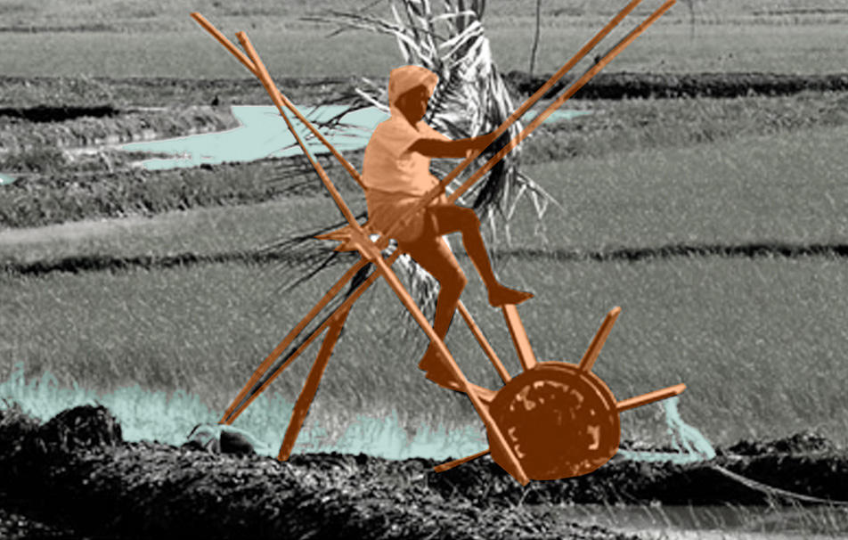
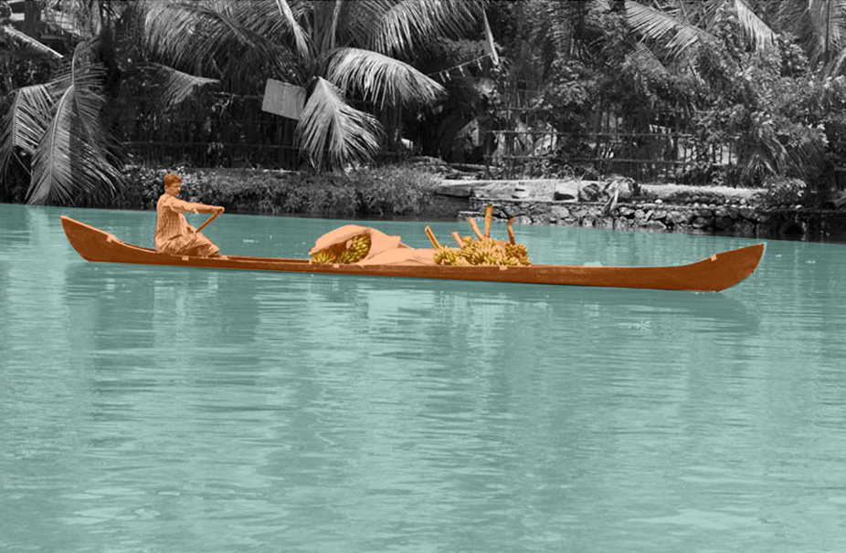
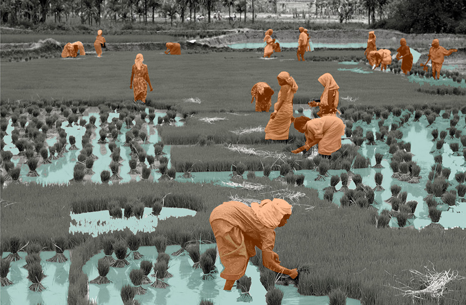
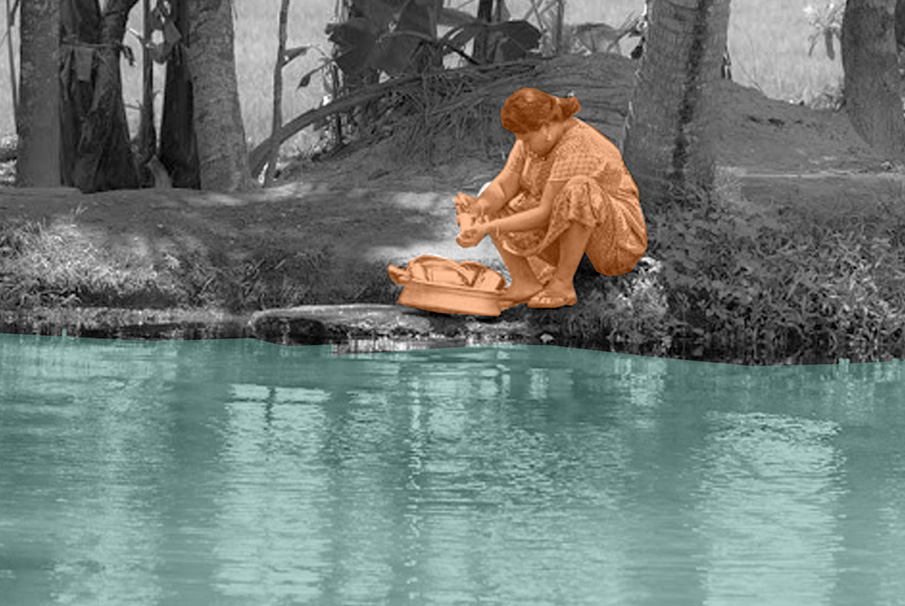
Clockwise. Farmer irrigating the field manually using a water wheel; female laborers harvesting paddy; man navigating through waterway in vallam, a canoe boat; lady washing utensils by the canal.
Circular Stories
The salt which came across as a curse sealing the fate of the farmers, however, was a blessing for the fishermen due to fish migration from the sea. Hence, the circle of life in Kuttanad was explicitly linked to this cycle of blessing and curse intermingling with the cycle of water and salt. Likewise, Kayalnilams also operated to optimize their performance within this spatio-temporal context specific to Kuttanad.
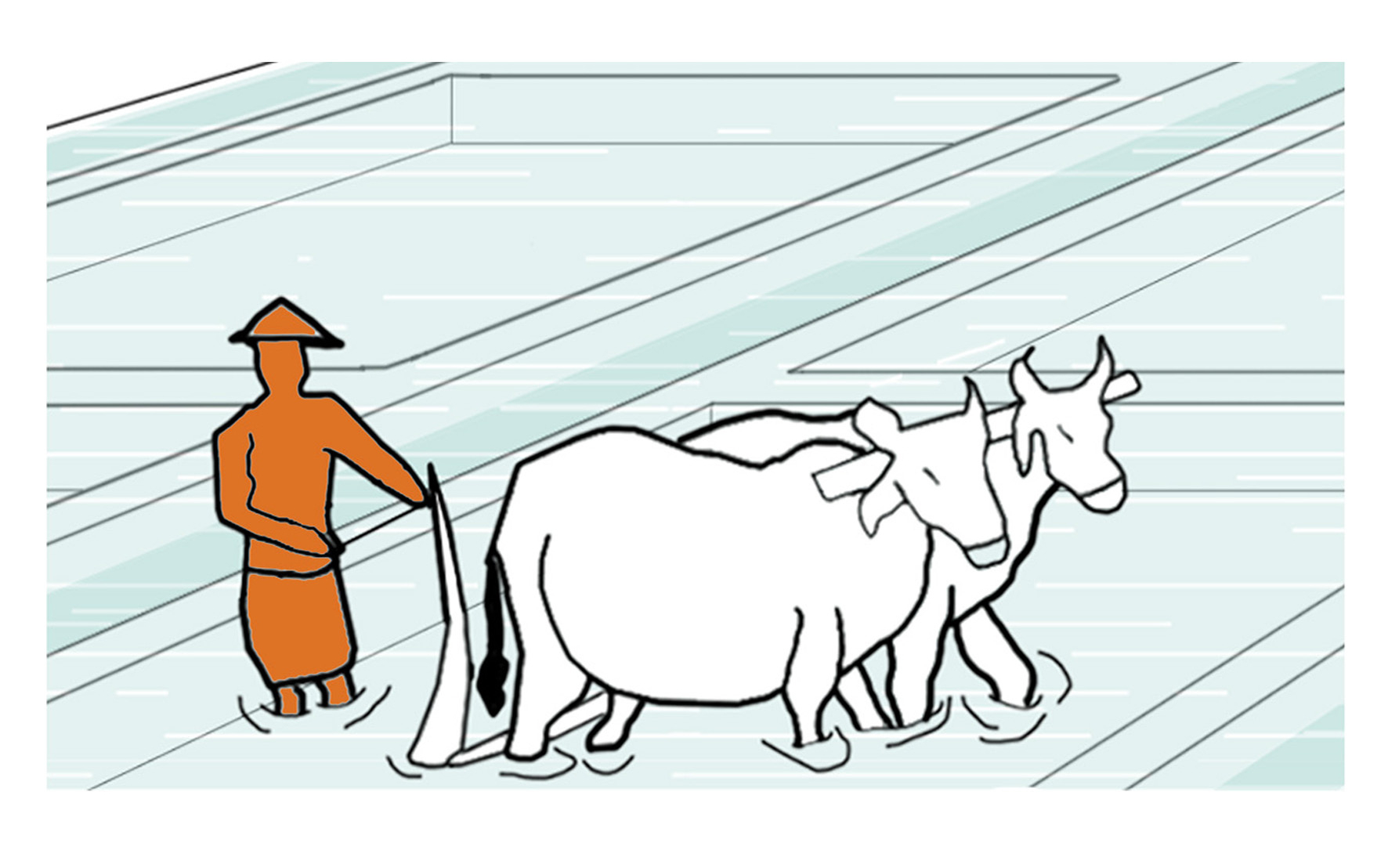
The action of turning up the earth when the fields are flooded with a plough that is made of locally available materials, like wood, in order to improve the workability of the soil. In the older days and even nowadays, some of the farmers employ cattle, like cows, to pull the plough manually.
Project Name: Kuttanad Kayalnilam Agrosystem, Kerala, India
Climate: Tropical monsoon
Year: 1880 – 1974 (a modified version still in use)
Water type: Seasonal mixing of saline and freshwater
Landscape type: Polder landscape in a deltaic basin
Meaning: Utilitarian landscape
Water Workers and Users: Farmers and fishermen
Soil: Sandy loam clay formed from riverine and lacustrine deposits