Water Harvesting System in Matera

View of Sassi di Matera and Gravina di Matera.

Traditional water harvesting system in Sassi di Matera, Italy

Wenting Gao
2023

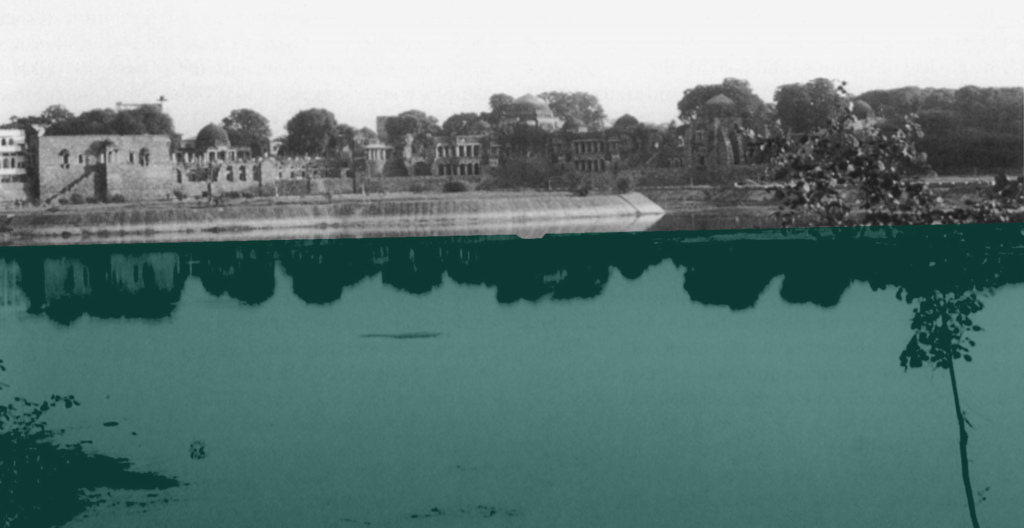
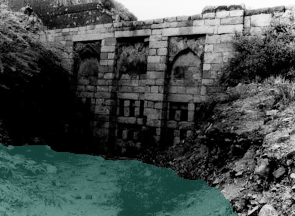
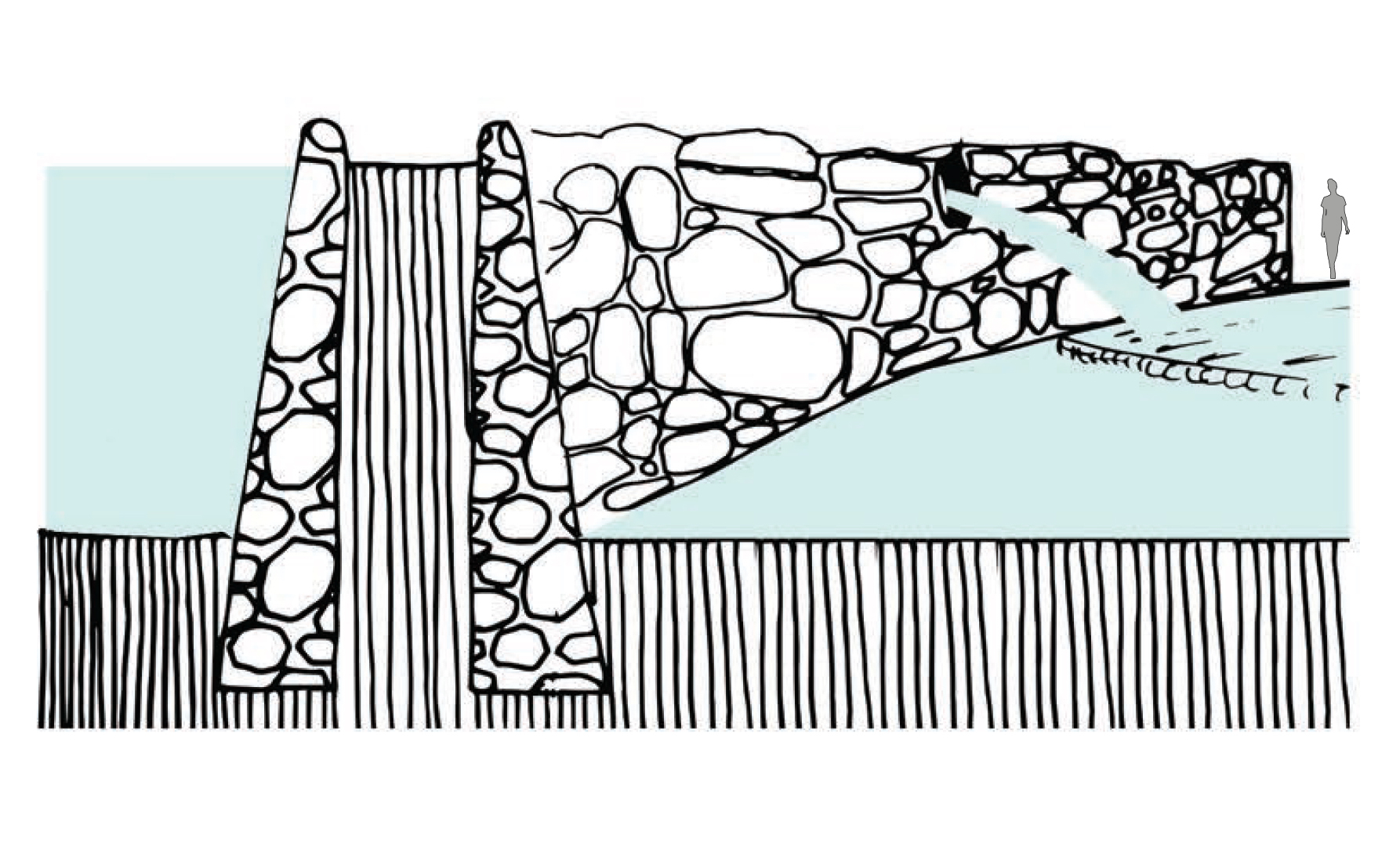
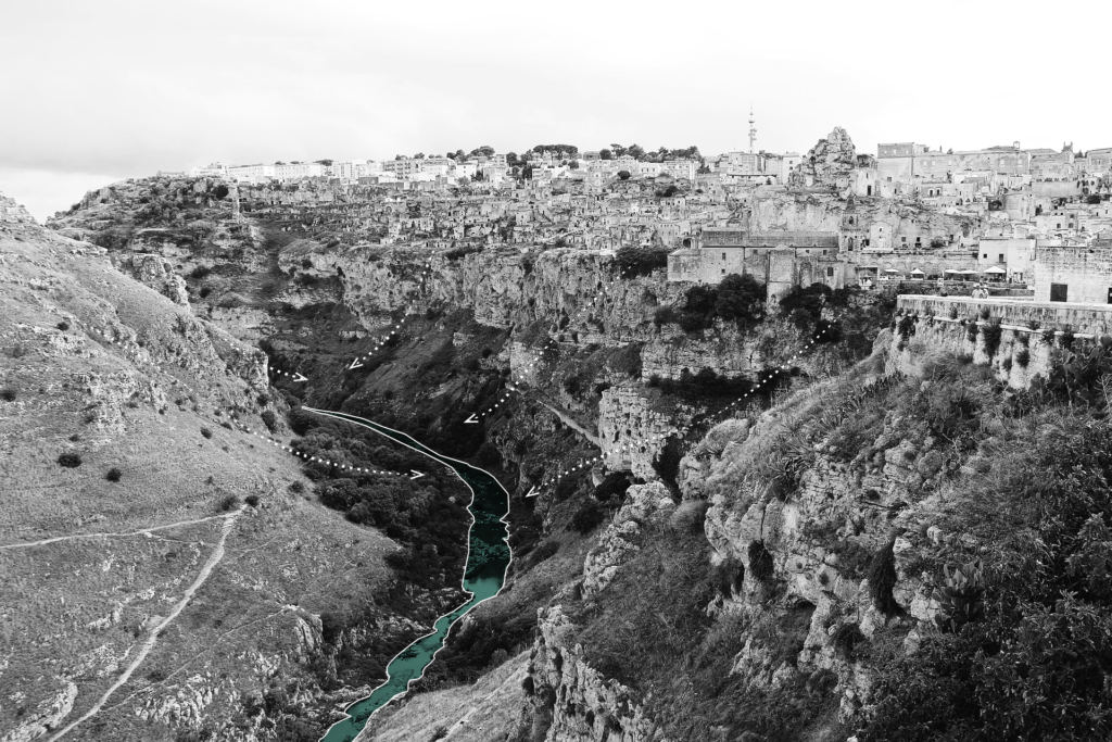
The two districts of Matera, Sasso Caveoso and Sasso Barisano, were built in the eroded terraced land near the natural water courses, called Grabiglioni, and formed by buildings and rock architectures carved into the rock of the Murgia Matera. Together with the Civita district (built on the spur that separates the two Sassi), they constitute the historic centre of the city of Matera. The water-harvesting system was composed of cisterns, catch basins, ponds, wells, fountains, condensers, neviera, as well as horizontal and vertical water channels. About 2210 cisterns were identified using a statistical approach, including 2039 small bell-shaped cisterns, 170 neighbourhood cisterns and two large cisterns of 1,300 and
5,000 m³ each. Water not only shaped the physical part of the city, but also influenced the way people live and work. The successful water-harvesting system created an an agro-pastoral society where most people were engaged in agriculture and husbandry, and about 56% were still land working peasants in 1754.

Traditional water system plan of Sassi di Matera in 1700s.

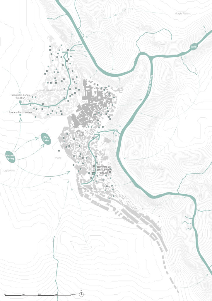
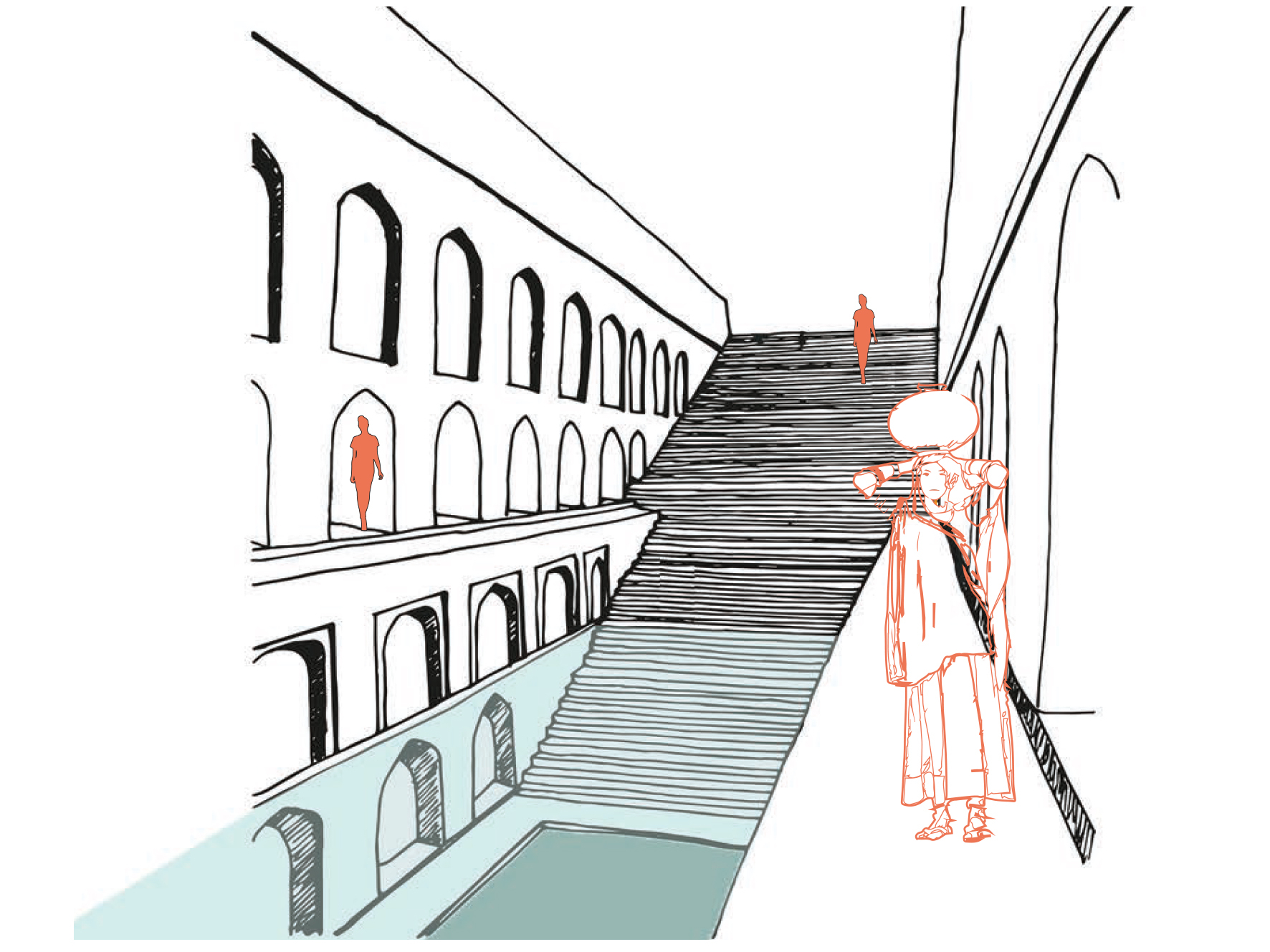
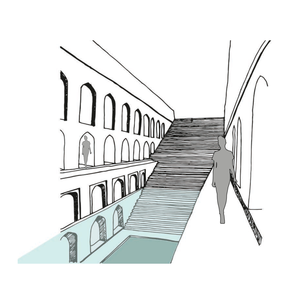
The grabiglioni, an important water channel in Sassi di Matera, is also the centre of public life. The vicinato, a common courtyard where children would play together and everyone helped each other out, is always accompanied by a cistern serving 4-6 families, so it naturally becomes the place for different domestic chores and social interactions.

People gathered in ‘‘vicinato’’ for social intercourse and domestic chores (Bottom right).

Circular Stories

Cicular diagram of the traditional water harvesting system in Sassi
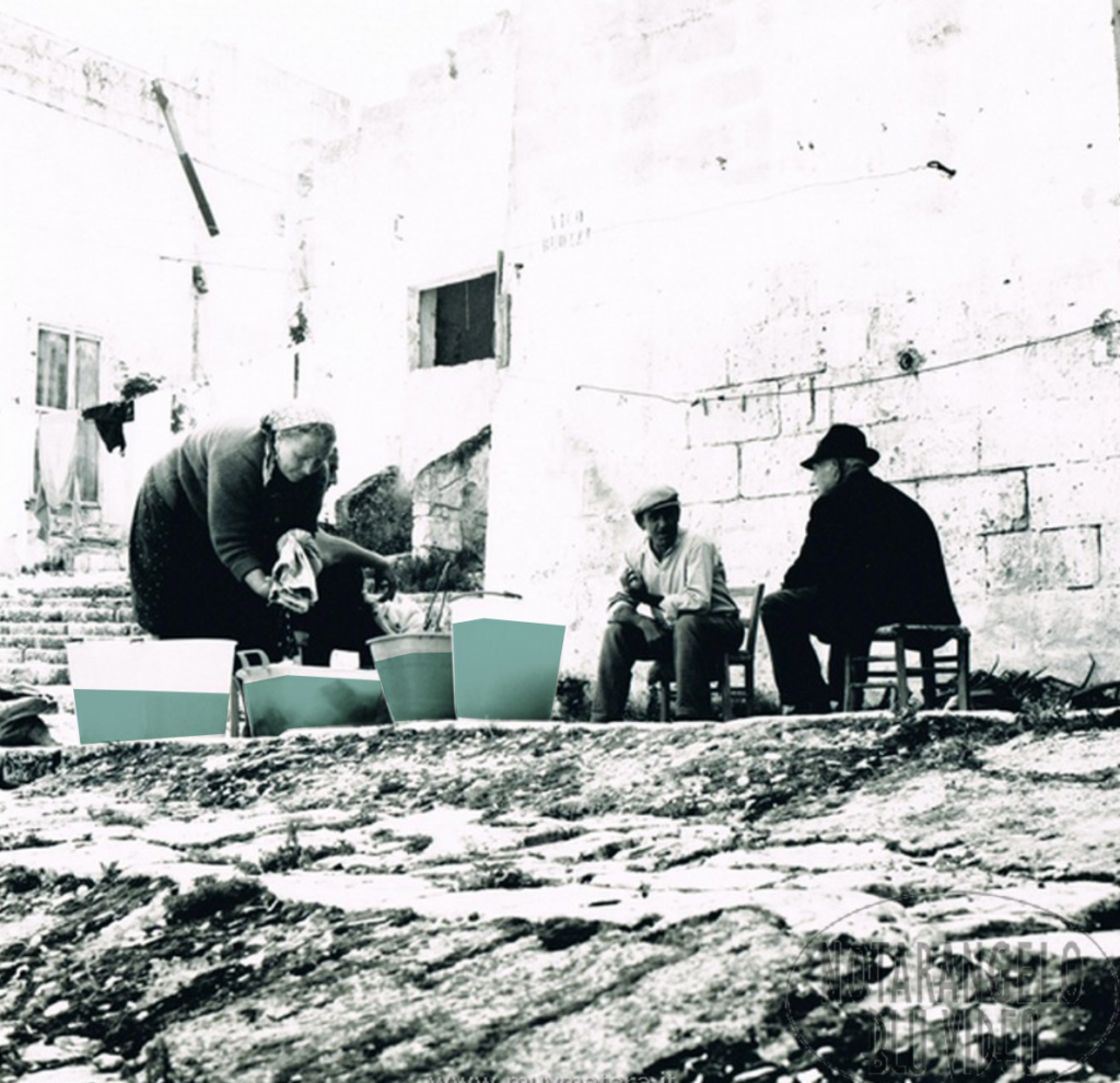
di Matera around 1700s; Circular diagrams of water usage (Bottom left).

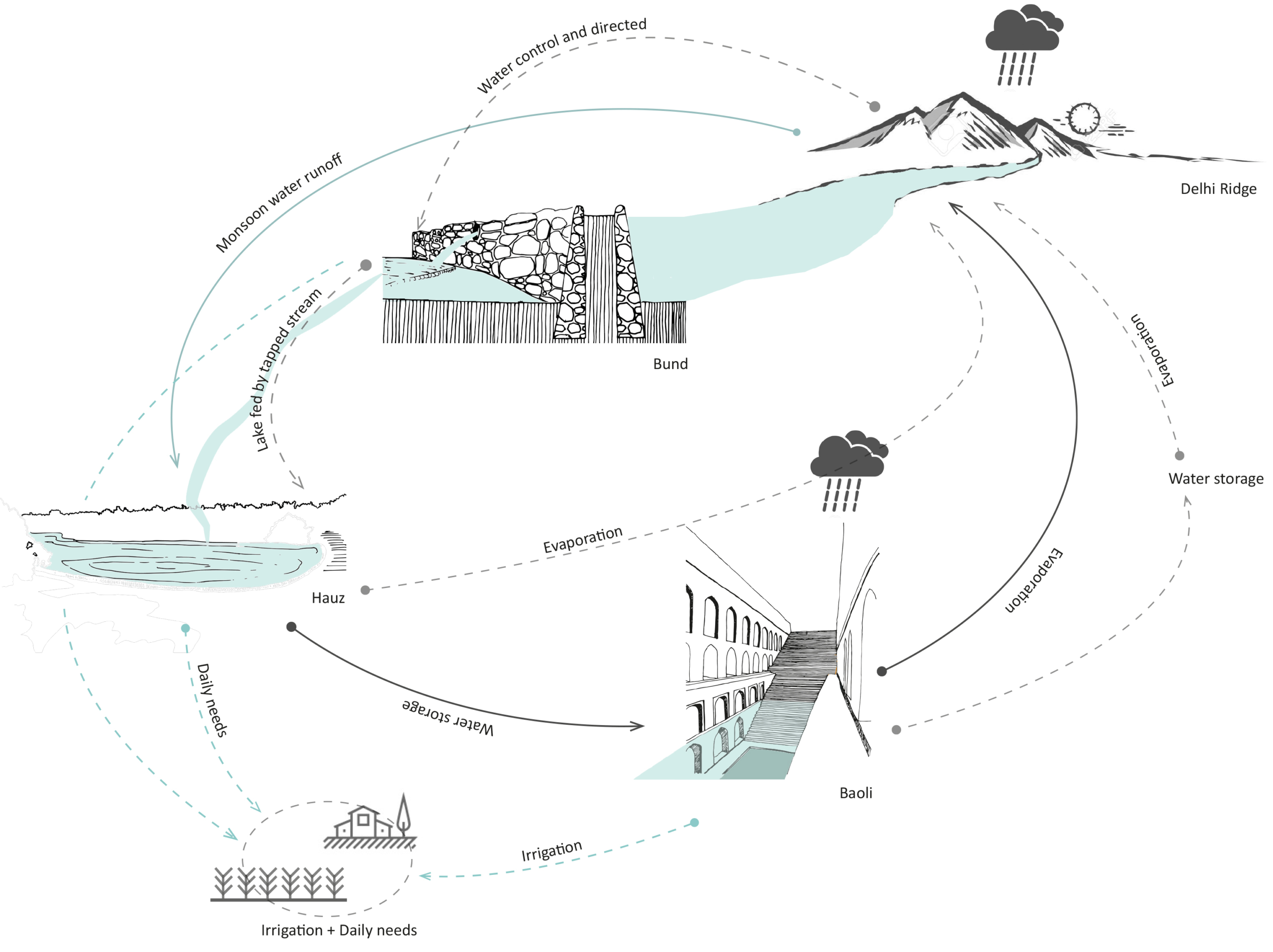
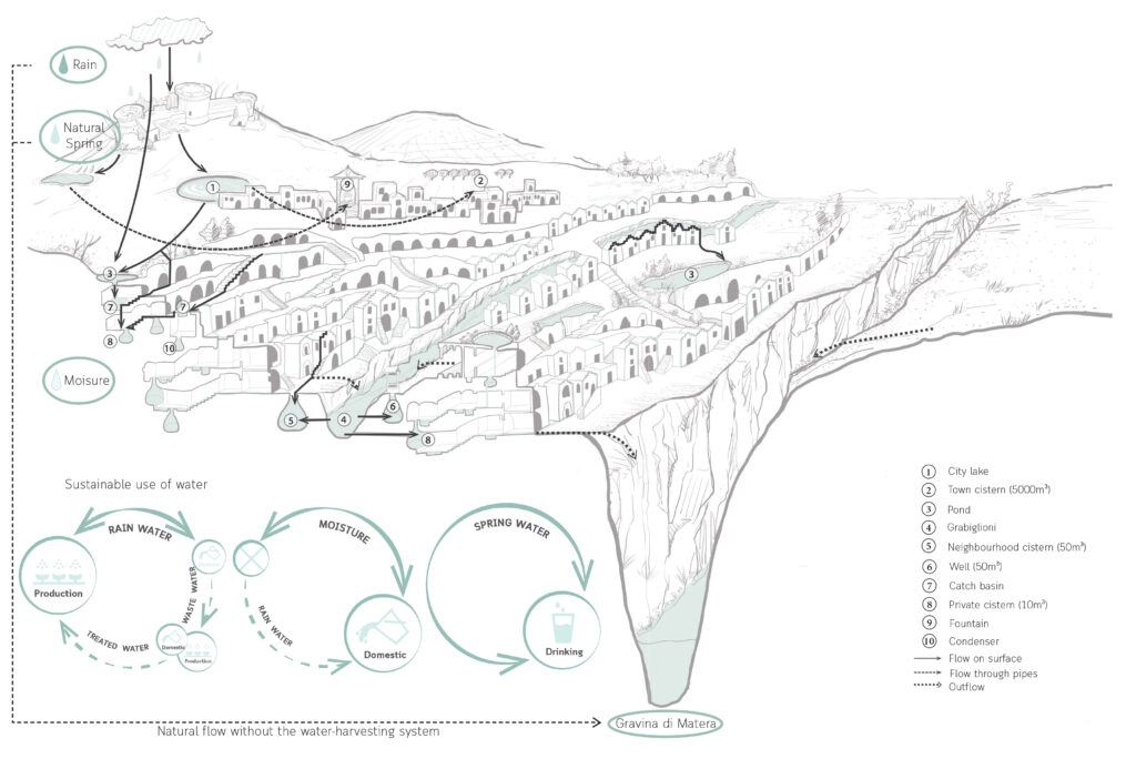
There are three types of water sources in Sassi, rainwater, natural springs, and moisture. In a natural condition, they will directly go into the Gravina di Matera, but with the help of the circular water system, they are used in a sustainable way for production, domestic use and drinking purposes.

Public rainwater cycle (Left); Private rain water cycle (Top right); Moist cycle (Bottom left); Spring water cycle (Bottom right).

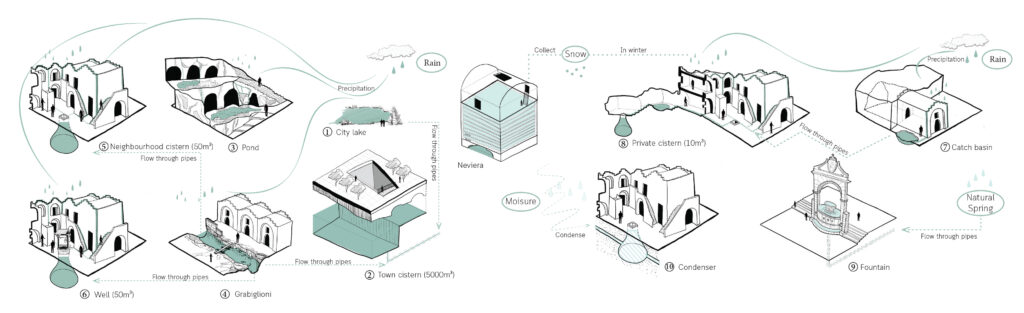
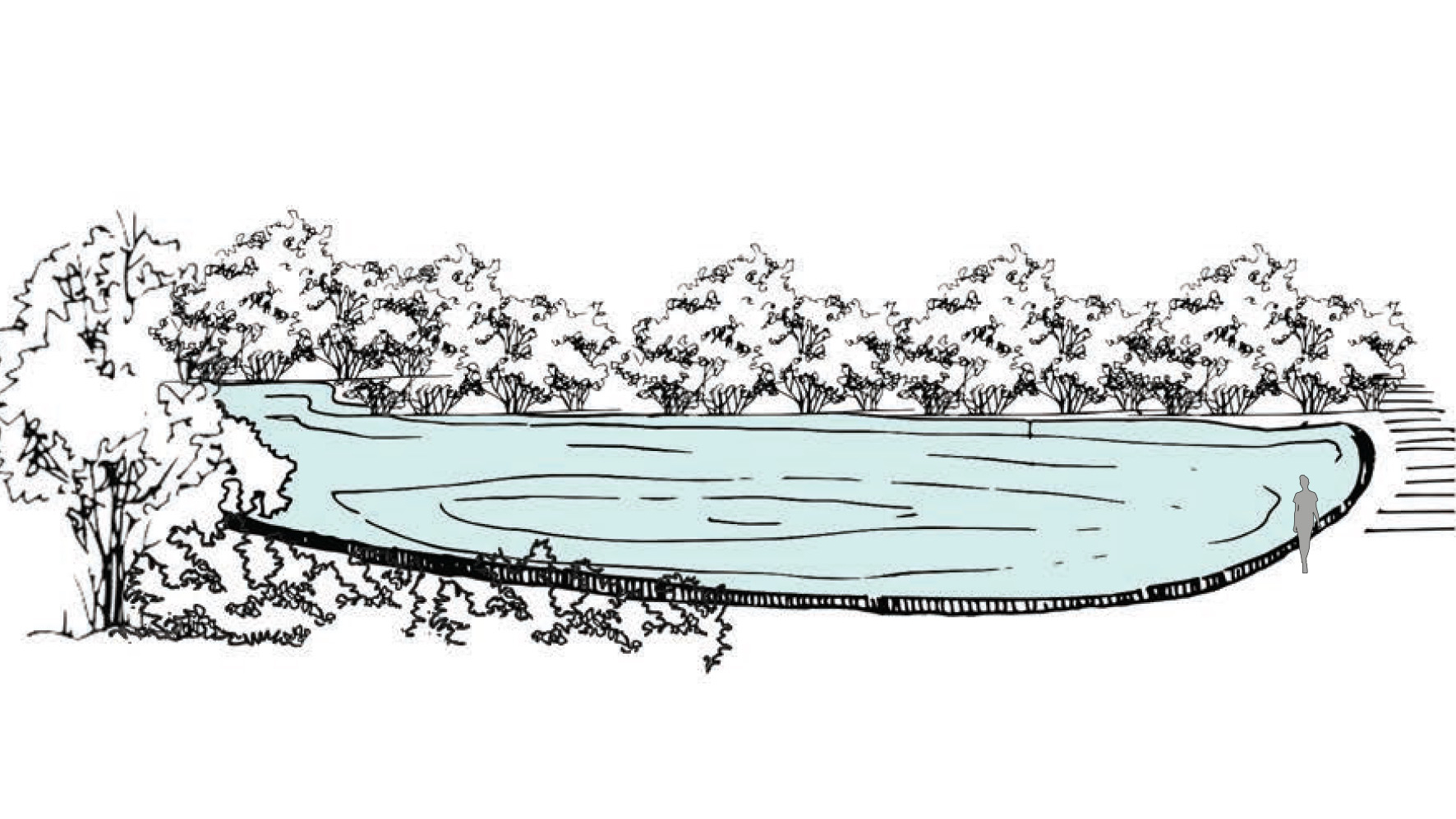
Firstly, the rainwater, which is also the dominant source in Sassi, is collected in lakes, ponds or catch basins at first, then goes into cisterns of different sizes with the help of horizontal and vertical water channels on roofs, stairs, wall and ground. Some cisterns are interconnected by underground pipes, while others are quite private and isolated. There is a water tank that is completely isolated, and it is used as the condenser to collect moisture, which is also a hidden water source in Sassi. In addition, a natural spring near Tramontano Castle is the only drinkable water source, which later led to the Fountain Ferdinandea for people to use.

Stepwells of Jaipur

Atmosphere of the stepwells.

Exploring into the ancient water wisdom of Jaipur Rajasthan, India.

Anubhuti Chandna
2019

Jaipur is one of the first planned city of northern India based on the principles of “Shilpa Shastra”, in fact “Jaipur clearly represents a dramatic departure from extant medieval cities with its ordered, grid-like structure – broad streets, criss-crossing at right anglese, earmarked sites for buildings, palaces, havelis, temples and gardens, neighbourhoods designated for caste and occupation” (UNESCO, 2015).

During the planning of the city, special attention was given to the water supply system. With half of the city surrounded by the hills, the city took advantage of various rain catchment areas that were available for storage direct response to local geophysical conditions.

Catchment areas of the different systems in the city of Jaipur.

The ruler built 16 miles long canals from the nearby river streams and brought water to the city through aqueducts, As the city grew with increased demand for water, a dam across the river of Dhravyavati was constructed in 1844 along with a canal which runs east to west of the city, wide enough for 5-7 horsemen to ride abreast. This covered canal would then distribute the water through various channels and wells across the city and open at some places for direct access. However, after the construction of the metalled roads and new pipe system of supply, the canal got buried within the markets and its deep walls got filled up.

5 typologies of stepwells in Amber.

Water has a special significance in Hindu mythology, believed to be as a boundary between heaven and earth. For centuries, stepwells and stepped ponds, also known as Bavdis, Bawadis, Baolis or Vavs, have not just played a significant role in functioning as traditional water systems, serving the community through generations but also as hotspots of social, cultural and touristic interactions. “While various water structures such as tanks, cisterns, paved stairways along rivers (ghats) and cylindrical wells are found elsewhere in India, stepwells and stepped ponds are indigenous to semi-arid regions of Gujarat and Rajasthan” (Livingston & Beach, 2002).

Clockwise. Typology 2, Cheela Bawadi; Typology 1, Atreya Bawadi; Typology 3, Sarai Bawadi; Typology 4, Bengali Baba ki Bawadi; Typology 5, Parshuram Dwar ki Bawadi.
Tattar ki Bawadi in Amber.

Delhi Sultanate Waterworks

Typical Baoli stepwell atmosphere.

Ancient network of water harvesting
structures in Delhi, India.

Tanvi Gupta
2020

Delhi is located in the Northern part of India being continuously inhabited since the 6th century B.C. Through most of its history, Delhi has served as the capital of various kingdoms, most notably the Delhi Sultanate and Mughal empire. Two prominent features of the geography of Delhi are the Yamuna floodplains and the Delhi ridge.

Delhi’s urban waterworks developed in early thirteenth century. They took the following main forms of hauz (water tank), baoli (stepwell) and bund (embankment). Collectively these small structures served the sultanate capitals of South Western Delhi. As with other ancient and medieval water systems, they were incremental and coordinated. Urban lakes, tanks and reservoirs were sited in gently sloping areas adjacent to hillside water control structures.

Bund network along Delhi Ridge.

Delhi sultanate waterworks developed during the early 13th century. They took three main forms – the bund network (embankment), hauz (water tank), and baoli (stepwell). These reflect the main strategies of the Delhi Sultanate water works – the bund network helps in directing and capturing the runoff from the ridge, the hauz stores the surplus monsoon surface water runoff and recharges groundwater while the baolis tap into the shallow groundwater along with storing rainwater.

Circular Stories

Circularity of the Delhi Sultanate Waterworks system.

Delhi Sultanate waterworks or harvesting structures were well coordinated with one another, each structure supporting the existence of the other. The bunds, the royal tanks called hauz and the baoli storage structures aided water evaporation and condensation into the atmosphere which again would be captured in the ridge landscape during monsoon.

Today, these water structures lie in a dilapidated state with some having been restored for heritage and tourism purposes. Thus, it is important to learn from past methods of harvesting water to overcome the hydrological problems Delhi is facing today.

Baoli (water stories)

Baoli
Stepwell

Rainwater and natural stormwater channels from Delhi ridge are stored in the ground and it is directly accessible to people by a flight of stairs. The narrow staircase is divided into three parts, which runs along the inner three walls of rectangular baoli.

  • Project Name: Delhi Sultanate Waterworks, Ancient network of water harvesting structures, Delhi, India
  • Climate: Overlap of humid subtropical and semi-arid
  • Year: 1206 A.D. – 1526 A.D.
  • Water type: Drinkable rainwater
  • Landscape type: Ridge landscape
  • Altitude: 220-230 m.a.s.l
  • Soil condition: Alluvium, Quartzitic ridge
  • Material: Delhi quartzite stone
  • Period: Fixed
  • Form: Surface
  • Use or function: Water harvesting

Bund

Bund
Embankment

Water harvesting mud embankments restrain natural streams of stormwater runoff in its upper reaches and direct it for storage in hauz (lake) and baoli (stepwell).

  • Project Name: Delhi Sultanate Waterworks, Ancient network of water harvesting structures, Delhi, India
  • Climate: Overlap of humid subtropical and semi arid
  • Year: 1206 A.D. – 1526 A.D.
  • Water type: Drinkable rainwater
  • Landscape type: Ridge landscape
  • Altitude: 220-230 m.a.s.l
  • Soil condition: Alluvium, Quartzitic ridge
  • Material: Stone masonry
  • Period: Fixed
  • Form: Point
  • Use or function: Water directing

Baoli (water works)

Baoli
Stepwell

Rainwater and natural storm water channels from Delhi ridge is stored in ground and it is directly accessible to people by a flight of stairs. The narrow staircase is divided into three parts, which runs along inner three walls of rectangular baoli.

  • Project Name: Delhi Sultanate Waterworks, Ancient network of water harvesting struc-tures, Delhi, India
  • Climate: Overlap of humid subtropical and semi arid
  • Year: 1206 A.D. – 1526 A.D.
  • Water type: Drinkable rainwater
  • Landscape type: Ridge landscape
  • Altitude: 220-230 m.a.s.l
  • Soil condition: Alluvium, Quartzitic ridge
  • Material: Delhi quartzite stone
  • Period: Fixed
  • Form: Surface
  • Use or function: Water harvesting

Hauz

Hauz
Lake

Water tanks which harvest rainwater and stormwater during monsoon season. Main function of the hauz was to collect rainwater over a large expanse of land.

  • Project Name: Delhi Sultanate Waterworks, Ancient network of water harvesting structures, Delhi, India
  • Climate: Overlap of humid subtropical and semi-arid
  • Year: 1206 A.D. – 1526 A.D.
  • Water type: Drinkable rainwater
  • Landscape type: Ridge landscape
  • Altitude: 220-230 m.a.s.l
  • Soil condition: Alluvium, Quartzitic ridge
  • Material: Excavated soil
  • Period: Fixed
  • Form: Surface
  • Use/ function: Water harvesting