Consecutive Dams and Mills System in Spain

Charterhouse of El Paular

Water Late Medieval Systems including
mills, fish farms and dams in El Paular charterhouse,
Spain

Javier Sanchez Jimenez
2023

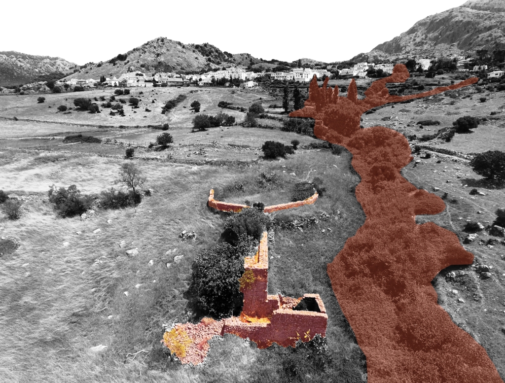
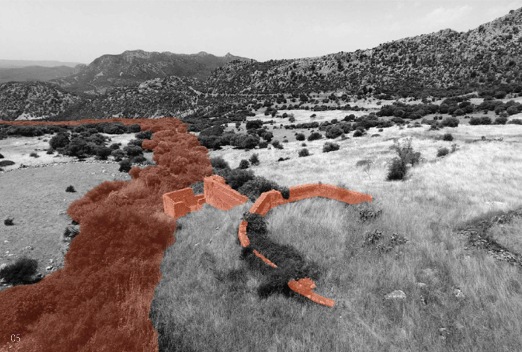
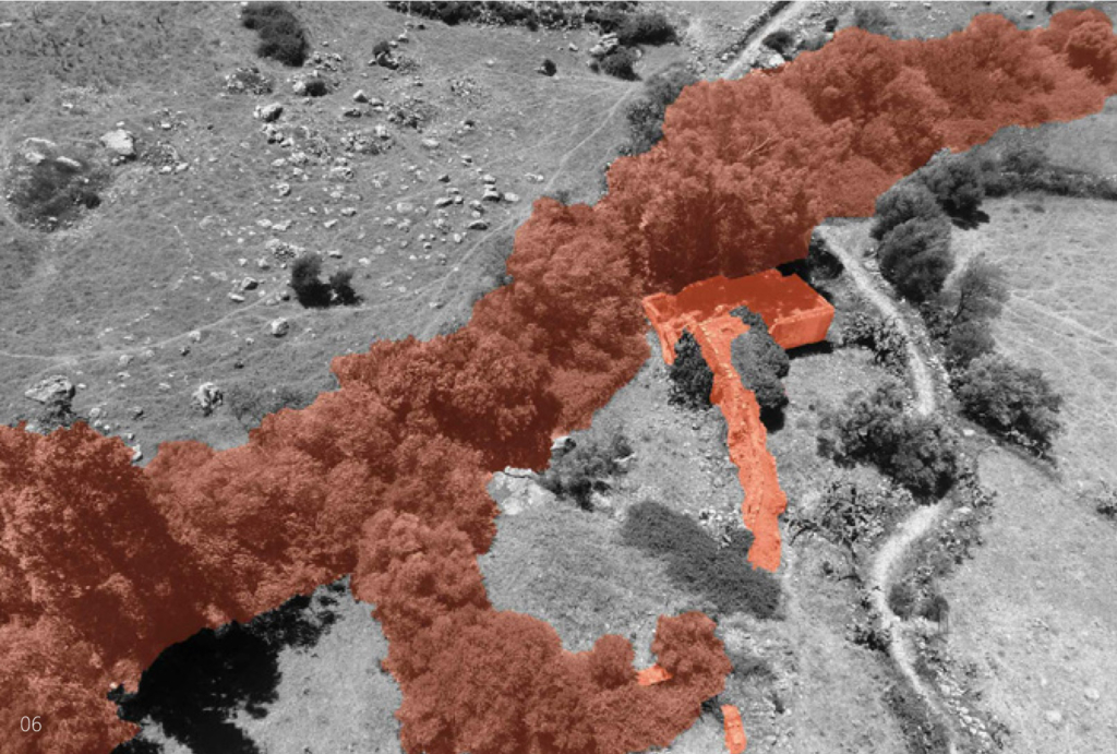
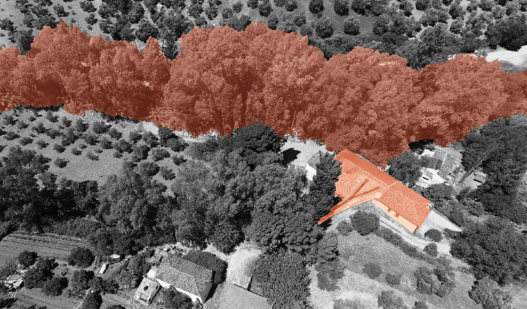
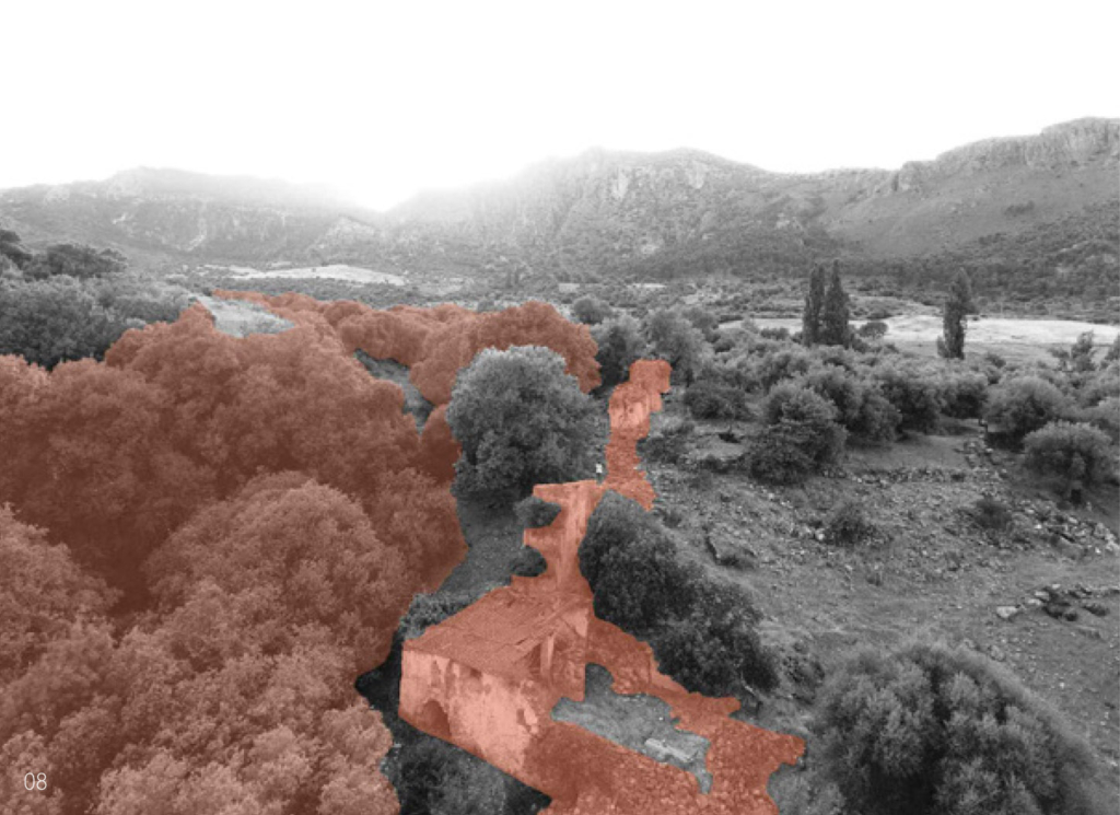
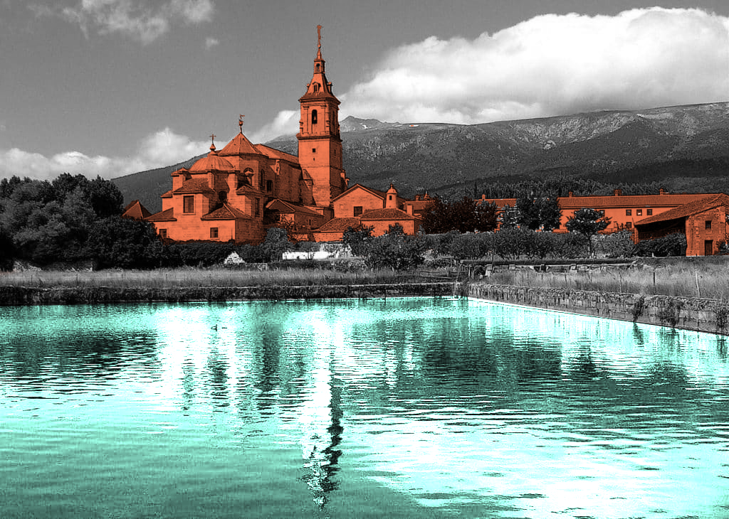
The Valley of Rascafria is a narrow dale which opens to towards the North, located in the Sierra de Guadarrama, the north-western border of the Madrid region in Spain. The valley has a minimum altutude of 1125 above sea level and it is surrounded by mountains over 2000 meters high.

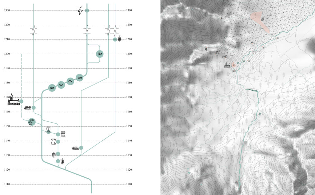
The monastery lands are situated within the upper Lozoya catchment area. This basin is a valley encircled by steep mountains that encircle a flatter plateau. one could suppose that this plain would be a fitting place for agriculture; however, the soil is too rocky for that. Regarding the quality of the water, it is exceptionally good since it comes from either rainfall or melted snow that runs down through a hard soil, which prevents it from contaminating with sediments.

Outdoor of an “Arca” (cleaning through decantation). This example belongs to a similar water system in El Escorial (Top left); Interior of an “Arca” (cleaning through decantation). This example belongs to a similar water system in El Escorial (Top middle); Water pavilion with fountain (Top centre); The former fish farms, now converted into a popular recreation area (Bottom left); The stone dams of the former fish farm (Bottom right).

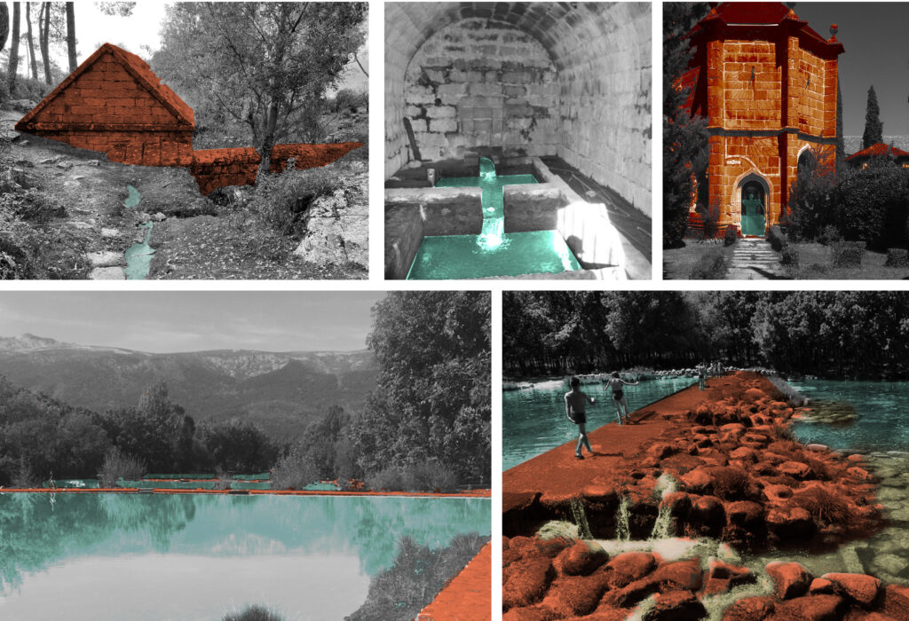
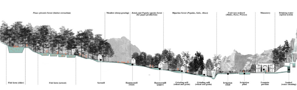
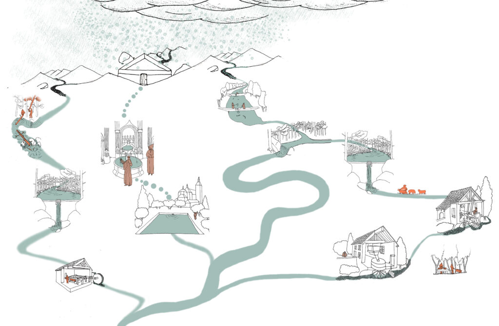
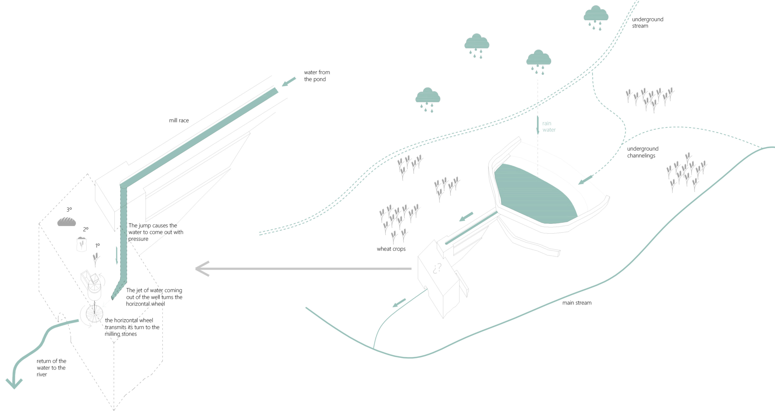
The water system was heavily modified, by the construction of consecutive dams. However, it is very significant to note that the ones that interrupted the river – the fish farms- were relatively short, not more than a meter and a half high. The only exception is the modern hydroelectric plant’s dam The higher ones, corresponding to the mills, are separated from the main river course, from which the water is diverted to them through canals. In consonance with modern times, new recreational facilities have been introduced, such as the lake of the Finnish forest or the reuse of the old fish farms as swimming pools.

Diagram of the system, with all the existing ponds and dams still existing and their past uses. (Left); Plan of the water system, also reflecting its interdependence with the vegetation. (Right)

Circular Stories

The existing watersystem is the origin of all the economical activities in the area and deeply intertwined with the kind of society that was able to settle and thrive here: one that did not depend on crops and had an easy access to grain- a log-lasting produce that could be grinded into flour to make bread and within an easy reach in the Castillian Moors, just at the other side of the mountains. This implied a certain level of initial wealth that enabled them to buy or build the high tech equioement needed in the watermills to produce the expensive elaborate products in which the monastery based their wealth.

Diagramatic section showing the interdependence betwen the vegetation and the water system.
Circularity of the system / Representation of sustainability.

The Water Mills of Sierra de Cadiz

Atmosphere of the system.

Water as a driving force in the historical
production of staple food: bread.

Gloria Rivero-Lamela
2019

The Sierra de Cádiz is located in the north-eastern end of the province of Cádiz; within Andalusia, in Spain. It comprises a large part of the Sierra de Grazalema Natural Park, declared a Biosphere Reserve in January 1977 and a Natural Park in December 1984.

It presents a rugged orography of steep slopes, which causes the Sierra de Cádiz to be the area where the provincial hydrographic network springs. The Majaceite, Guadalete, Guadalporcún and the Zahara and Hurones reservoirs stand out.

In addition to these physical issues, it is a cultural region, since it has been an isolated area (Hispanic-Muslim border during more than two centuries) that has generated among its inhabitants the awareness of sharing a common history and a cultural past.

Catchment area of Sierra de Cadiz.

They are, in addition, functional architectural interventions: for its industrial use and for the required productive profitability, water was necessary for its operation. Therefore, these mills were built with the precision and logic of the small hydraulic engineering works that, together with other minor and usual works in these places, such as ditches, canals, ponds, etc., make up a network of constructions aimed at control and management of hydrological resources that the artisan industries of the Sierra de Cádiz region require.

The function of the mills determines its design. On a small scale, the mill is distinguished by its location close to the rivers and by the external infrastructure works that channel the water to its interior: the millrace, the well and the wheelhouse.

All the water mills of the Sierra de Cádiz have a horizontal wheel and a well, one or two at most, and they may or may not have a pond. They were built when the watercourses had no speed or sufficient flow.

Almost all the mills had a mixed structure with masonry load-bearing walls of irregular stone, taken with mortar of sand and lime, 60-80 cm thick, plastered with lime and wooden beams. Most of the roofs had one or two water structures, also made with wooden structure, thatched and Arab tile. The main space that articulates the building is the grinding room, located above the wheelhouse.

If it exists, the pond is built where the slope of the land is not excessive to achieve, with minimal construction resources, store as much water as possible. The water is conducted from the pond to the well by the millrace, which bypasses the topography. The well is located in the area of the greatest slope so that the waterfall generates enough force to move the horizontal wheel. The position and length of the millrace result from the position of the pond and the well according to the topography. The system is further optimized with the mill’s proximity to the river for the immediate return of the water to the natural course.

Functional diagram of the mills.