Tsùn – 圳

Tsùn – 圳
Irrigation ditch

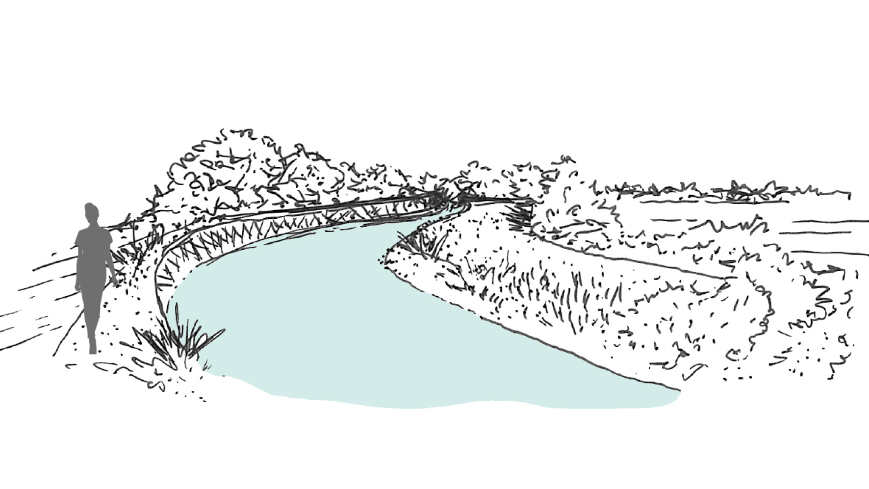
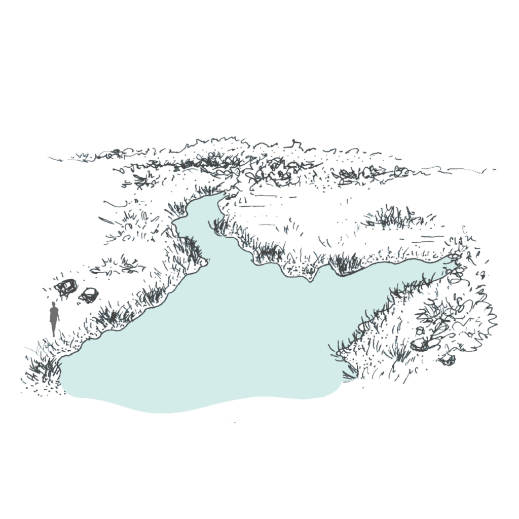
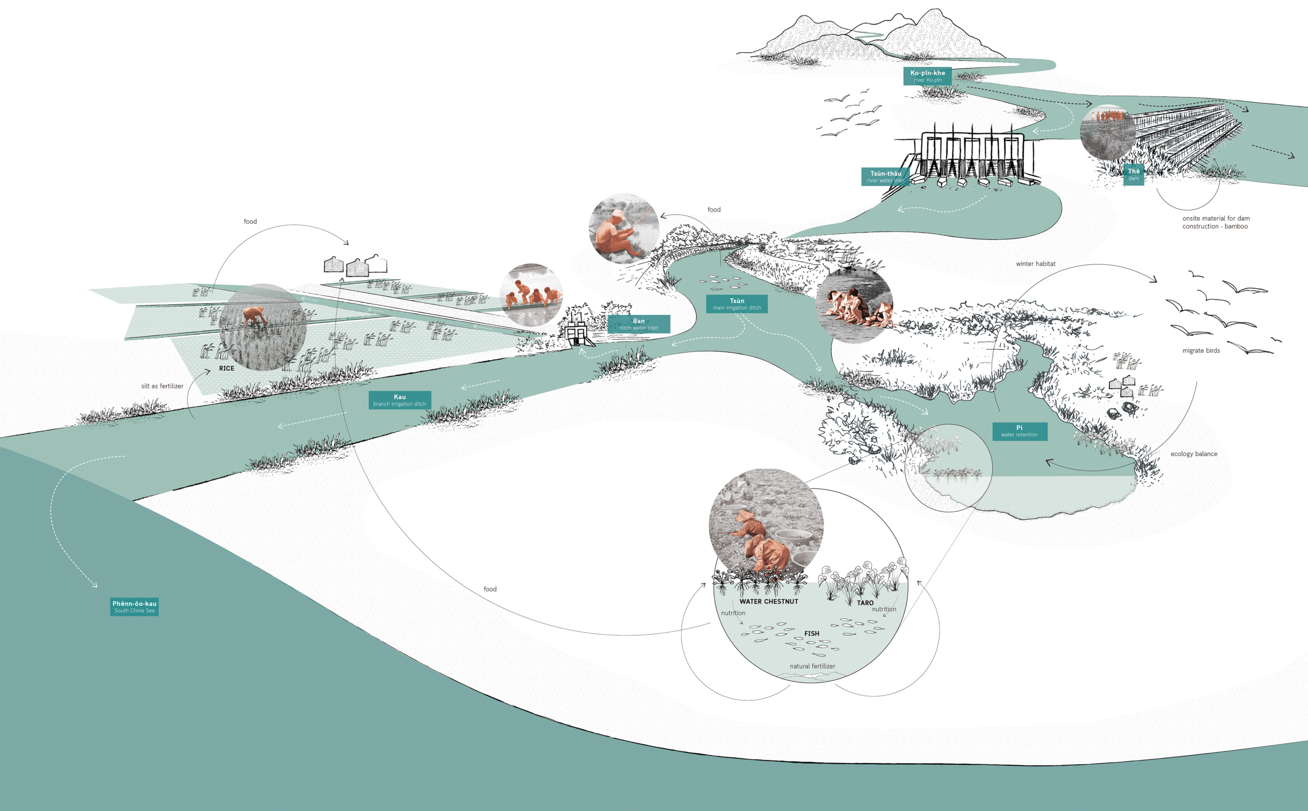
An open waterway that provides clean fresh water for drinking and irrigational use. Small ones are called “Kau 溝”, big ones are called called “Tsùn 圳”.

  • Project: Ksôkong Tsùn Irrigation System, Taiwan
  • Climate: Tropical savanna climate with dry-winter characteristics
  • Year: proximity 1839
  • Water type: river water
  • Landscape type: river plain
  • Altitude: 0-20 m.a.s.l. (meters above sea level)
  • Soil condition: alluvial soil
  • Materials: excavated soil and rammed earth
  • Period: permanent
  • Form: a network of lines
  • Use or Function: water supply for agriculture

Pi – 陂

Pi – 陂
Water gate

Water gate that regulates water between irrigation ditches.

  • Project: Ksôkong Tsùn Irrigation System, Taiwan
  • Climate: Tropical savanna climate with dry-winter characteristics
  • Year: 1839
  • Water type: river water
  • Landscape type: river plain
  • Altitude: 0-20 m.a.s.l. (meters above sea level)
  • Soil condition: alluvial soil
  • Materials: brick, metal, wood
  • Period: permanent
  • Form: Point
  • Use or Function: control

Ksôkong Tsùn Irrigation System

Atmosphere of Kaoshiung canal system.

A traditional irrigation system that set the
the foundation of Kaohsiung City.

Man-Chuan Sandy Lin
2020

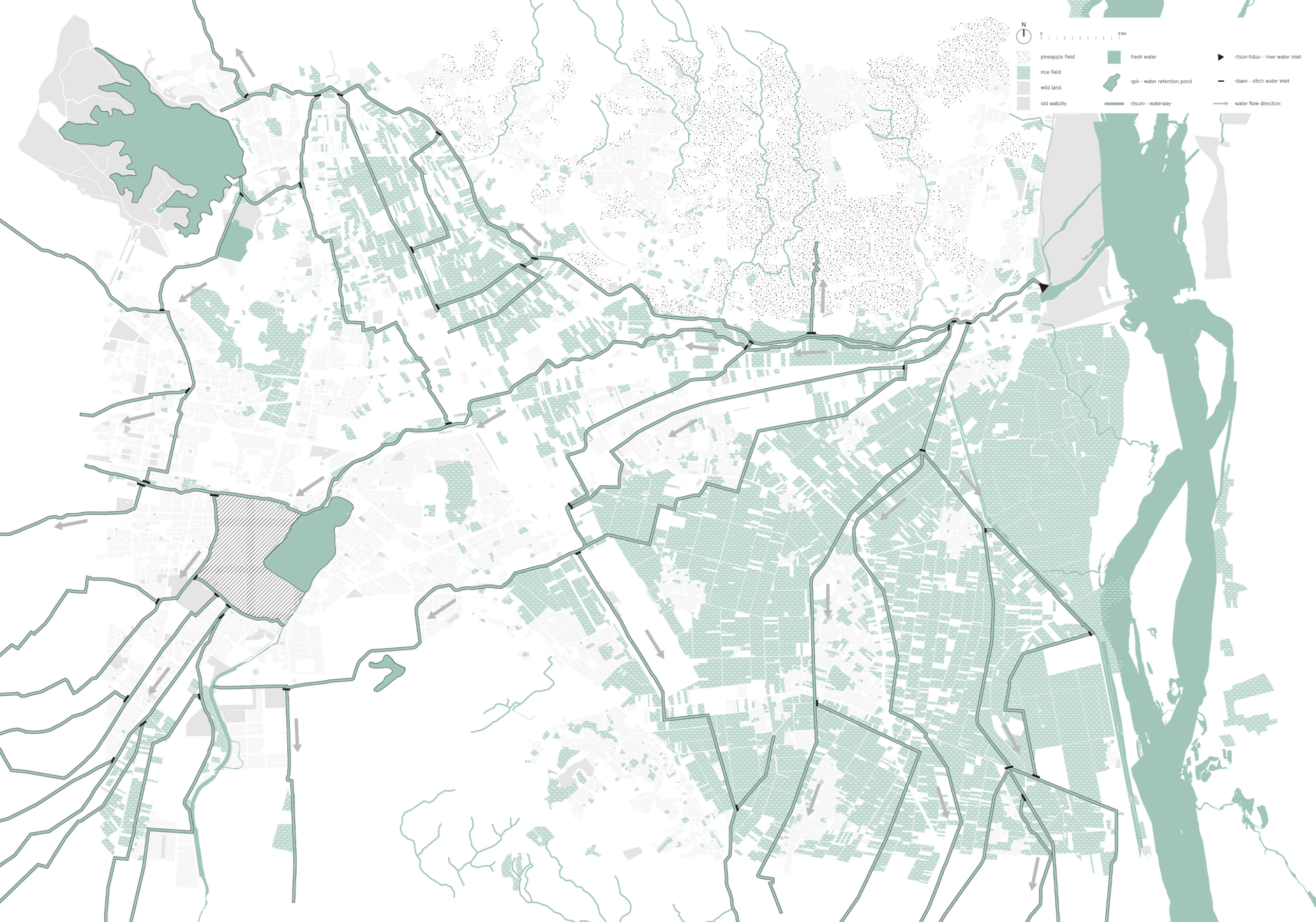
The growth of Kaohsiung is closely related to its irrigation system. The Ksôkong Tsùn irrigation system is a traditional water management and irrigation system used for the purpose of agriculture. The system dates back in 19th century and it has been claimed as municipal heritage site of the city of Kaohsiung.

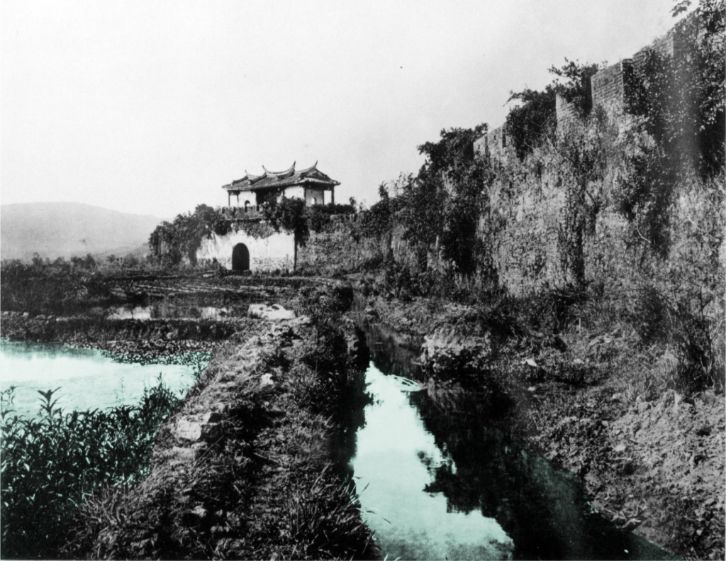
Plan showing zoom in detail of Cao-Gong irrigation system.

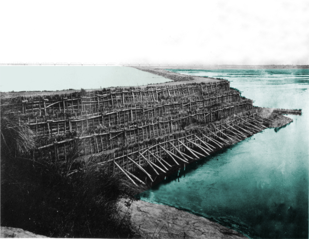
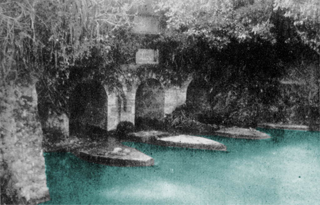
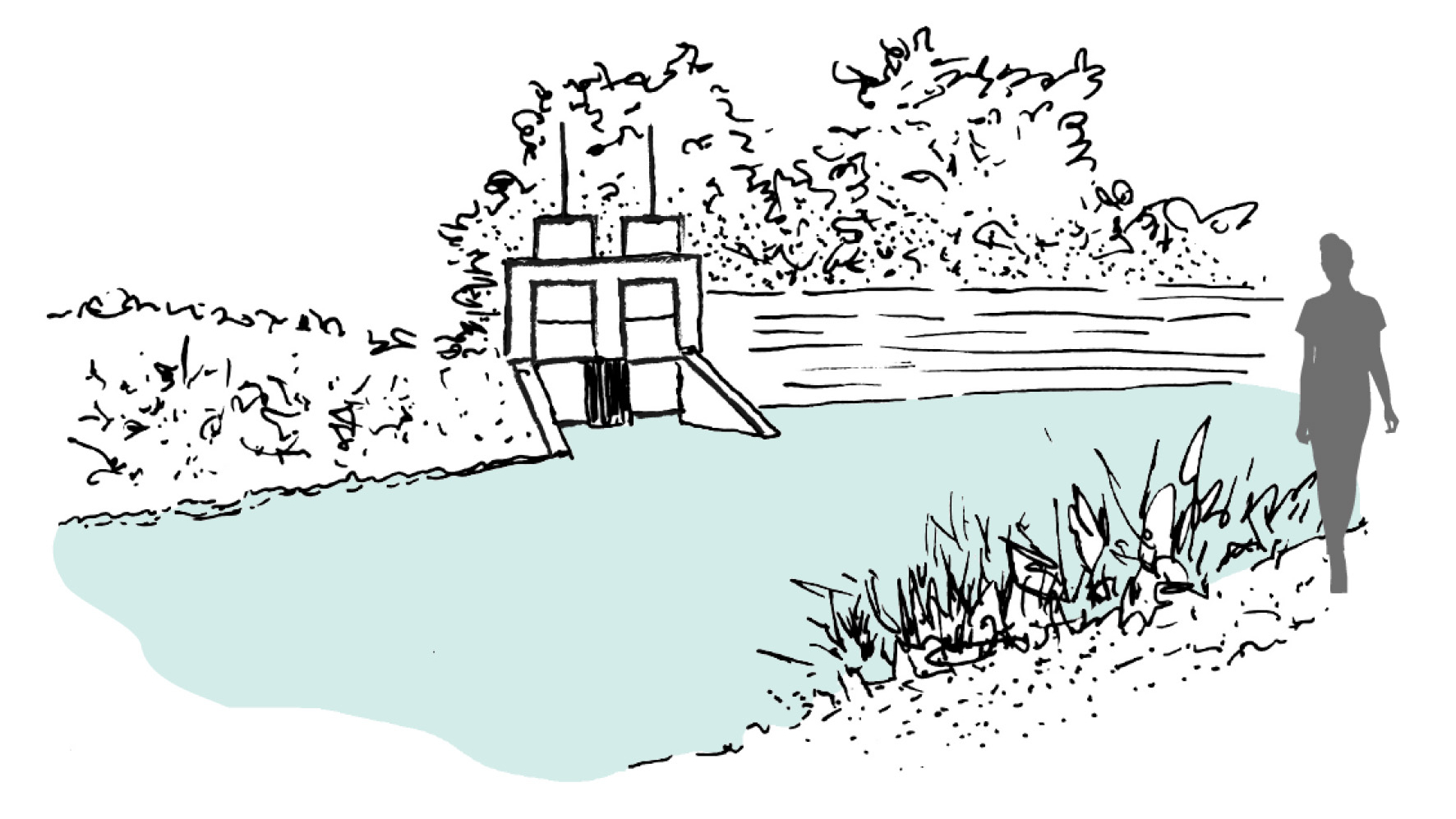
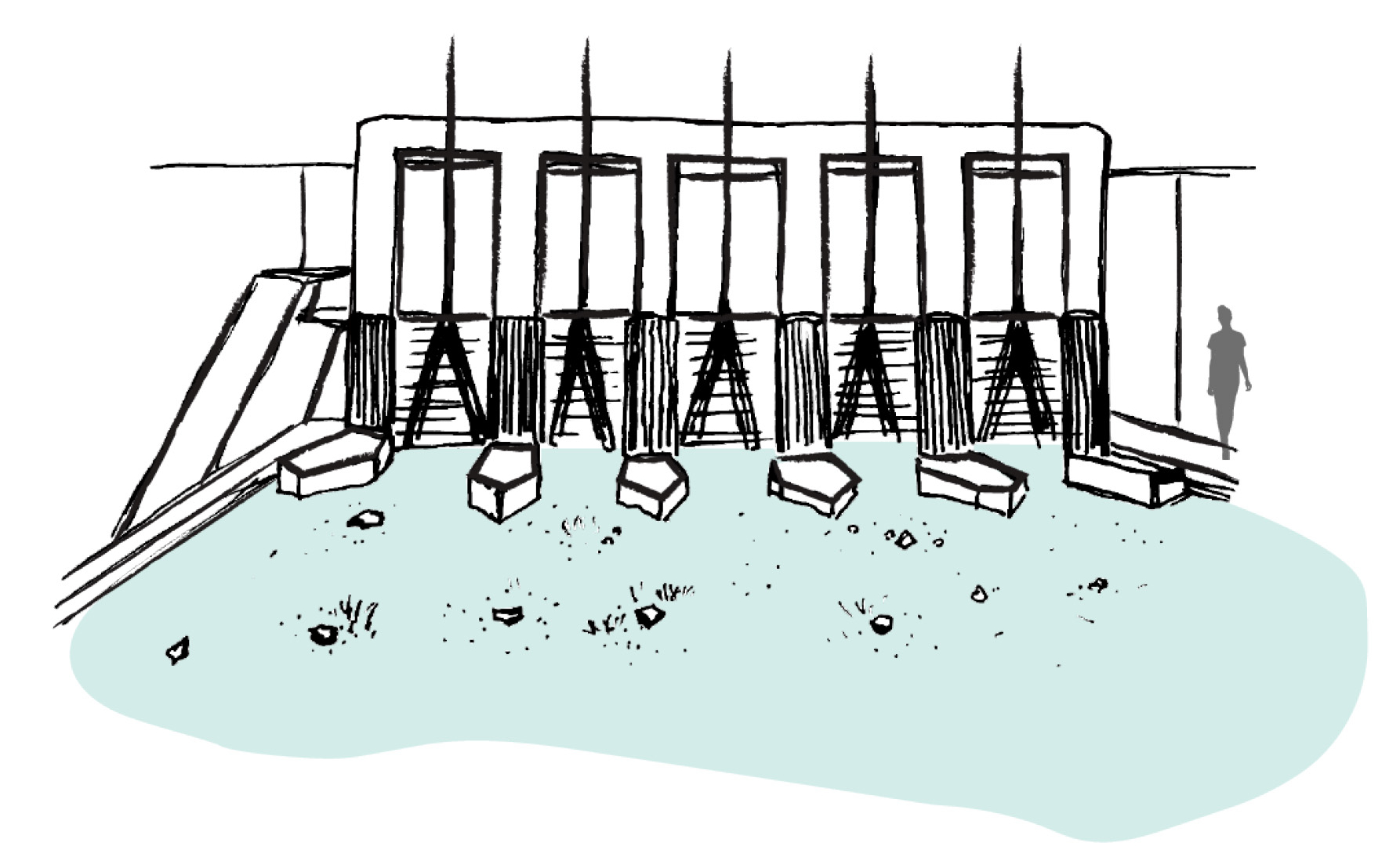
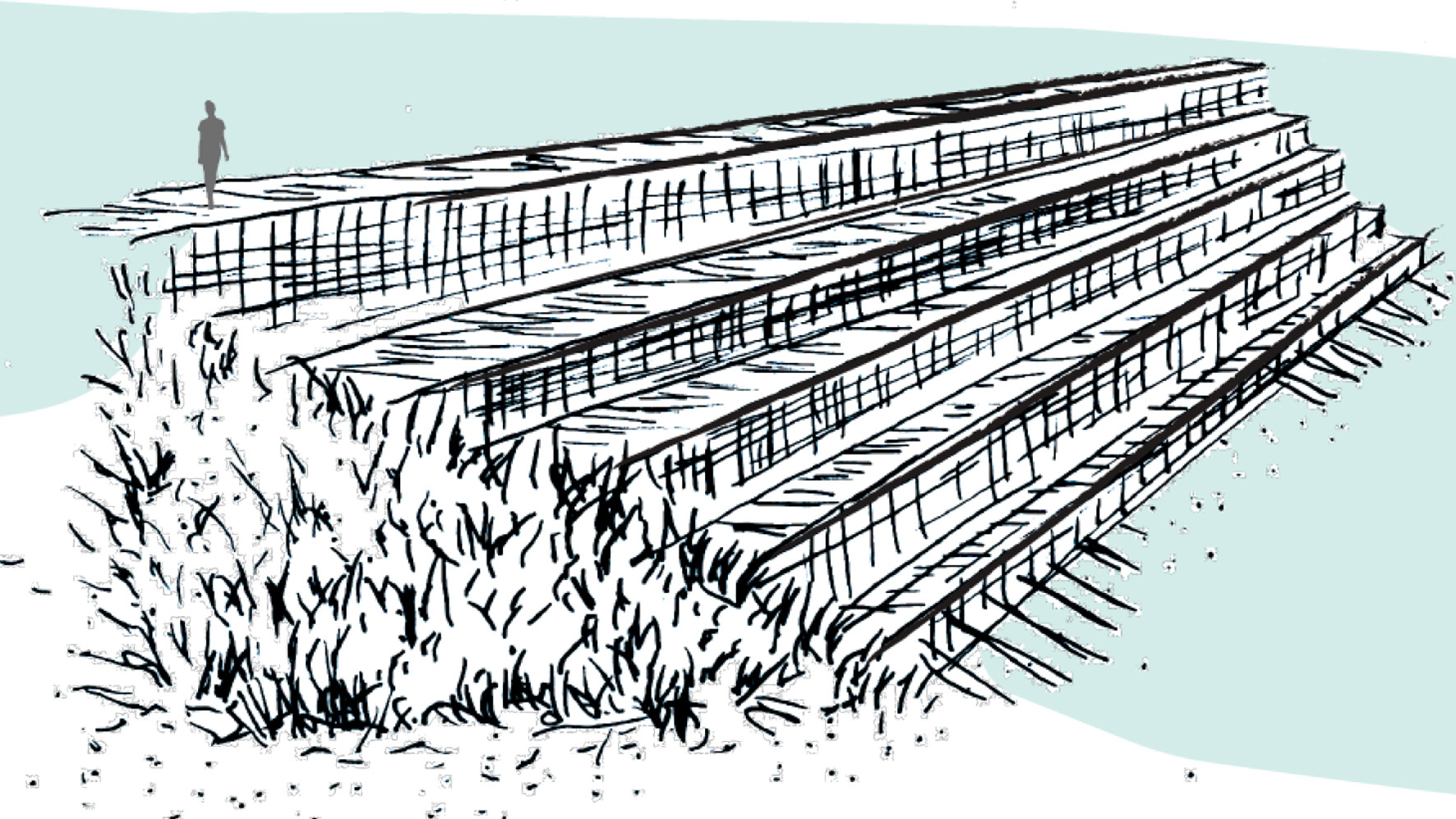
The Ksôkong Tsùn irrigation system consists mainly four types of elements: dam, inlet, waterway, water retention pond.

Circular Stories

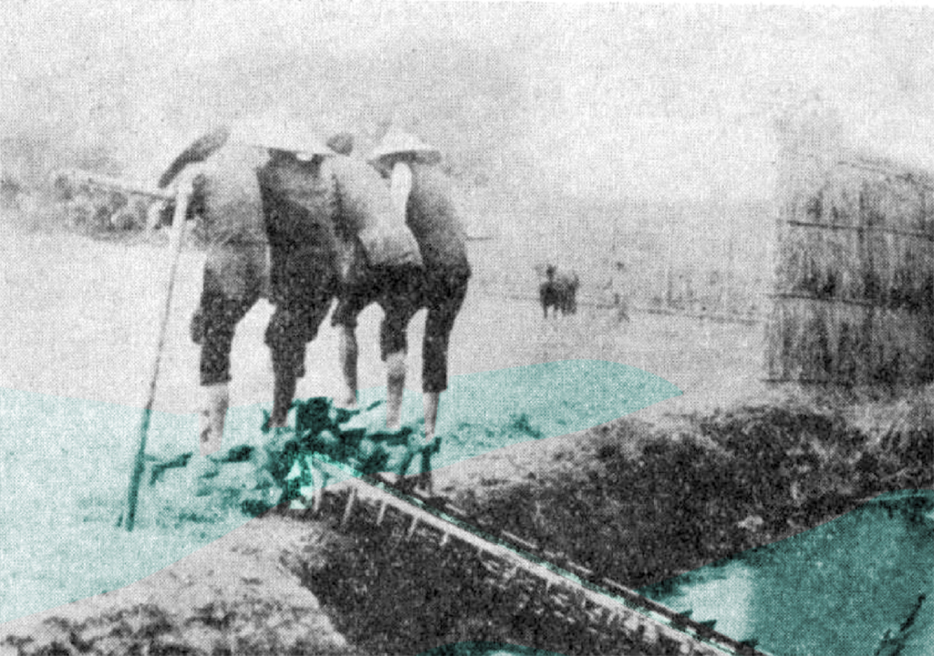
In Taiwan, the connection between land and people was once profound and unbreakable, especially in agricultural society before modernization.

Water from river Ko-pin-khe is obtained from a dam, regulated using inlets, to irrigate rice fields following natural topography and weaved an aquatic landscape. Besides the rice fields, water plants production such as taros and water chestnuts, were located in the water retention. This agriculture production, together with aquaculture, formed a circular system that supported one another. On the landscape, Ksô-kong irrigation system accommodated a variety of human activities. At the time people were close to water, scenes like women doing laundry and socializing by the water, children playing in the field, and men fishing on the edge of waterways were common on daily basis.

A story of circularity of a lifestyle that utilizes water resource as irrigation system in southern Taiwan.

Pān – 汴

Pān – 汴
Irrigation ditch water inlet

Water gate that regulates water between irrigation ditches.

  • Project: Ksôkong Tsùn Irrigation System, Taiwan
  • Climate: Tropical savanna climate with dry-winter characteristics
  • Year: 1839
  • Water type: river water
  • Landscape type: river plein
  • Altitude: 0-20 m.a.s.l. (meters above sea level)
  • Soil condition: alluvial soil
  • Materials: brick, metal, wood
  • Period: permanent
  • Form: Point
  • Use or Function: control

Tsùn-thâu – 圳頭

Tsùn-thâu – 圳頭
River water inlet

A gate element that can control the amount of irrigation water intake. In typhoon season, the gate can be closed to protect crops from flooding.

  • Project: Ksôkong Tsùn Irrigation System, Taiwan
  • Climate: Tropical savanna climate with dry-winter characteristics
  • Year: 1839
  • Water type: river water
  • Landscape type: river plain
  • Altitude: 0-20 m.a.s.l. (meters above sea level)
  • Soil condition: alluvial soil
  • Materials: brick, wood, metal
  • Period: permanent
  • Form: point
  • Use or Function: control

Thê – 堤

Thê – 堤
Dam

A linear obstacle built perpendicular to a river to guild and direct water to the river water inlet for irrigation ditch.

  • Project: Ksôkong Tsùn Irrigation System, Taiwan
  • Climate: Tropical savanna climate with dry-winter characteristics
  • Year: 1839
  • Water type: river water
  • Landscape type: river plain
  • Altitude: 0-20 m.a.s.l. (meters above sea level)
  • Soil condition: alluvial soil
  • Materials: bamboo, excavated earth
  • Period: proximity from every October until next July (re-built every October during the dry season and got flooded away during typhoon season.)
  • Form: Point
  • Use or Function: Direction