The Roman Aqueducts

Aqua Claudia, Parco degli Acquedotti, Rome.

A system of pipes, canals, and supporting structures used to convey water from its source to its main distribution point.

Camilla Di Nicola
2020

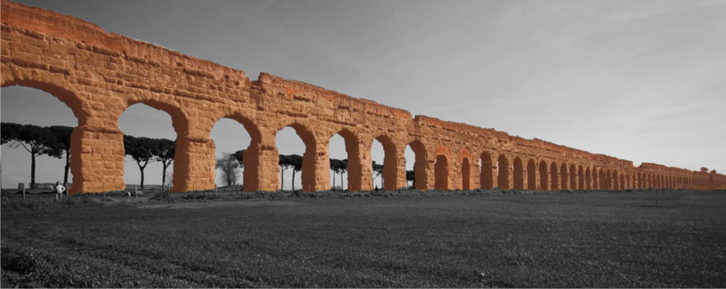
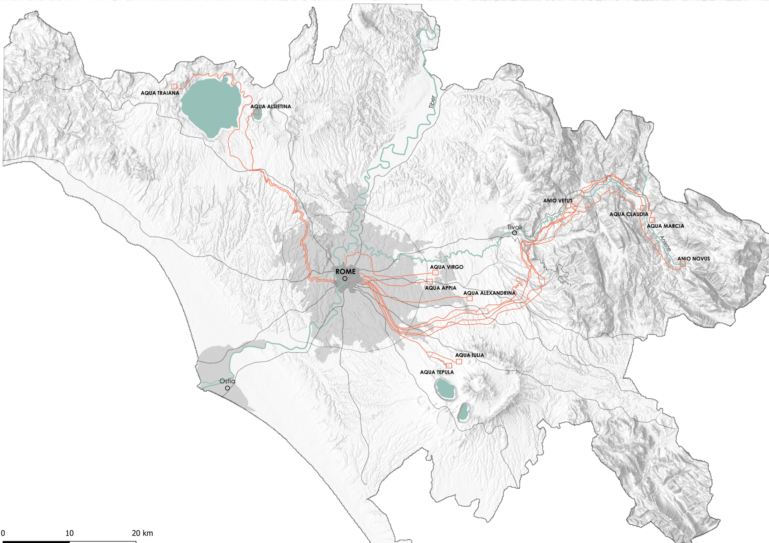
The Roman Aqueduct systems were built over a period of about 500 years, from 312 B.C. to A.D. 226. Both public and private funds paid for construction. The city of Rome had around 11 aqueduct systems supplying freshwater from sources as far as 92 km away.

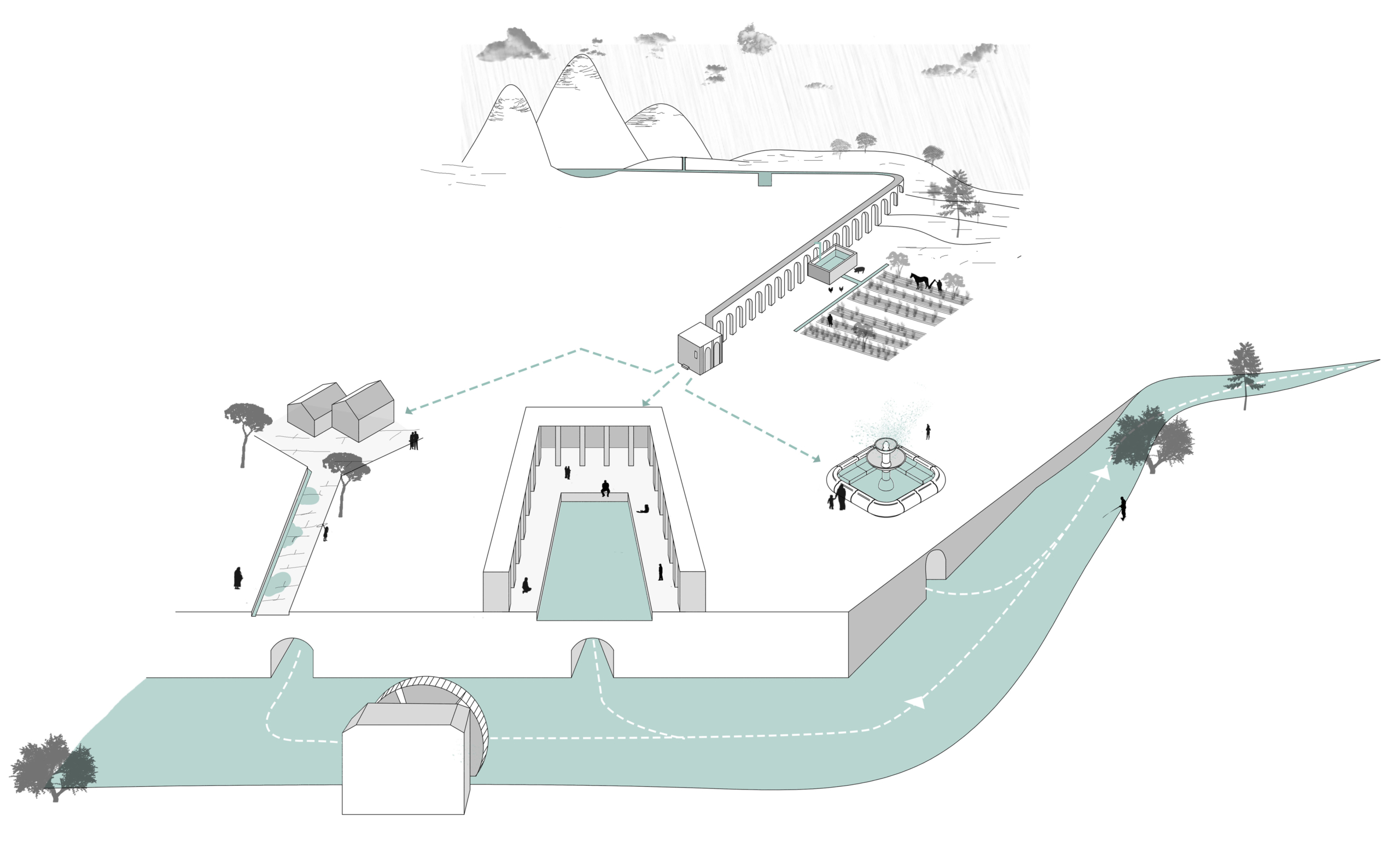
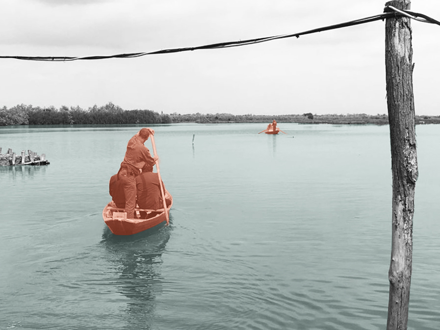
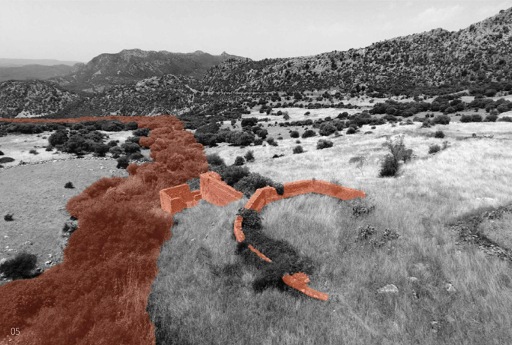
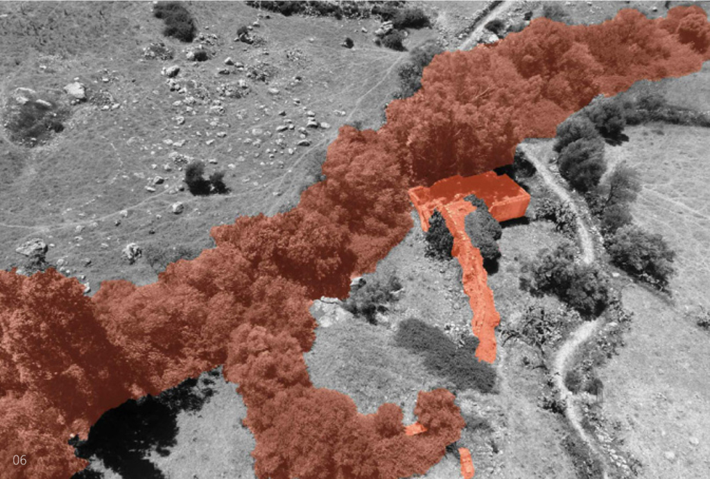
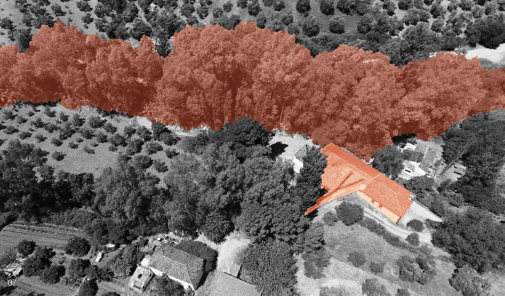
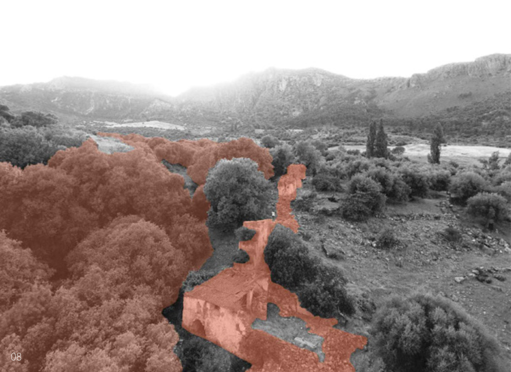
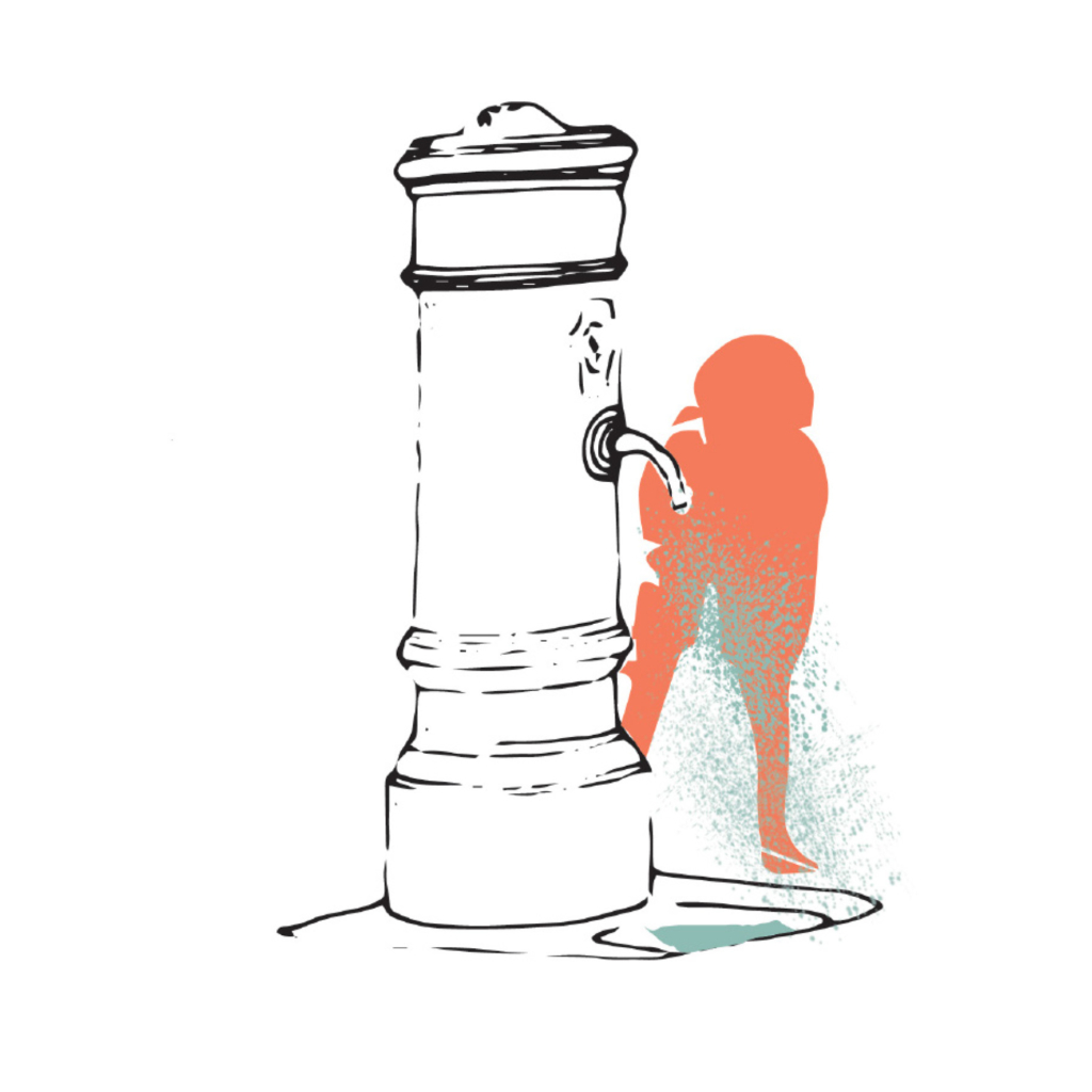
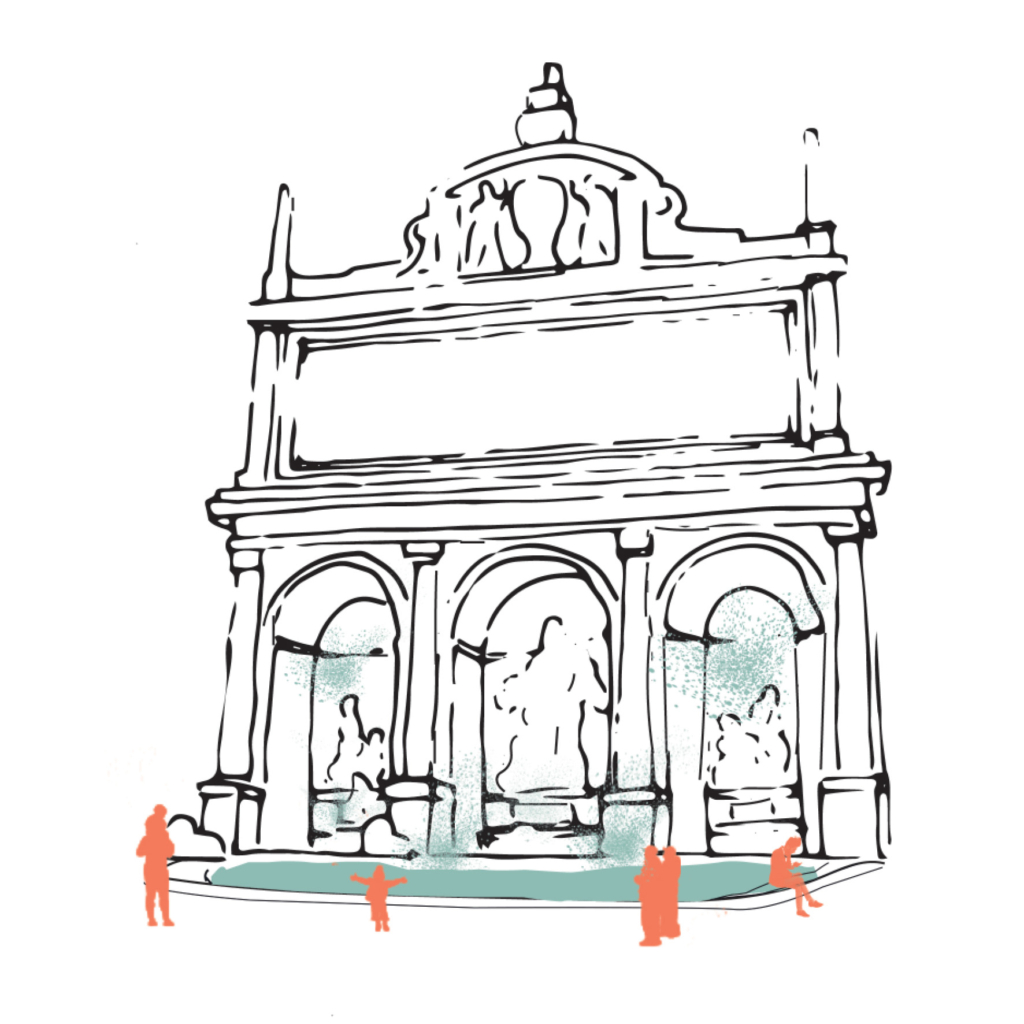
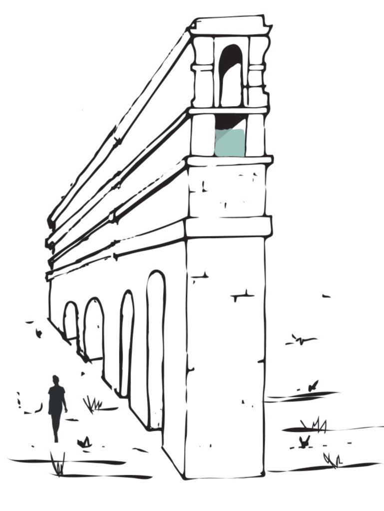
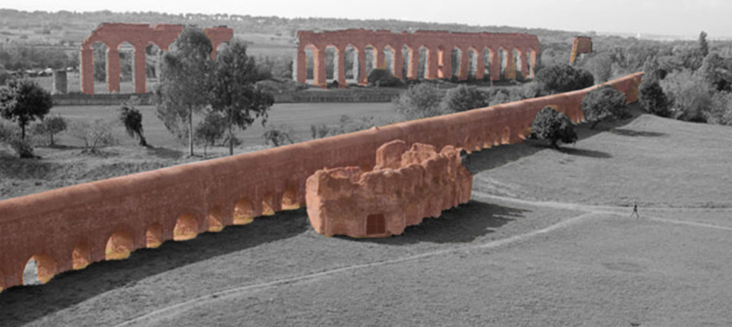
The aqueducts were made from a series of pipes, tunnels, canals, and bridges. Gravity and the natural slope of the land allowed aqueducts to channel water from a freshwater source, such as a lake or underground springs, to a city. As water flowed into the cities, it was used for drinking, irrigation, and to supply hundreds of public fountains and baths. The principle was relatively simple: pure and abundant sources in the hills around Rome could be tapped, and their waters diverted into artificial channels running gently towards the city on a gradient designed to deliver them at a useful height, to flow around the city and feed street fountains, baths, and (for a fee) private houses.

Map of the aqueducts in the Municipality of Rome, from the countryside to the city center.

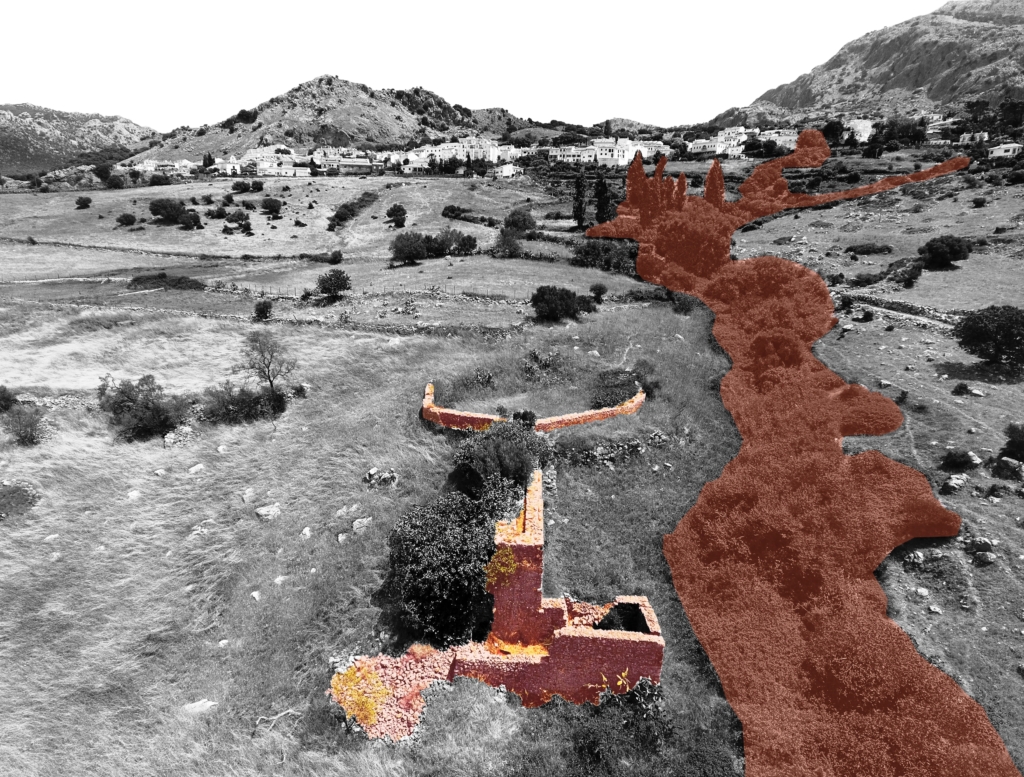
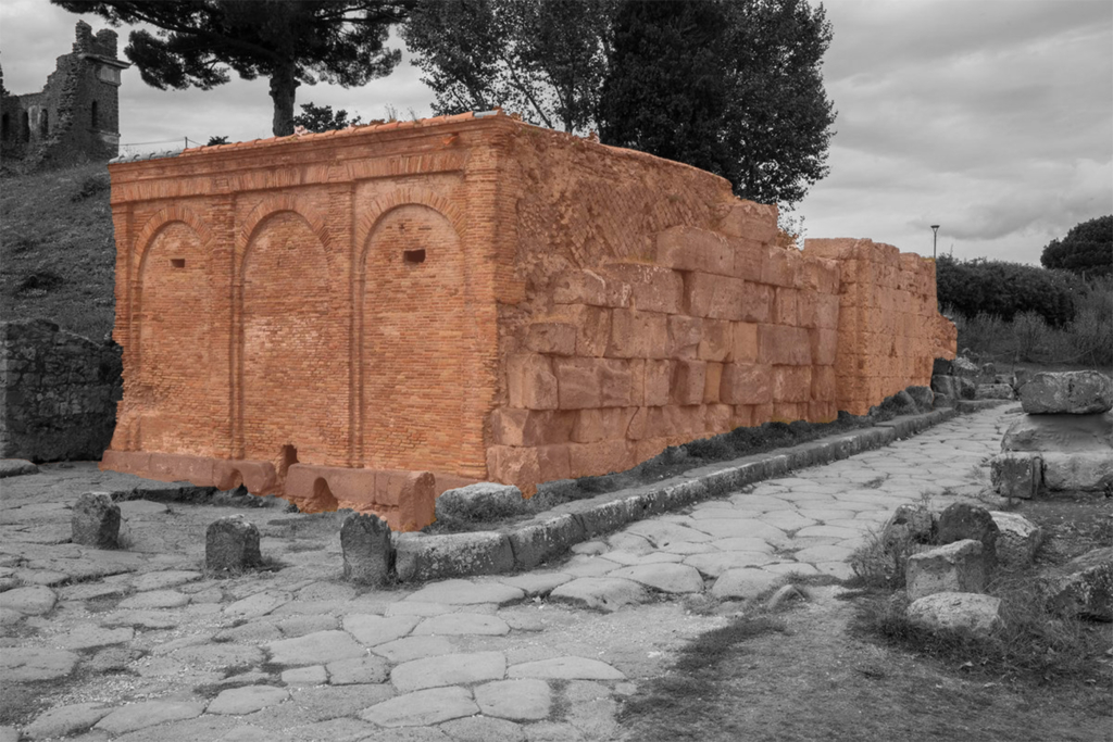
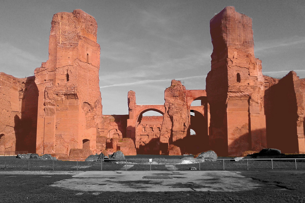
The aqueduct system consisted of several elements, of which the remains can still be seen. The piscina limaria, where sedimentation tanks were used to purify the water, the cisterna, cistern, which collected rainwater or excess water from the aqueducts for periods of drought. At the end of the aqueducts, there was the castellum aquae which distributed the water inside the city. The aqueducts were fundamental to provide drinking water to the city but also for other functions such as thermae, baths, that helped the well-being and health of citizens.

Circular Stories

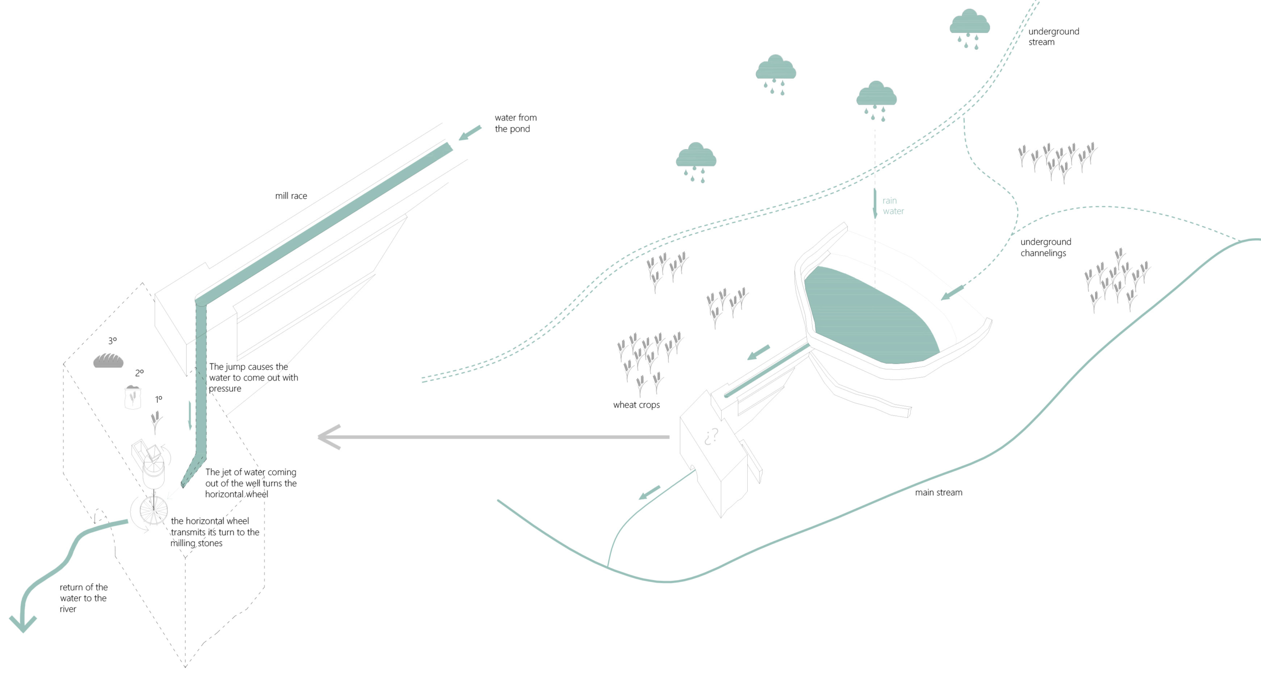
The first thing to do to start the construction of an aqueduct was to find a source of water that was drinkable and at a certain height that could allow its exploitation through pressure. After the inspection of the water quality, long underground tunnels were built in which the water flowed. Furthermore, the purification of the water was also guaranteed by the porosity of the soil (mainly tuff) that filtered the rainwater.

Finally, the settling tank (piscina limaria) improved the water purification by collecting the debris at the bottom of the tank. The canal, or specus, was constructed to maintain a constant slope so as to overcome the differences in height the arches. Excess water from the aqueducts and rainwater was collected in the cisterns.

Once arrived in the city, the water was distributed through the castellum in three different directions: for public fountains, for baths, and for some privileged private houses. The water was also used to clean the streets, improving the sanitary quality of the city. Only then, the water was channelled into the sewer system and then ended up in the river which was organized with a system of grain mills.

The spatial representation of an aqueduct and the different functions that the water has before its final destination, the river.

Valli da pesca of the Venice Lagoon

Fishing valley in Lio Piccolo, northern Venetian Lagoon.

A traditional extensive aquaculture system along the border of the Venetian Lagoon.

Amina Chouairi
2020

The fishing valleys aquaculture system is located in the Venetian Lagoon, Veneto region, Italy. Their first traces have been found since the first 11th century A.D.

Nowadays this extensive fish cultivation system is spread over 8500 ha. of the current lagoon, and its main elements are the fishing ponds, the embankments separating the valleys from the lagoon, the mansions, and the waterworks able to calibrate the amount of fresh water and salt water to introduce in the valleys.

Veneto region, its watershed and the fishing valleys located in the Venetian Lagoon (orange).

The fishing valley master, capovalle, the fishing valley workers and the guardian are the three fundamental figures for the fishing valley management in the Venetian Lagoon. The capovalle is the chief of the fishing valleys, regulating the water regime and employing of seasonal workers; the workers are in charge of different managing activities; the guardian monitors the valley daily.

Circular Stories

Circularity between aquaculture, agriculture and agro-tourism in the fishing valleys nowadays. A synthetic scheme.

Since the first decades of the 20th century, the fishing valleys can be addressed as an extensive polyculture, where the main activity of fish farming has been juxtaposed by farm animals breeding (as horses, sheep, hens, goats, cows, etc.), vegetable gardens and orchards (cultivating horseradish, radicchio, asparagus, artichoke, etc.), reeds, mulch, fertilizer
and hay production.

Despite its relatively low rates in terms of production, compared to other intensive aquacultures, this activity is associated with reasonably low management costs: fishing valleys in the Venetian Lagoon are mainly family farms employing seasonal workers during the busiest seasons
(spring and autumn). Recently, many of the fishing valleys have implemented their accommodation activity, providing a slower and lighter touristic alternative to discover the outer lagoon territory, in counter-trend to the mass tourism suffocating the historical centre of Venice.

The Water Mills of Sierra de Cadiz

Atmosphere of the system.

Water as a driving force in the historical
production of staple food: bread.

Gloria Rivero-Lamela
2019

The Sierra de Cádiz is located in the north-eastern end of the province of Cádiz; within Andalusia, in Spain. It comprises a large part of the Sierra de Grazalema Natural Park, declared a Biosphere Reserve in January 1977 and a Natural Park in December 1984.

It presents a rugged orography of steep slopes, which causes the Sierra de Cádiz to be the area where the provincial hydrographic network springs. The Majaceite, Guadalete, Guadalporcún and the Zahara and Hurones reservoirs stand out.

In addition to these physical issues, it is a cultural region, since it has been an isolated area (Hispanic-Muslim border during more than two centuries) that has generated among its inhabitants the awareness of sharing a common history and a cultural past.

Catchment area of Sierra de Cadiz.

They are, in addition, functional architectural interventions: for its industrial use and for the required productive profitability, water was necessary for its operation. Therefore, these mills were built with the precision and logic of the small hydraulic engineering works that, together with other minor and usual works in these places, such as ditches, canals, ponds, etc., make up a network of constructions aimed at control and management of hydrological resources that the artisan industries of the Sierra de Cádiz region require.

The function of the mills determines its design. On a small scale, the mill is distinguished by its location close to the rivers and by the external infrastructure works that channel the water to its interior: the millrace, the well and the wheelhouse.

All the water mills of the Sierra de Cádiz have a horizontal wheel and a well, one or two at most, and they may or may not have a pond. They were built when the watercourses had no speed or sufficient flow.

Almost all the mills had a mixed structure with masonry load-bearing walls of irregular stone, taken with mortar of sand and lime, 60-80 cm thick, plastered with lime and wooden beams. Most of the roofs had one or two water structures, also made with wooden structure, thatched and Arab tile. The main space that articulates the building is the grinding room, located above the wheelhouse.

If it exists, the pond is built where the slope of the land is not excessive to achieve, with minimal construction resources, store as much water as possible. The water is conducted from the pond to the well by the millrace, which bypasses the topography. The well is located in the area of the greatest slope so that the waterfall generates enough force to move the horizontal wheel. The position and length of the millrace result from the position of the pond and the well according to the topography. The system is further optimized with the mill’s proximity to the river for the immediate return of the water to the natural course.

Functional diagram of the mills.

Nasone

Nasone
Freshwater drinking fountain

Literally the term Nasone means big nose. It is the typical roman freshwater drinking fountain. The city of Rome began installing nasoni around the 1870s to provide fresh water supplies for citizens; today there are still between 2500 and 2800 Nasoni in Rome.

  • Project Name: The Roman Aqueducts – Rome, Italy.
  • Climate: Temperate – Mediterranean Climate
  • Year: 1874
  • Water Type: Drinkable
  • Meaning: Fountains of contemporary Rome
  • Users: Citizens
  • Accessibility: Public
  • Materials: Cast iron
  • Temporality: Fixed
  • Form: Point
  • Use or function: Aside from the social-welfare benefits of supplying drinkable water to citizens, nasoni serve as needed ventilation valves for the Roman water-supply system.

Mostra d’acqua

Mostra d’acqua
Water fountain

From Latin mostrare, to show, to reveal, to exhibit. It was the name for a large public fountain with monumental functions. Usually, they were the terminus of an aqueduct.

  • Project Name: The Roman Aqueducts, Rome, Italy
  • Climate: Temperate, Mediterranean Climate
  • Year: III B.C – I A.D. century
  • Water Type: Drinkable, freshwater
  • Landscape Type: Not relevant
  • Meaning: Representation, exhibition
  • Users: Citizens
  • Accessibility: Mainly public
  • Soil condition: Not relevant
  • Materials: Travertine and Carrara marble
  • Temporality: Fixed
  • Form: Point
  • Use or Functions: To drink, ornamental

Aqueduct

Aqueduct
“The Roman Aqueducts”, Rome, Italy

An artificial channel for conveying water. It was built underground and on embankments, according to the level, but also for great distances on long arcades.

  • Project Name: Roman Aqueducts, Rome, Italy
  • Climate: Temperate, Mediterranean Climate
  • Year: III century B.C – I A.D. century
  • Water Type: Drinkable, fresh water
  • Landscape Type: From the mountains to the city
  • Altitude: 400 – 20 m a.s.l.
  • Soil condition: Not relevant
  • Materials: Bricks and lime
  • Temporality: Fixed
  • Form: Network of line
  • Use or Functions: To bring drinkable water into the city