Harnam Water Meadows

Water Meadows during irrigation.

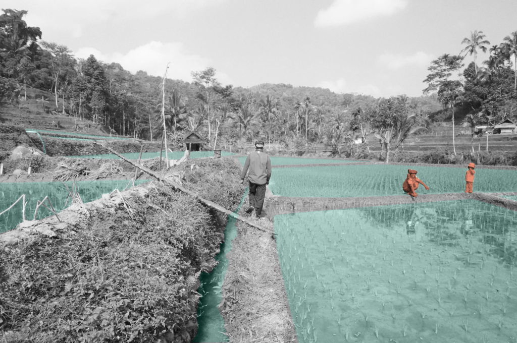
A pasture productive system in traditional English agriculture.

Farnoosh Bazrafkan
2021

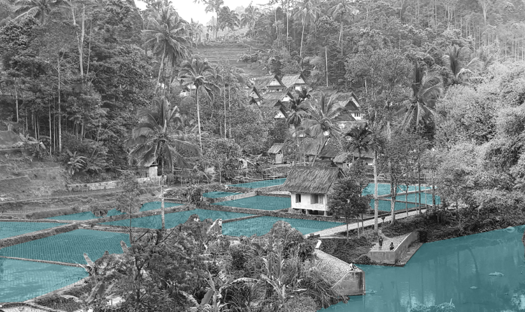
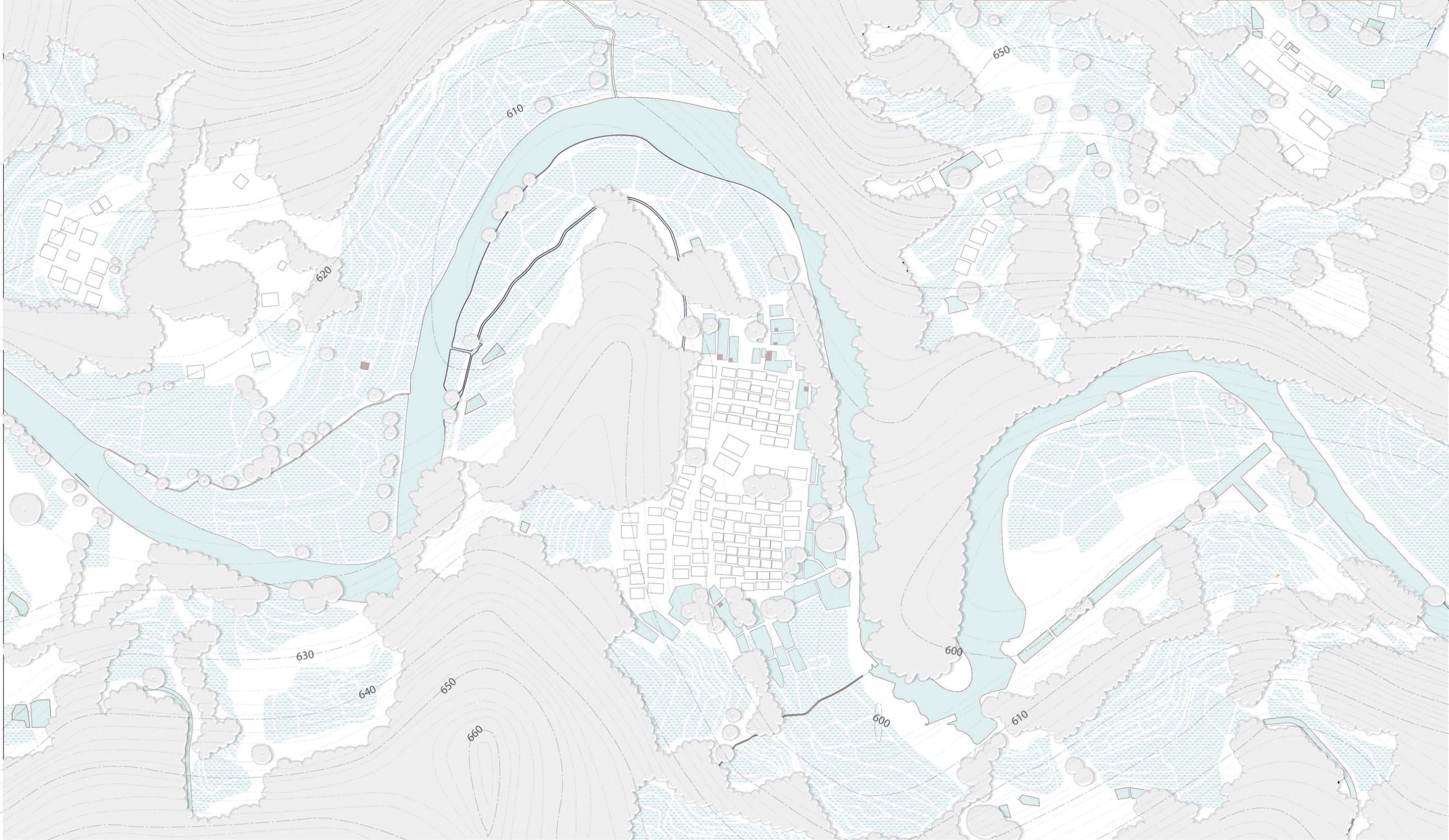
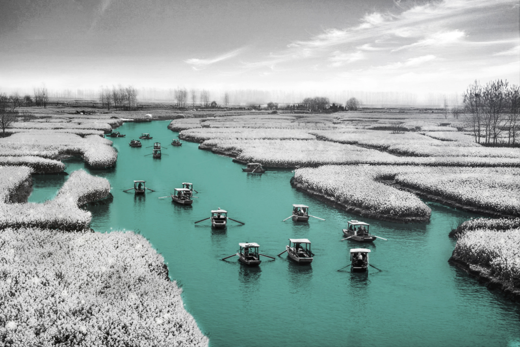
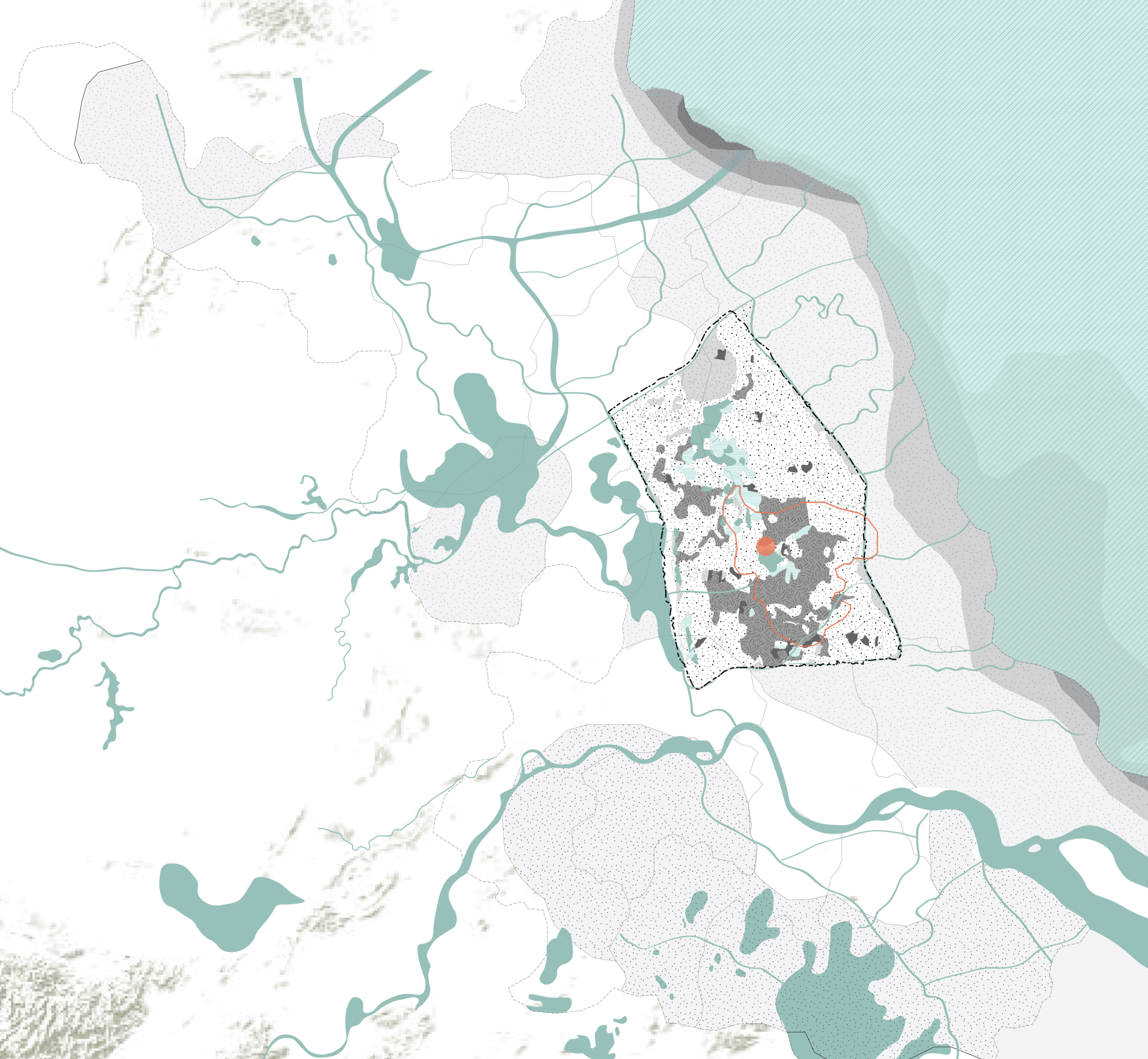
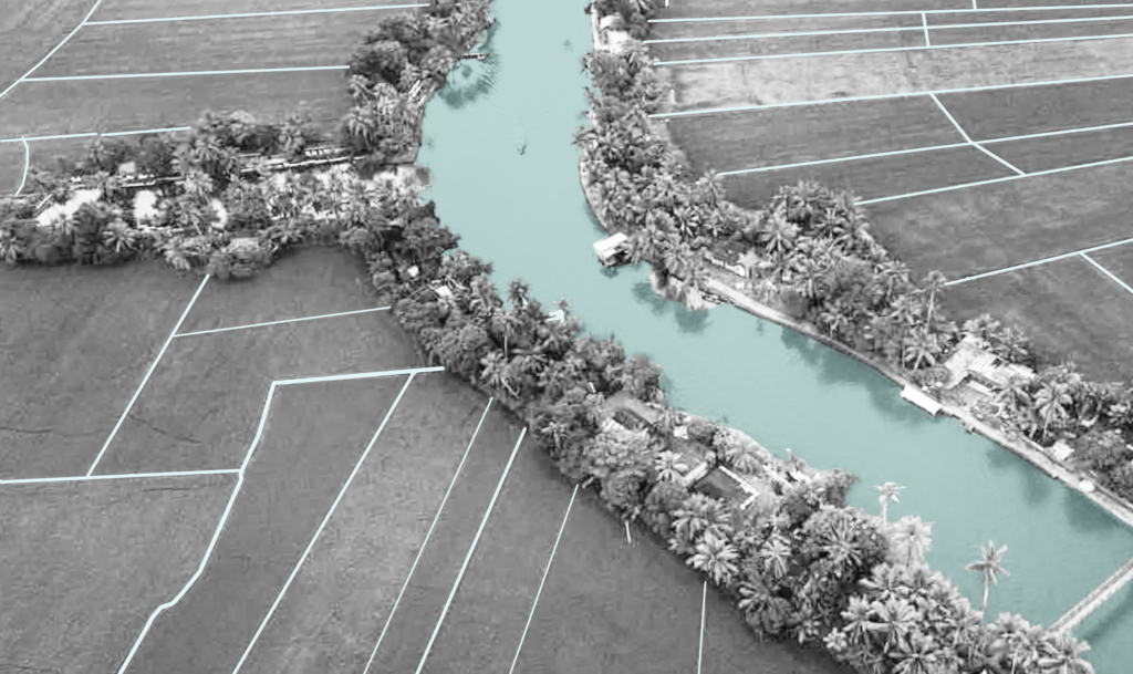
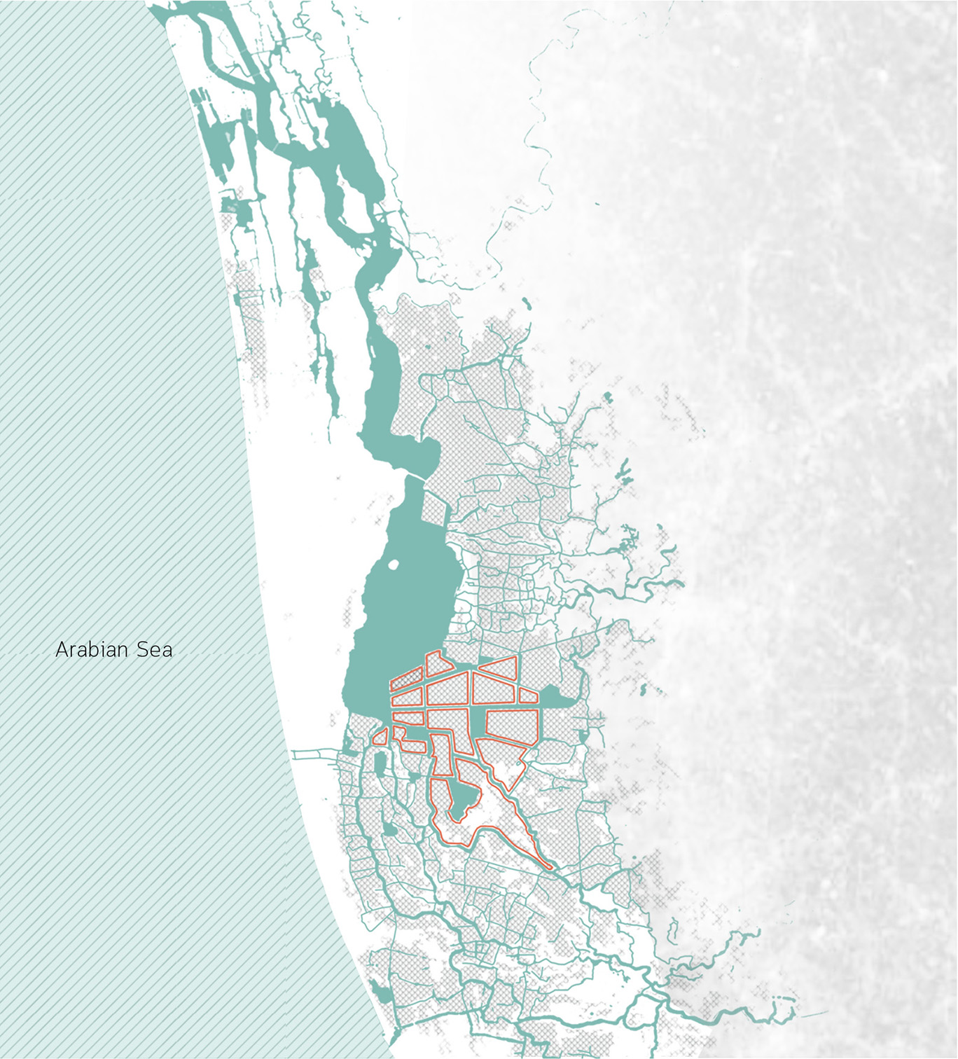
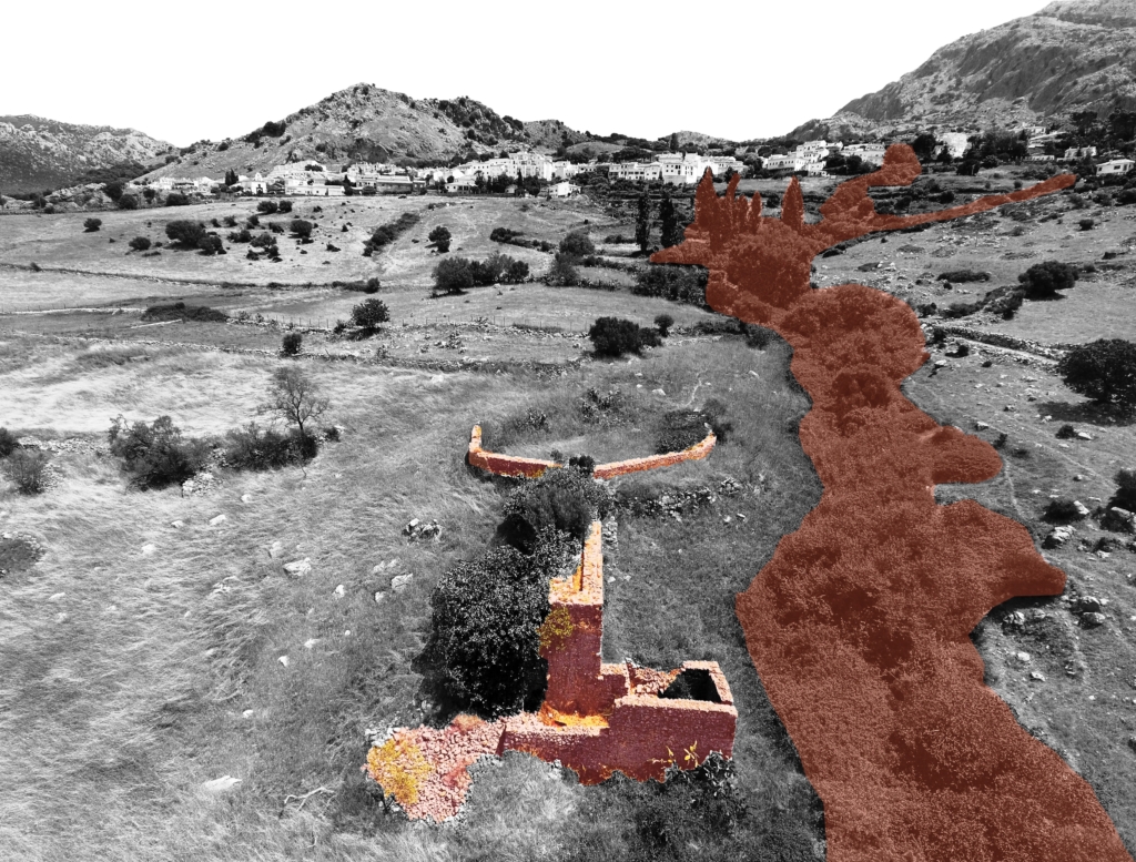
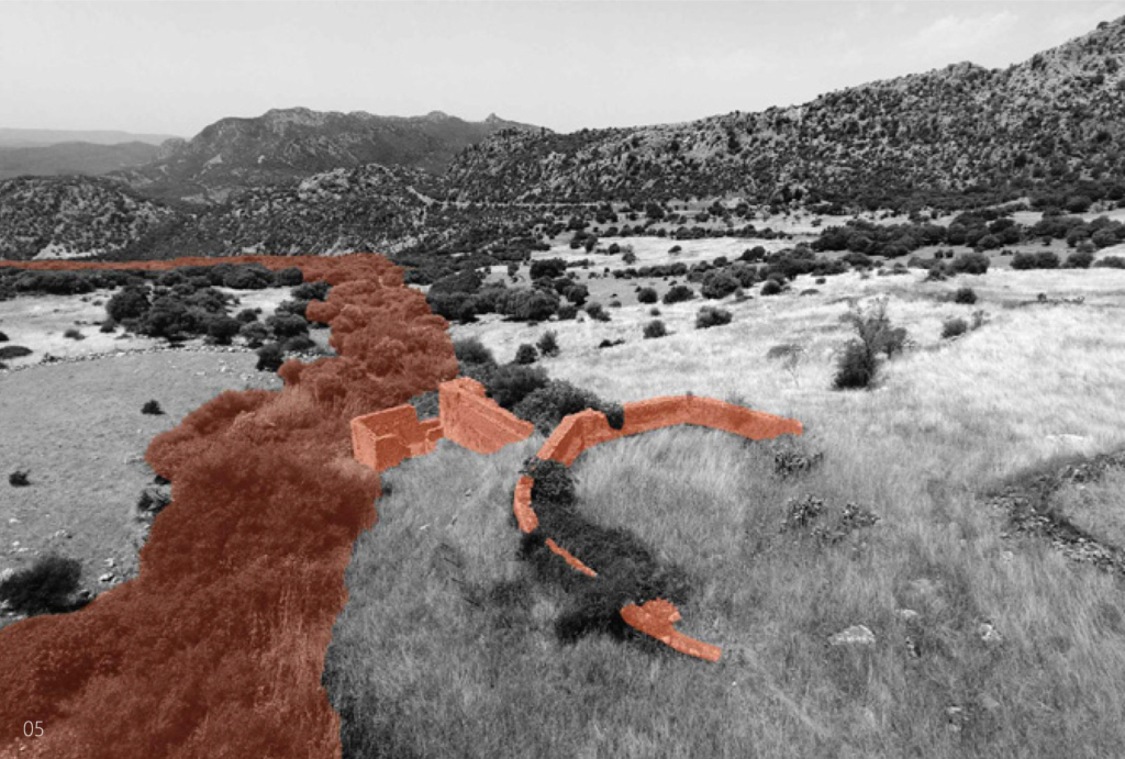
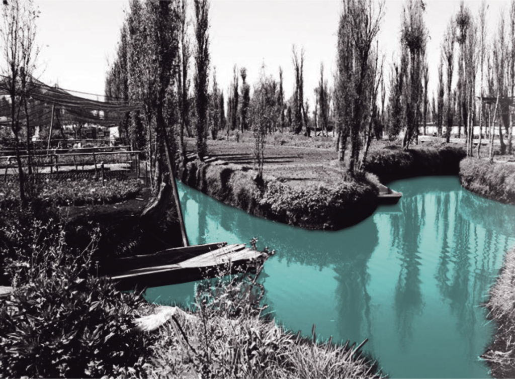
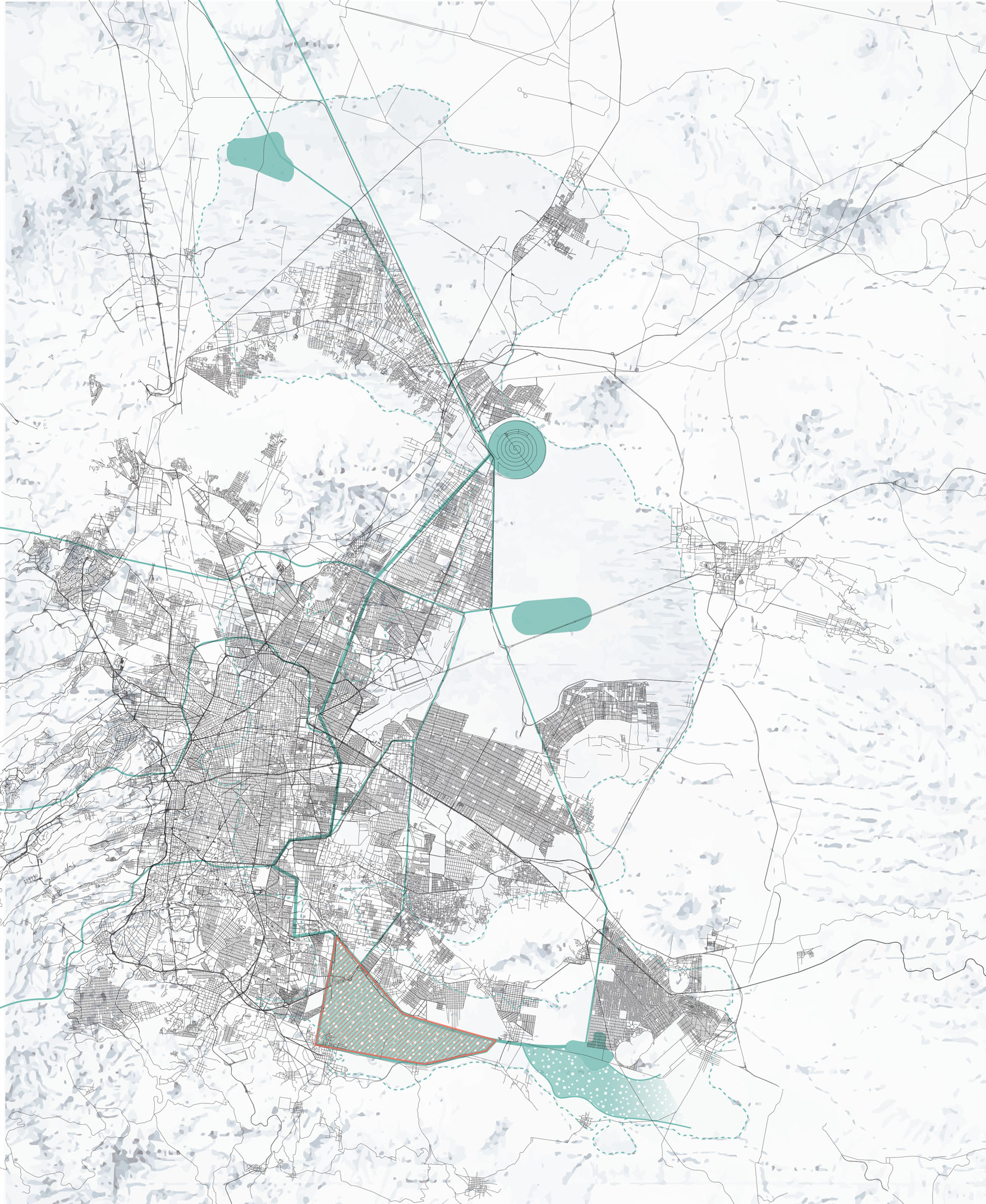
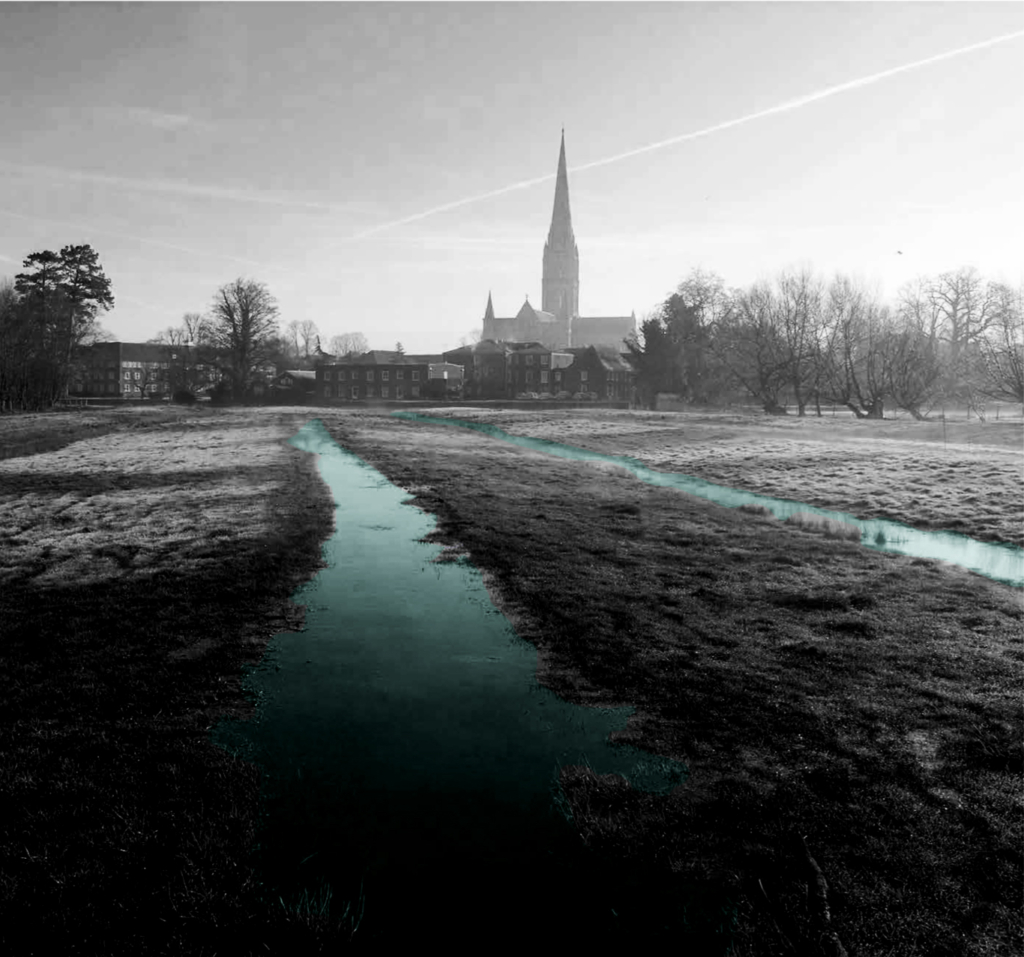
The Harnham Water Meadows are located inland in the South-Western part of England. The water catchment area of
Harnham being a part of the county of Wiltshire. The rivers of this area are largely spring-fed and provide a stable flow
throughout the year. Along the floodplains of these rivers a series of (abondoned) water meadows can be found.
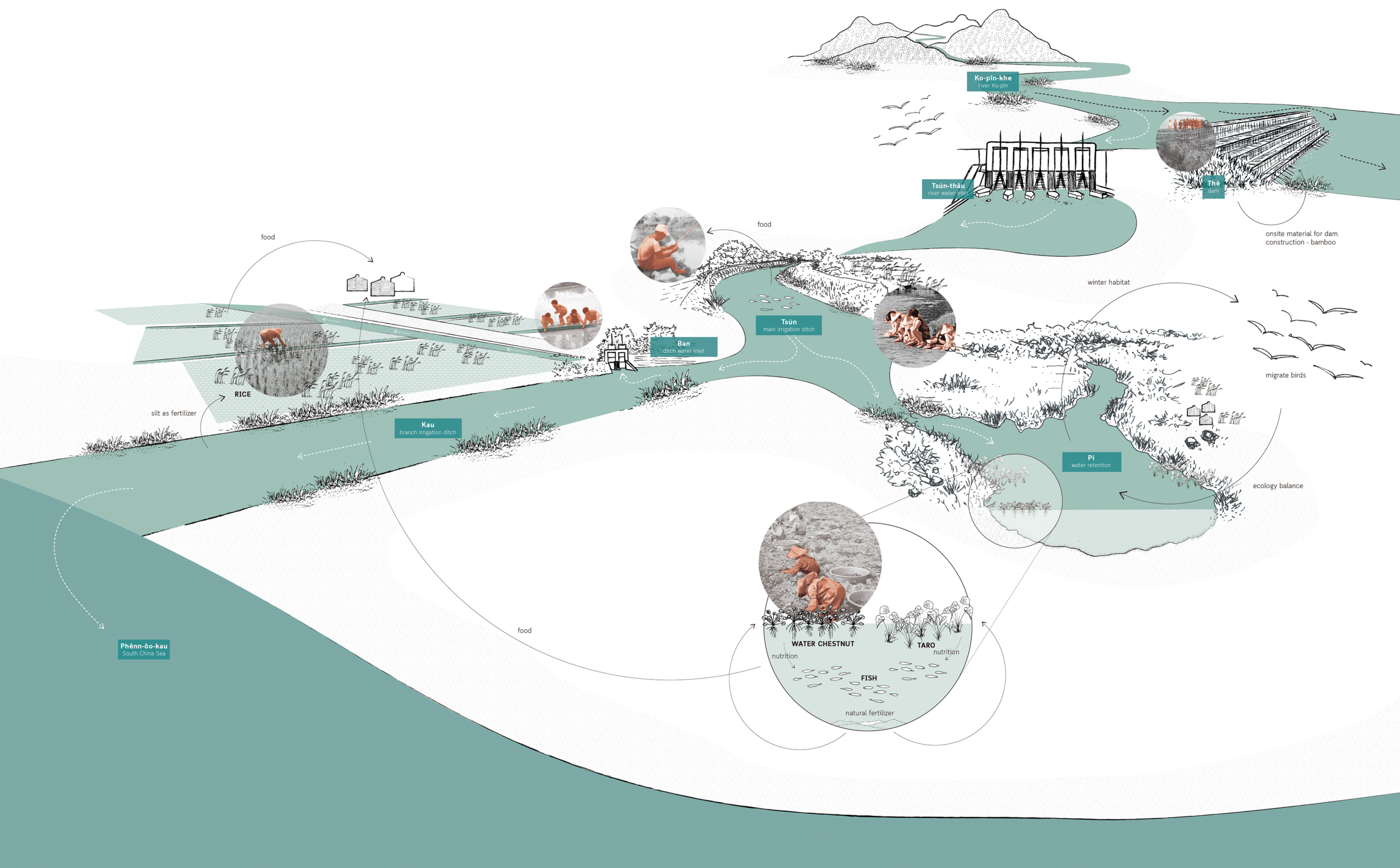
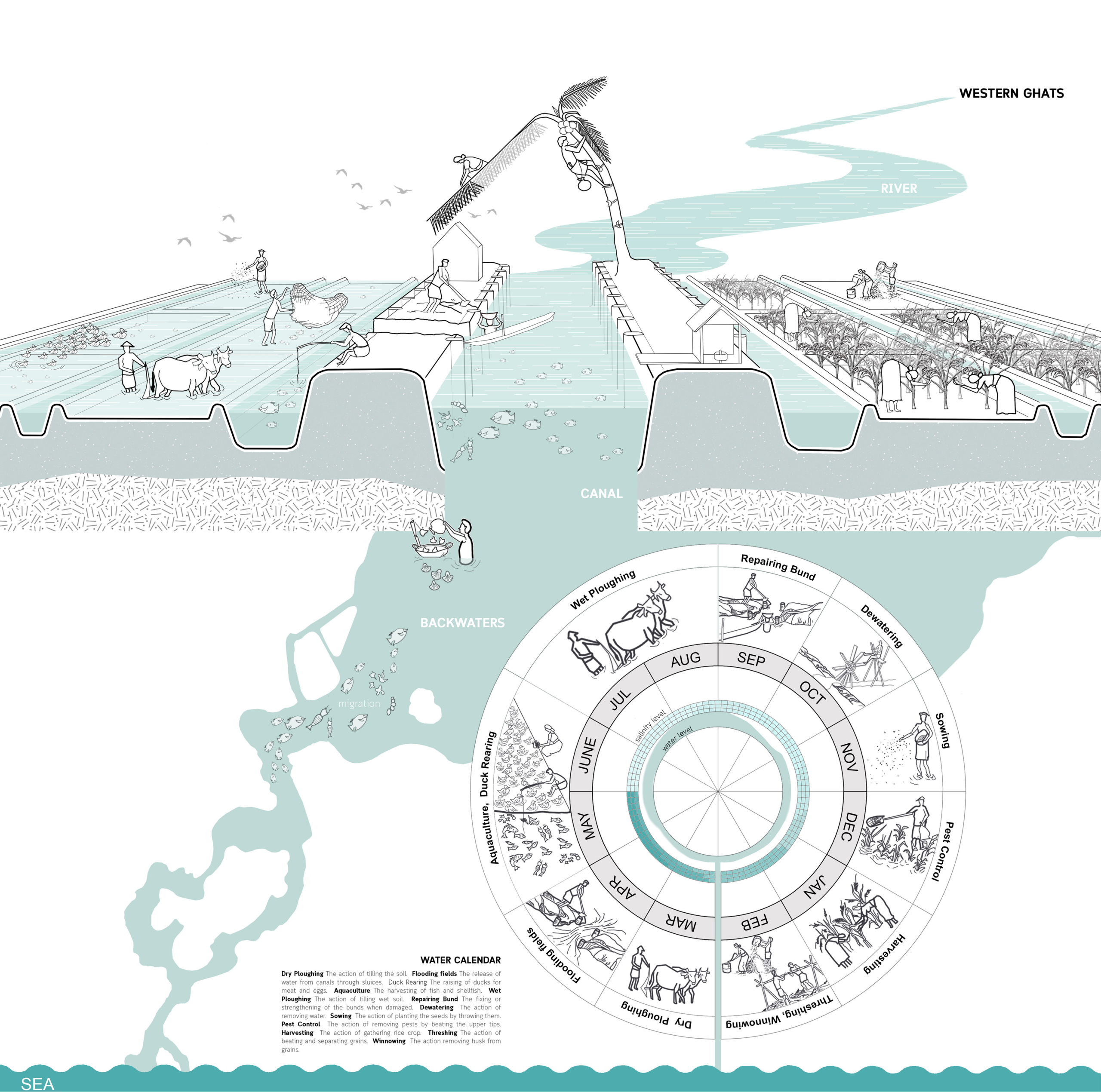
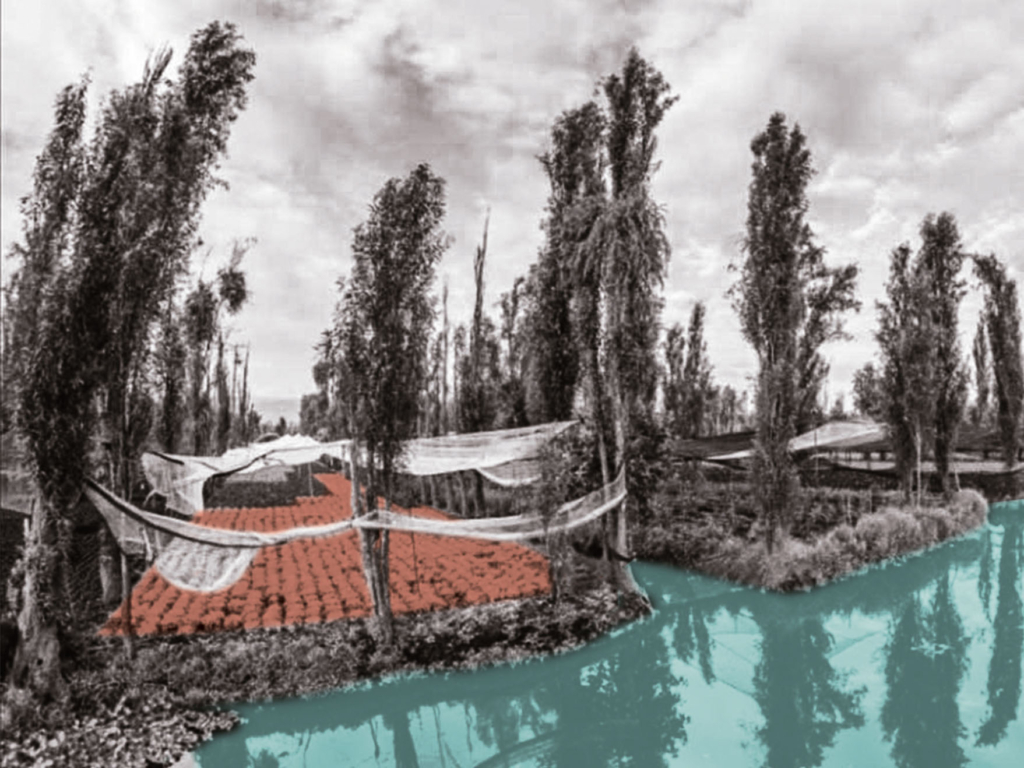
Water meadows are part of a well known irrigation system in England. The chalk valley landscapes of Wessex are an important county for water meadows because of the topsoil texture and slightly alkaline water they provide, elements that are needed for grass sward development.

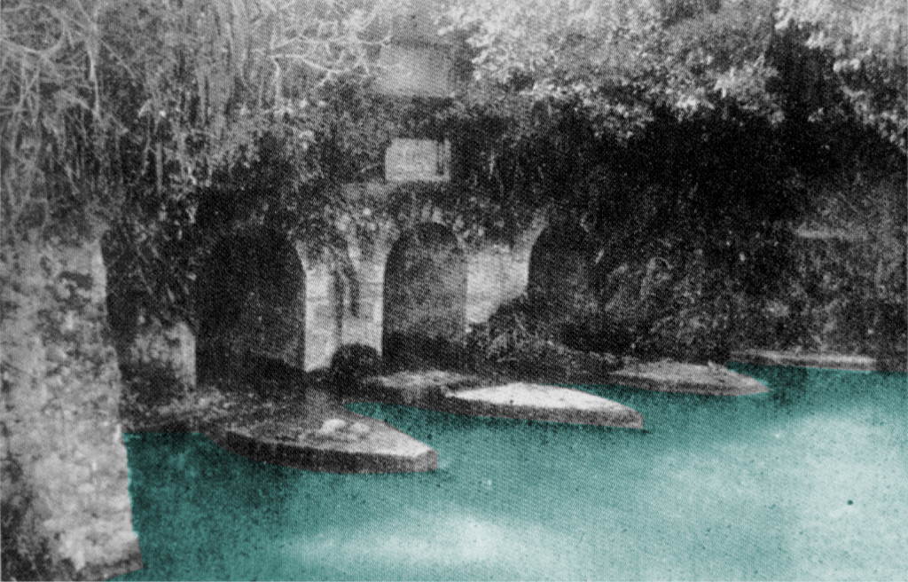
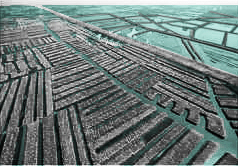
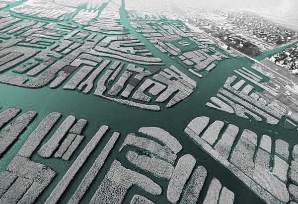
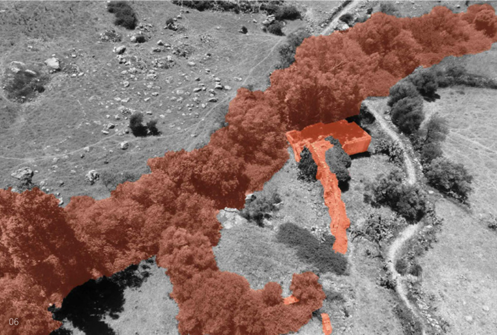
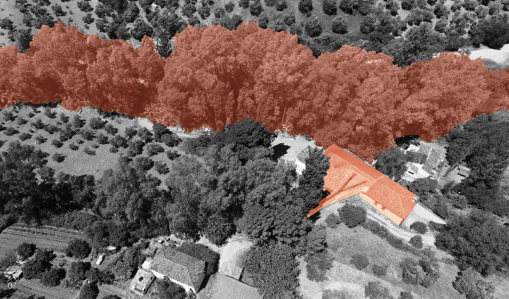
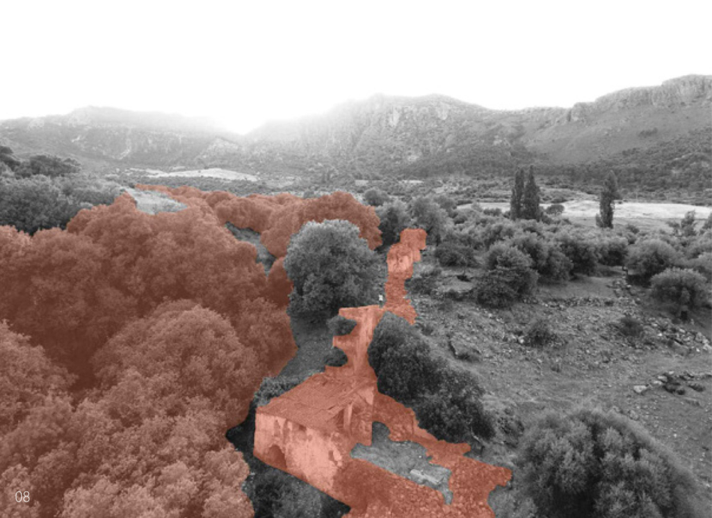
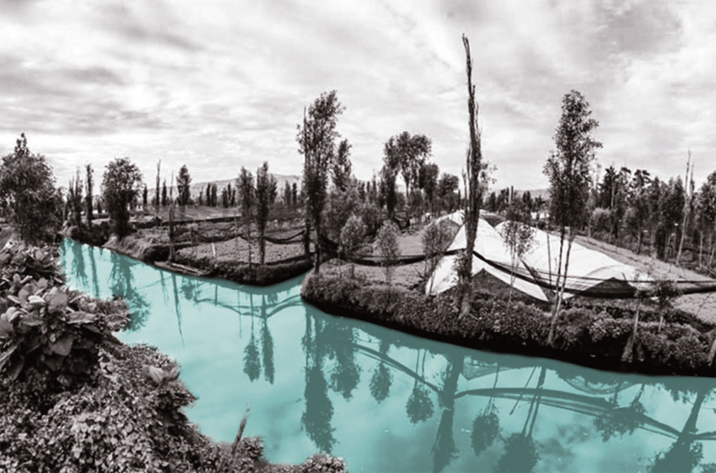
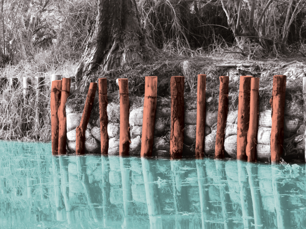
The Harnham Water Meadows, as a remnant of the 17th-century farming revolution, form an important part of the historical English landscape. These floodplain meadows are altered in such a way as to control the flow of water in order to improve agricultural activities. Due to their common occurrence, water meadows are often regarded as semi-natural features in the landscape while in reality they are notably artificially constructed.

The water system plan including mills, hatches and aqueducts.

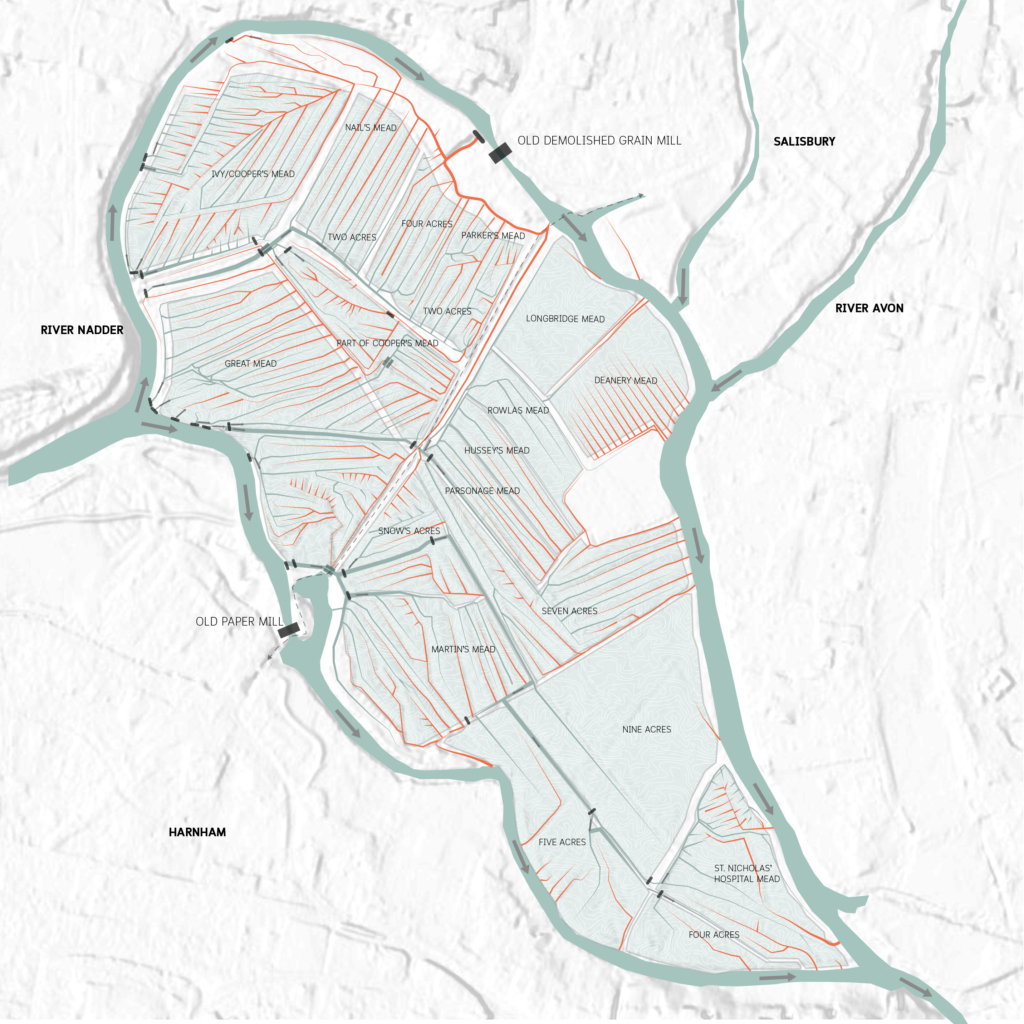
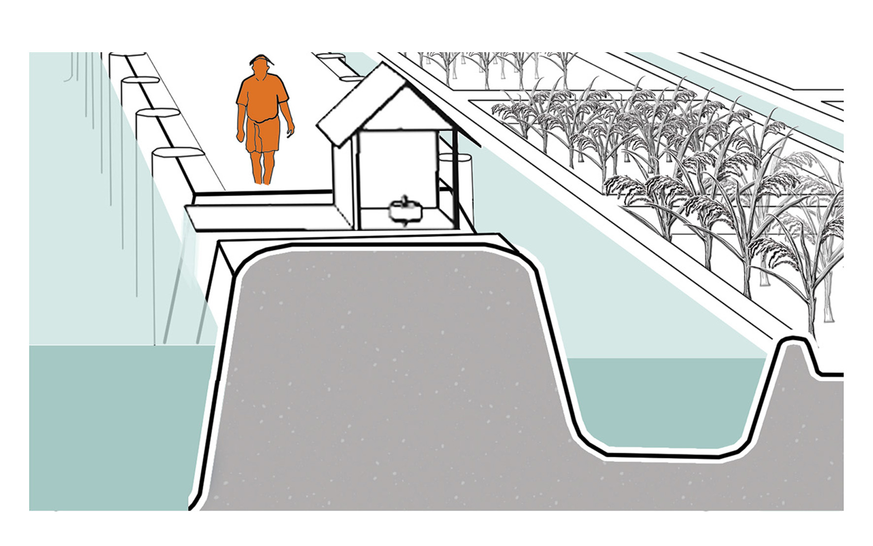
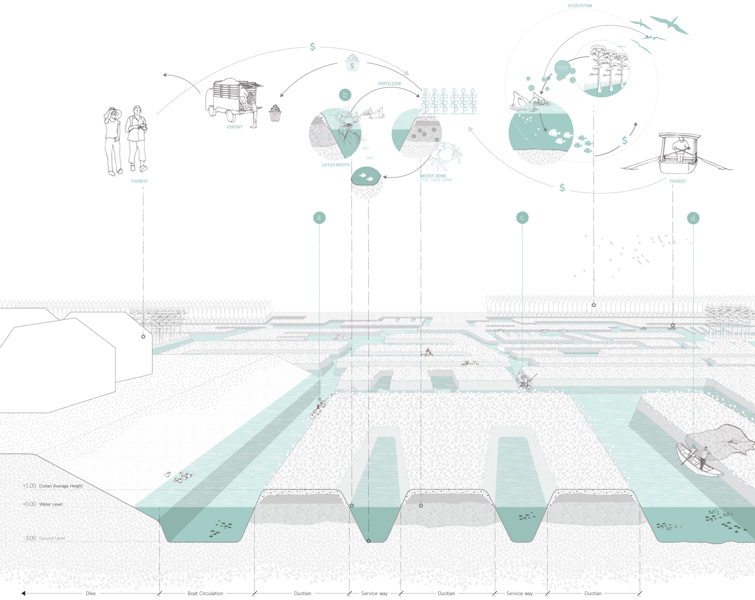
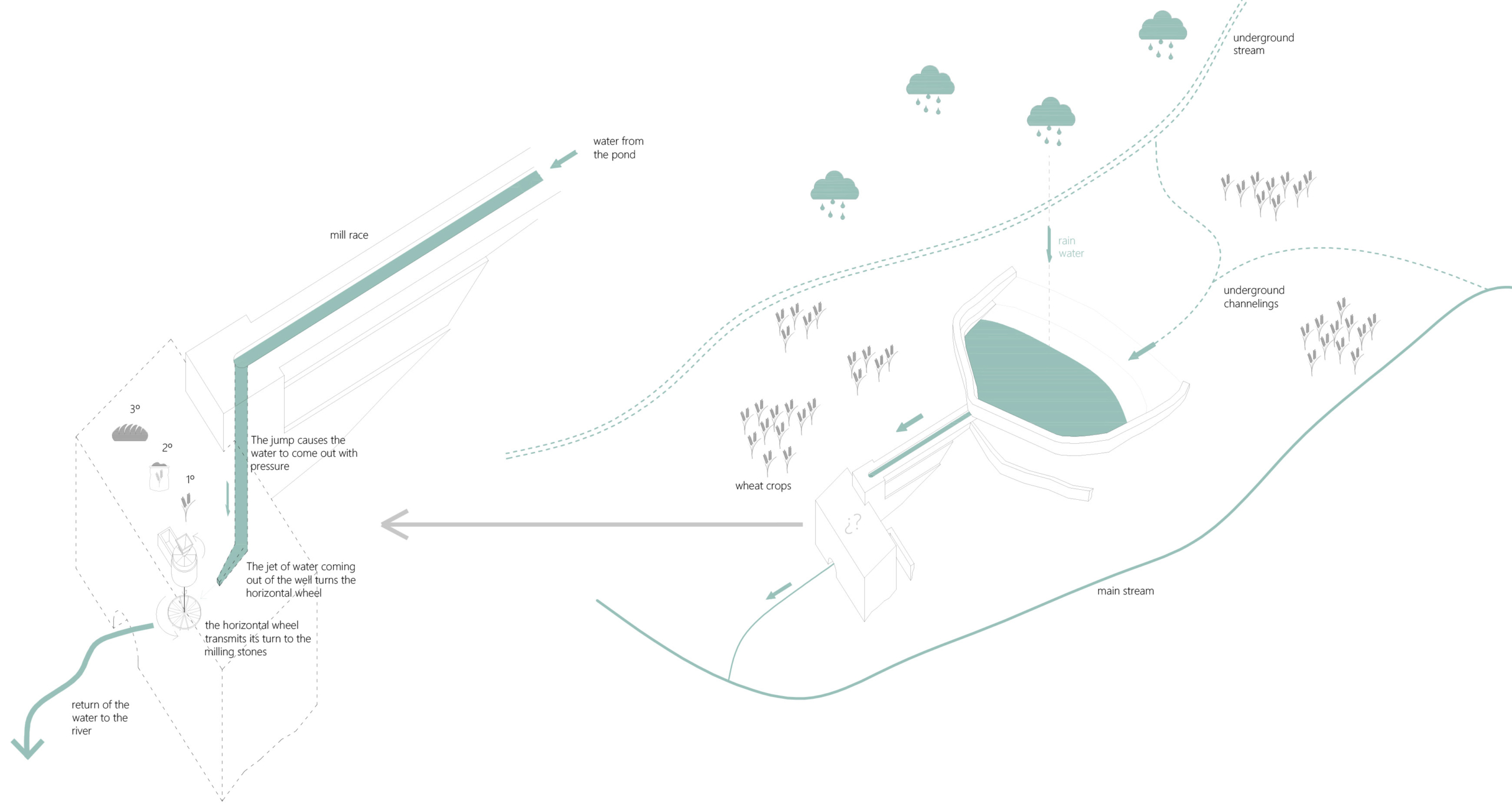
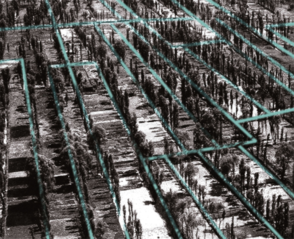
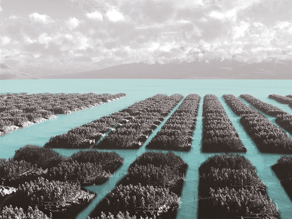
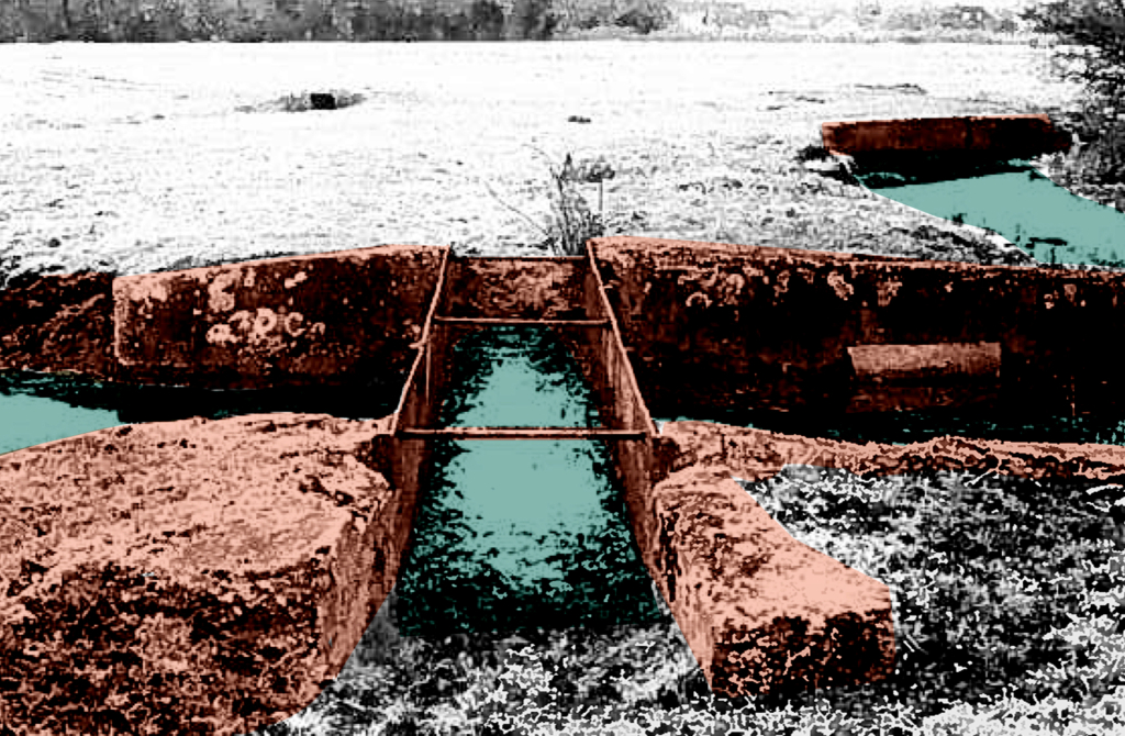
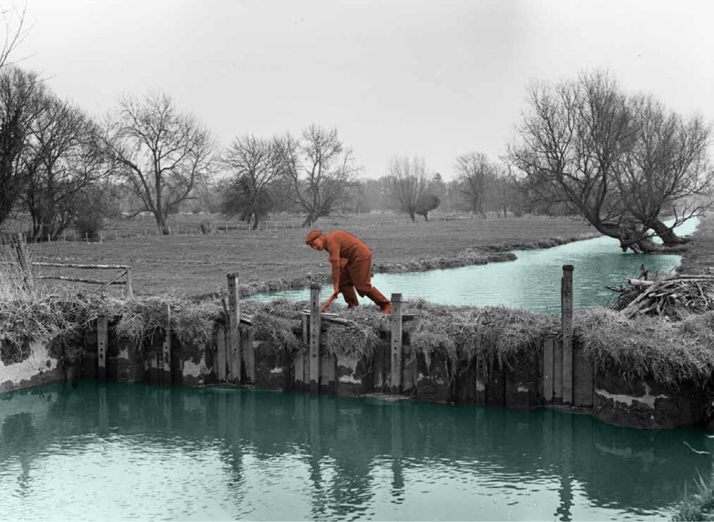
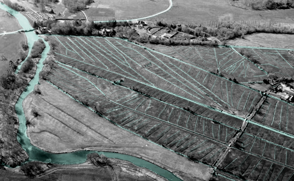
In more detail, in figure 17 it becomes evident that the two mills at Salisbury and Harnham are integrated into the water system and provide a raised water level upstream through impoundment. Then, the main carriages, controlled by
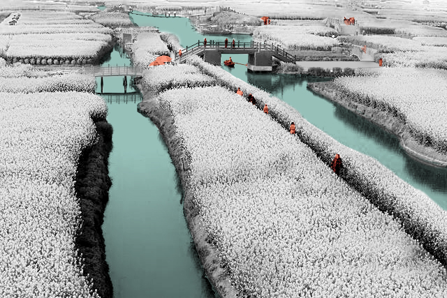
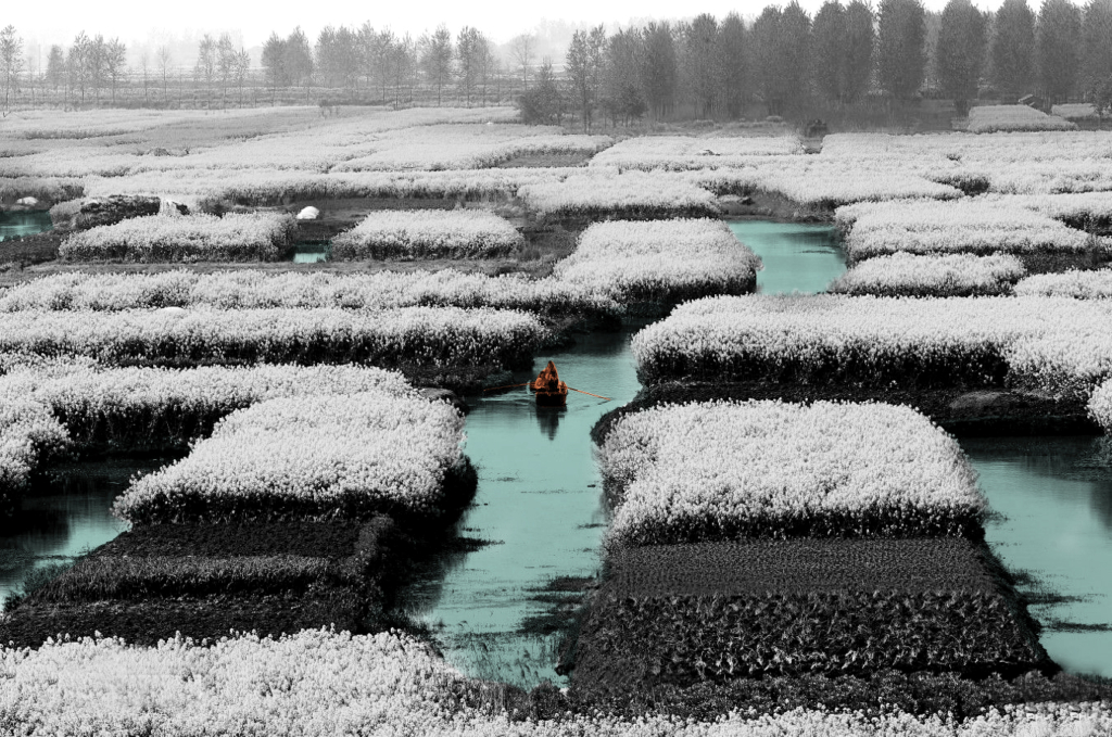
so-called hatches or sluice gates, allow the flow of water into the meadows. Eventually, river water would run along the tops of the constructed ridges so that water trickles through the grass at a depth of 25mm. The passage of water would return back into the river system via drains that lead to a tail drain back into the river Avon.
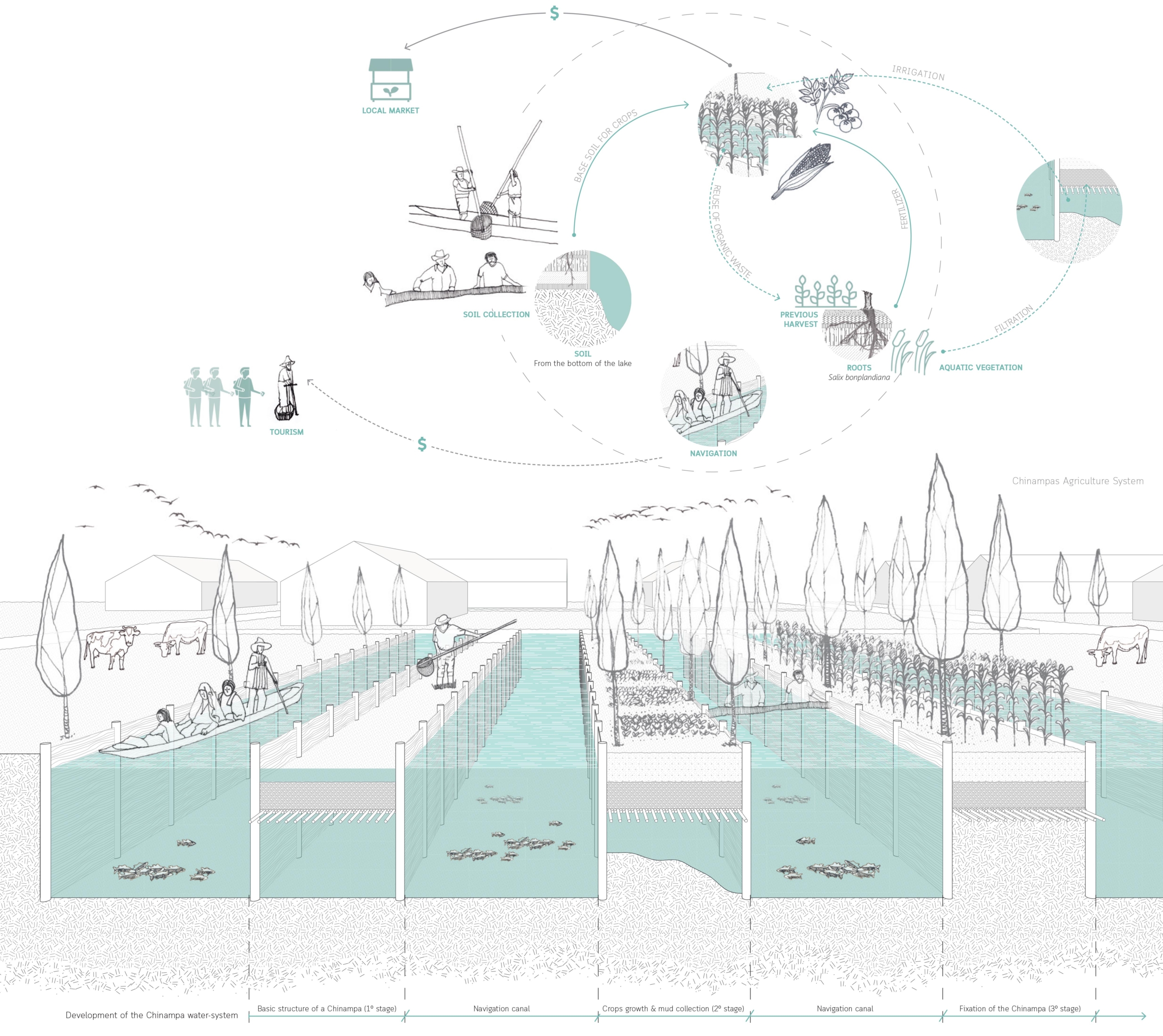
Circular Stories

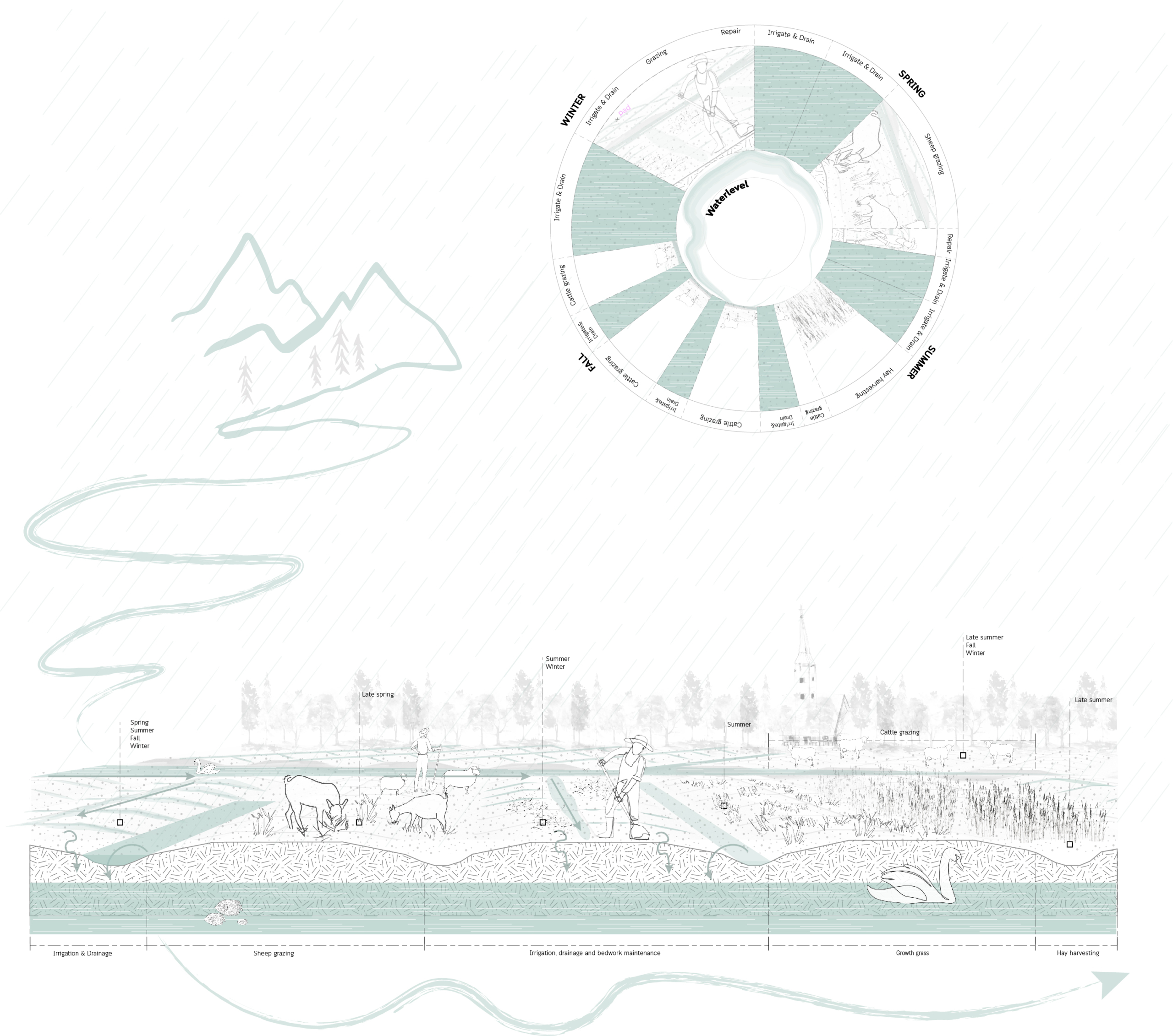
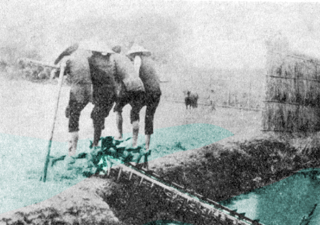
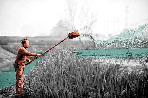
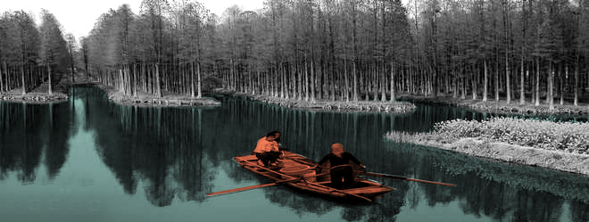
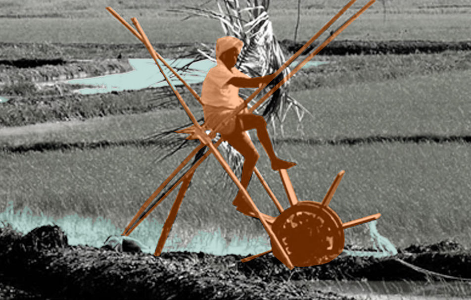
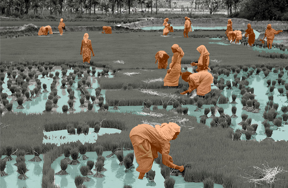
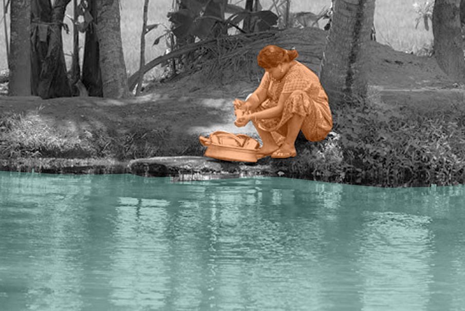
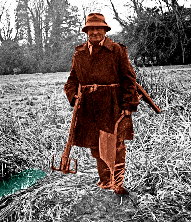
Initially, water meadows were part of the English agricultural “Sheep-Corn System”. The meadows provided grass while the sheep grazing this grass provided fertilization, leading to better crops on surrounding arable fields. Within this agricultural system, “floated” watermeadows were used for irrigation in the winter or early in spring, bringing nutrients and oxygen into the soil. Typically, this caused the grass to start growing about one month earlier than un-floated floodplain meadows. Later in the season, during the summer when the soil was drying out, water meadows were re-watered so that (typically) two cuts of hay were taken and used to feed other animals – cattle and horses. The drowning of the meadows took place in a cyclical management system. Meadows were usually drowned
for a few days followed by drained for a few days (3-7 days). In mid-March when grass would reach a height of 150mm, sheep would graze the fields of the meadows. Towards the end of May, the sheep would be removed again, allowing the grass to produce hay crops. From June until the end of September dairy cattle grazed, causing problems for the meadow surface and water banks. The latter leads to bedwork maintenance during the end of the fall.

Dewatering motor

Dewatering station and motor

An indigenous technical device placed at the edge of the Kayalnilam for pumping water out from low-lying areas to the major canals or backwaters. It consists of a submerged brass vessel that sucks water out and is run by an electric motor kept inside the pump house. The sucked water flows out through a rectangular brass box.

  • Project: Kuttanad Kayalnilam Agrosystem, Kerala, India
  • Climate: Tropical monsoon
  • Year: 1880-1974 (a modified version is still in use)
  • Water type: Seasonal mixing of saline and freshwater
  • Landscape: Polder landscape in a deltaic basin
  • Altitude: -3 – +1.5 m.a.s.l
  • Soil condition: Sandy loam clay formed from riverine or lacustrine deposits
  • Material: Wood and Brass
  • Temporality: Seasonal
  • Form: Point
  • Use or Function: Pump water out

Tsùn – 圳

Tsùn – 圳
Irrigation ditch

An open waterway that provides clean fresh water for drinking and irrigational use. Small ones are called “Kau 溝”, big ones are called called “Tsùn 圳”.

  • Project: Ksôkong Tsùn Irrigation System, Taiwan
  • Climate: Tropical savanna climate with dry-winter characteristics
  • Year: proximity 1839
  • Water type: river water
  • Landscape type: river plain
  • Altitude: 0-20 m.a.s.l. (meters above sea level)
  • Soil condition: alluvial soil
  • Materials: excavated soil and rammed earth
  • Period: permanent
  • Form: a network of lines
  • Use or Function: water supply for agriculture

Pi – 陂

Pi – 陂
Water gate

Water gate that regulates water between irrigation ditches.

  • Project: Ksôkong Tsùn Irrigation System, Taiwan
  • Climate: Tropical savanna climate with dry-winter characteristics
  • Year: 1839
  • Water type: river water
  • Landscape type: river plain
  • Altitude: 0-20 m.a.s.l. (meters above sea level)
  • Soil condition: alluvial soil
  • Materials: brick, metal, wood
  • Period: permanent
  • Form: Point
  • Use or Function: control

Kampung Naga

View of Kampung Naga.

An integrated living system of a traditional
Sundanese hamlet in West Java, Indonesia.

Ayu Tri Prestasia and Boomi Kim
2019

The spatial organization of Kampung Naga is influenced by its location on the valley. The topographical characteristics of the site defines the vertical zonation of the hamlet, which is closely related to the utilization of the landscape into the water management system.

Kampung Naga floor plan.

Based on its spatial relation to the settlement area, Kampung Naga can be divided into 3 distinctive zones. The “forbidden forest”, the Sacred Area, is preserved at the top of the composition to infiltrate, filter and store the water through its roots. The settlement area, the Inner Area, is located in the middle with terraced soils following its natural topography. At the lowest level, the Outer Area, fish pond system become the location where almost all the water-related activities take place. Bamboo fences are used as the boundary of the settlement area which at the same time clearly separates these three zones.

Strategic position of the areas on the topography.

Kampung Naga maintains the traditional living with nature amidst modernity that develops around the area. No new technology such as the use of electricity and related devices is allowed in the hamlet. The boundary of Kampung Naga is strictly preserved to balance the number of people whose lives can be supported by the food supply and the ability to manage the wastewater inside the village. While maintaining the number of people who live inside, the rest of the family members can live outside the village.

Although almost all water-related activities are located on the Outer Area, water is treated as a major part of their lives. People keep its space to “breathe”, use it wisely, and purify the wastewater before finally being returned to its original place. Centralization of the activities are designed as an integrated system of water and ecological cycle.

Circular Stories

Nature works in circular systems. Living with nature, people in Kampung Naga believe that they need to understand thoroughly and preserve this circularity. Water, as one of the main resources of lives, is used wisely to maintain its circularity. The three water sources which are located on the higher parts of the topography are kept clean free from any activities that could contaminate the water quality. People are forbidden to cut trees in the forest on the hill to maintain its ability to absorb and purify the rainwater to the ground water table. In this case, myth and tradition are used by the community as rules that have to be obeyed. After the water is used for daily activities, it is purified by fishpond systems before finally being returned to the river.

Circularity in a house scale, Kampung Naga village.

Ksôkong Tsùn Irrigation System

Atmosphere of Kaoshiung canal system.

A traditional irrigation system that set the
the foundation of Kaohsiung City.

Man-Chuan Sandy Lin
2020

The growth of Kaohsiung is closely related to its irrigation system. The Ksôkong Tsùn irrigation system is a traditional water management and irrigation system used for the purpose of agriculture. The system dates back in 19th century and it has been claimed as municipal heritage site of the city of Kaohsiung.

Plan showing zoom in detail of Cao-Gong irrigation system.

The Ksôkong Tsùn irrigation system consists mainly four types of elements: dam, inlet, waterway, water retention pond.

Circular Stories

In Taiwan, the connection between land and people was once profound and unbreakable, especially in agricultural society before modernization.

Water from river Ko-pin-khe is obtained from a dam, regulated using inlets, to irrigate rice fields following natural topography and weaved an aquatic landscape. Besides the rice fields, water plants production such as taros and water chestnuts, were located in the water retention. This agriculture production, together with aquaculture, formed a circular system that supported one another. On the landscape, Ksô-kong irrigation system accommodated a variety of human activities. At the time people were close to water, scenes like women doing laundry and socializing by the water, children playing in the field, and men fishing on the edge of waterways were common on daily basis.

A story of circularity of a lifestyle that utilizes water resource as irrigation system in southern Taiwan.

Xinghua Duotian Agrosystem

Atmosphere of the system with boats for tourist.

A traditional water-land utilization technique
developed by Chinese ancestors.

Rapa Surajas
2019

The map illustrates the landscape condition of the area which is located inside the Lixiahe plain. The geographical condition is a low-lying area surrounded by higher land as the borders. Lixiahe plain is highly influenced by the rivers and the Yellow Sea since it is a deltaic area with an average height of 2.5 meters above sea level. The development of the Yellow river brought various types of soil and sedimentation to the area, and this led to the changed of the ecological condition of the wetland.

Landscape condition is not the only factor that triggered the Chinese ancestor to invent the raised field, but the sociological condition was also a significant aspect. Xinghua is located in the area surrounded by major rivers which were distinctively an important commercial trade area (Yanying etl., 2014). The population overgrew which led to massive food demand. This essential problem can only be solved by increasing the cultivable area (The People’s Government of Xinghua City ,2014).

As a consequence, Xinghua people began to explore the possibility to increase cultivable land. One of the potentials brought by the occurrence of the hygrophytes which began to grow in the area (The People’s Government of Xinghua City, 2014), this is the indicator of the fertile soil quality brought by the yellow river. Xinghua people began to dig the soil from the river and mounding the earth platform to create the floating farmland. It is when the raised field has begun to form.

Catchment map shows different type of soil and sedimentation brought by the Yellow River.

More than thousands of raised fields had been constructed to produce agricultural products for the community. It created a unique landscape pattern for the area. Xinghua became the important cultivated land and the Duotian-raised field also contributed to a flood control system of the area.

Although this technique has been applied in various areas all over the world, Xinghua Duotian is one of the few traditional systems which is still functional. Its long history and adaptability to the excessive water condition make Xinghua Duotian different from other raised field systems. It is recognized as an example of sustainability in agriculture (The People’s Government of Xinghua City, 2014).

Circular Stories

The previous flood-prone area has been sustainably utilized by combining forestry, agriculture and aquaculture. The trees planted on the ridges provided fruits and food for the ducks, feeding fishes in the ditches, raising crabs and lobsters inside the soil of the raised field. The natural aqua-planting became a great source of food for birds and ducks while their roots acted as a high quality fertilizer (The People’s Government of Xinghua City, 2014). The new ecological network has contributed to the growth of the crops and created a remarkable landscape to attract a discrete number of tourists. The area is fully established, bringing considerable economic benefits while securing biodiversity and ecosystem services.

Kuttanad Kayalnilam Agrosystem

Aerial view of the agrosystem.

A traditional paddy farming system
below sea level.

Naeema Ali
2020

The birth of the cultural landscape was marked by the onset of the land reclamation process, locally known as “Kayalkuthu”. When the region encountered acute food shortage in the late 1800s, the virgin landscapes were considered as a gift from the backwaters and were brought to agricultural glory.

Kuttanad cultural landscape.

Here, water management was quintessentially a unit of the cultural expression of the site specific challenges faced by people, be in terms of topography, climate or social hierarchy. The low-lying landscape was subjugated for the benefit of men and women and how they did this narrates the legend behind the existing agricultural landscape of Kuttanad. These radical ingenuities tell us stories of how humans and nature exchanged roles between being makers and takers of the landscape.

Circular Stories

The salt which came across as a curse sealing the fate of the farmers, however, was a blessing for the fishermen due to fish migration from the sea. Hence, the circle of life in Kuttanad was explicitly linked to this cycle of blessing and curse intermingling with the cycle of water and salt. Likewise, Kayalnilams also operated to optimize their performance within this spatio-temporal context specific to Kuttanad.

Cyclical water system.

The Water Mills of Sierra de Cadiz

Atmosphere of the system.

Water as a driving force in the historical
production of staple food: bread.

Gloria Rivero-Lamela
2019

The Sierra de Cádiz is located in the north-eastern end of the province of Cádiz; within Andalusia, in Spain. It comprises a large part of the Sierra de Grazalema Natural Park, declared a Biosphere Reserve in January 1977 and a Natural Park in December 1984.

It presents a rugged orography of steep slopes, which causes the Sierra de Cádiz to be the area where the provincial hydrographic network springs. The Majaceite, Guadalete, Guadalporcún and the Zahara and Hurones reservoirs stand out.

In addition to these physical issues, it is a cultural region, since it has been an isolated area (Hispanic-Muslim border during more than two centuries) that has generated among its inhabitants the awareness of sharing a common history and a cultural past.

Catchment area of Sierra de Cadiz.

They are, in addition, functional architectural interventions: for its industrial use and for the required productive profitability, water was necessary for its operation. Therefore, these mills were built with the precision and logic of the small hydraulic engineering works that, together with other minor and usual works in these places, such as ditches, canals, ponds, etc., make up a network of constructions aimed at control and management of hydrological resources that the artisan industries of the Sierra de Cádiz region require.

The function of the mills determines its design. On a small scale, the mill is distinguished by its location close to the rivers and by the external infrastructure works that channel the water to its interior: the millrace, the well and the wheelhouse.

All the water mills of the Sierra de Cádiz have a horizontal wheel and a well, one or two at most, and they may or may not have a pond. They were built when the watercourses had no speed or sufficient flow.

Almost all the mills had a mixed structure with masonry load-bearing walls of irregular stone, taken with mortar of sand and lime, 60-80 cm thick, plastered with lime and wooden beams. Most of the roofs had one or two water structures, also made with wooden structure, thatched and Arab tile. The main space that articulates the building is the grinding room, located above the wheelhouse.

If it exists, the pond is built where the slope of the land is not excessive to achieve, with minimal construction resources, store as much water as possible. The water is conducted from the pond to the well by the millrace, which bypasses the topography. The well is located in the area of the greatest slope so that the waterfall generates enough force to move the horizontal wheel. The position and length of the millrace result from the position of the pond and the well according to the topography. The system is further optimized with the mill’s proximity to the river for the immediate return of the water to the natural course.

Functional diagram of the mills.

Chinampas agriculture and settlement patterns

Floating gardens of Xochimilco.

Floating gardens of the Aztec Empire of the city of Tenochtitlán.

Catalina Rey Hernández
2019

The Valley of Mexico is a highlands plateau, located in the Trans-Mexican Volcanic Belt. It contains most of the Mexico City Metropolitan Area. Hydrologically, it is an enclosed valley containing the bed of five lakes which are currently extinct. The lakes did not have a natural outlet for water to flow, leading to several floods in the area. The Spaniards decided to drain the former lake-beds to make the city safer, thus transforming the lacustrine landscape into a valley.

Actual system of canals, retention basins and Chinampas in the Metropolitan area of Mexico City.

Chinampas, also known as floating gardens, are an ancient Mesoamerican water system for agriculture and territorial expansion. This was done through a raft covered with soil which was used to cultivate vegetables and flowers as well as to expand the territory on the water surface of lakes and lagoons of the valley of the city of Tenochtitlan, Mexico, converting it into a floating city.

The origin of chinampas started with one of the main problems that the Aztecs faced: lack of land to build their houses. Tenochtitlan island didn’t have enough room for all the inhabitants. Therefore, they fixed this situation by extending those parts of the island where the water was shallow by reclaiming land with alternate beds of reeds and mud taken from the bottom of the lagoon. While the inhabited islands could be enlarged, other lands could be created to support wildlife for hunting and gathering, while other Chinampas served as extensive gardens.

Circular Stories

Today, Chinampas are still present in the southern part of the Valley of Mexico, on the canals of Xochimilco. Although many of these floating gardens were constructed and thoroughly tended to from the Post-Classic period through the Spanish conquest, many of these plots of land still exist and are in active use thanks to present-day farmers that have revived this traditional water system. In addition, the traditional way of cultivation and the form of transport have attracted many tourists who want to experience the Chinampas, through piragüas (traditional canoes) especially to see flower nurseries.

Circularity of the system, representation of its sustainability. Section perspective of the Chinampas water-system.

For the entire booklet of the Chinampas agriculture and settlement patterns be so kind as to contact us through the form in the Contact section.