Weir

Weir

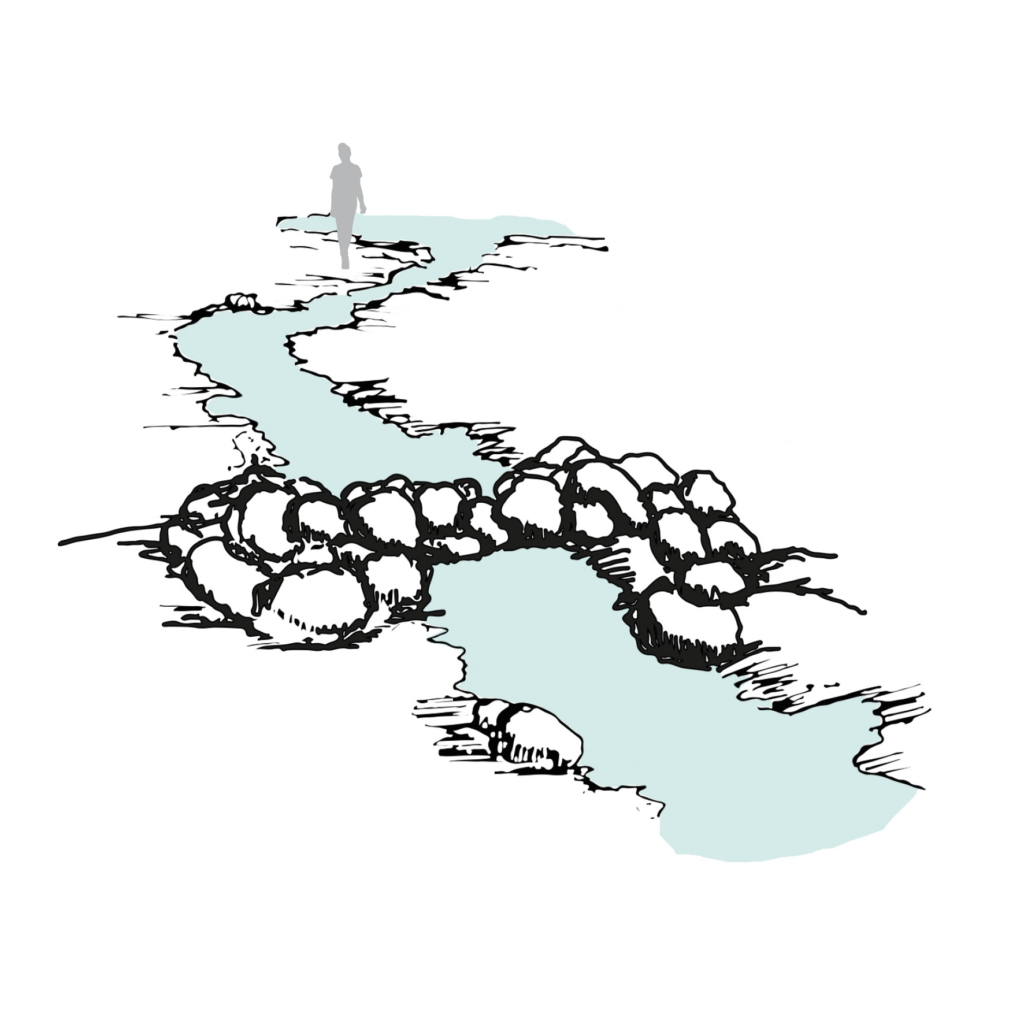
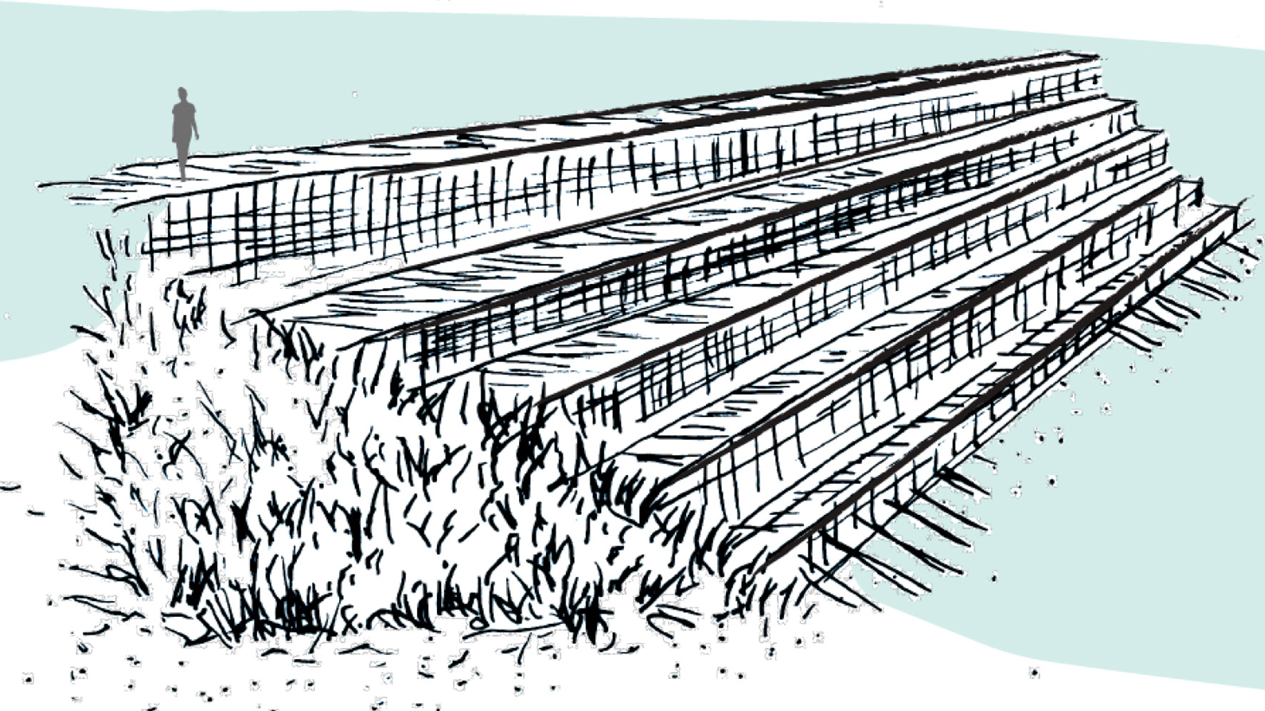
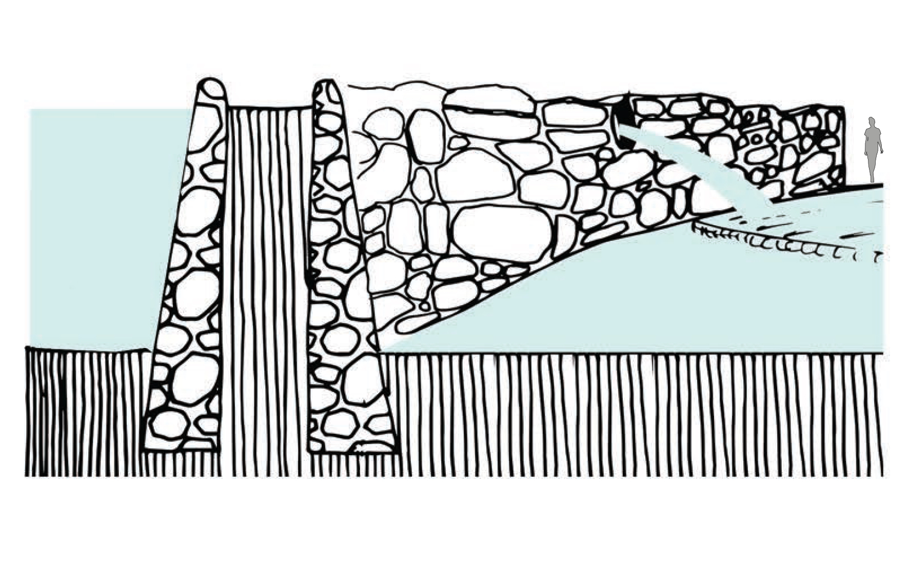
Flexible walls constructed with eroded basalt rock, positioned across waterways and wetland areas. Used to capture large pools of water where eels and fish could be kept fresh, during autumn and winter, for maturing or to catch when required.

  • Project: Aboriginal eel Aquaculture – Gunditjmara Country.
  • Climate: Temperate – Warm-summer Mediterranean
  • Year: 4000 BC
  • Water type: Fresh water
  • Landscape: Volcano stream
  • Altitude: 20-30 m.a.s.l
  • Soil condition: Peat and basalt rocks
  • Material: Basalt rocks
  • Temporality: Seasonal, autumn and winter
  • Form: Point
  • Use or Function: Aquaculture

Trap

Trap

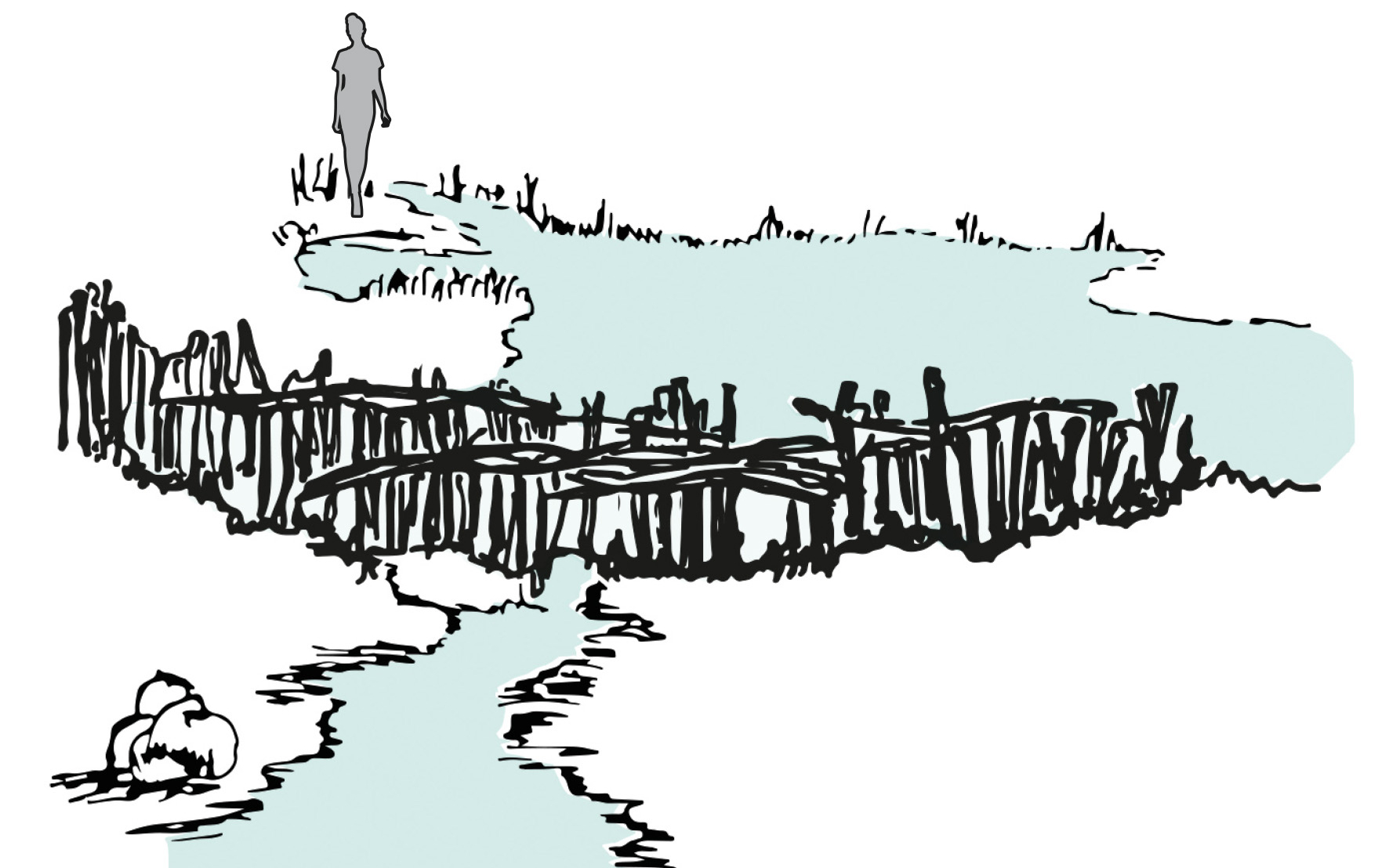
Artificial and built-up structures with gaps or sections for water to flow through and where a Gnarraban (basket) can be placed. These structures were positioned across races and natural drainage lines. The traps could be built as V-shaped basalt block walls, or as a woven timber fence.

  • Project: Aboriginal eel Aquaculture – Gunditjmara Country.
  • Climate: Temperate – Warm-summer Mediterranean
  • Year: 4000 BC
  • Water type: Freshwater
  • Landscape: Volcano stream
  • Altitude: 20-30 m.a.s.l
  • Soil condition: Peat and basalt rocks
  • Material: Basalt rocks or timber
  • Temporality: Seasonal, autumn and winter
  • Form: Point
  • Use or Function: Aquaculture

Pān – 汴

Pān – 汴
Irrigation ditch water inlet

Water gate that regulates water between irrigation ditches.

  • Project: Ksôkong Tsùn Irrigation System, Taiwan
  • Climate: Tropical savanna climate with dry-winter characteristics
  • Year: 1839
  • Water type: river water
  • Landscape type: river plein
  • Altitude: 0-20 m.a.s.l. (meters above sea level)
  • Soil condition: alluvial soil
  • Materials: brick, metal, wood
  • Period: permanent
  • Form: Point
  • Use or Function: control

Tsùn-thâu – 圳頭

Tsùn-thâu – 圳頭
River water inlet

A gate element that can control the amount of irrigation water intake. In typhoon season, the gate can be closed to protect crops from flooding.

  • Project: Ksôkong Tsùn Irrigation System, Taiwan
  • Climate: Tropical savanna climate with dry-winter characteristics
  • Year: 1839
  • Water type: river water
  • Landscape type: river plain
  • Altitude: 0-20 m.a.s.l. (meters above sea level)
  • Soil condition: alluvial soil
  • Materials: brick, wood, metal
  • Period: permanent
  • Form: point
  • Use or Function: control

Thê – 堤

Thê – 堤
Dam

A linear obstacle built perpendicular to a river to guild and direct water to the river water inlet for irrigation ditch.

  • Project: Ksôkong Tsùn Irrigation System, Taiwan
  • Climate: Tropical savanna climate with dry-winter characteristics
  • Year: 1839
  • Water type: river water
  • Landscape type: river plain
  • Altitude: 0-20 m.a.s.l. (meters above sea level)
  • Soil condition: alluvial soil
  • Materials: bamboo, excavated earth
  • Period: proximity from every October until next July (re-built every October during the dry season and got flooded away during typhoon season.)
  • Form: Point
  • Use or Function: Direction

Curugan

Curugan
Gutter

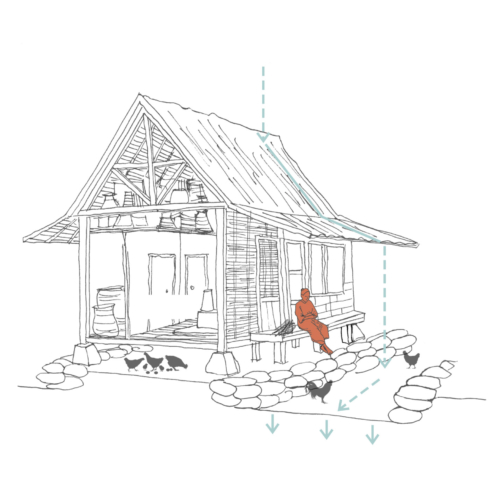
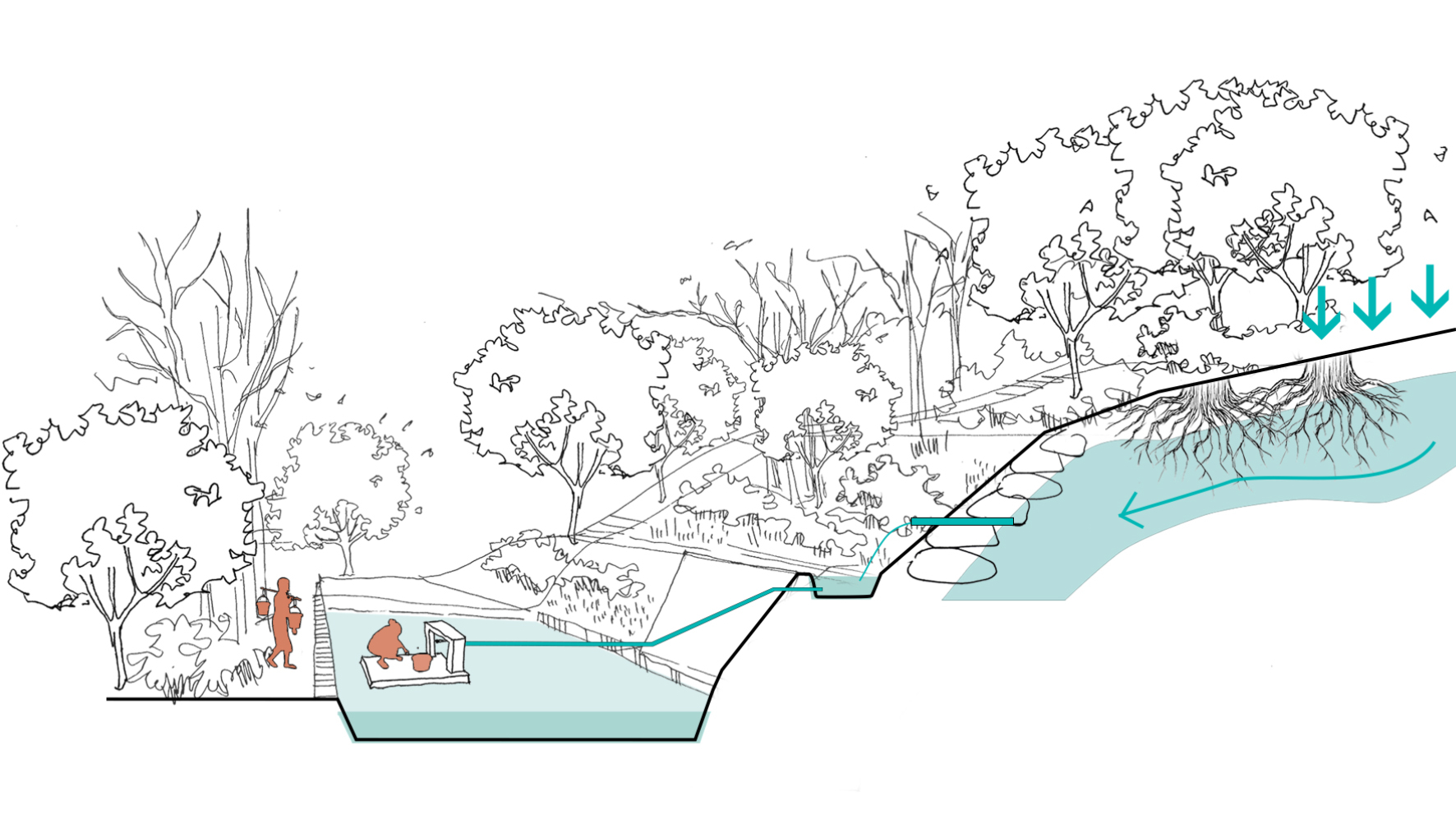
The houses in Kampung Naga are built on a raised platform in a linear arrangement. This level difference forms a gutter that is bounded by river stones, creating storm -water drainage channels.

  • Project:: Kampung Naga
  • Climate: Tropical – Mild temperate humid
  • Year: Current
  • Water Type: Fresh water
  • Landscape: Plain
  • Altitude: 584 m.a.s.l
  • Soil Condition: Inceptisols & Entisols
  • Material: Fluvial rocks
  • Temporality: Fixed
  • Form: Line Use or
  • Function : Stormwater drainage

Air Nyusu

Air Nyusu
Spring water

A system to extract the spring water by creating a hole against the hill wall and channeling the water with pipes to the platform underneath. The spring water is a result of water infiltration through the pristine ‘forbidden’ forest and filtered by its roots. The people of Kampung Naga use it as a source for drinking water.

  • Project: Kampung Naga
  • Climate: Tropical – Mild temperate humid
  • Year: Current
  • Water Type: Freshwater
  • Landscape: Valley
  • Altitude: 584 m.a.s.l
  • Soil Condition: Inceptisols & Entisols
  • Material: Stones, Concrete, Pipes
  • Period: Fixed
  • Form: Point
  • Use or Function: Potable water source

Balong

Balong
  • Project: Kampung Naga
  • Climate: Tropical – Mild temperate humid
  • Year: Current
  • Water Type: Fresh water
  • Landscape: Plain
  • Altitude: 584 m.a.s.l
  • Soil Condition: Inceptisols & Entisols
  • Material: Fluvial rocks & Concrete
  • Period: Fixed
  • Form: Surface
  • Use or Function : Fish farming, natural water purification

Bund

Bund
Embankment

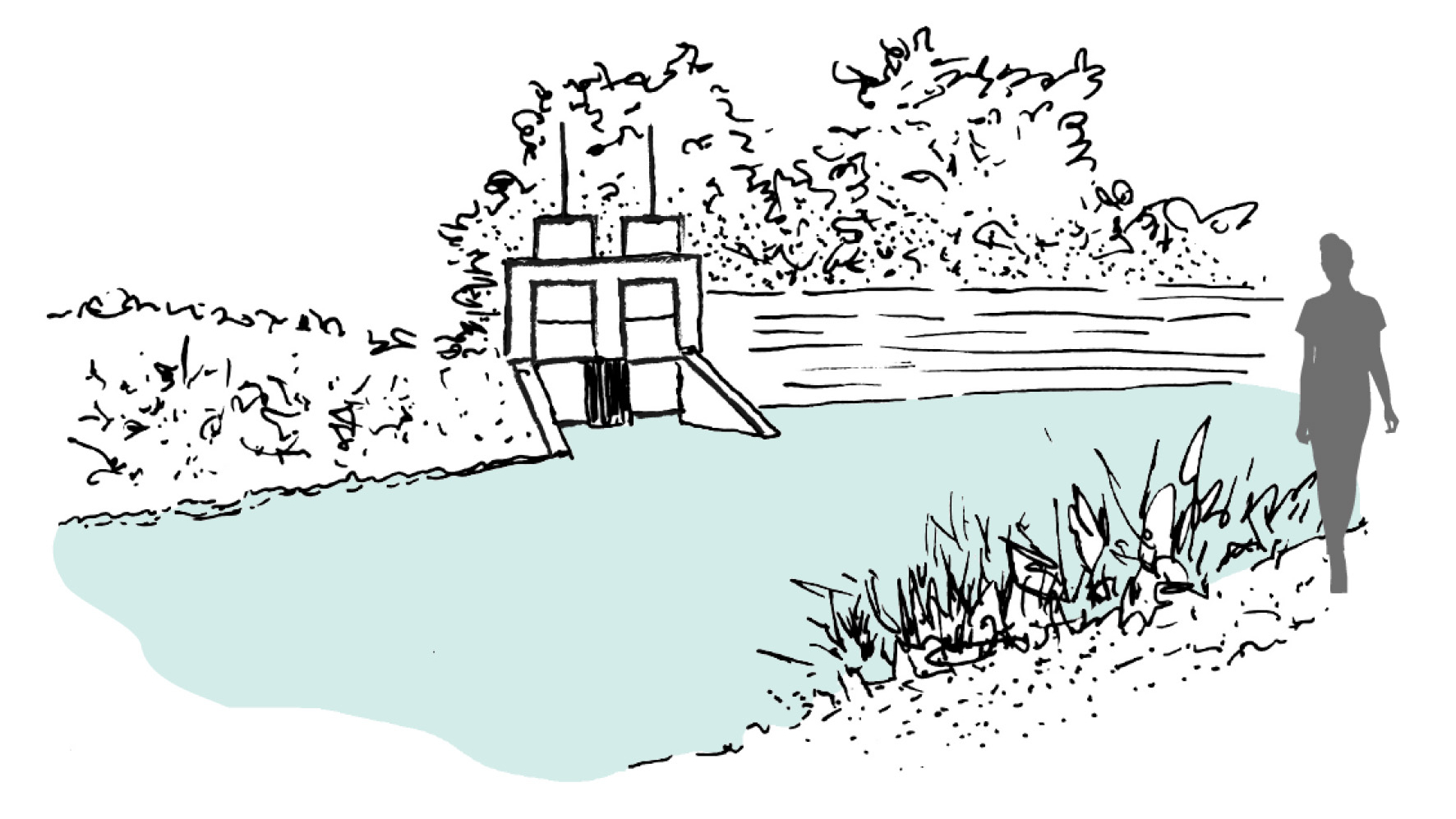
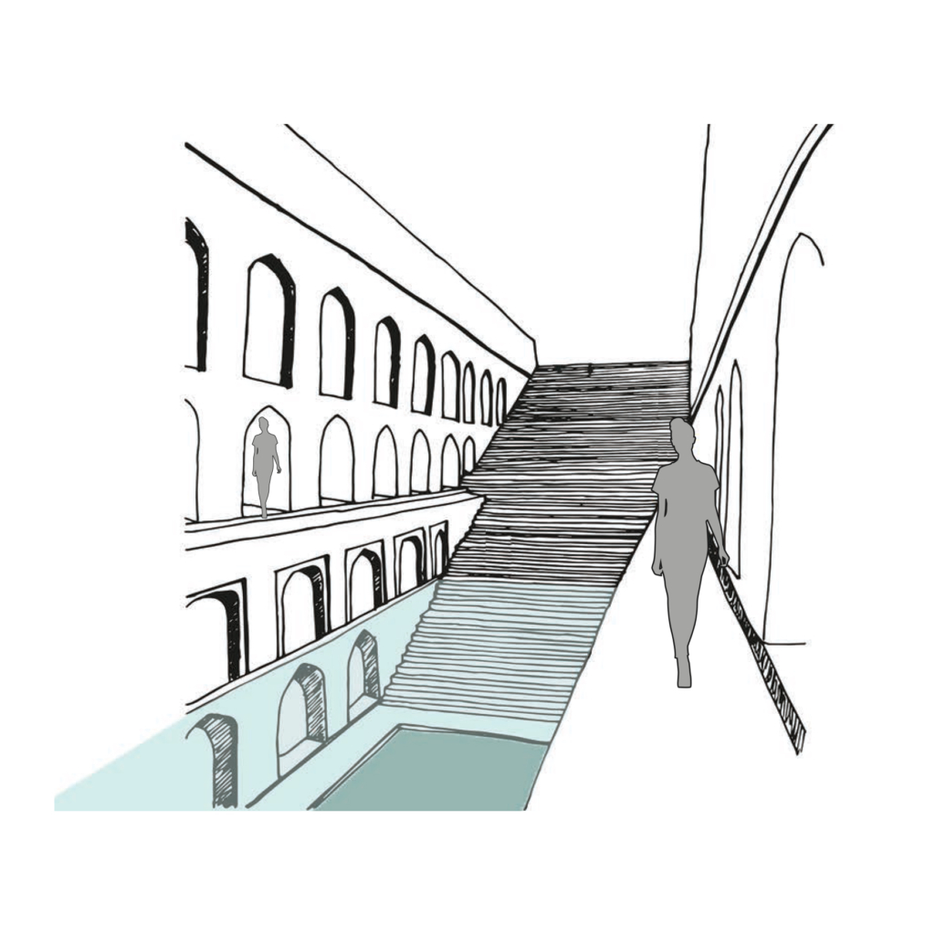
Water harvesting mud embankments restrain natural streams of stormwater runoff in its upper reaches and direct it for storage in hauz (lake) and baoli (stepwell).

  • Project Name: Delhi Sultanate Waterworks, Ancient network of water harvesting structures, Delhi, India
  • Climate: Overlap of humid subtropical and semi arid
  • Year: 1206 A.D. – 1526 A.D.
  • Water type: Drinkable rainwater
  • Landscape type: Ridge landscape
  • Altitude: 220-230 m.a.s.l
  • Soil condition: Alluvium, Quartzitic ridge
  • Material: Stone masonry
  • Period: Fixed
  • Form: Point
  • Use or function: Water directing

Baoli (water works)

Baoli
Stepwell

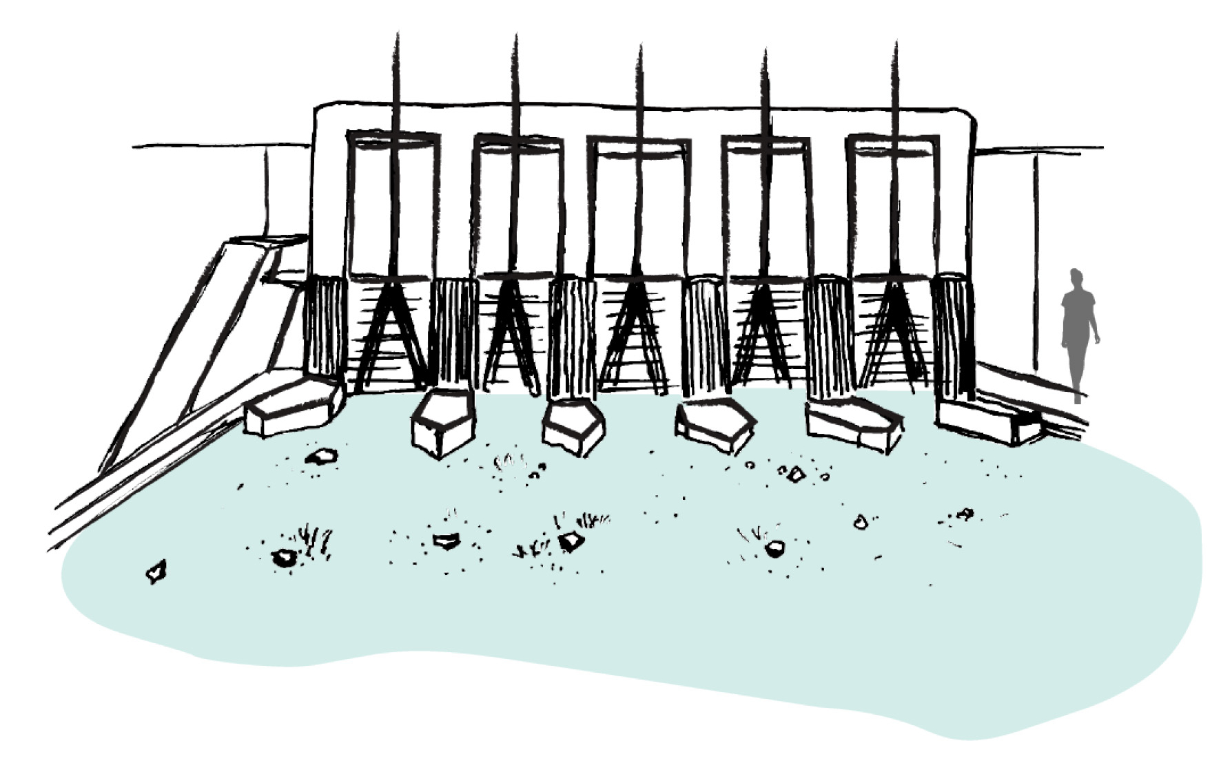
Rainwater and natural storm water channels from Delhi ridge is stored in ground and it is directly accessible to people by a flight of stairs. The narrow staircase is divided into three parts, which runs along inner three walls of rectangular baoli.

  • Project Name: Delhi Sultanate Waterworks, Ancient network of water harvesting struc-tures, Delhi, India
  • Climate: Overlap of humid subtropical and semi arid
  • Year: 1206 A.D. – 1526 A.D.
  • Water type: Drinkable rainwater
  • Landscape type: Ridge landscape
  • Altitude: 220-230 m.a.s.l
  • Soil condition: Alluvium, Quartzitic ridge
  • Material: Delhi quartzite stone
  • Period: Fixed
  • Form: Surface
  • Use or function: Water harvesting