Street Communal Fountains in Cyprus

Remains of the old fountain in Choullou village, Paphos.

Transporting water from a non-local spring to the village households through street taps.

Xenia Georgiadou
2023

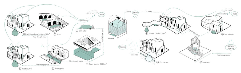
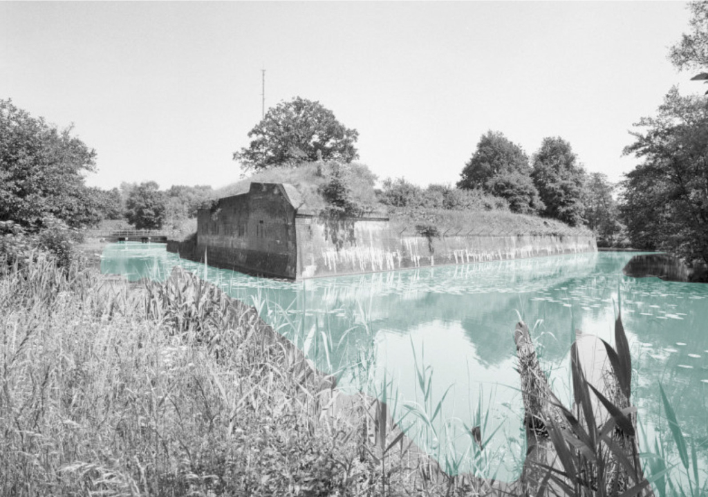
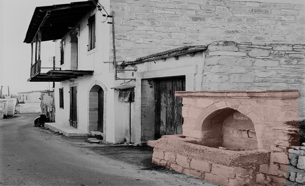
After the 40s, people in the villages used to be supplied with drinking water through public fountains, which were located in the main square of the village. The source of this system were either spring, chain-of-well or a borehole as well as the source water could be used for domestic or irrigation purposes. One example of spring that still provides with drikning water the households of a village is the Teratsia spring in Paphos forest.

The housewives are discussing while they collect water.
Traditional clay jars for water storing purposes.

Furthermore, Cypriot artists have been influenced and inspired by the process of supplying water in the household through the public taps and they wrote poems and songs talking about this. Additionally, a traditional dance had been generated about the water supply from the fountain to the household, where the women used to wear their traditional costumes. For instance, a traditional song, which is written in the Cypriot dialect is presented below:

Στείλε με μάνα μάνα στο νερό
Send me, mother, oh mother to (bring some) water
να σου το φέρω δροσερό
to bring you fresh water
τζι’ αν δε στο φέρω φέρω καθαρό
And if I will not bring, bring you clean water
την νιότη μου να μεν χαρώ.
may I not enjoy my youth.
[…]
Στη βρύση μάνα μάνα μου έφτασα
After I got, mother, oh mother to the fountain
τζαι το σταμνί μου γέμωσα
and after I filled up my jug
τζι άξαφνα παραπάτησα
Suddenly I misstepped
τζαι το σταμνί μου τσάκισα.
and I broke my jug.

Circular Stories

Diagram of communal fountains system.

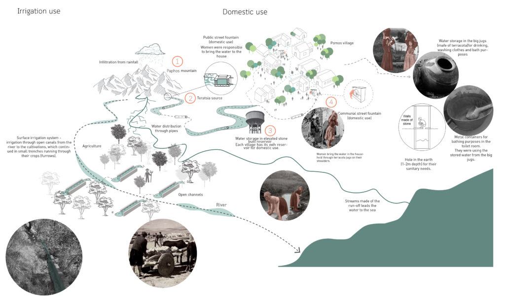
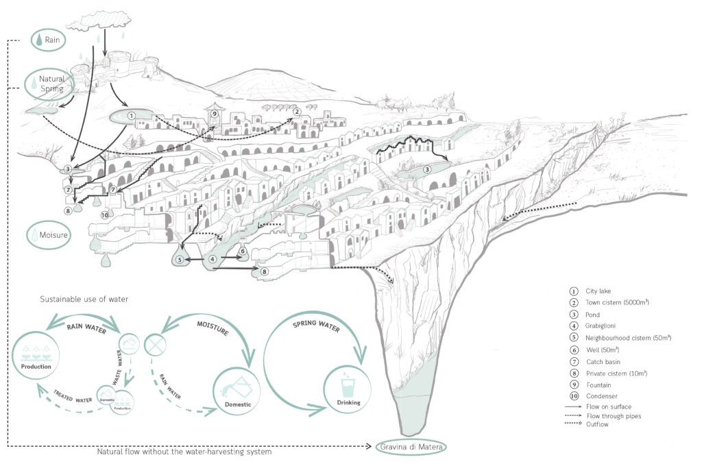
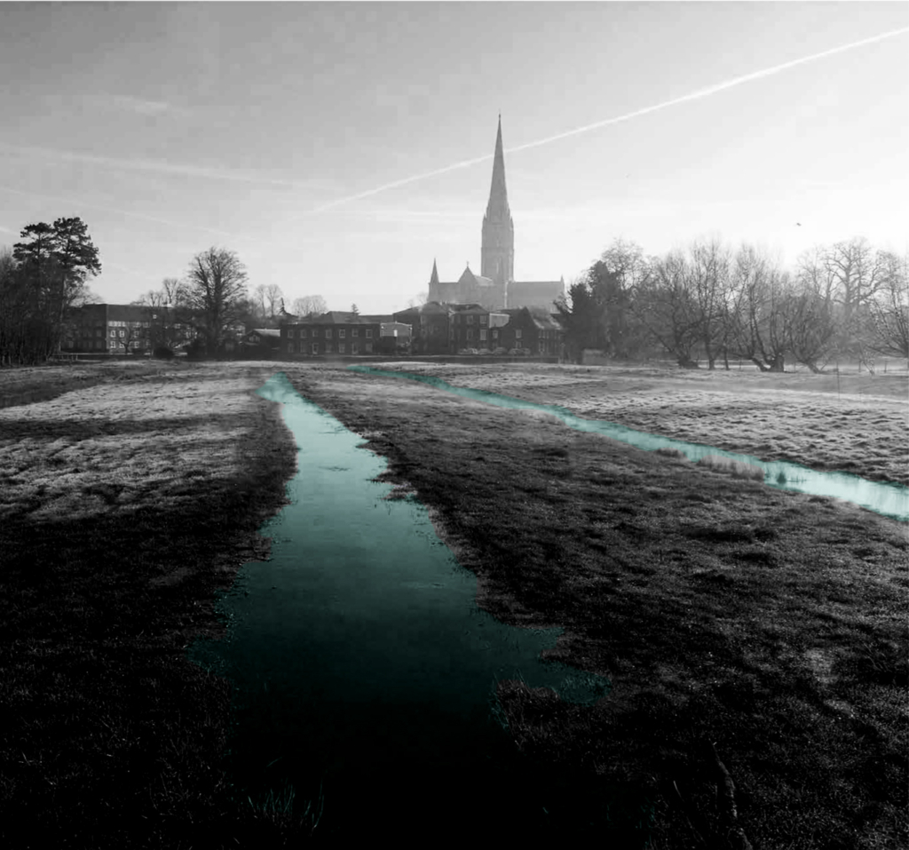
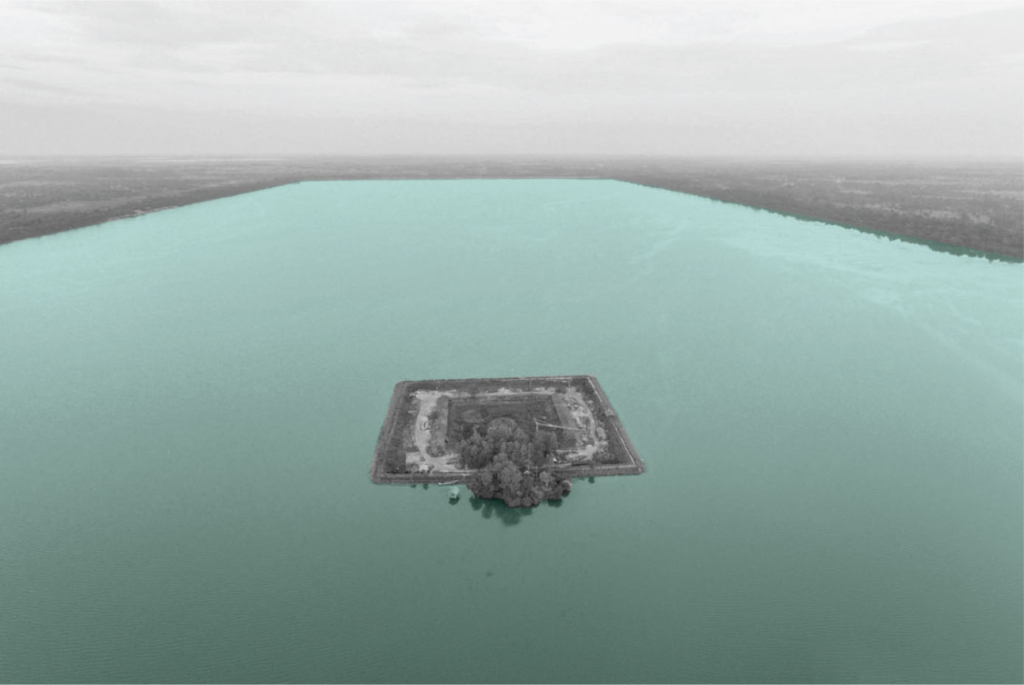
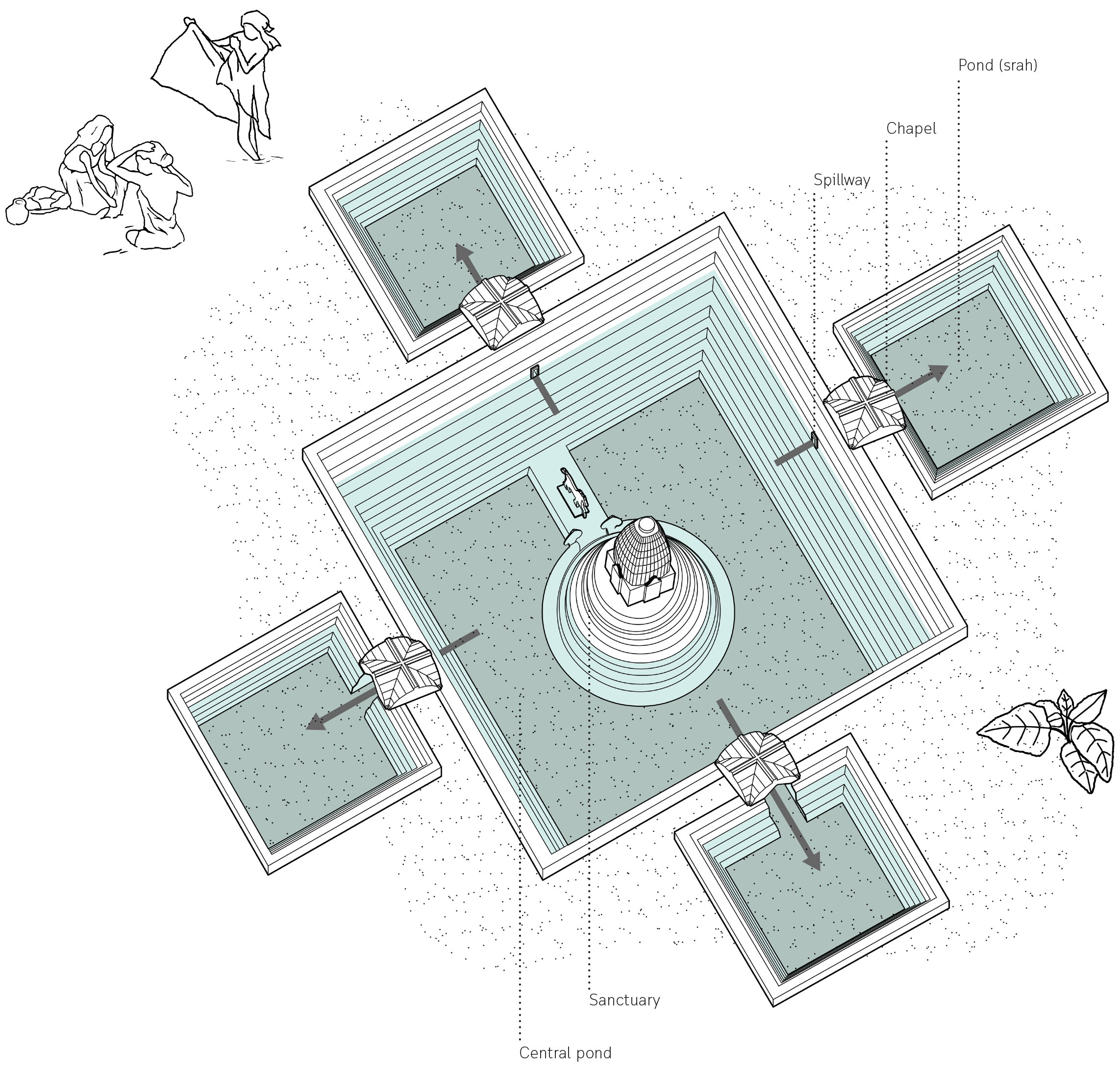
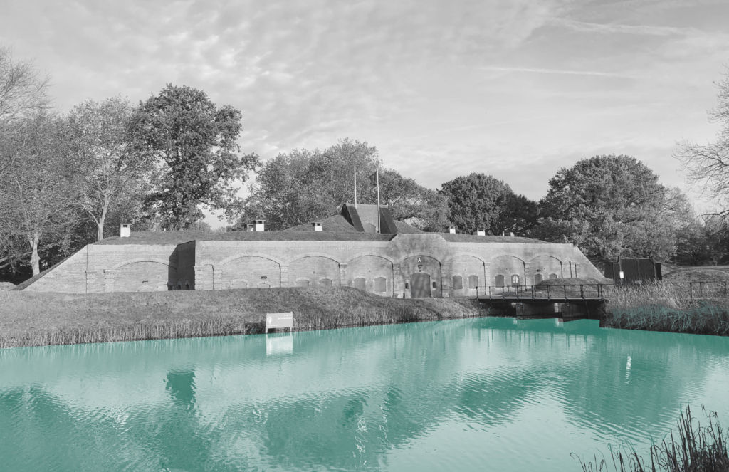
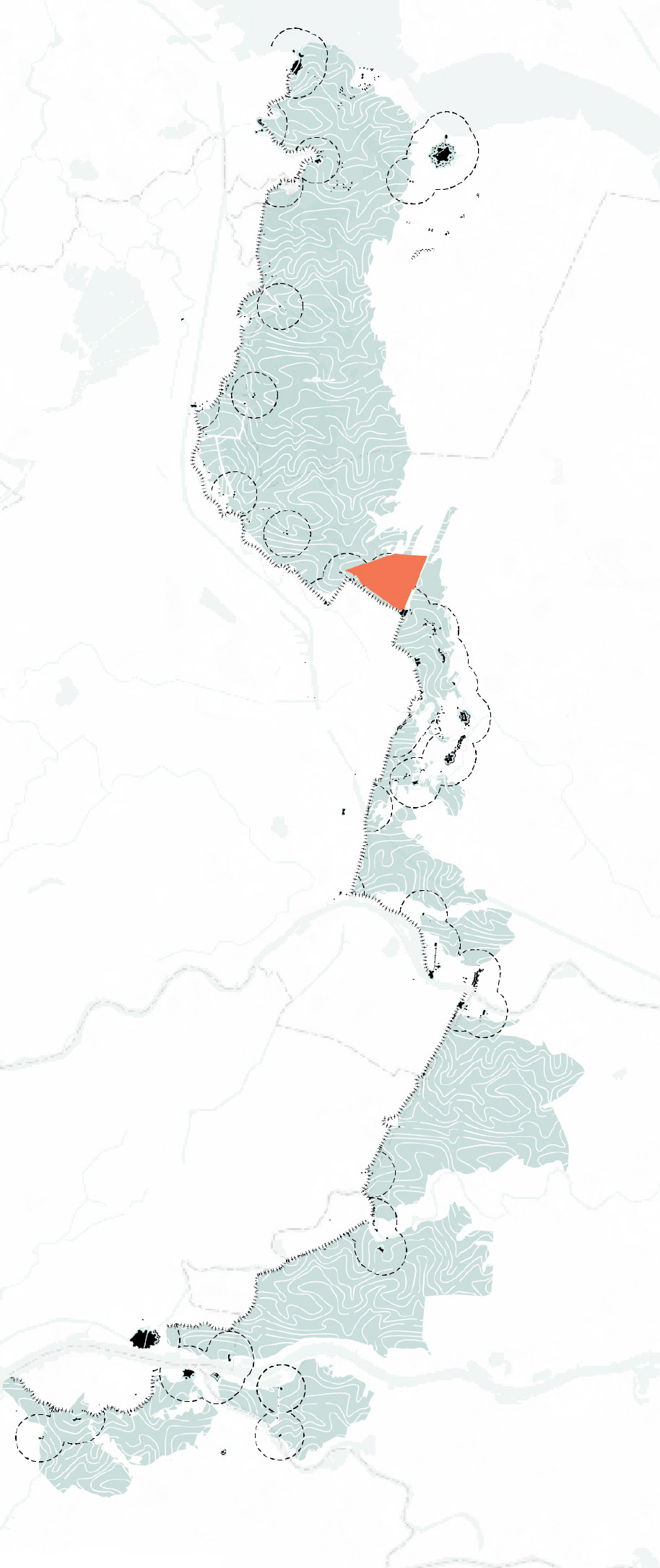
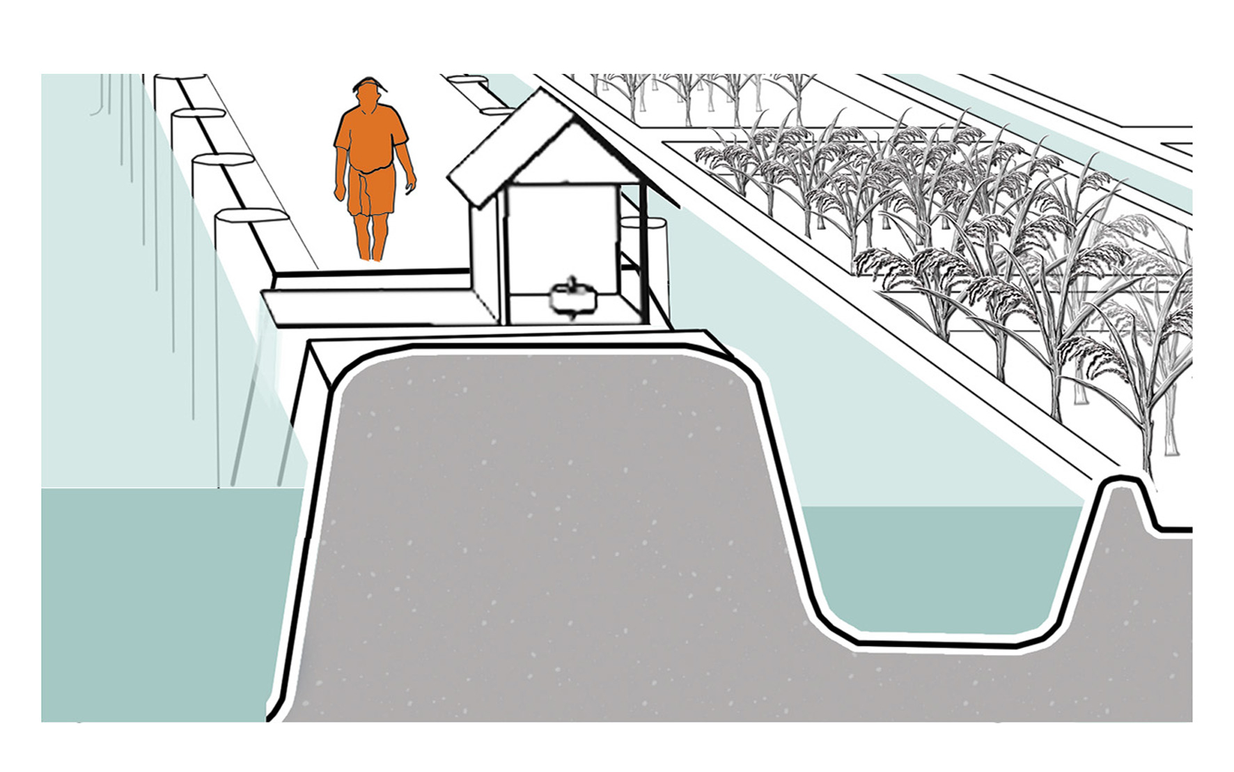
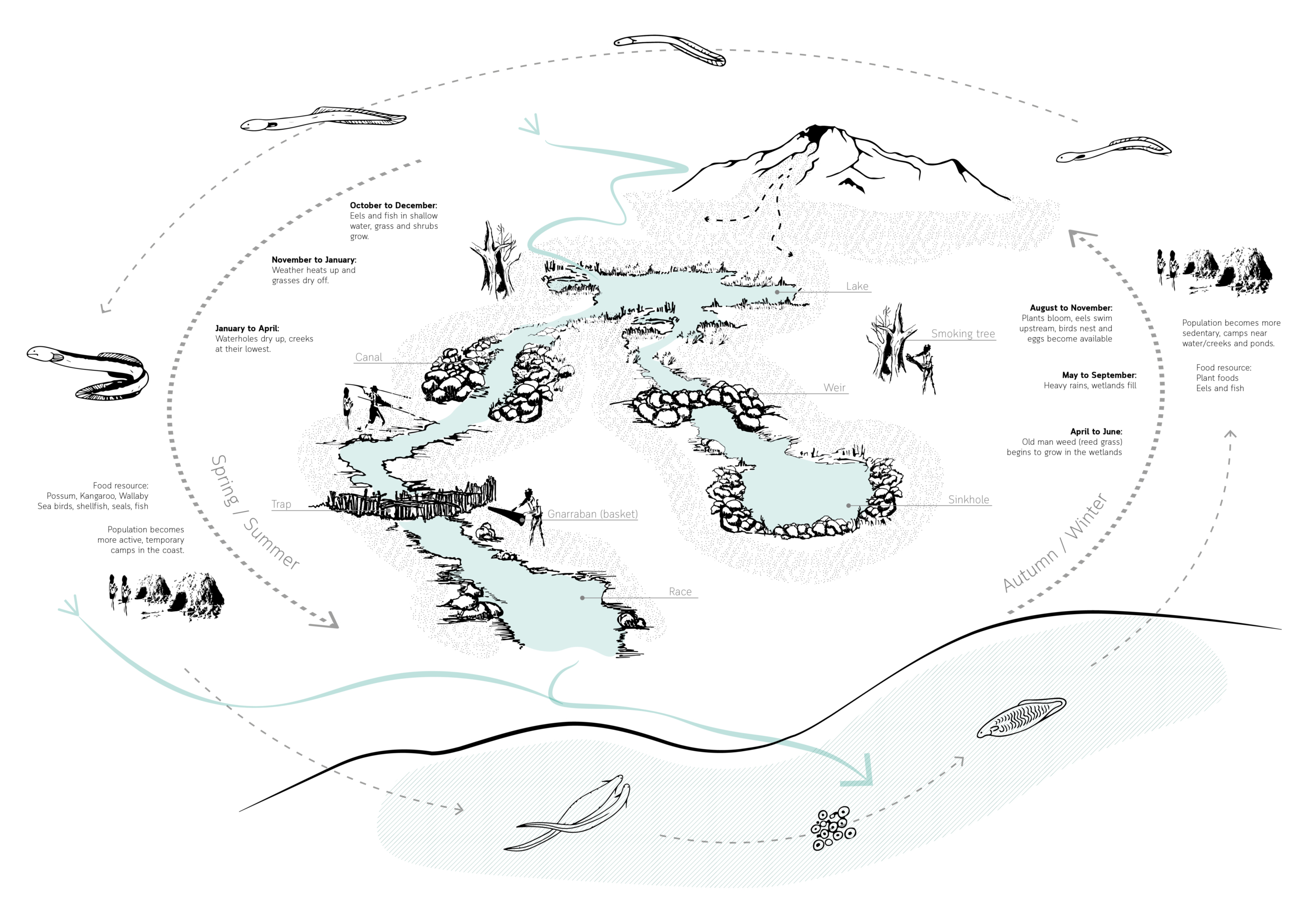
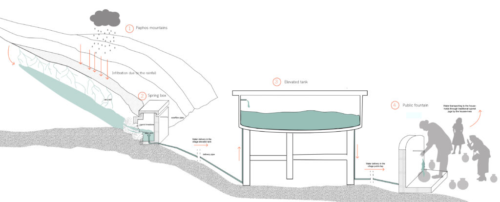
The diagram illustrates how the water system with the street fountains for drinking water supply used to work. Particularly, the Paphos forest is represented by mountains, where the infiltration happens due to the rainfall and small streams are created, which end up in the sea.

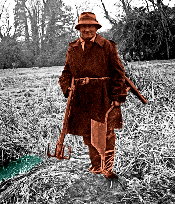
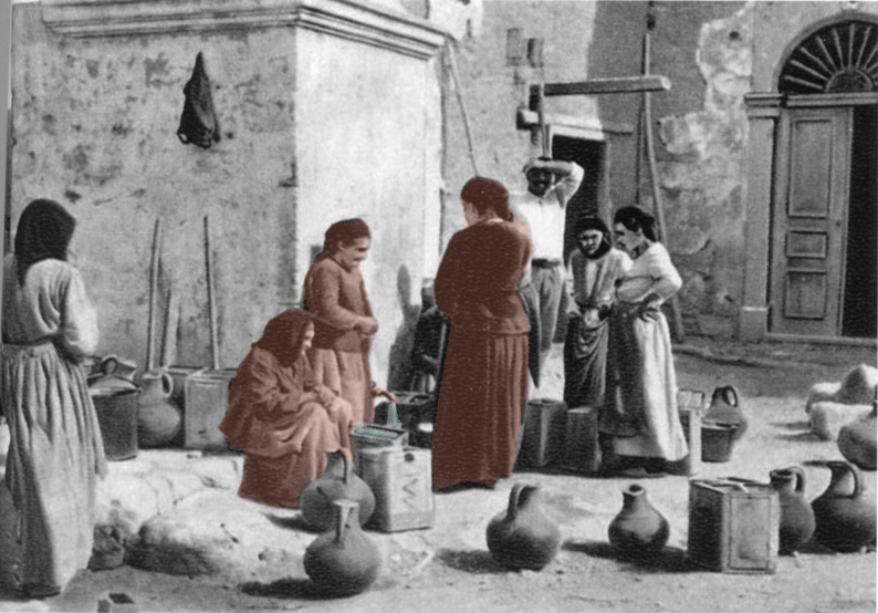
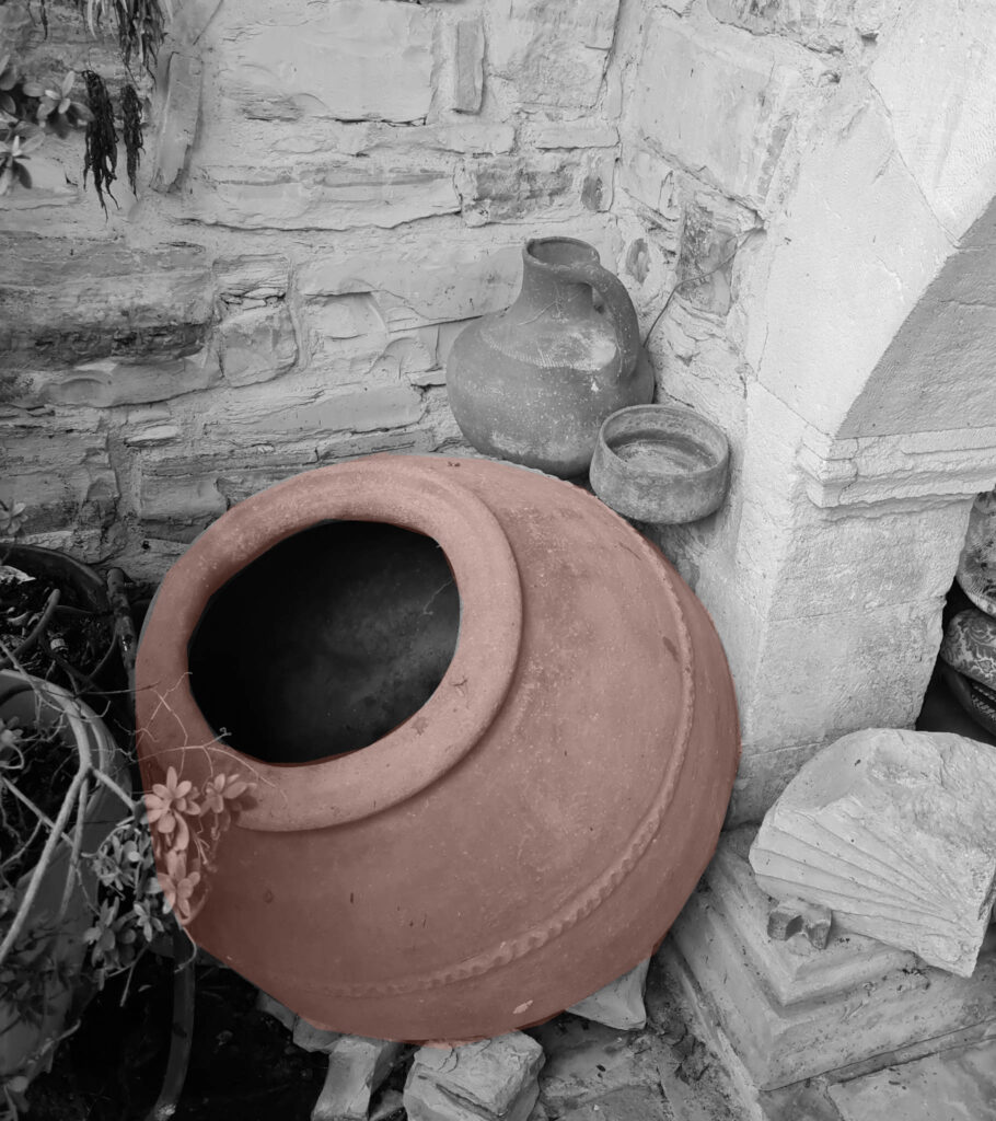
The streams are gathered to the foot of the mountain where a spring is generated called “Teratsia”. People have created the spring box, where the water passes through the limestone for purification purposes, which allows the water to be drinkable. Moving on, the water flows to the spring box, where is stored and then, through underground pipes ends up in the concrete-built elevated reservoirs. which is elevated for more pressure. Each village had its own elevated reservoirs. Then, the water flows through underground pipes to the street fountains, where the women used to collect it. The communal fountains were located in central points in the village, in order to be accessible by the locals. Housewives used to bring the water to their house, in clay traditional jugs and they usually store it in big clay jars.

Section of the water system.

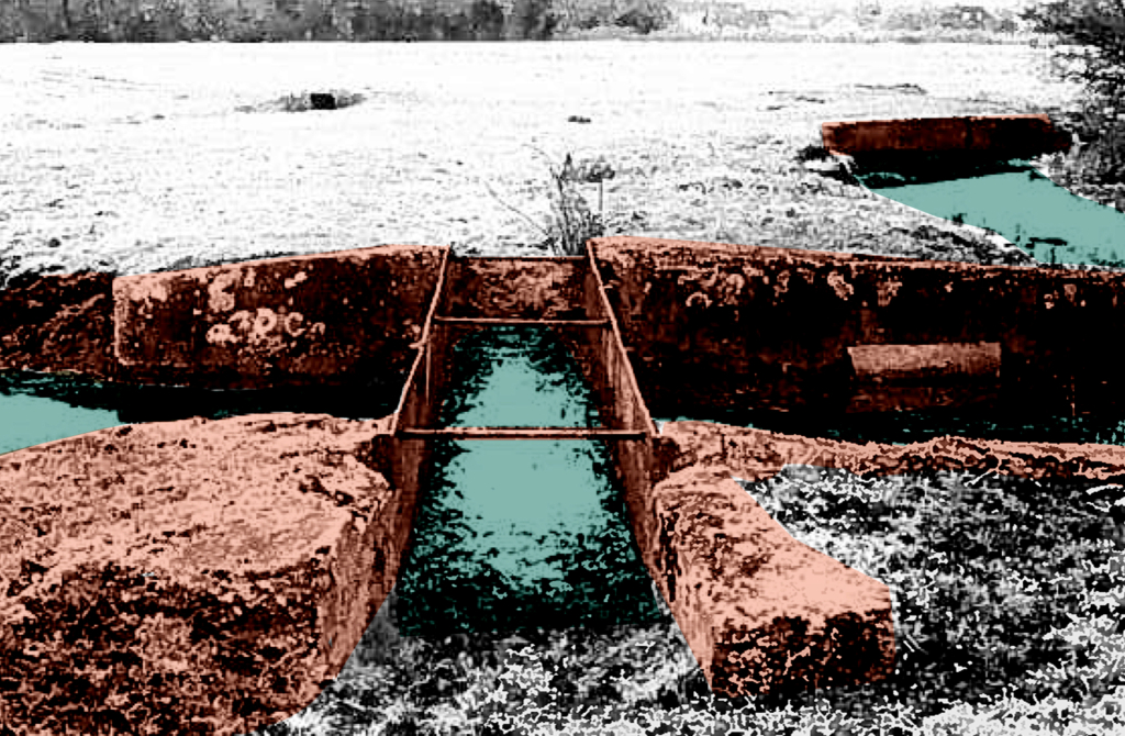
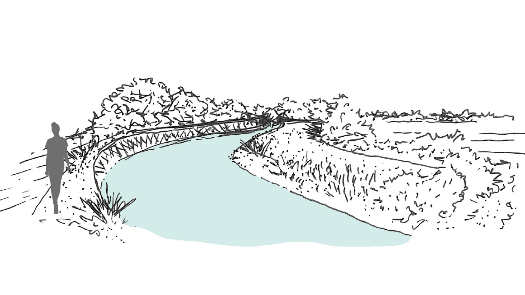
In addition, during this period, agriculture had been developed. Livadis, a permanent river was not seasonal then, and it ensured the water supply for local agriculture aspect. Specifically, the agriculture were located on the two sides of the river. Therefore, a surface irrigation system, especially open channels were used to transfer the water from the river to the trees.

Water Harvesting System in Matera

View of Sassi di Matera and Gravina di Matera.

Traditional water harvesting system in Sassi di Matera, Italy

Wenting Gao
2023

The two districts of Matera, Sasso Caveoso and Sasso Barisano, were built in the eroded terraced land near the natural water courses, called Grabiglioni, and formed by buildings and rock architectures carved into the rock of the Murgia Matera. Together with the Civita district (built on the spur that separates the two Sassi), they constitute the historic centre of the city of Matera. The water-harvesting system was composed of cisterns, catch basins, ponds, wells, fountains, condensers, neviera, as well as horizontal and vertical water channels. About 2210 cisterns were identified using a statistical approach, including 2039 small bell-shaped cisterns, 170 neighbourhood cisterns and two large cisterns of 1,300 and
5,000 m³ each. Water not only shaped the physical part of the city, but also influenced the way people live and work. The successful water-harvesting system created an an agro-pastoral society where most people were engaged in agriculture and husbandry, and about 56% were still land working peasants in 1754.

Traditional water system plan of Sassi di Matera in 1700s.

The grabiglioni, an important water channel in Sassi di Matera, is also the centre of public life. The vicinato, a common courtyard where children would play together and everyone helped each other out, is always accompanied by a cistern serving 4-6 families, so it naturally becomes the place for different domestic chores and social interactions.

People gathered in ‘‘vicinato’’ for social intercourse and domestic chores (Bottom right).

Circular Stories

Cicular diagram of the traditional water harvesting system in Sassi
di Matera around 1700s; Circular diagrams of water usage (Bottom left).

There are three types of water sources in Sassi, rainwater, natural springs, and moisture. In a natural condition, they will directly go into the Gravina di Matera, but with the help of the circular water system, they are used in a sustainable way for production, domestic use and drinking purposes.

Public rainwater cycle (Left); Private rain water cycle (Top right); Moist cycle (Bottom left); Spring water cycle (Bottom right).

Firstly, the rainwater, which is also the dominant source in Sassi, is collected in lakes, ponds or catch basins at first, then goes into cisterns of different sizes with the help of horizontal and vertical water channels on roofs, stairs, wall and ground. Some cisterns are interconnected by underground pipes, while others are quite private and isolated. There is a water tank that is completely isolated, and it is used as the condenser to collect moisture, which is also a hidden water source in Sassi. In addition, a natural spring near Tramontano Castle is the only drinkable water source, which later led to the Fountain Ferdinandea for people to use.

Harnam Water Meadows

Water Meadows during irrigation.

A pasture productive system in traditional English agriculture.

Farnoosh Bazrafkan
2021

The Harnham Water Meadows are located inland in the South-Western part of England. The water catchment area of
Harnham being a part of the county of Wiltshire. The rivers of this area are largely spring-fed and provide a stable flow
throughout the year. Along the floodplains of these rivers a series of (abondoned) water meadows can be found.
Water meadows are part of a well known irrigation system in England. The chalk valley landscapes of Wessex are an important county for water meadows because of the topsoil texture and slightly alkaline water they provide, elements that are needed for grass sward development.

The Harnham Water Meadows, as a remnant of the 17th-century farming revolution, form an important part of the historical English landscape. These floodplain meadows are altered in such a way as to control the flow of water in order to improve agricultural activities. Due to their common occurrence, water meadows are often regarded as semi-natural features in the landscape while in reality they are notably artificially constructed.

The water system plan including mills, hatches and aqueducts.

In more detail, in figure 17 it becomes evident that the two mills at Salisbury and Harnham are integrated into the water system and provide a raised water level upstream through impoundment. Then, the main carriages, controlled by
so-called hatches or sluice gates, allow the flow of water into the meadows. Eventually, river water would run along the tops of the constructed ridges so that water trickles through the grass at a depth of 25mm. The passage of water would return back into the river system via drains that lead to a tail drain back into the river Avon.

Circular Stories

Initially, water meadows were part of the English agricultural “Sheep-Corn System”. The meadows provided grass while the sheep grazing this grass provided fertilization, leading to better crops on surrounding arable fields. Within this agricultural system, “floated” watermeadows were used for irrigation in the winter or early in spring, bringing nutrients and oxygen into the soil. Typically, this caused the grass to start growing about one month earlier than un-floated floodplain meadows. Later in the season, during the summer when the soil was drying out, water meadows were re-watered so that (typically) two cuts of hay were taken and used to feed other animals – cattle and horses. The drowning of the meadows took place in a cyclical management system. Meadows were usually drowned
for a few days followed by drained for a few days (3-7 days). In mid-March when grass would reach a height of 150mm, sheep would graze the fields of the meadows. Towards the end of May, the sheep would be removed again, allowing the grass to produce hay crops. From June until the end of September dairy cattle grazed, causing problems for the meadow surface and water banks. The latter leads to bedwork maintenance during the end of the fall.

Angkor Hydraulic City

The world’s most extensive medieval sacred water management network of the ancient Kmer Empire.

Krit Thienvutichai
2019

Angkor Wat is one of the most important archaelogical sites in Southeast Asia. WIth impressive monuments, several different ancient urban plans and large water reservoirs, the site is a unique concentration of features testifying to an exceptional civilization (UNESCO).

Water management zones classified by topographic condition.

The hydraulic city was classified into three principle zones, with their topographic conditions of hydrogeology and elevation, functioned as one large system to supply the whole region. In the collector zone, the water was taken from natural rivers. In the aggregator and collector zones, water was stored mainly in the earthen embankments of barays, temple moats and small reservoirs.

The temple island of Naek Pean used to function as a hospital. The central pond symbolizes a mythical lake in the Himalayas whose water is thought to cure all illness. The water overflows from the central pond through chapels to fill up four small ponds with healing water. The ancient Khmers may have believed that bathing in its successive ponds would have restore balance within the body and cured illness or at least washed away sin.

The Naek Pean water management structure.

The New Dutch Waterline

Fort Voordrop on the New Dutch Waterline.

Water as a defence line comprised of a system of waterworks for inundating and military elements for troops.

Huadong Zhu
2019

The New Dutch Waterline was built to defend Holland, the west part of the Netherlands and it is 85 km long. Large areas of agricultural land (polders) were flooded with a layer of approximately 40-60 cm of water- The traditional drainage system of the polder landscape was transformed into a 4 km wide defence line.

The New Dutch Waterline at regional scale.

Pumps and sluices guide the water out of the deep lying polders, in war-time the water could be directed into the polder. In a normal situation the water table is higher during winter. During a dry summer, water needs to be taken in from the boezem system. The boezem system is the discharge water network which brings the polder water from into the outer water. The whole water system can be set in motion by switching the pumping stations on and off or changing the direction of the water flow.

Normally the land is drained for agricultural use. After peat digging, used as fuel the land turned into a lake a became useless. By draining the inner lakes, new, deeper lake-bed polders were created. During the war period, the polders were transformed into lakes again and could not be crossed by enemies on foot or by horse.

Delving peat.

During normal times, the water is pumped out into the river, part of the boezem system. During war times, the waterworks can switch the direction and pump the water into the polder. Today they pump water into the polders during dry summers.

The existing water management in a polder is based on an independent managed water level. The system consisted of mills, later replaced by pumping stations and the sluices. The polders have different water levels. During the war the area was flooded polder by polder.

Top to bottom. Flood phase 1; Flood phase 2; Flood phase 3.

For the entire booklet of The New Dutch Waterline be so kind as to contact us through the form in the Contact section.

Stepwells of Jaipur

Atmosphere of the stepwells.

Exploring into the ancient water wisdom of Jaipur Rajasthan, India.

Anubhuti Chandna
2019

Jaipur is one of the first planned city of northern India based on the principles of “Shilpa Shastra”, in fact “Jaipur clearly represents a dramatic departure from extant medieval cities with its ordered, grid-like structure – broad streets, criss-crossing at right anglese, earmarked sites for buildings, palaces, havelis, temples and gardens, neighbourhoods designated for caste and occupation” (UNESCO, 2015).

During the planning of the city, special attention was given to the water supply system. With half of the city surrounded by the hills, the city took advantage of various rain catchment areas that were available for storage direct response to local geophysical conditions.

Catchment areas of the different systems in the city of Jaipur.

The ruler built 16 miles long canals from the nearby river streams and brought water to the city through aqueducts, As the city grew with increased demand for water, a dam across the river of Dhravyavati was constructed in 1844 along with a canal which runs east to west of the city, wide enough for 5-7 horsemen to ride abreast. This covered canal would then distribute the water through various channels and wells across the city and open at some places for direct access. However, after the construction of the metalled roads and new pipe system of supply, the canal got buried within the markets and its deep walls got filled up.

5 typologies of stepwells in Amber.

Water has a special significance in Hindu mythology, believed to be as a boundary between heaven and earth. For centuries, stepwells and stepped ponds, also known as Bavdis, Bawadis, Baolis or Vavs, have not just played a significant role in functioning as traditional water systems, serving the community through generations but also as hotspots of social, cultural and touristic interactions. “While various water structures such as tanks, cisterns, paved stairways along rivers (ghats) and cylindrical wells are found elsewhere in India, stepwells and stepped ponds are indigenous to semi-arid regions of Gujarat and Rajasthan” (Livingston & Beach, 2002).

Clockwise. Typology 2, Cheela Bawadi; Typology 1, Atreya Bawadi; Typology 3, Sarai Bawadi; Typology 4, Bengali Baba ki Bawadi; Typology 5, Parshuram Dwar ki Bawadi.
Tattar ki Bawadi in Amber.

Dewatering motor

Dewatering station and motor

An indigenous technical device placed at the edge of the Kayalnilam for pumping water out from low-lying areas to the major canals or backwaters. It consists of a submerged brass vessel that sucks water out and is run by an electric motor kept inside the pump house. The sucked water flows out through a rectangular brass box.

  • Project: Kuttanad Kayalnilam Agrosystem, Kerala, India
  • Climate: Tropical monsoon
  • Year: 1880-1974 (a modified version is still in use)
  • Water type: Seasonal mixing of saline and freshwater
  • Landscape: Polder landscape in a deltaic basin
  • Altitude: -3 – +1.5 m.a.s.l
  • Soil condition: Sandy loam clay formed from riverine or lacustrine deposits
  • Material: Wood and Brass
  • Temporality: Seasonal
  • Form: Point
  • Use or Function: Pump water out

Tsùn – 圳

Tsùn – 圳
Irrigation ditch

An open waterway that provides clean fresh water for drinking and irrigational use. Small ones are called “Kau 溝”, big ones are called called “Tsùn 圳”.

  • Project: Ksôkong Tsùn Irrigation System, Taiwan
  • Climate: Tropical savanna climate with dry-winter characteristics
  • Year: proximity 1839
  • Water type: river water
  • Landscape type: river plain
  • Altitude: 0-20 m.a.s.l. (meters above sea level)
  • Soil condition: alluvial soil
  • Materials: excavated soil and rammed earth
  • Period: permanent
  • Form: a network of lines
  • Use or Function: water supply for agriculture

Pi – 陂

Pi – 陂
Water gate

Water gate that regulates water between irrigation ditches.

  • Project: Ksôkong Tsùn Irrigation System, Taiwan
  • Climate: Tropical savanna climate with dry-winter characteristics
  • Year: 1839
  • Water type: river water
  • Landscape type: river plain
  • Altitude: 0-20 m.a.s.l. (meters above sea level)
  • Soil condition: alluvial soil
  • Materials: brick, metal, wood
  • Period: permanent
  • Form: Point
  • Use or Function: control

Aboriginal Eel Aquaculture

Network of shallow races and ponds for eel harvesting.

Aboriginal eel aquaculture system in
Gunditjmara Country, South West Victoria, Australia.

María José Zúñiga
2020

The Budj Bim Cultural Landscape is located in the Country of the Gunditjmara aboriginal people in Victoria, Australia. Budj Bim (known today as Mount Eccles) is the volcano that thousands of years ago caused an extensive lava flow that transformed the landscape and provided the base for the aquaculture system developed by the Gunditjmara people. The extensive network of canals, traps and weirs was once a highly productive aquaculture system constructed to trap, store and harvest eels. Today, it is recognized as one of the world’s most extensive and oldest aquaculture systems.

Catchment plan showing the lava flow (orange) and the wetland (azure).

Large parts of the system have now disappeared, not only because of environmental changes through time but also because of the modifications done to the site by the British colonization. However, several areas have been protected and reconstructed, showing a network of components that blend in with the landscape. The traces that can be seen now, hold the cultural practice of many generations which had a deep understanding of their land and lived a dynamic relationship with water, materials, nature, and climate.

The most recognizable features are the constructions made with the placement of basalt rocks. This material was used for constraining the water in canals, shallow races or sinkholes. The rocks were piled up across waterways to form weirs and dams. Timber fences became traps in which woven baskets were placed to catch the eels.

Circular Stories

One of the most remarkable aspects of the Gunditjmara people is their extensive knowledge and understanding of their land. This knowledge was passed through generations through oral transmission for thousands of years, and allowed them to obtain an active and profound relationship with nature and the living beings that surround them.

The productivity of the system as well as the settlement of the communities was largely determined by the different seasons. Another factor that was key for the productivity of the system is the understanding of the eel’s life cycle and their migratory behaviour. The kooyang (short-finned eels), spend the majority of their life cycle in fresh waters but return to their spawning grounds along the Coral Sea. The eels have five stages in their life cycle, as adults, they migrate to the sea during summer and autumn for spawning, and return to the fresh water during winter and spring.

Water cycle and eel growth cycle in Gunditjmara Country.
Gunditjmara people.