The world’s most extensive medieval sacred water management network of the ancient Kmer Empire.
Krit Thienvutichai 2019
Angkor Wat is one of the most important archaelogical sites in Southeast Asia. WIth impressive monuments, several different ancient urban plans and large water reservoirs, the site is a unique concentration of features testifying to an exceptional civilization (UNESCO).
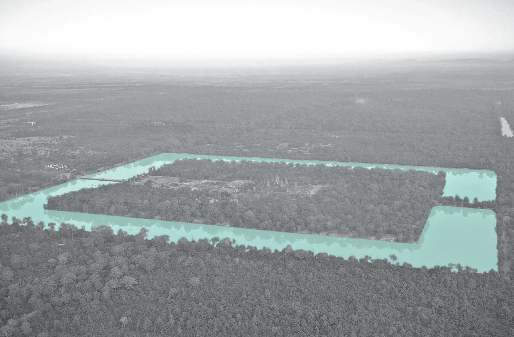
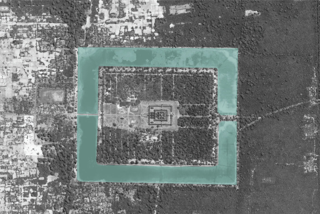
Water management zones classified by topographic condition.
The hydraulic city was classified into three principle zones, with their topographic conditions of hydrogeology and elevation, functioned as one large system to supply the whole region. In the collector zone, the water was taken from natural rivers. In the aggregator and collector zones, water was stored mainly in the earthen embankments of barays, temple moats and small reservoirs.
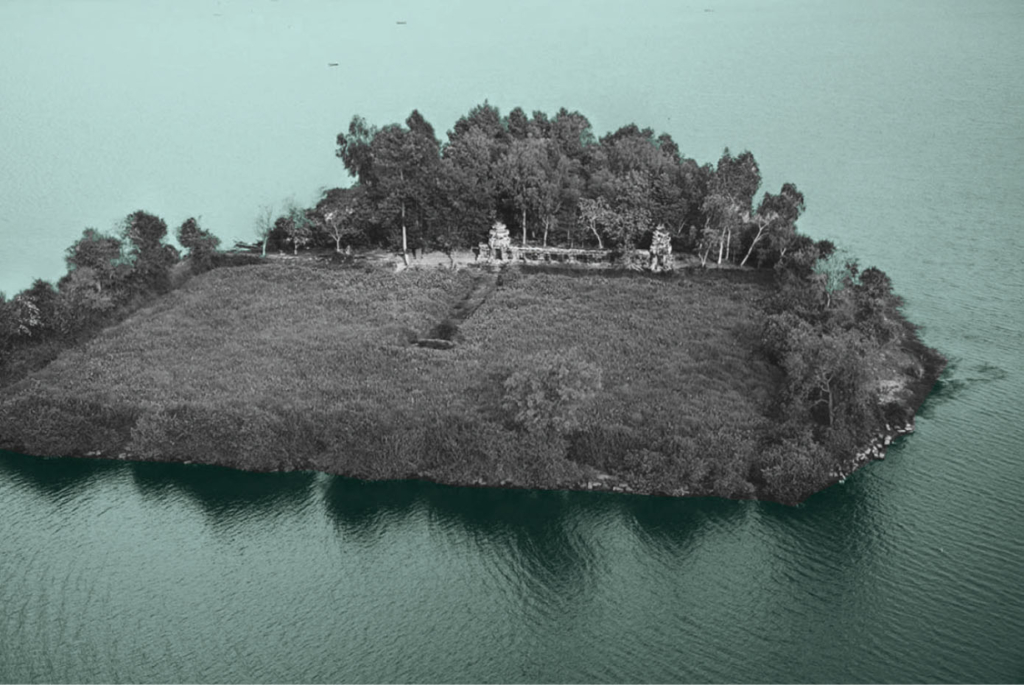
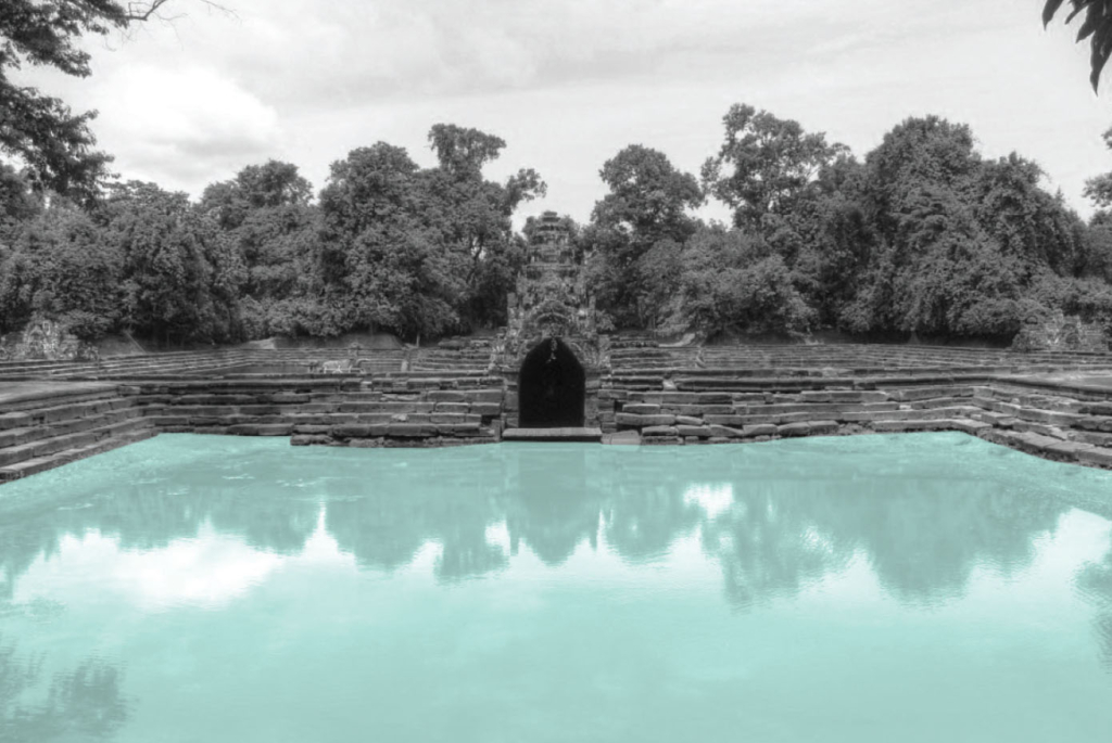
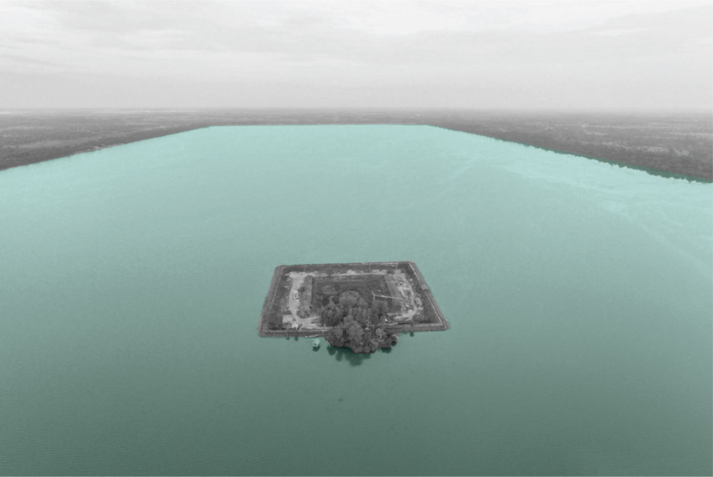
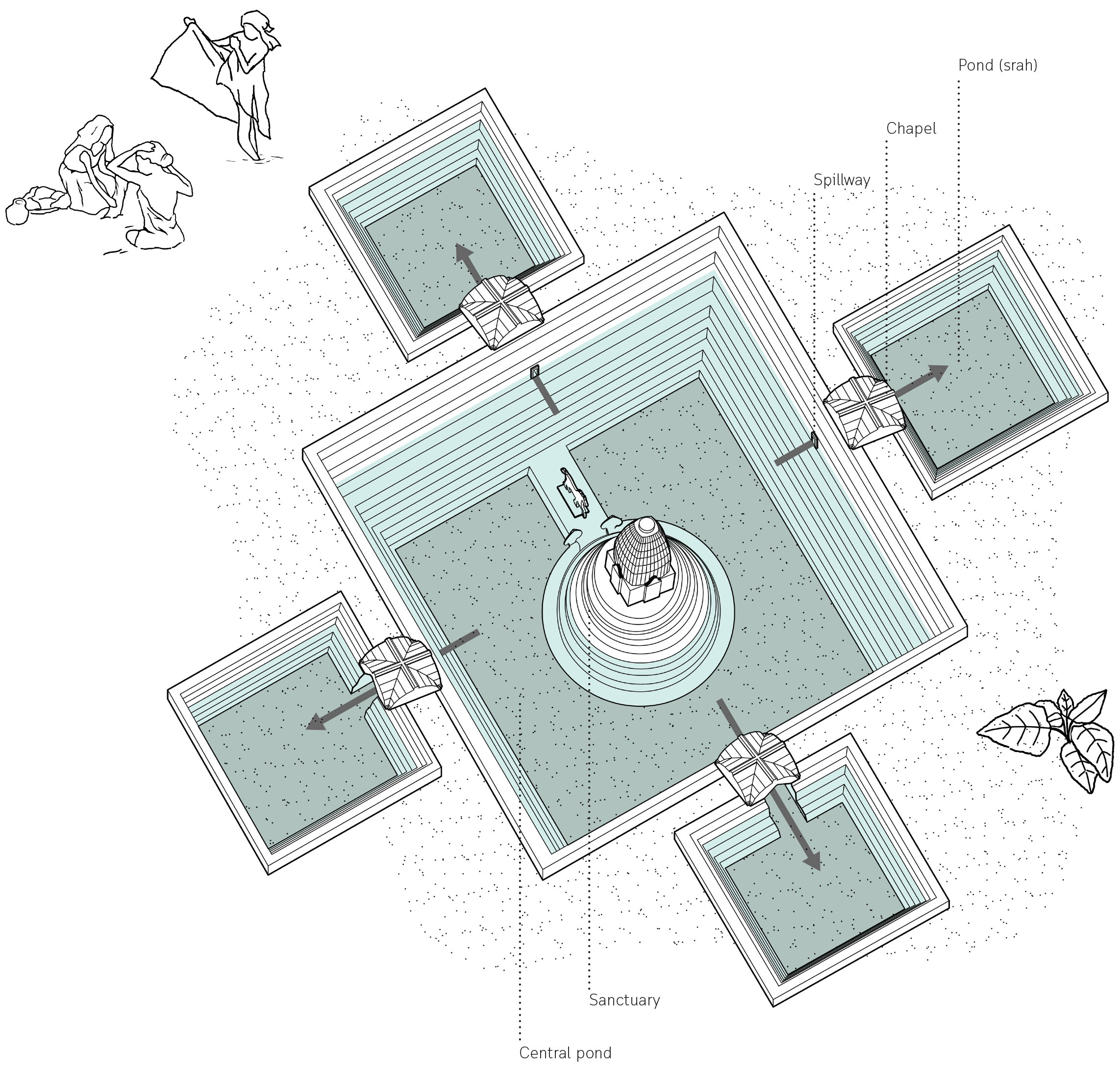
Clockwise. Mebon, island temple at the centre of the baray; geometric form of Angkor Wat aerial plan; Naek Pean, island temple at the centre of north baray; Baray, large artificial rectangular water reservoir.
The temple island of Naek Pean used to function as a hospital. The central pond symbolizes a mythical lake in the Himalayas whose water is thought to cure all illness. The water overflows from the central pond through chapels to fill up four small ponds with healing water. The ancient Khmers may have believed that bathing in its successive ponds would have restore balance within the body and cured illness or at least washed away sin.
Ancient network of water harvesting structures in Delhi, India.
Tanvi Gupta 2020
Delhi is located in the Northern part of India being continuously inhabited since the 6th century B.C. Through most of its history, Delhi has served as the capital of various kingdoms, most notably the Delhi Sultanate and Mughal empire. Two prominent features of the geography of Delhi are the Yamuna floodplains and the Delhi ridge.
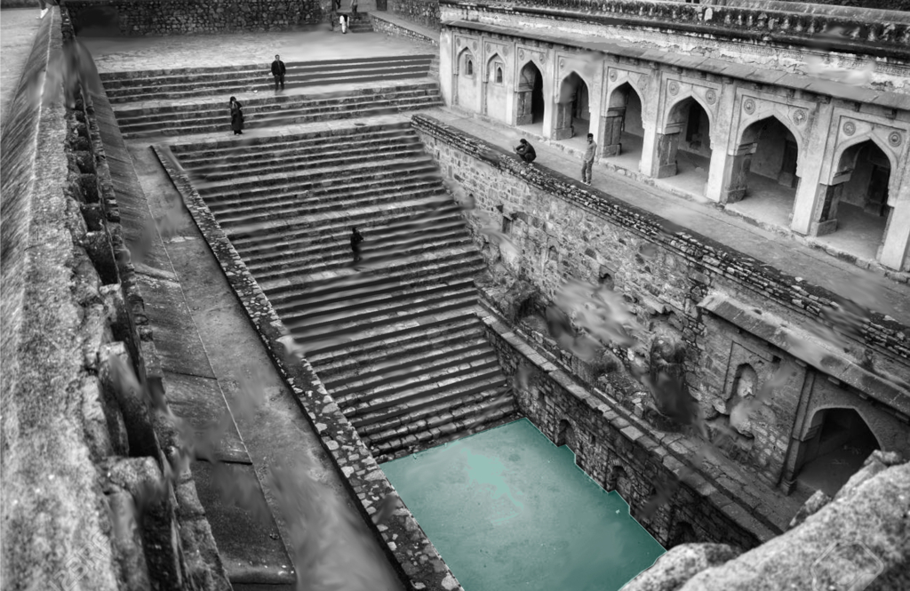
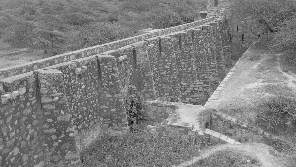
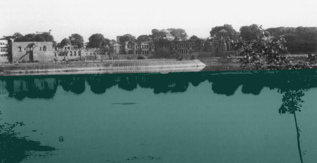
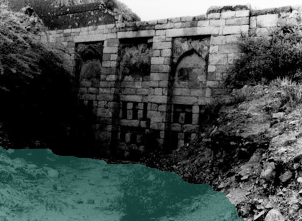
Clockwise. Satpulla embankment or bund; historical photo of Baoli at Tughlaqabad; historical photo of Hauz-i-khas lake (water tank); historical photo of Sluice gate at Tughlaqabad.
Delhi’s urban waterworks developed in early thirteenth century. They took the following main forms of hauz (water tank), baoli (stepwell) and bund (embankment). Collectively these small structures served the sultanate capitals of South Western Delhi. As with other ancient and medieval water systems, they were incremental and coordinated. Urban lakes, tanks and reservoirs were sited in gently sloping areas adjacent to hillside water control structures.
Bund network along Delhi Ridge.
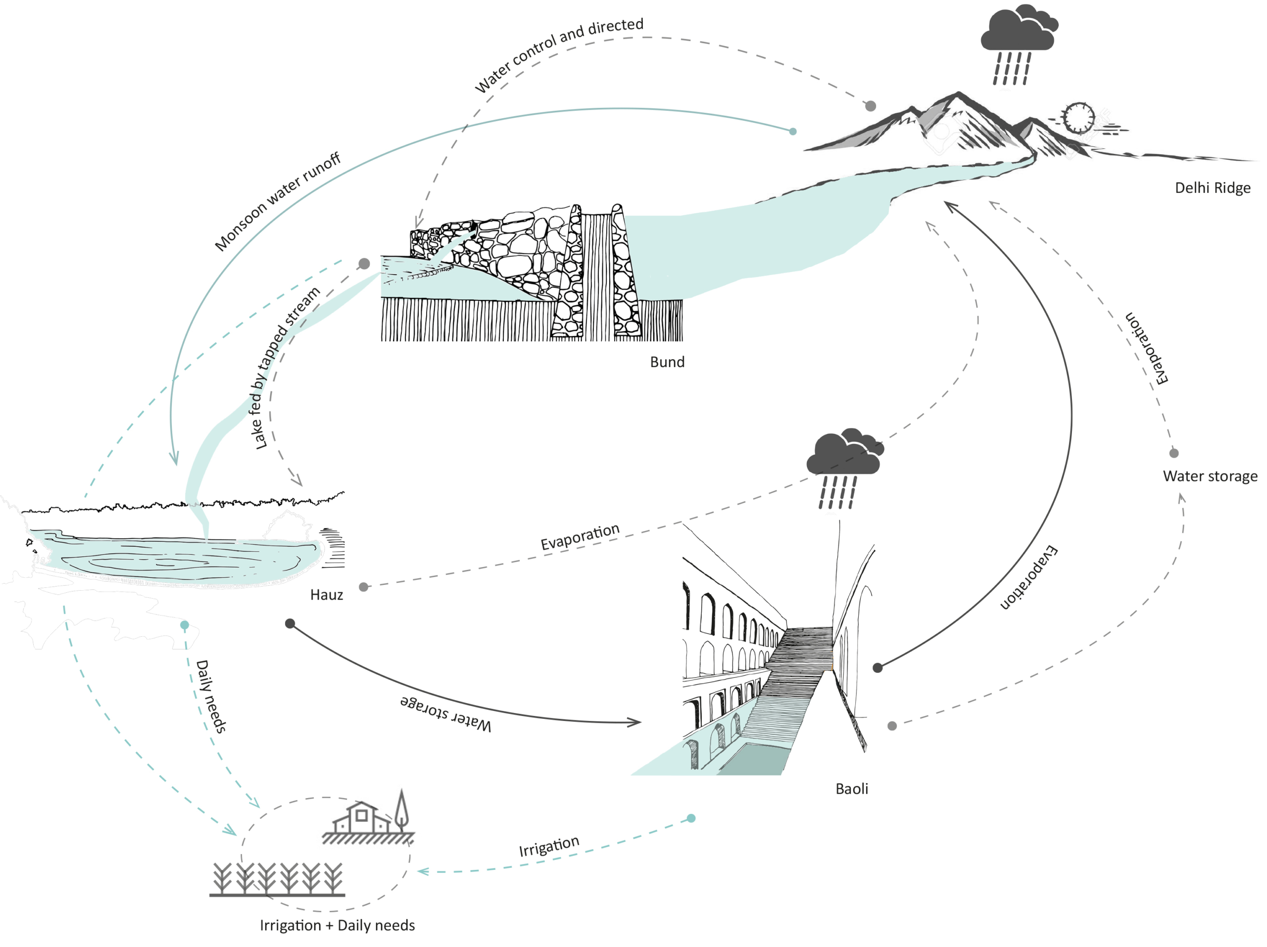
Delhi sultanate waterworks developed during the early 13th century. They took three main forms – the bund network (embankment), hauz (water tank), and baoli (stepwell). These reflect the main strategies of the Delhi Sultanate water works – the bund network helps in directing and capturing the runoff from the ridge, the hauz stores the surplus monsoon surface water runoff and recharges groundwater while the baolis tap into the shallow groundwater along with storing rainwater.
Circular Stories
Circularity of the Delhi Sultanate Waterworks system.
Delhi Sultanate waterworks or harvesting structures were well coordinated with one another, each structure supporting the existence of the other. The bunds, the royal tanks called hauz and the baoli storage structures aided water evaporation and condensation into the atmosphere which again would be captured in the ridge landscape during monsoon.
Today, these water structures lie in a dilapidated state with some having been restored for heritage and tourism purposes. Thus, it is important to learn from past methods of harvesting water to overcome the hydrological problems Delhi is facing today.
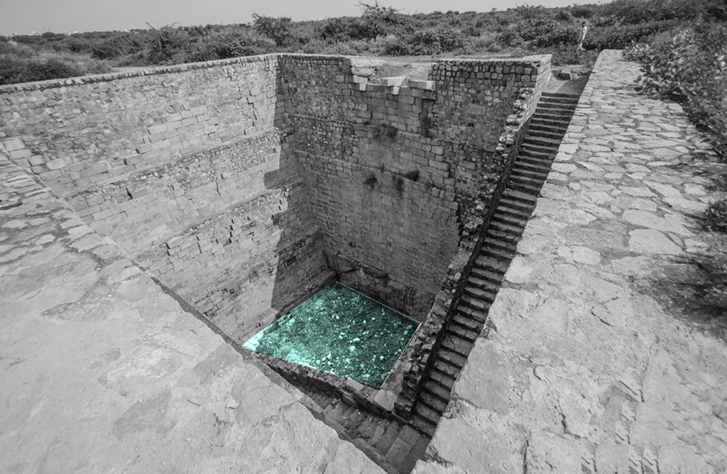
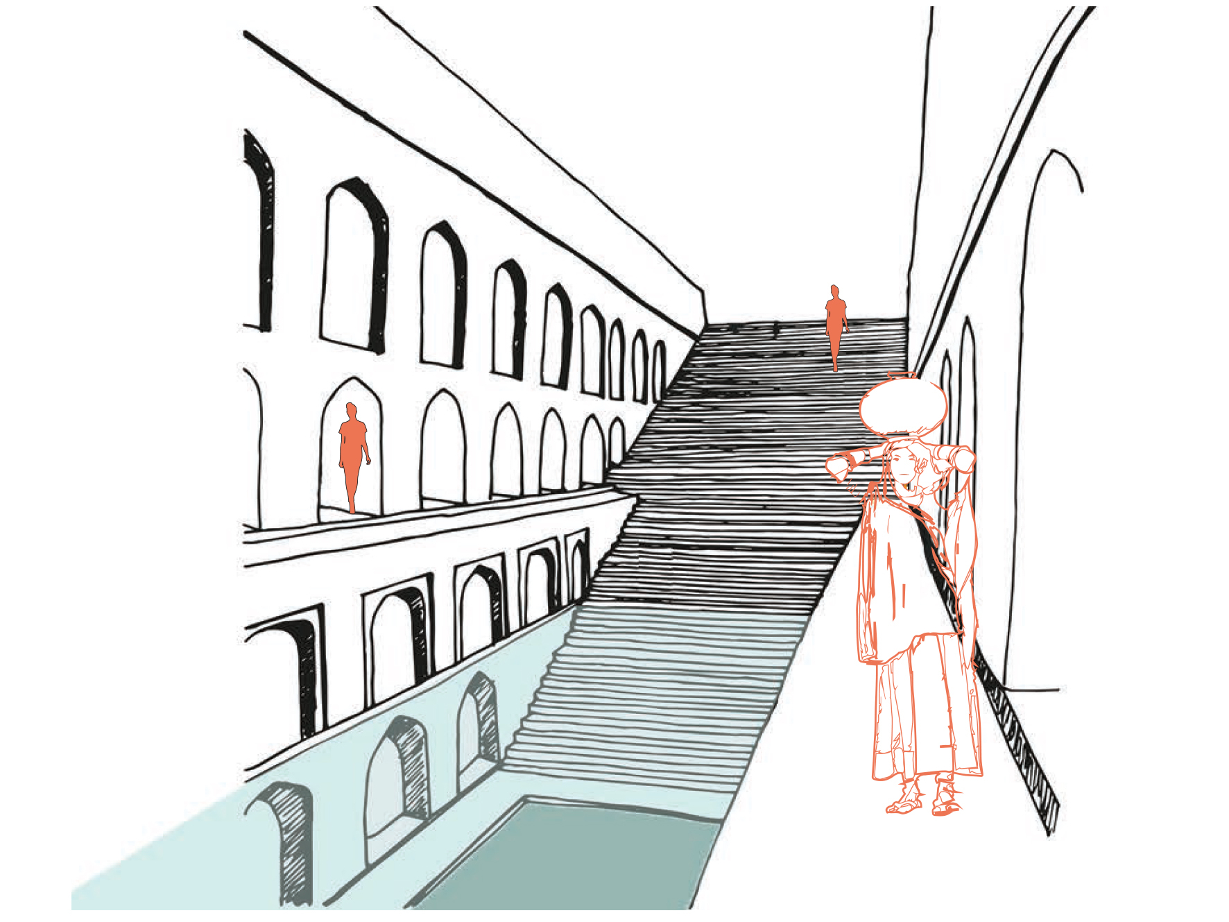
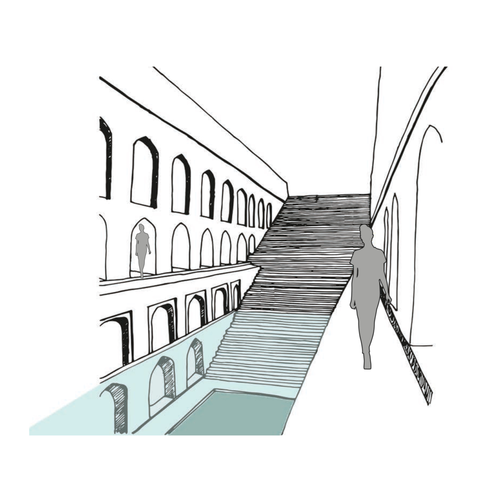
Rainwater and natural stormwater channels from Delhi ridge are stored in the ground and it is directly accessible to people by a flight of stairs. The narrow staircase is divided into three parts, which runs along the inner three walls of rectangular baoli.
Project Name: Delhi Sultanate Waterworks, Ancient network of water harvesting structures, Delhi, India
Climate: Overlap of humid subtropical and semi-arid
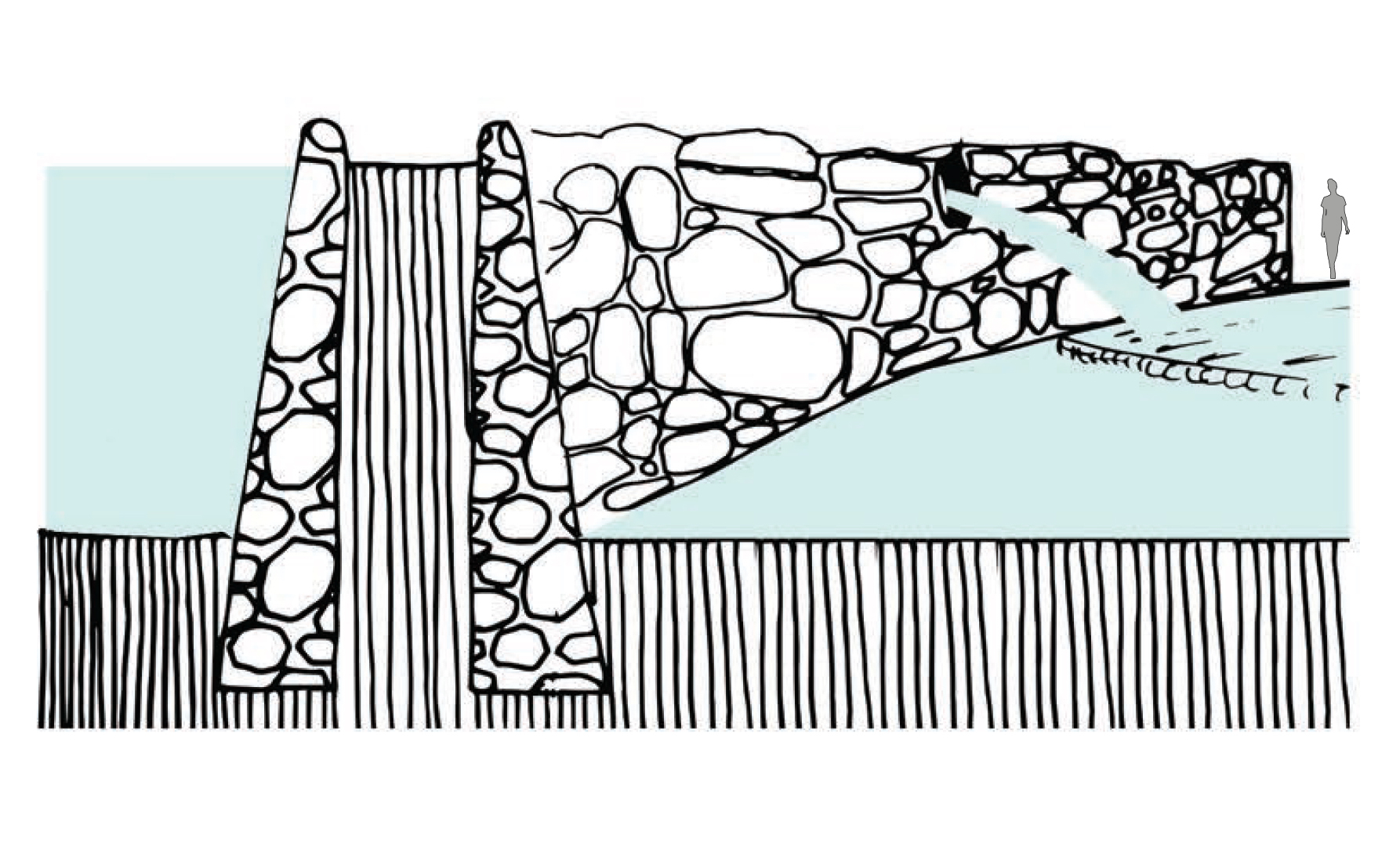
Water harvesting mud embankments restrain natural streams of stormwater runoff in its upper reaches and direct it for storage in hauz (lake) and baoli (stepwell).
Project Name: Delhi Sultanate Waterworks, Ancient network of water harvesting structures, Delhi, India
Climate: Overlap of humid subtropical and semi arid
Rainwater and natural storm water channels from Delhi ridge is stored in ground and it is directly accessible to people by a flight of stairs. The narrow staircase is divided into three parts, which runs along inner three walls of rectangular baoli.
Project Name: Delhi Sultanate Waterworks, Ancient network of water harvesting struc-tures, Delhi, India
Climate: Overlap of humid subtropical and semi arid
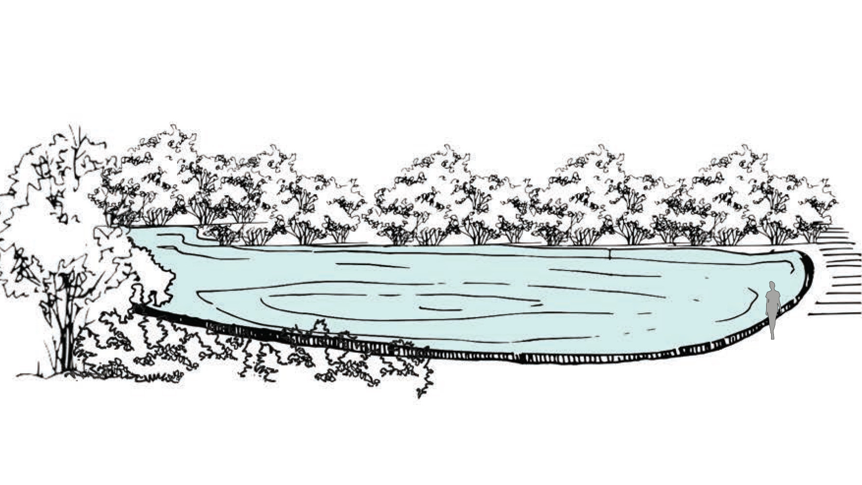
Water tanks which harvest rainwater and stormwater during monsoon season. Main function of the hauz was to collect rainwater over a large expanse of land.
Project Name: Delhi Sultanate Waterworks, Ancient network of water harvesting structures, Delhi, India
Climate: Overlap of humid subtropical and semi-arid