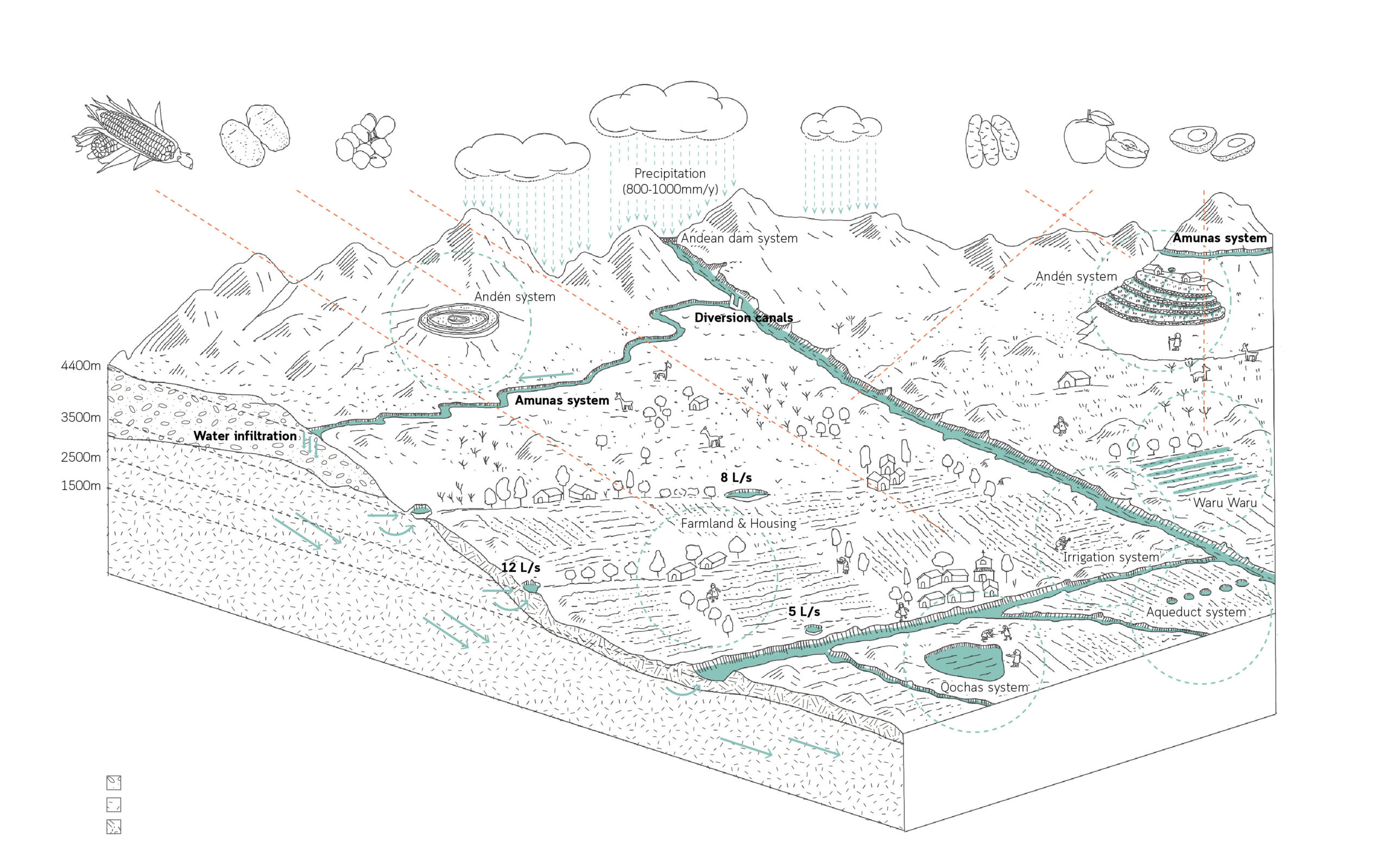
An ancient water system in the Andes that delays groundwater from reaching rivers until the dry season by sowing runoff into the ground and filtering it down the hill slopes.
Wanning Liang
2023
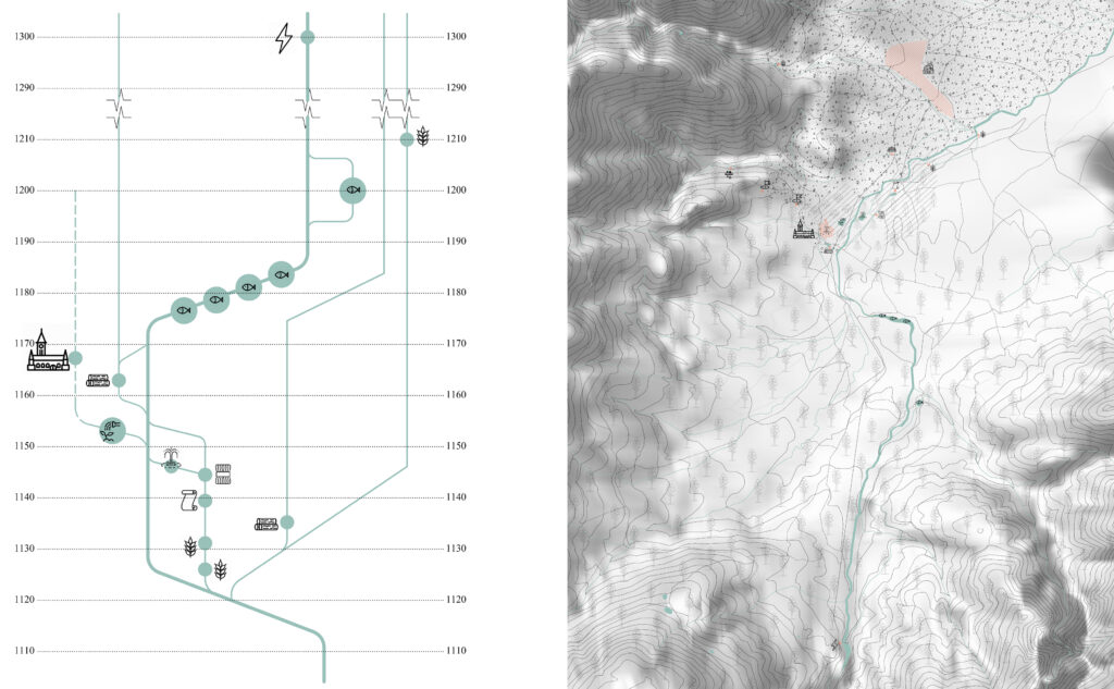
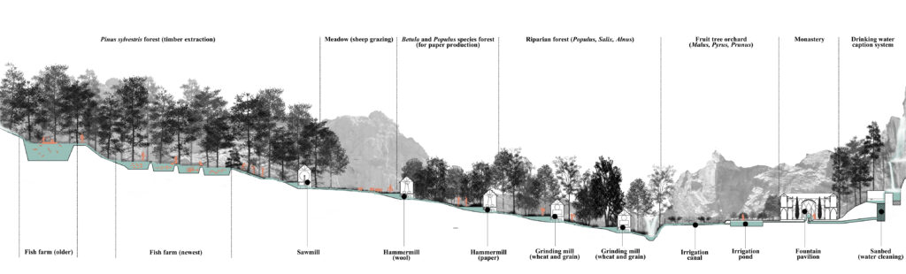
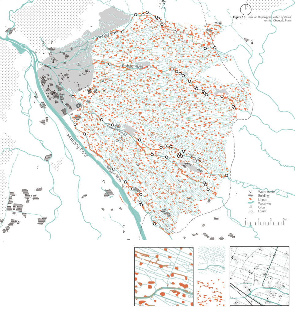
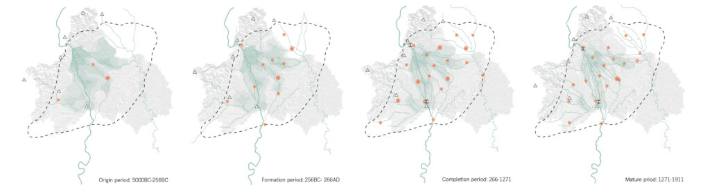
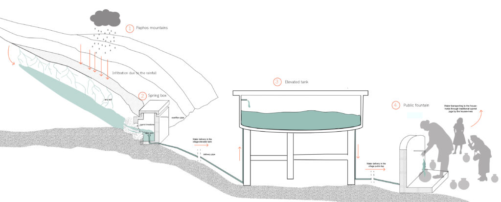
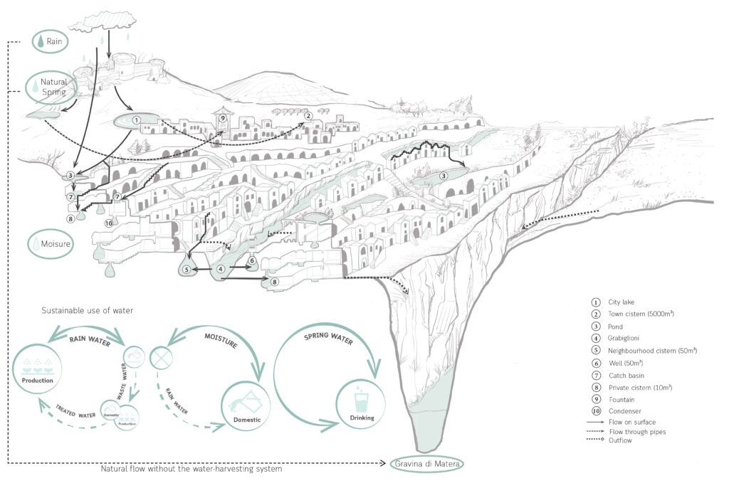
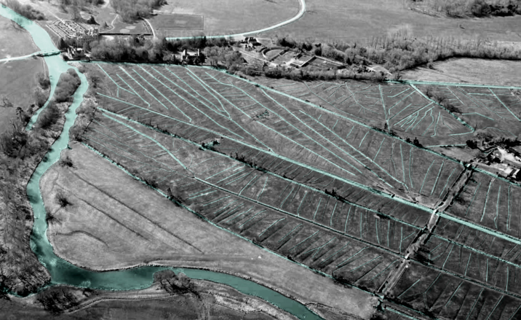
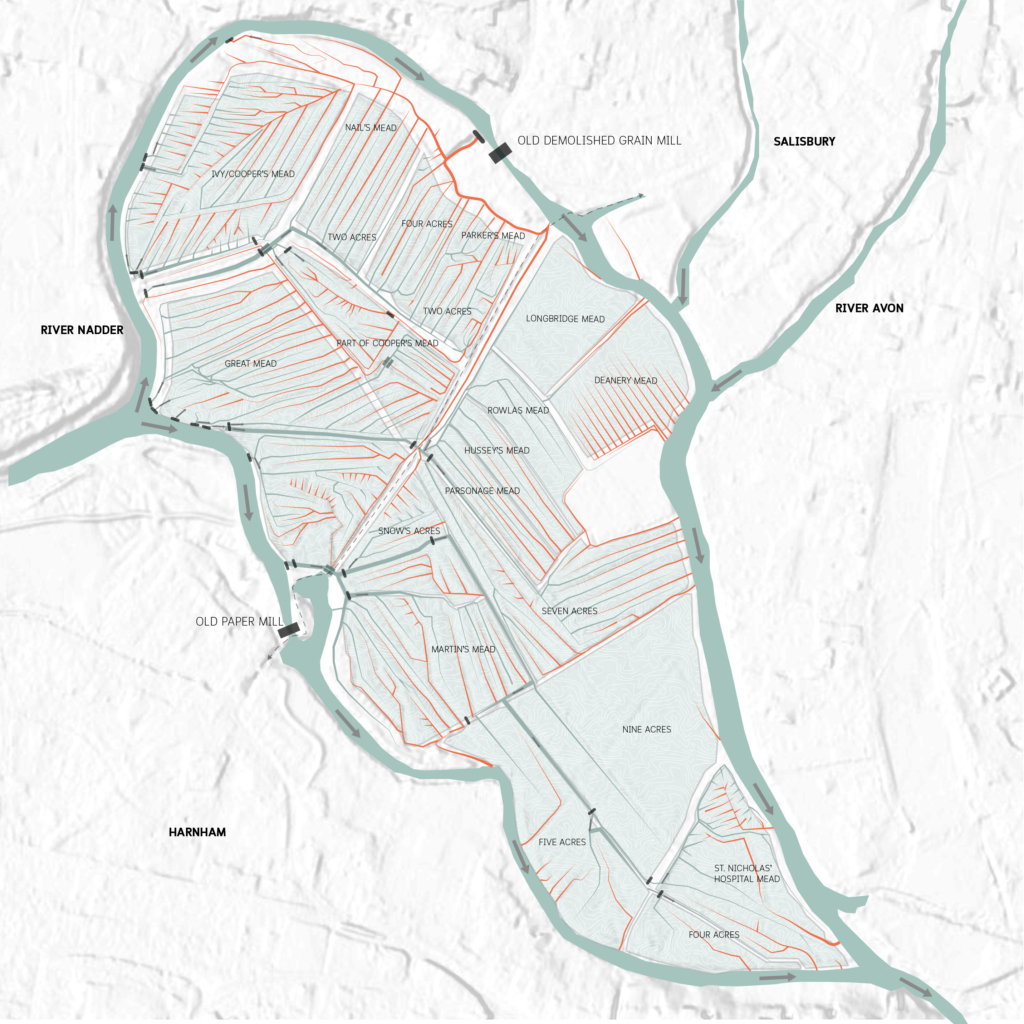
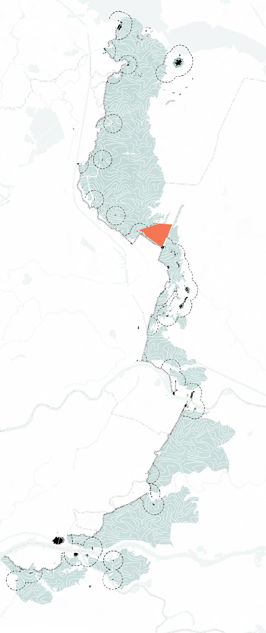
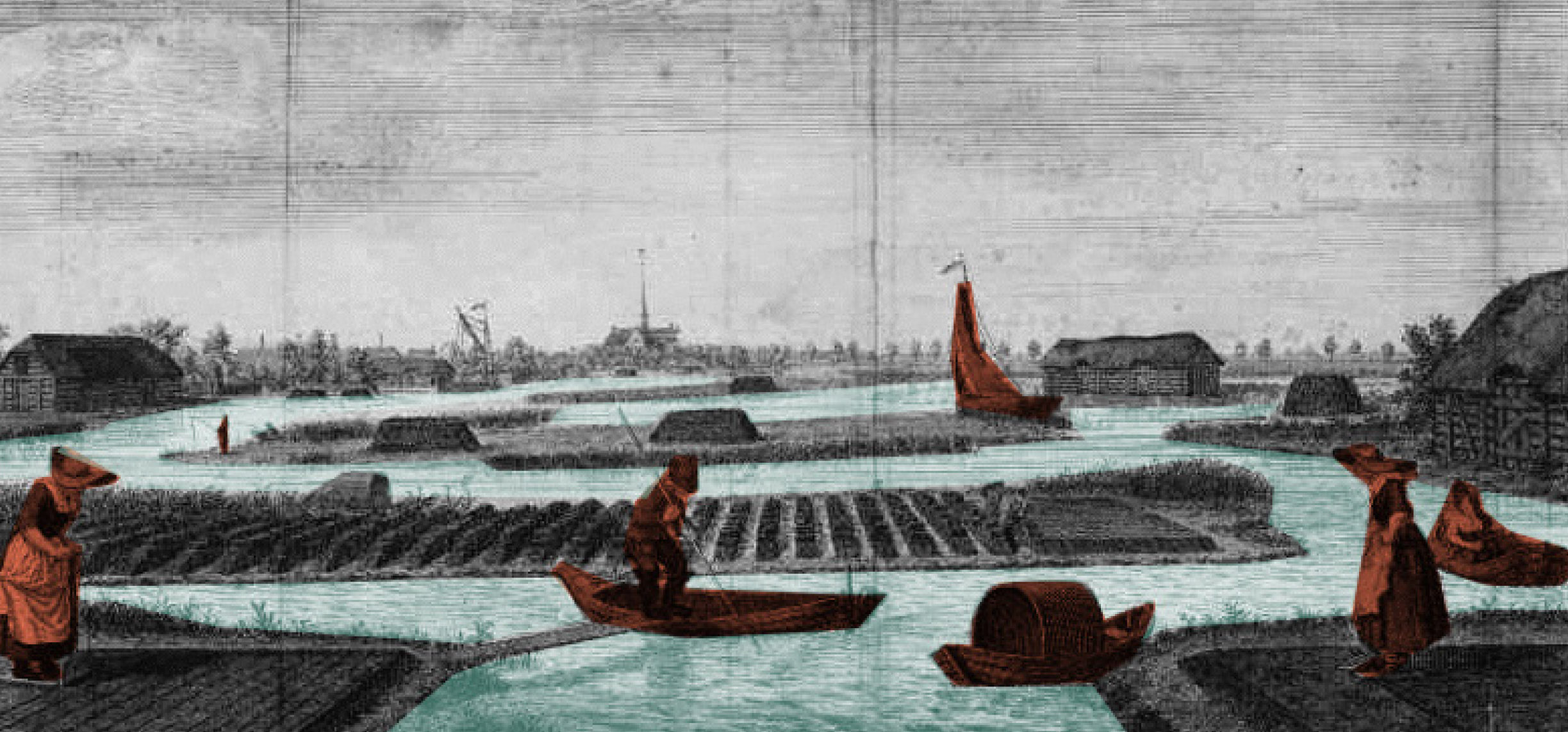
The Chillón-Rímac-Lurín basin is located in the province of Lima, and its primary water system is comprised of the Chillón, Rímac, and Lurín rivers, as well as their tributaries, creeks, and lagoons, among others. The Amunas system can be regarded as an additional recharge system. Chillón-Rímac and Lurín are the principal aquifers that hold groundwater in the region. In contrast to Lurín, the Chillón and Rímac aquifers are interconnected and trade their groundwater. The three aquifers cover roughly 866.46 km2 or 10% of the entire land area.

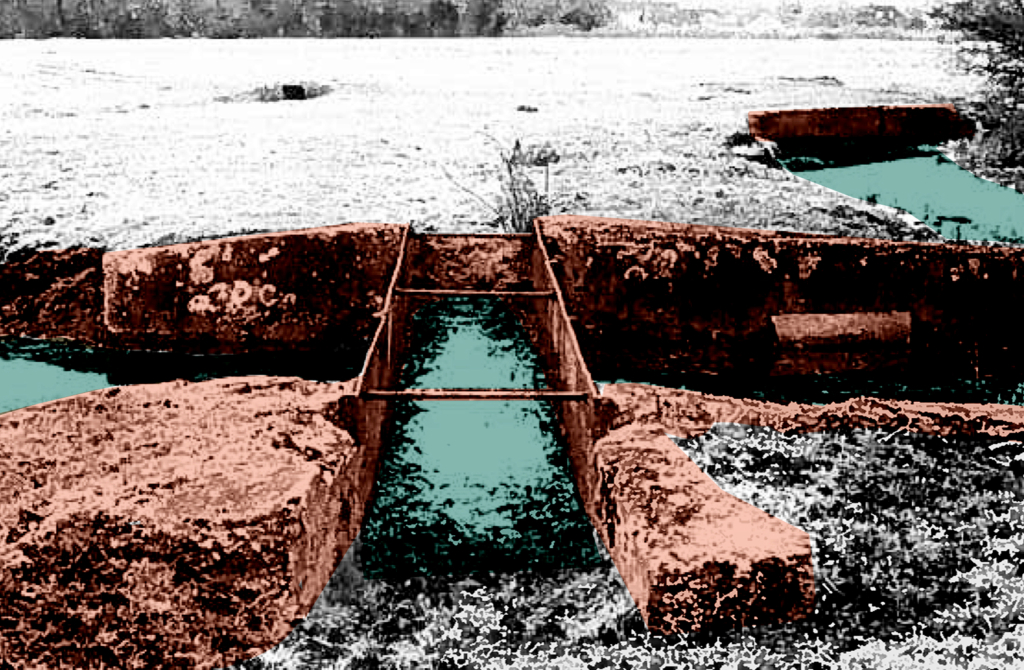
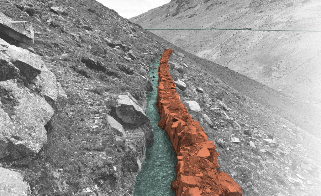
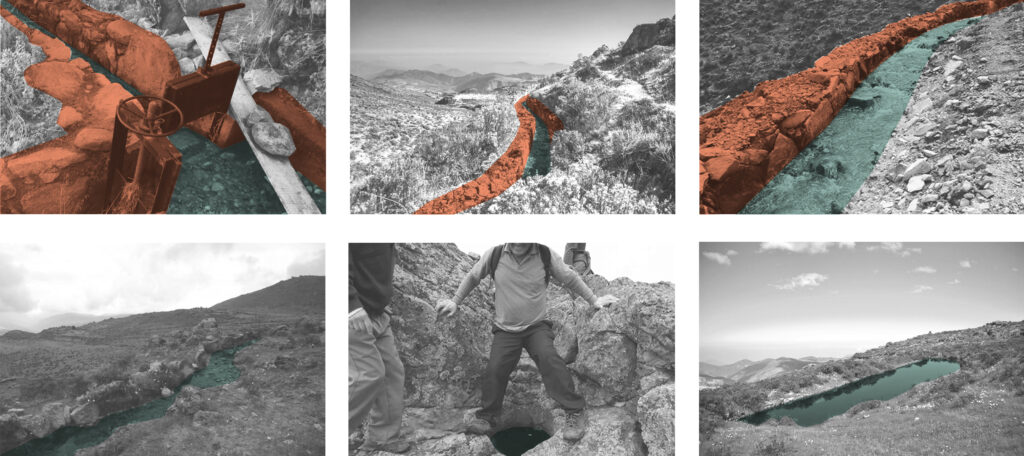
The development of the Amunas, the water-bearing rocks constituting the underground structure of the Amunas, where water gradually moves through cracks in the sediments and rocks until it reaches the springs beneath the slopes. Water is kept in the soil and flows considerably more slowly below the surface than it would overland. During the dry season, springs are sustained by water that would have otherwise been lost by flooding.
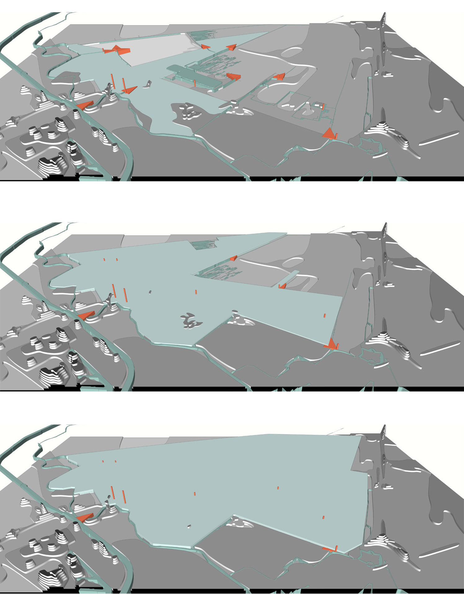
11 of the original Amunas canals are still in operation, supplying 65 active springs and 14 tiny ponds with water.
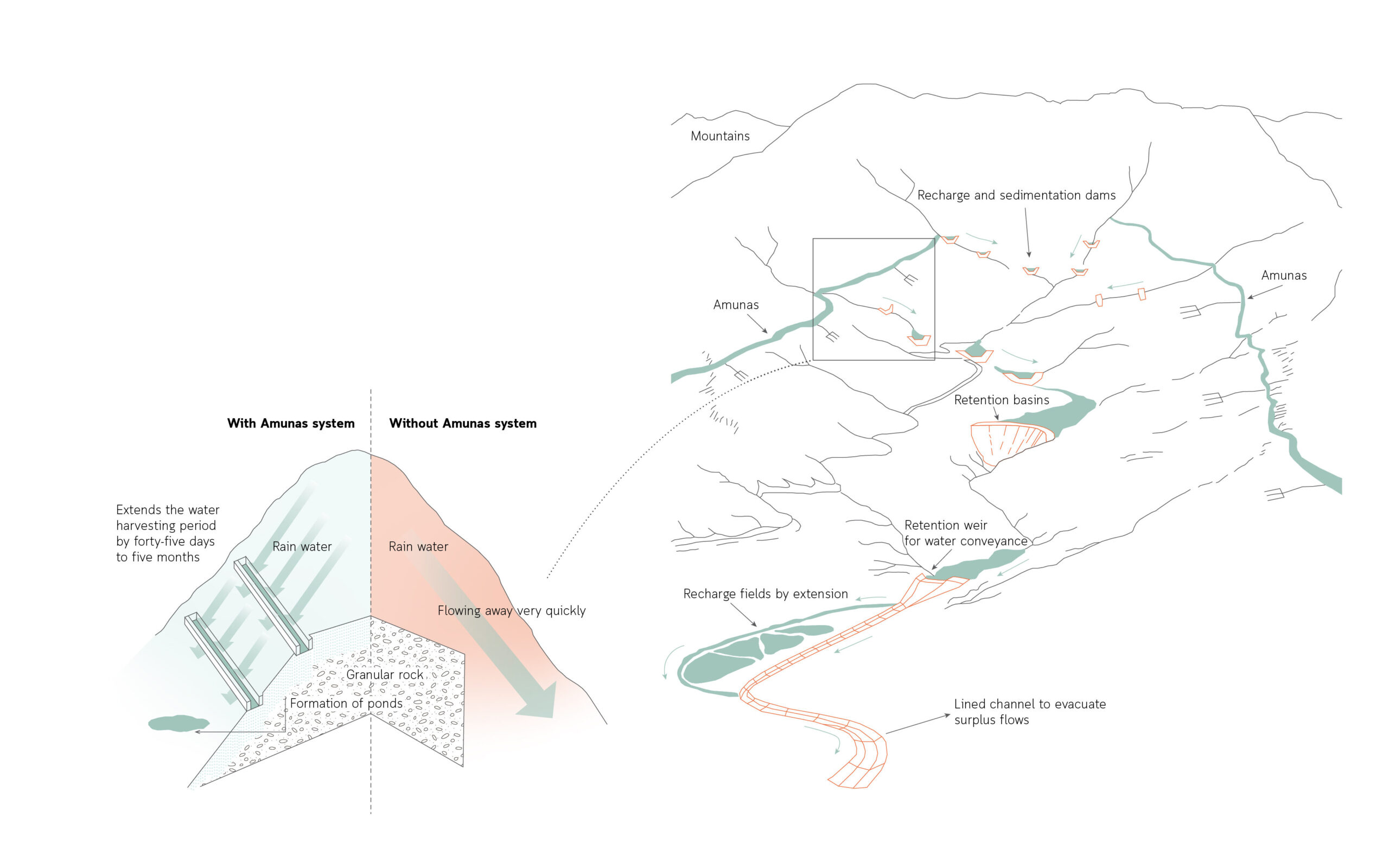
In the Peruvian Andes, where water shortage is severe and there are water-bearing rocks for underground storage, the Amunas artificial recharge system would be beneficial. Sand and gravel soils are nearly nonexistent in the Andes; the majority of the area is covered by rocks. These include claystone, which generates the thin and fragile arable soils that sustain agricultural activity in the Andes, and granular rock, which forms the water-supplying rocky hills of the highlands. Thus, it may be stated that dense rocks with low porosity and open fissures allow for the storage and release of water as springs. In the majority of basins, this is the only permanent source of water, hence its significance.
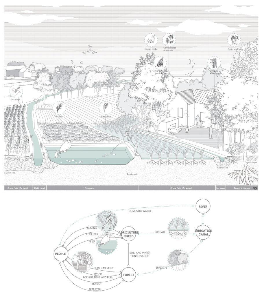
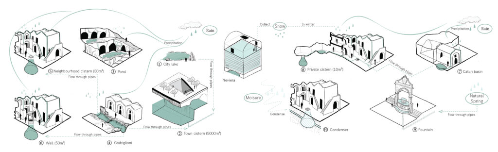
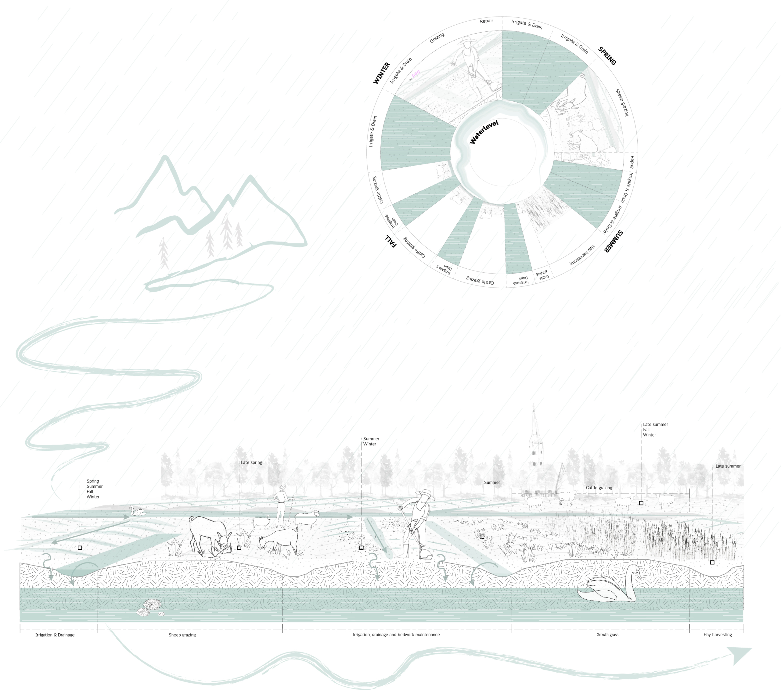
Water recharge of soil, subsoil and aquifers, through human interventions aimed at retaining, infiltrating, storing and regulating runoff water from rainfall.
Circular Stories
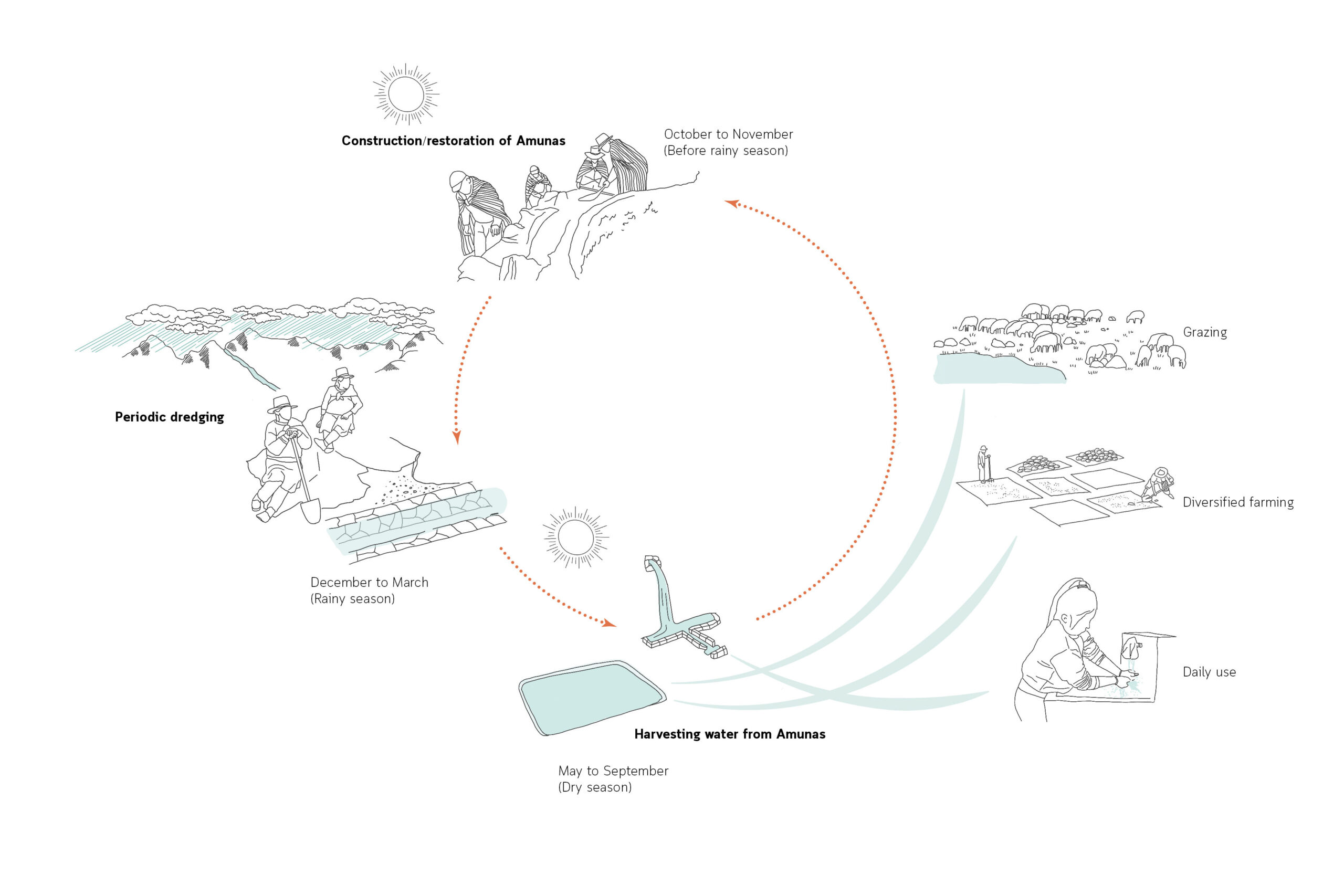
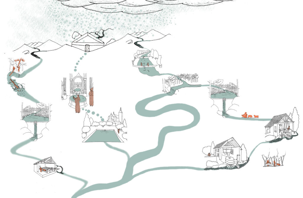
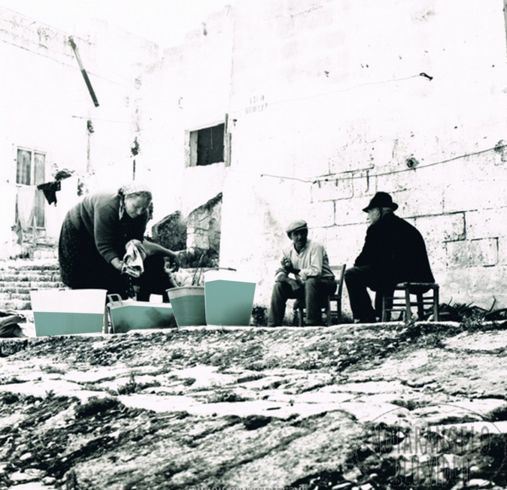
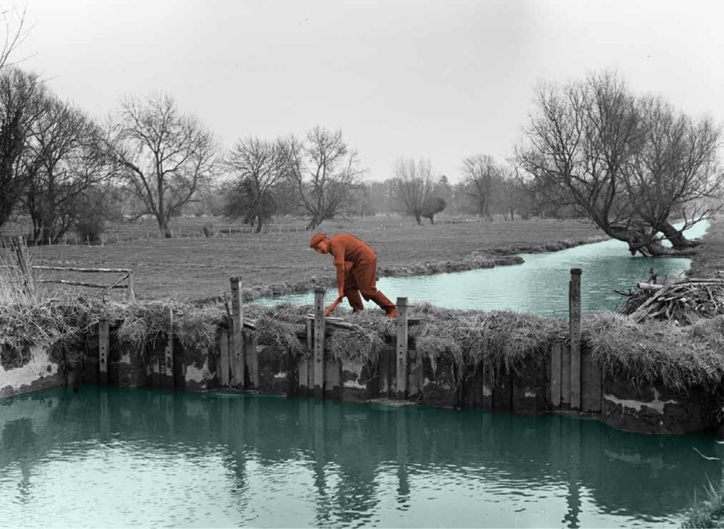
The existence of the community is essential for the Amunas to function, as it is a crucial factor in the physical and organizational aspects of planting, harvesting, conducting, and infiltrating rainwater into the mountain in order to ‘humanely’ recharge the aquifers.
In the district of San Pedro de Casta, where the Amunas are protected, where there are no snow-capped mountains, and where everything depends on precipitation, the inhabitants continue to practice this traditional method of water collection and agriculture. According to the statements of the settlers, the Amunas preserve the water in the springs and streams during the dry or water-scarce seasons for domestic and agricultural use, as well as for public services; as a result, they organize annually, with a sense of reverence and ritual, a large community celebration of gratitude and dedication.