The world’s most extensive medieval sacred water management network of the ancient Kmer Empire.
Krit Thienvutichai 2019
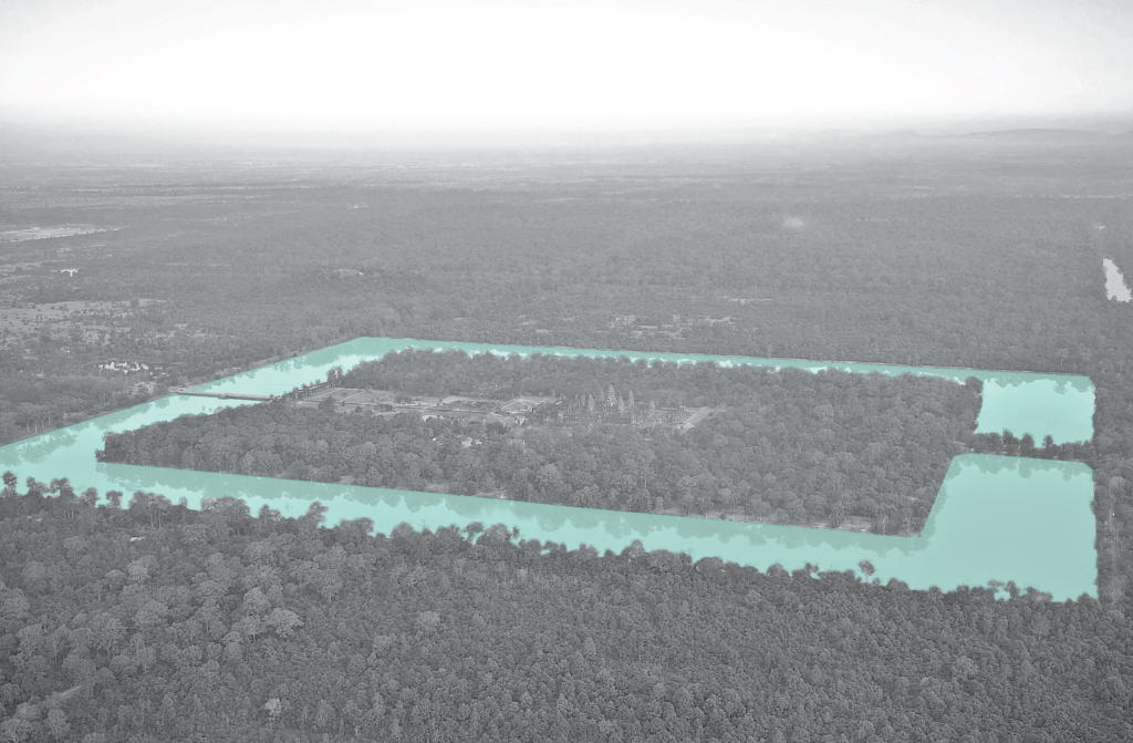
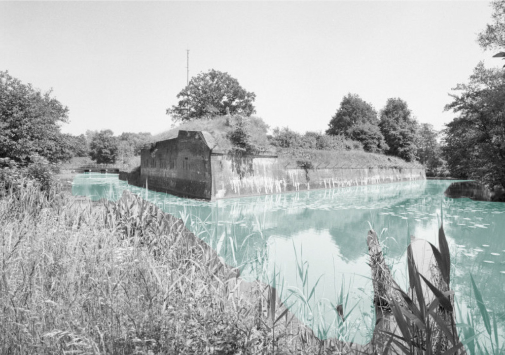
Angkor Wat is one of the most important archaelogical sites in Southeast Asia. WIth impressive monuments, several different ancient urban plans and large water reservoirs, the site is a unique concentration of features testifying to an exceptional civilization (UNESCO).
Water management zones classified by topographic condition.
The hydraulic city was classified into three principle zones, with their topographic conditions of hydrogeology and elevation, functioned as one large system to supply the whole region. In the collector zone, the water was taken from natural rivers. In the aggregator and collector zones, water was stored mainly in the earthen embankments of barays, temple moats and small reservoirs.
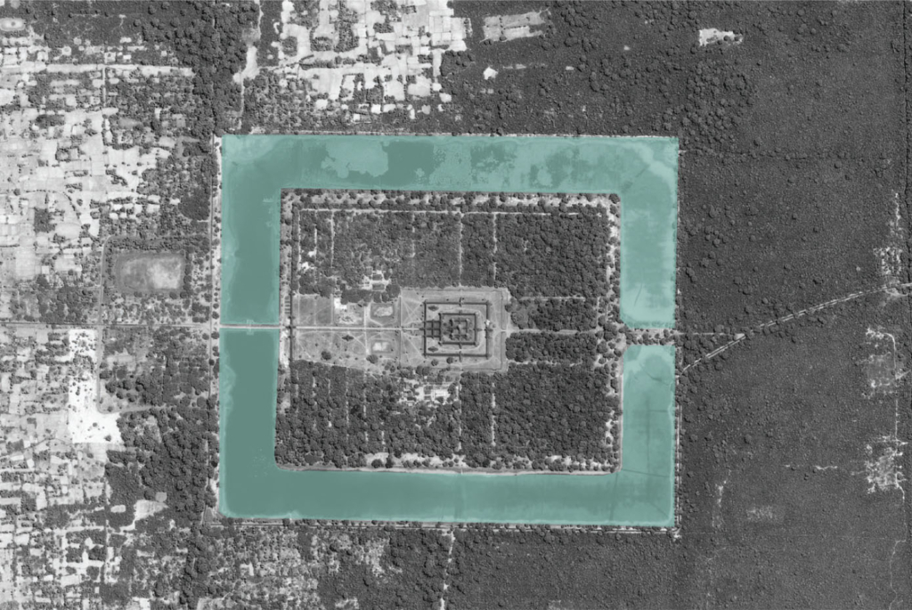
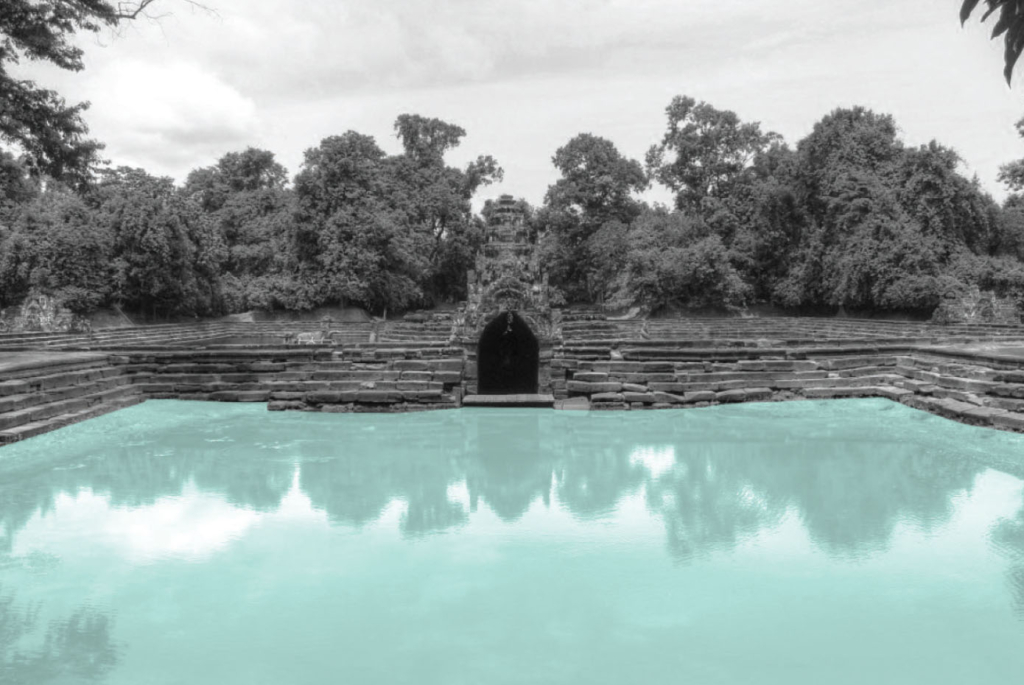
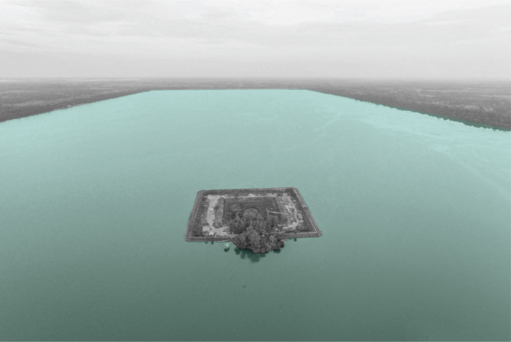
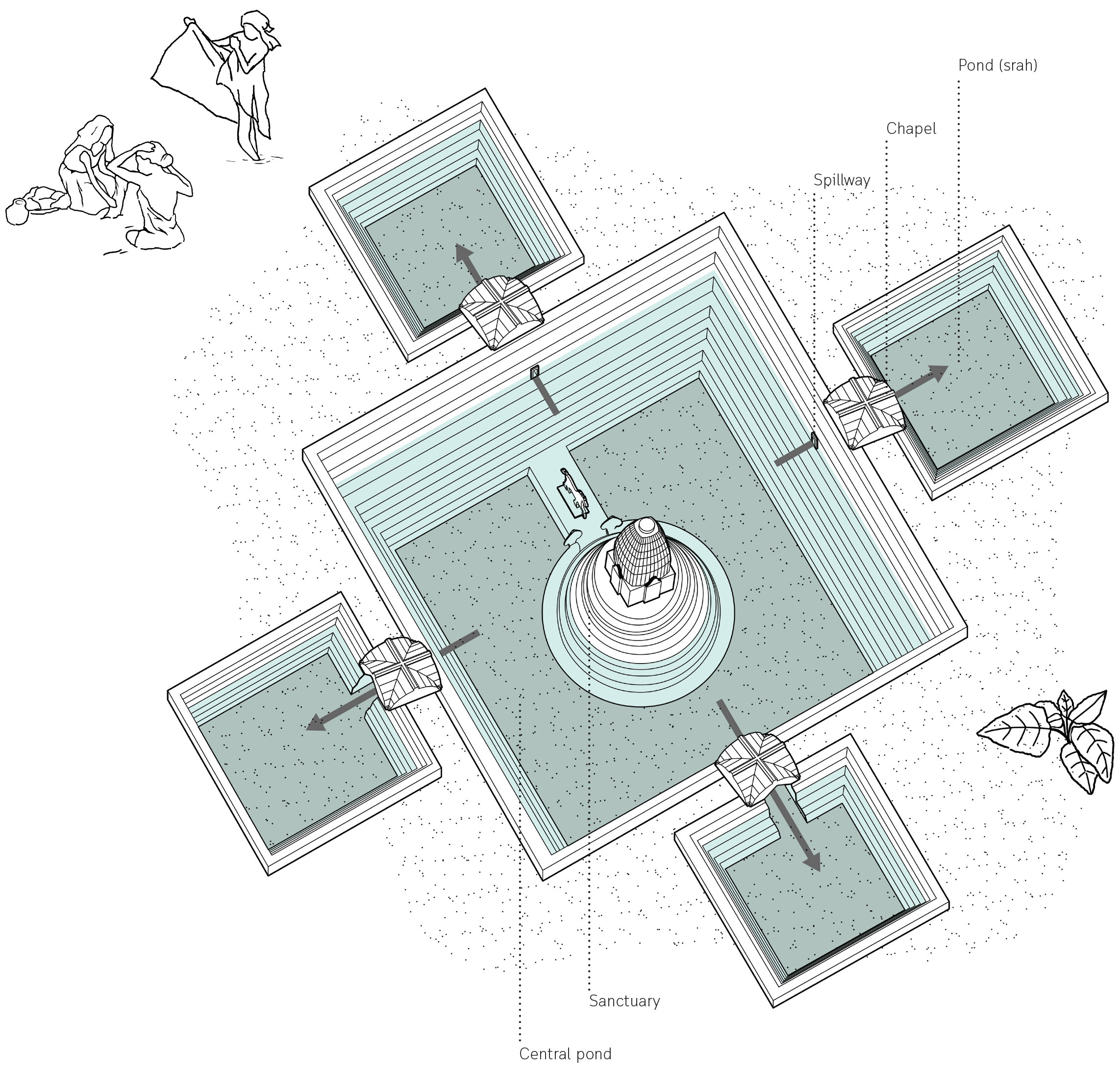
Clockwise. Mebon, island temple at the centre of the baray; geometric form of Angkor Wat aerial plan; Naek Pean, island temple at the centre of north baray; Baray, large artificial rectangular water reservoir.
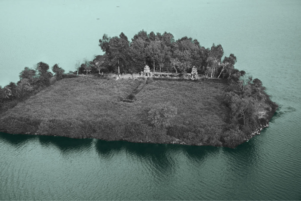
The temple island of Naek Pean used to function as a hospital. The central pond symbolizes a mythical lake in the Himalayas whose water is thought to cure all illness. The water overflows from the central pond through chapels to fill up four small ponds with healing water. The ancient Khmers may have believed that bathing in its successive ponds would have restore balance within the body and cured illness or at least washed away sin.
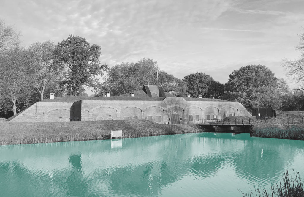
Water as a defence line comprised of a system of waterworks for inundating and military elements for troops.
Huadong Zhu 2019
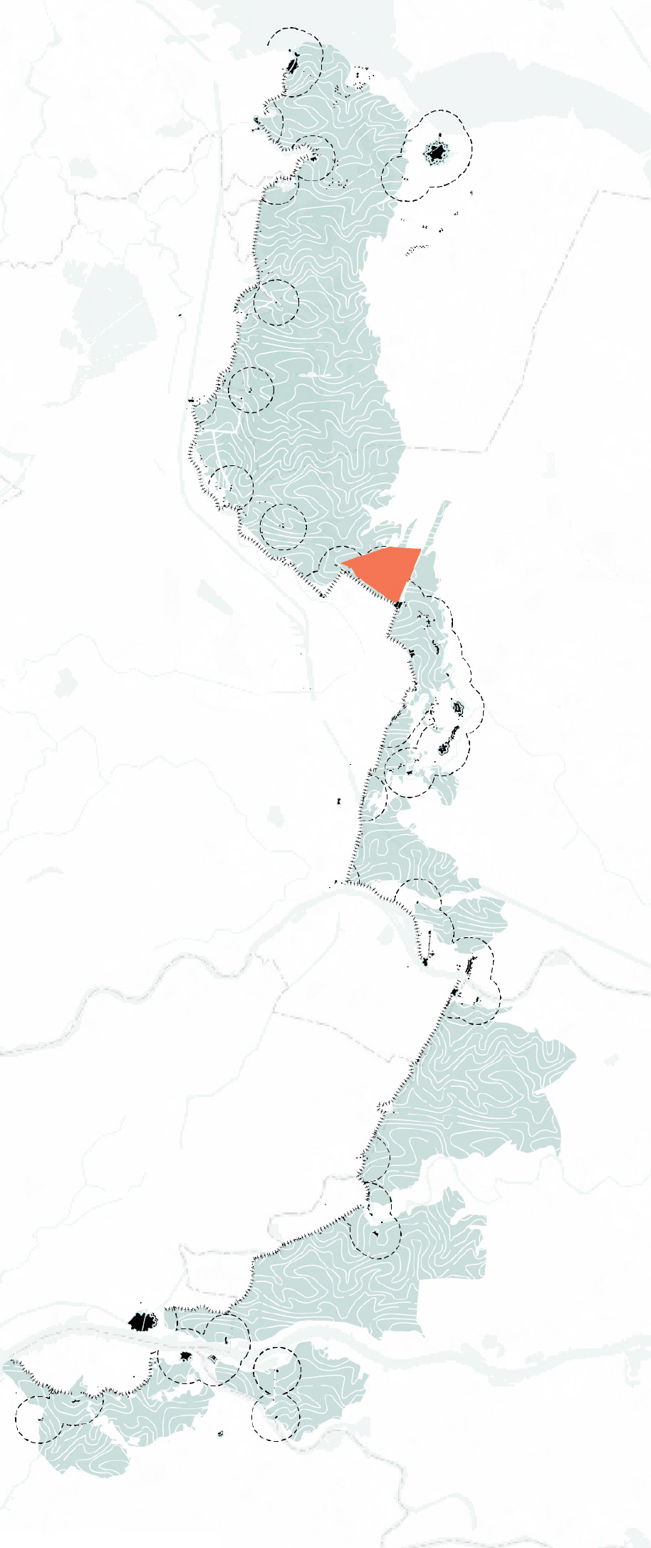
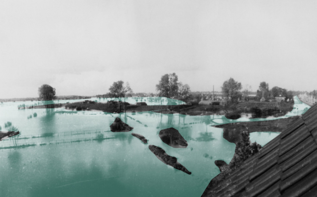
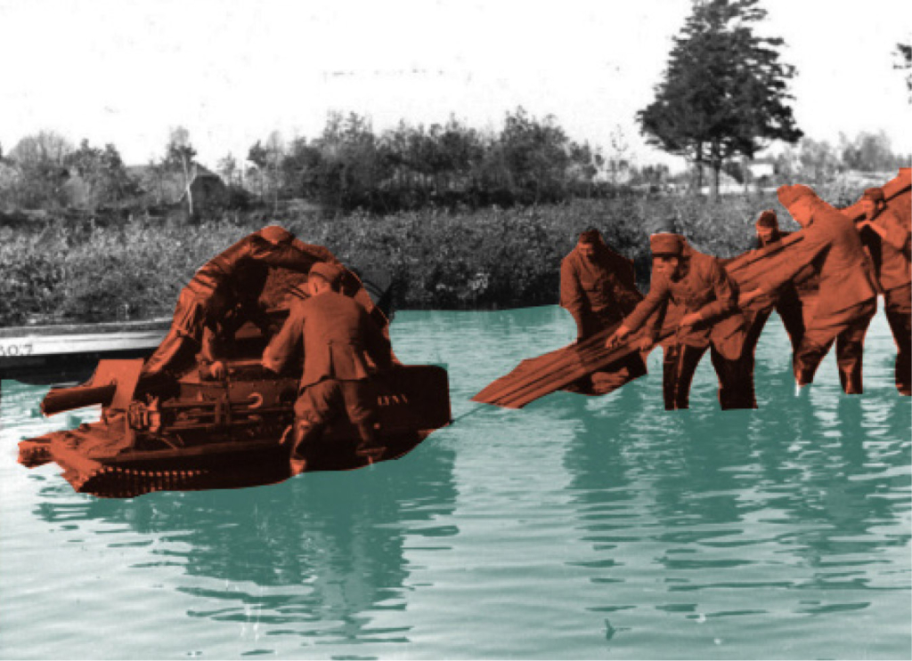
The New Dutch Waterline was built to defend Holland, the west part of the Netherlands and it is 85 km long. Large areas of agricultural land (polders) were flooded with a layer of approximately 40-60 cm of water- The traditional drainage system of the polder landscape was transformed into a 4 km wide defence line.
The New Dutch Waterline at regional scale.
Pumps and sluices guide the water out of the deep lying polders, in war-time the water could be directed into the polder. In a normal situation the water table is higher during winter. During a dry summer, water needs to be taken in from the boezem system. The boezem system is the discharge water network which brings the polder water from into the outer water. The whole water system can be set in motion by switching the pumping stations on and off or changing the direction of the water flow.
Left to right. Mill; Forts on the New Dutch Waterline; Inundation in 1945.
Normally the land is drained for agricultural use. After peat digging, used as fuel the land turned into a lake a became useless. By draining the inner lakes, new, deeper lake-bed polders were created. During the war period, the polders were transformed into lakes again and could not be crossed by enemies on foot or by horse.
Left to right. Dutch soldiers on guard; Operation of the waterline during exercise.Delving peat.
During normal times, the water is pumped out into the river, part of the boezem system. During war times, the waterworks can switch the direction and pump the water into the polder. Today they pump water into the polders during dry summers.
The existing water management in a polder is based on an independent managed water level. The system consisted of mills, later replaced by pumping stations and the sluices. The polders have different water levels. During the war the area was flooded polder by polder.
Top to bottom. Flood phase 1; Flood phase 2; Flood phase 3.
For the entire booklet of The New Dutch Waterline be so kind as to contact us through the form in the Contact section.
Exploring into the ancient water wisdom of Jaipur Rajasthan, India.
Anubhuti Chandna 2019
Jaipur is one of the first planned city of northern India based on the principles of “Shilpa Shastra”, in fact “Jaipur clearly represents a dramatic departure from extant medieval cities with its ordered, grid-like structure – broad streets, criss-crossing at right anglese, earmarked sites for buildings, palaces, havelis, temples and gardens, neighbourhoods designated for caste and occupation” (UNESCO, 2015).
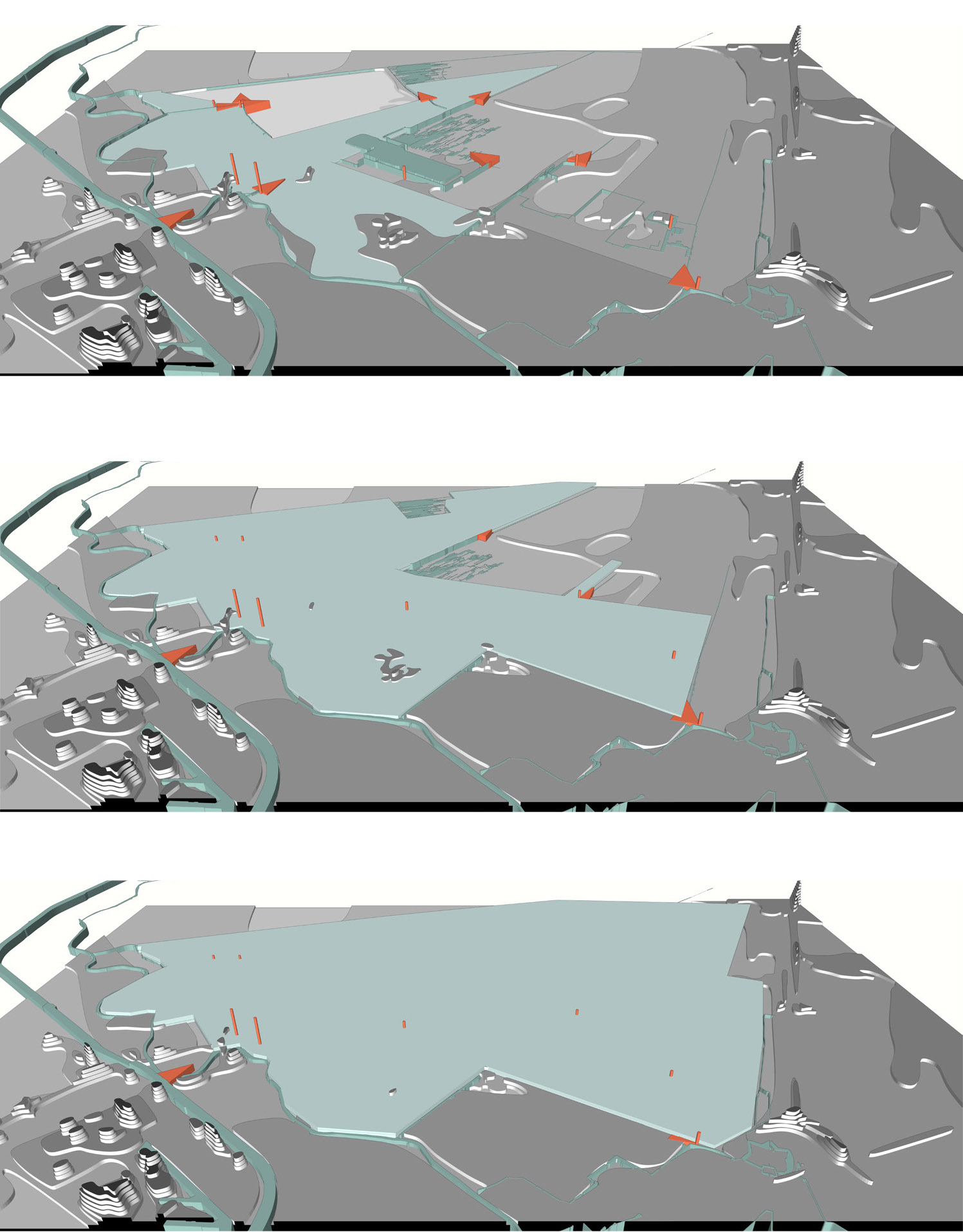
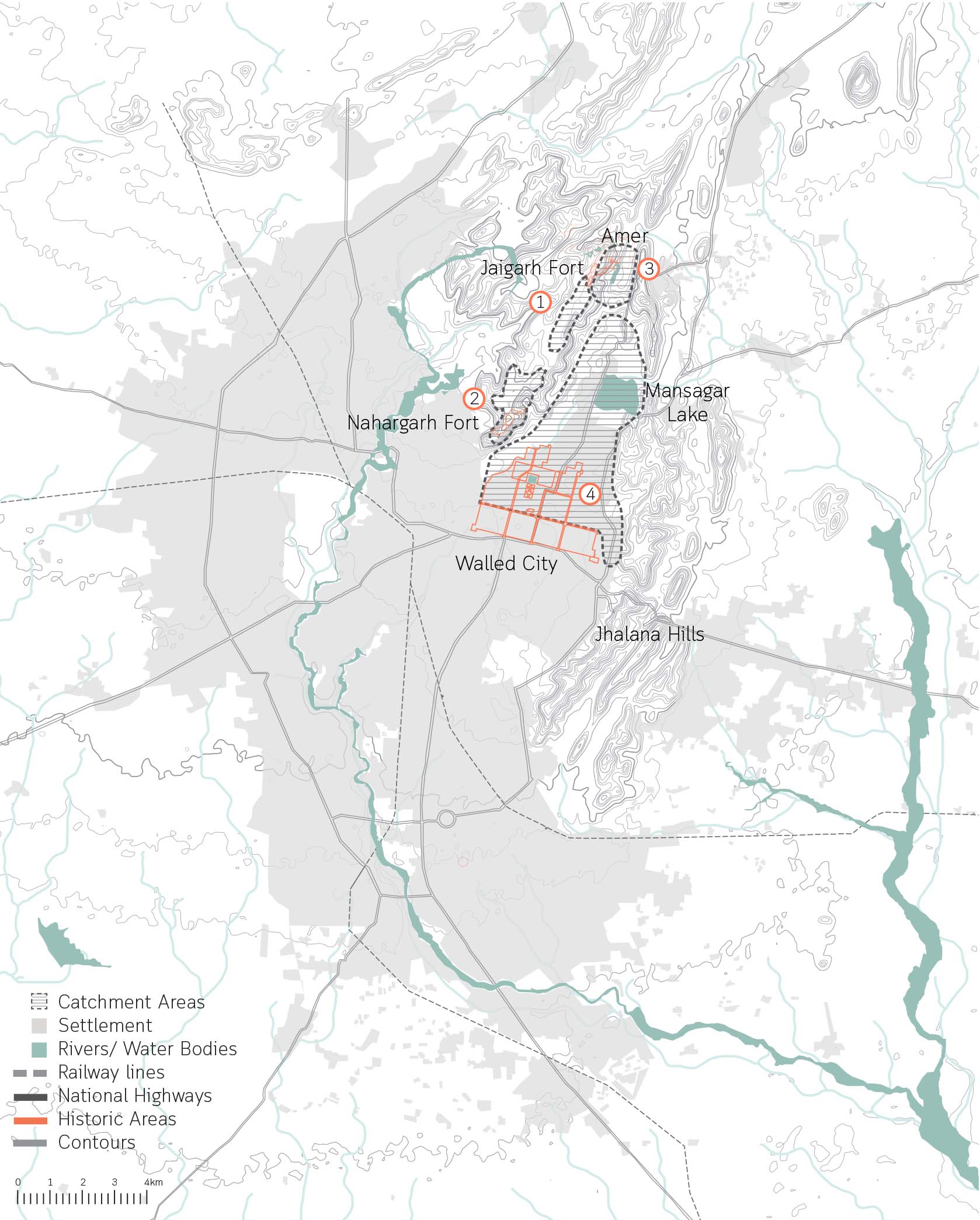
During the planning of the city, special attention was given to the water supply system. With half of the city surrounded by the hills, the city took advantage of various rain catchment areas that were available for storage direct response to local geophysical conditions.
Catchment areas of the different systems in the city of Jaipur.
The ruler built 16 miles long canals from the nearby river streams and brought water to the city through aqueducts, As the city grew with increased demand for water, a dam across the river of Dhravyavati was constructed in 1844 along with a canal which runs east to west of the city, wide enough for 5-7 horsemen to ride abreast. This covered canal would then distribute the water through various channels and wells across the city and open at some places for direct access. However, after the construction of the metalled roads and new pipe system of supply, the canal got buried within the markets and its deep walls got filled up.
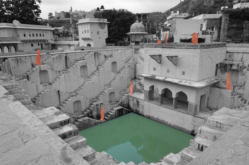
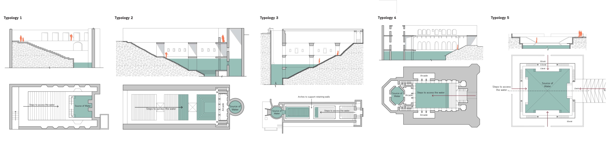
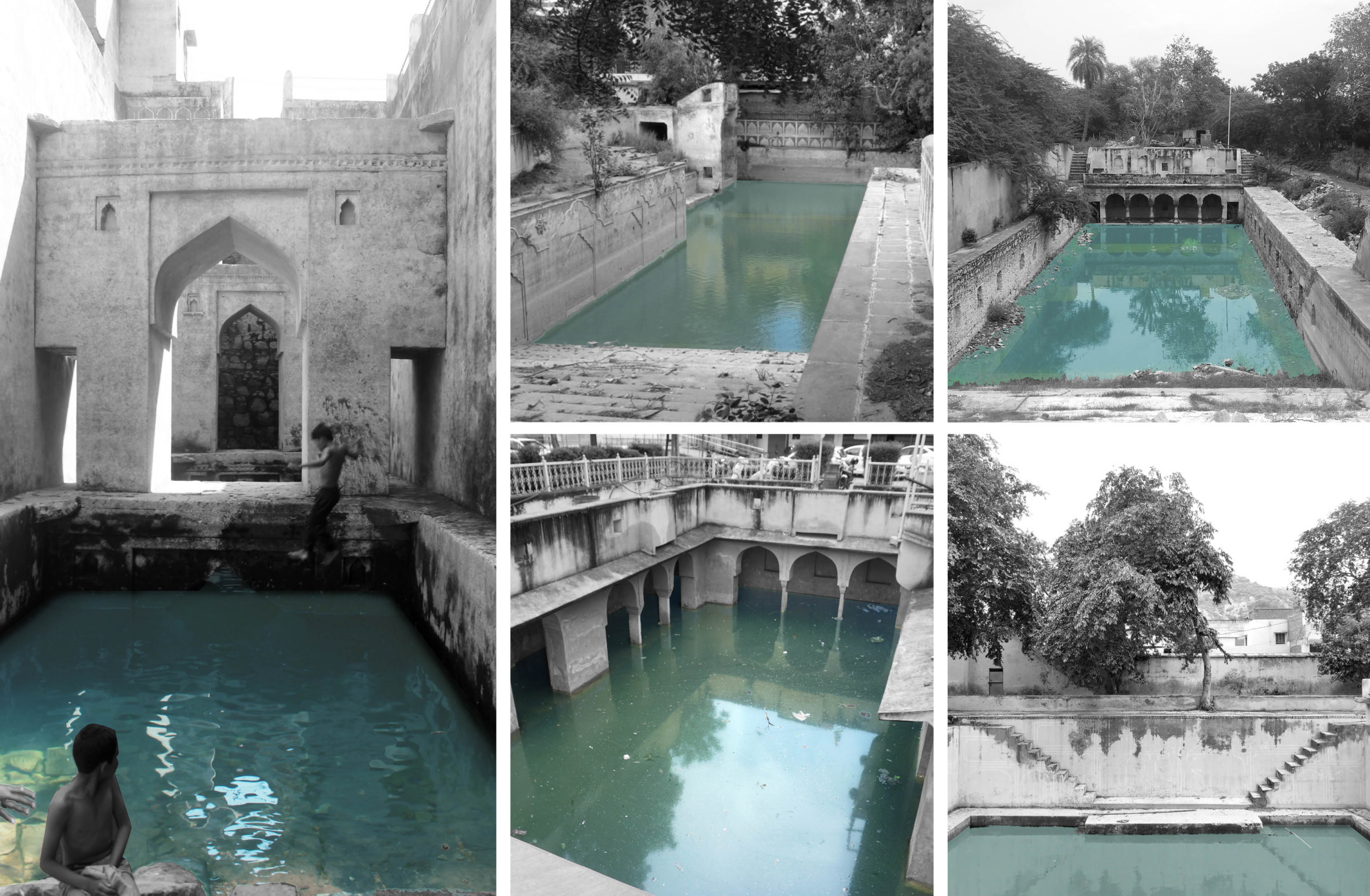
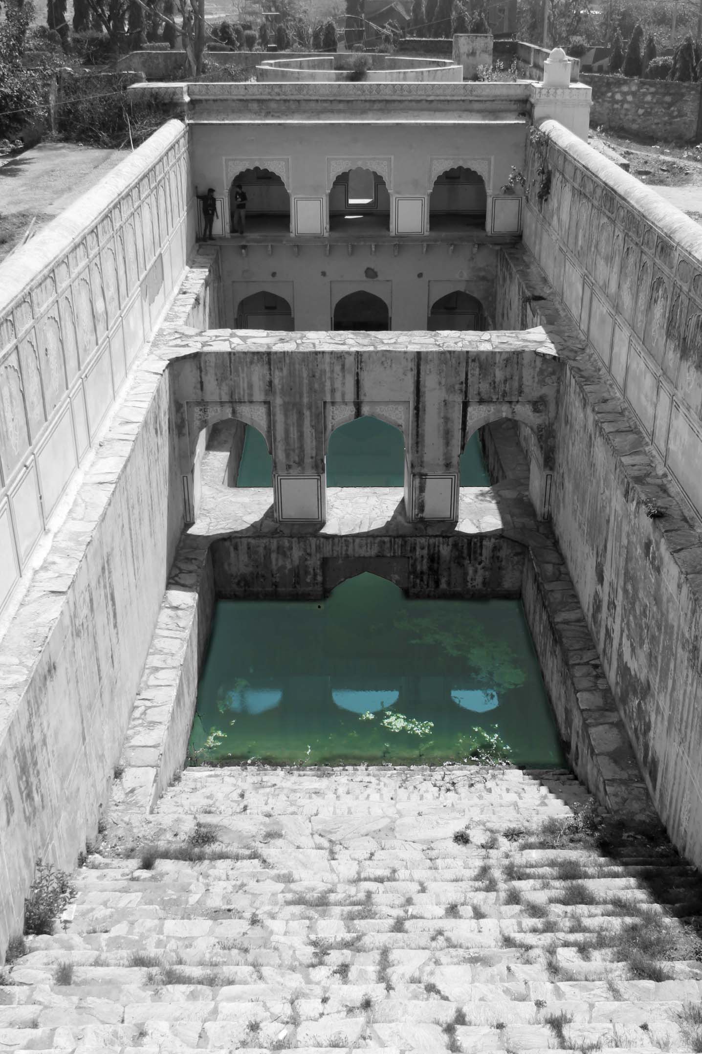
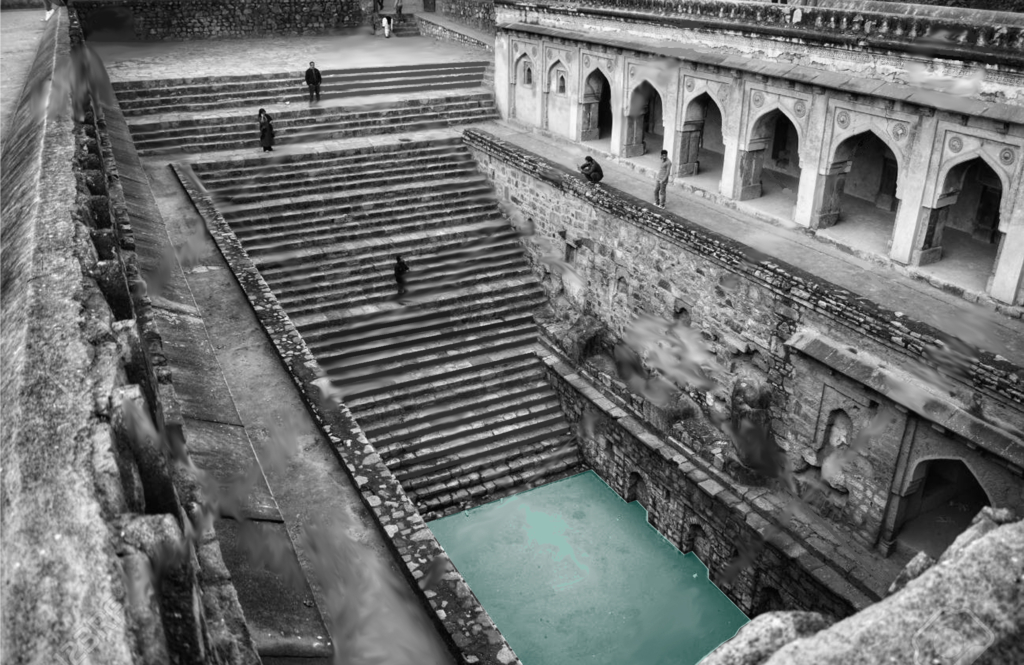
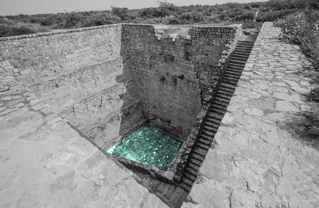
5 typologies of stepwells in Amber.
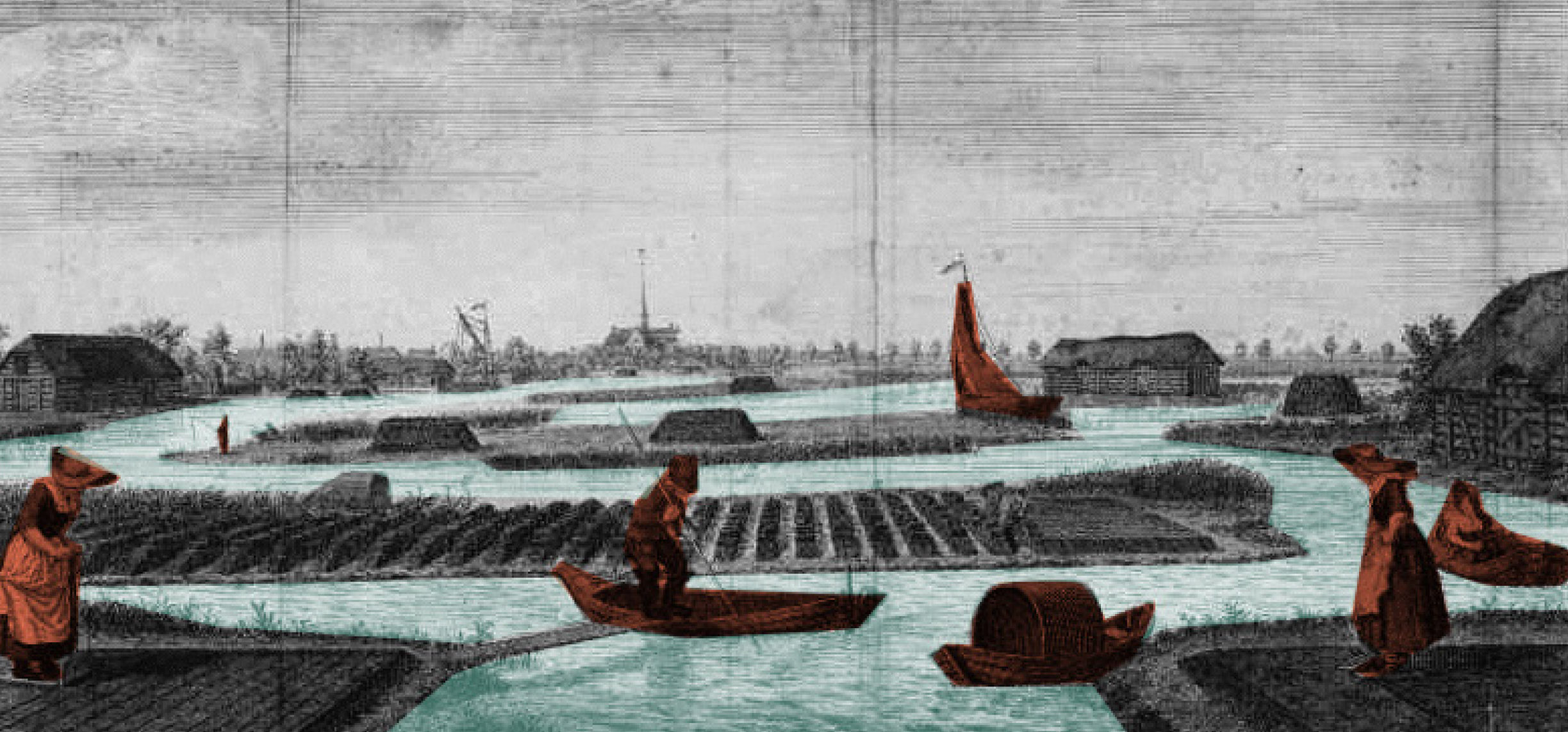
Water has a special significance in Hindu mythology, believed to be as a boundary between heaven and earth. For centuries, stepwells and stepped ponds, also known as Bavdis, Bawadis, Baolis or Vavs, have not just played a significant role in functioning as traditional water systems, serving the community through generations but also as hotspots of social, cultural and touristic interactions. “While various water structures such as tanks, cisterns, paved stairways along rivers (ghats) and cylindrical wells are found elsewhere in India, stepwells and stepped ponds are indigenous to semi-arid regions of Gujarat and Rajasthan” (Livingston & Beach, 2002).
Clockwise. Typology 2, Cheela Bawadi; Typology 1, Atreya Bawadi; Typology 3, Sarai Bawadi; Typology 4, Bengali Baba ki Bawadi; Typology 5, Parshuram Dwar ki Bawadi.Tattar ki Bawadi in Amber.
An integrated living system of a traditional Sundanese hamlet in West Java, Indonesia.
Ayu Tri Prestasia and Boomi Kim 2019
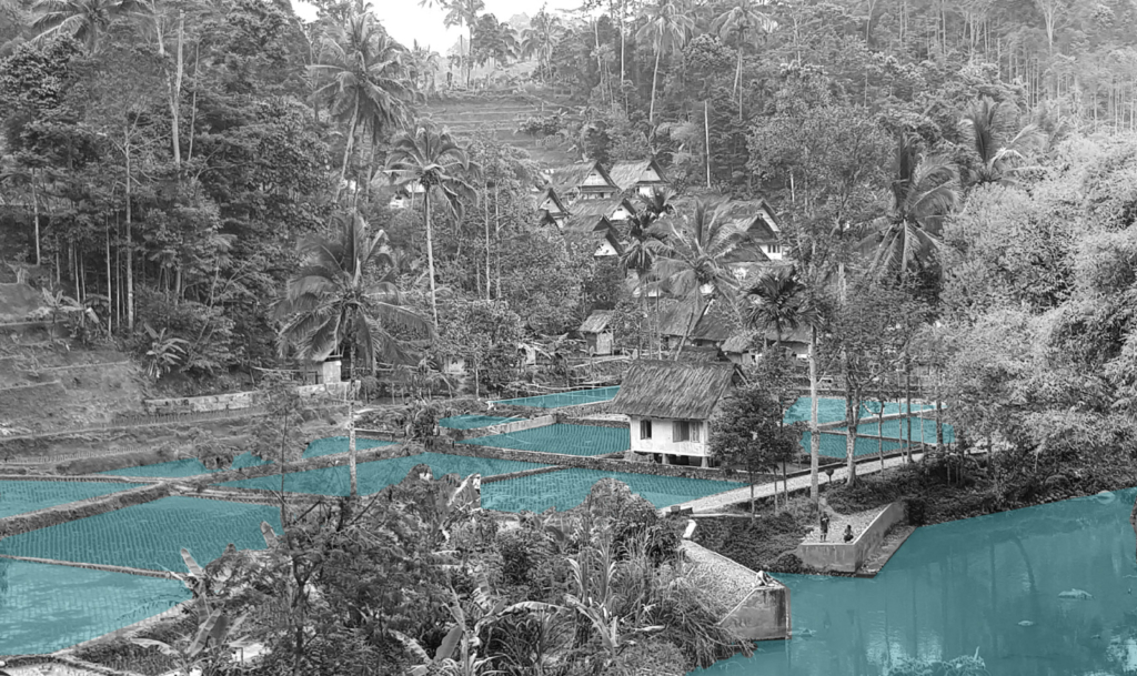
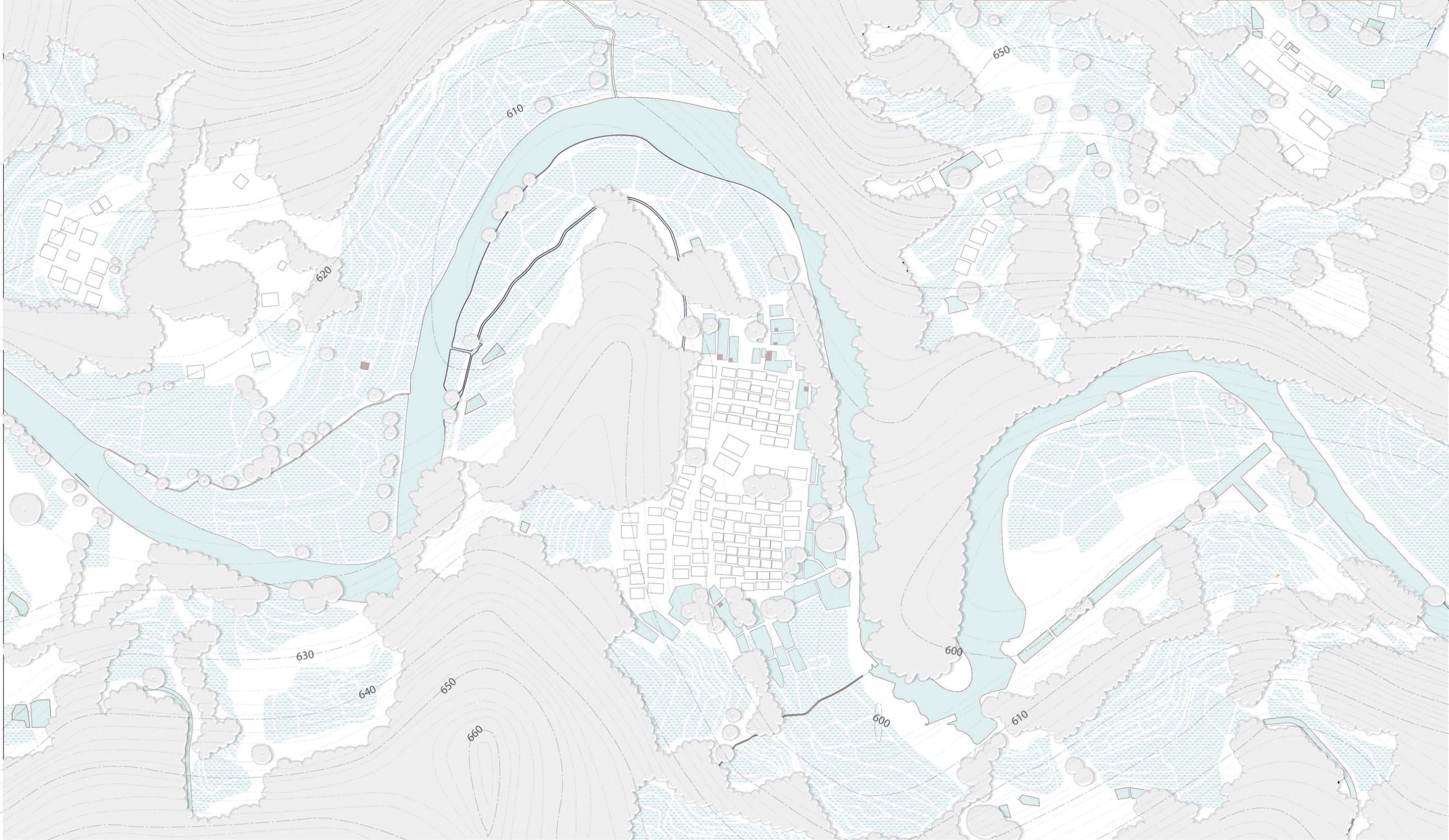
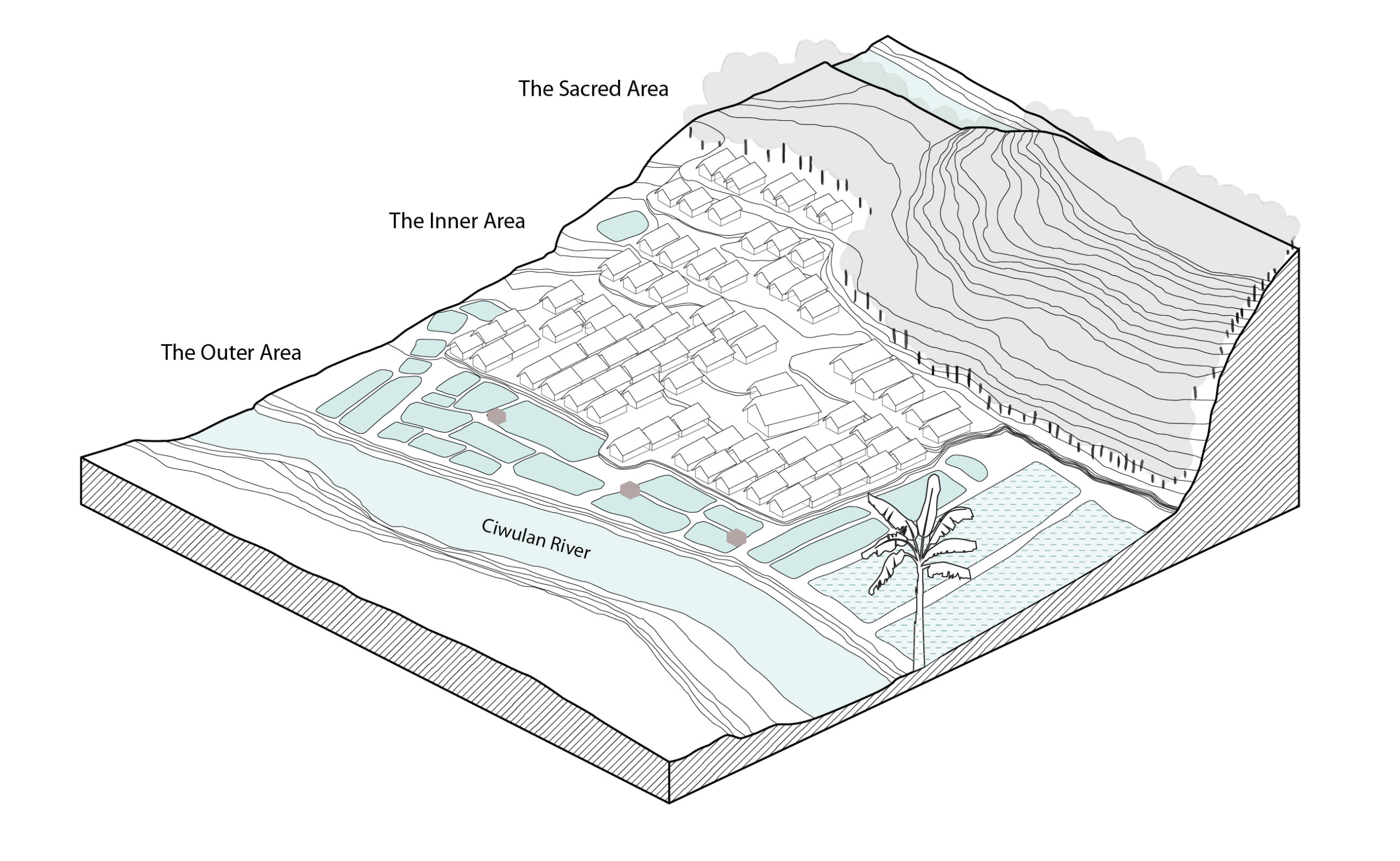
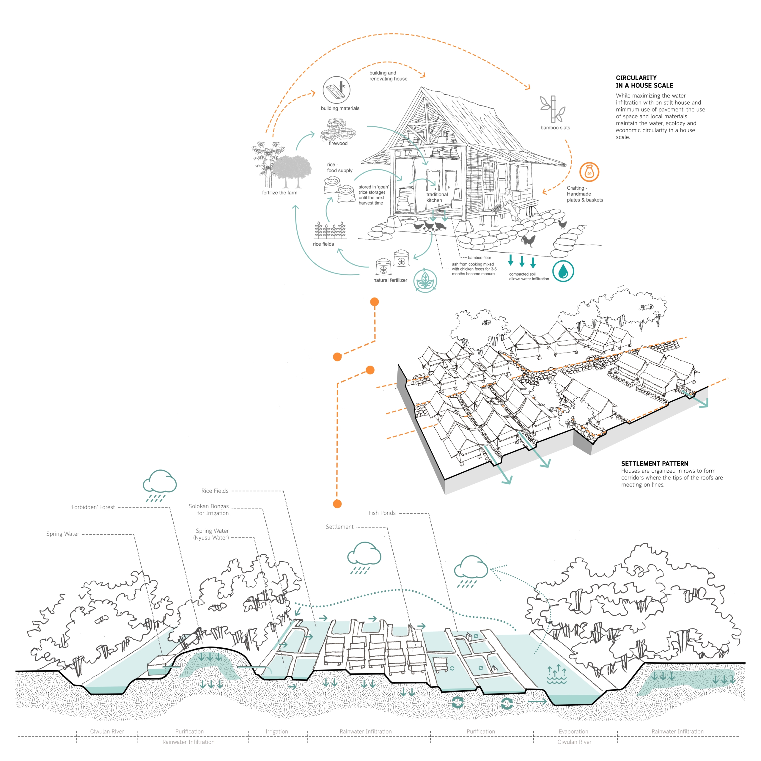
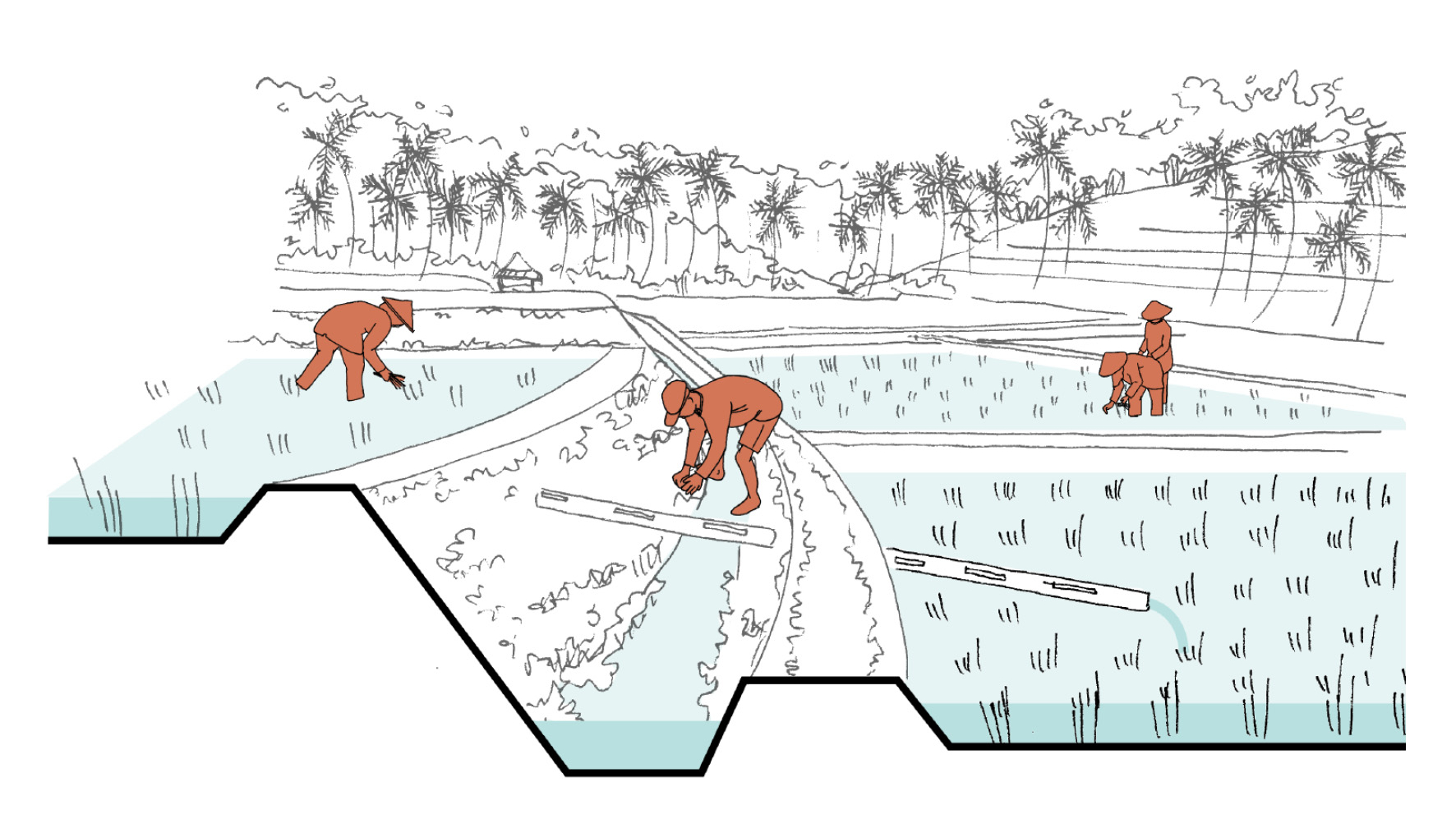
The spatial organization of Kampung Naga is influenced by its location on the valley. The topographical characteristics of the site defines the vertical zonation of the hamlet, which is closely related to the utilization of the landscape into the water management system.
Kampung Naga floor plan.
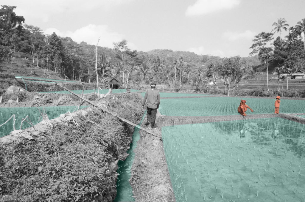
Based on its spatial relation to the settlement area, Kampung Naga can be divided into 3 distinctive zones. The “forbidden forest”, the Sacred Area, is preserved at the top of the composition to infiltrate, filter and store the water through its roots. The settlement area, the Inner Area, is located in the middle with terraced soils following its natural topography. At the lowest level, the Outer Area, fish pond system become the location where almost all the water-related activities take place. Bamboo fences are used as the boundary of the settlement area which at the same time clearly separates these three zones.
Strategic position of the areas on the topography.
Kampung Naga maintains the traditional living with nature amidst modernity that develops around the area. No new technology such as the use of electricity and related devices is allowed in the hamlet. The boundary of Kampung Naga is strictly preserved to balance the number of people whose lives can be supported by the food supply and the ability to manage the wastewater inside the village. While maintaining the number of people who live inside, the rest of the family members can live outside the village.
Although almost all water-related activities are located on the Outer Area, water is treated as a major part of their lives. People keep its space to “breathe”, use it wisely, and purify the wastewater before finally being returned to its original place. Centralization of the activities are designed as an integrated system of water and ecological cycle.
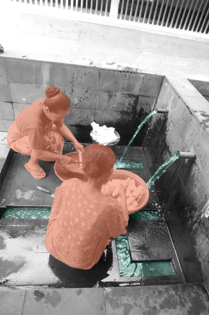
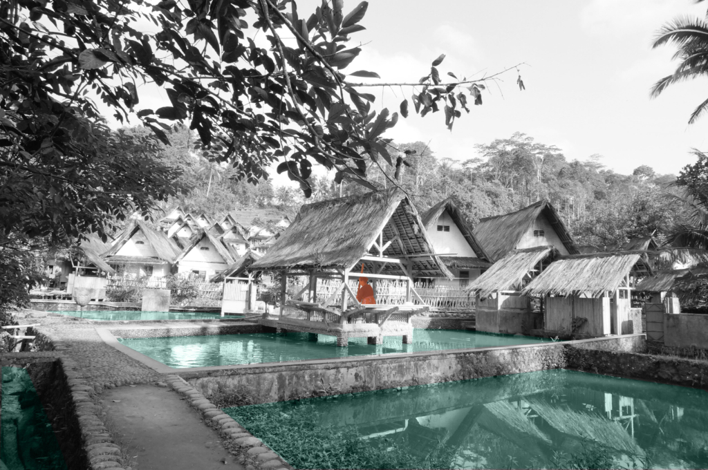
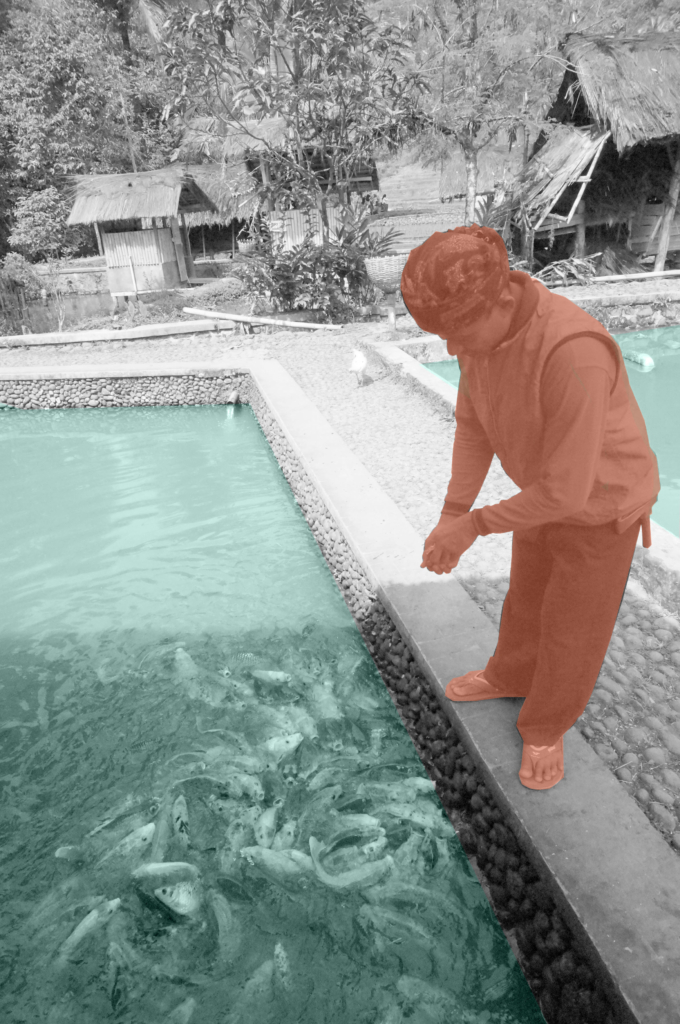
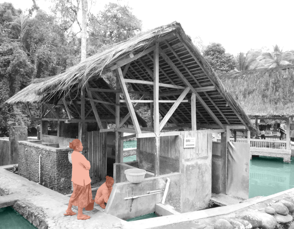
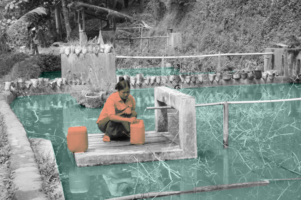
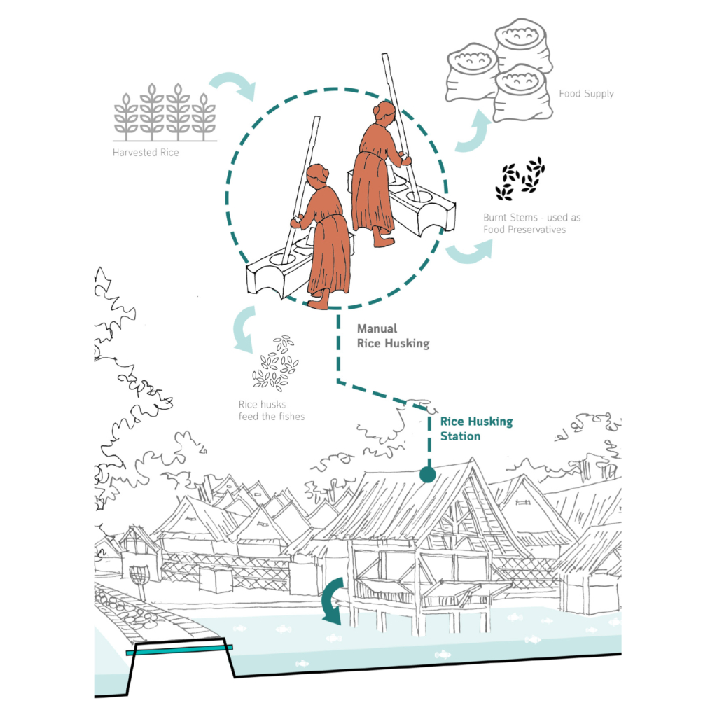
Clockwise. Women use the only water found inside the Inner Area at the Mosque to clean food materials; rice husking station is located above the fishpond; rice terraces which are irrigated from the river; man feeding the fishes; woman washing dishes at the latrine building above the fishponds; woman filling container with Nyusu Water.
Circular Stories
Nature works in circular systems. Living with nature, people in Kampung Naga believe that they need to understand thoroughly and preserve this circularity. Water, as one of the main resources of lives, is used wisely to maintain its circularity. The three water sources which are located on the higher parts of the topography are kept clean free from any activities that could contaminate the water quality. People are forbidden to cut trees in the forest on the hill to maintain its ability to absorb and purify the rainwater to the ground water table. In this case, myth and tradition are used by the community as rules that have to be obeyed. After the water is used for daily activities, it is purified by fishpond systems before finally being returned to the river.
Circularity in a house scale, Kampung Naga village.
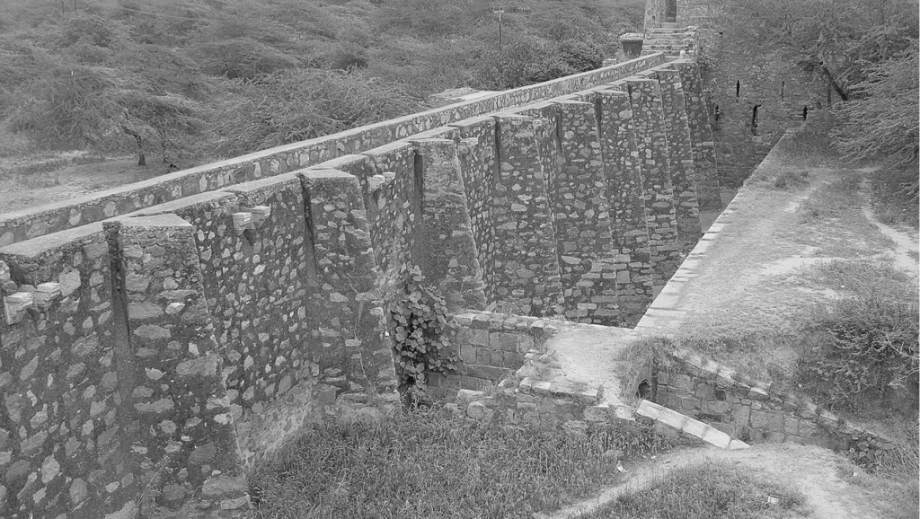
Ancient network of water harvesting structures in Delhi, India.
Tanvi Gupta 2020
Delhi is located in the Northern part of India being continuously inhabited since the 6th century B.C. Through most of its history, Delhi has served as the capital of various kingdoms, most notably the Delhi Sultanate and Mughal empire. Two prominent features of the geography of Delhi are the Yamuna floodplains and the Delhi ridge.
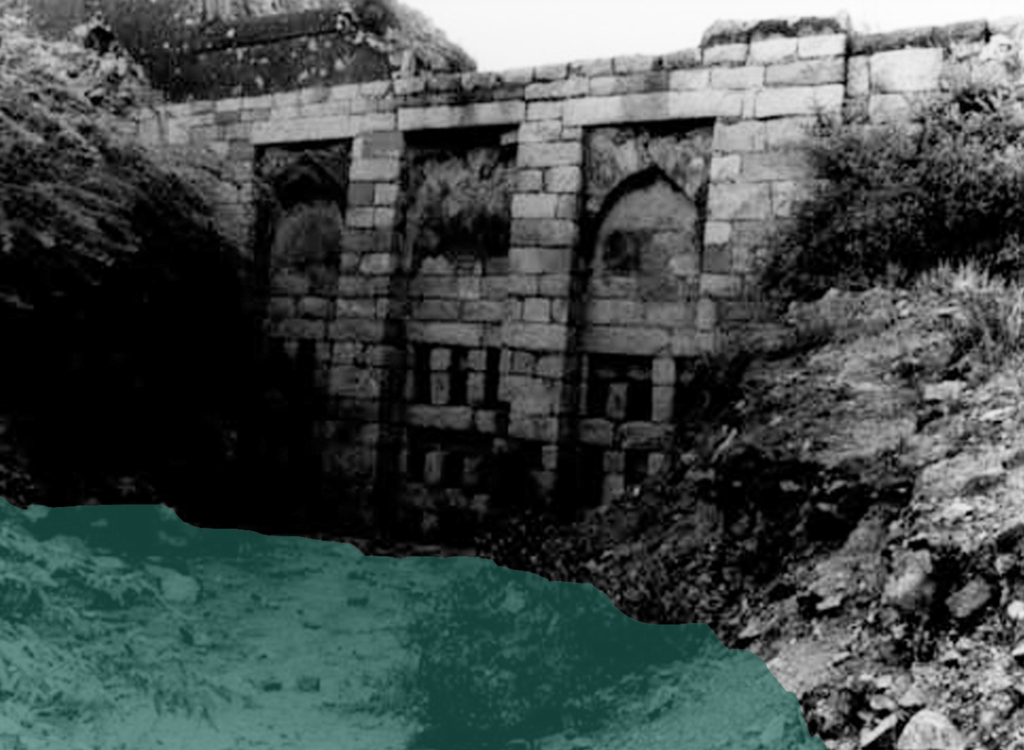
Clockwise. Satpulla embankment or bund; historical photo of Baoli at Tughlaqabad; historical photo of Hauz-i-khas lake (water tank); historical photo of Sluice gate at Tughlaqabad.
Delhi’s urban waterworks developed in early thirteenth century. They took the following main forms of hauz (water tank), baoli (stepwell) and bund (embankment). Collectively these small structures served the sultanate capitals of South Western Delhi. As with other ancient and medieval water systems, they were incremental and coordinated. Urban lakes, tanks and reservoirs were sited in gently sloping areas adjacent to hillside water control structures.
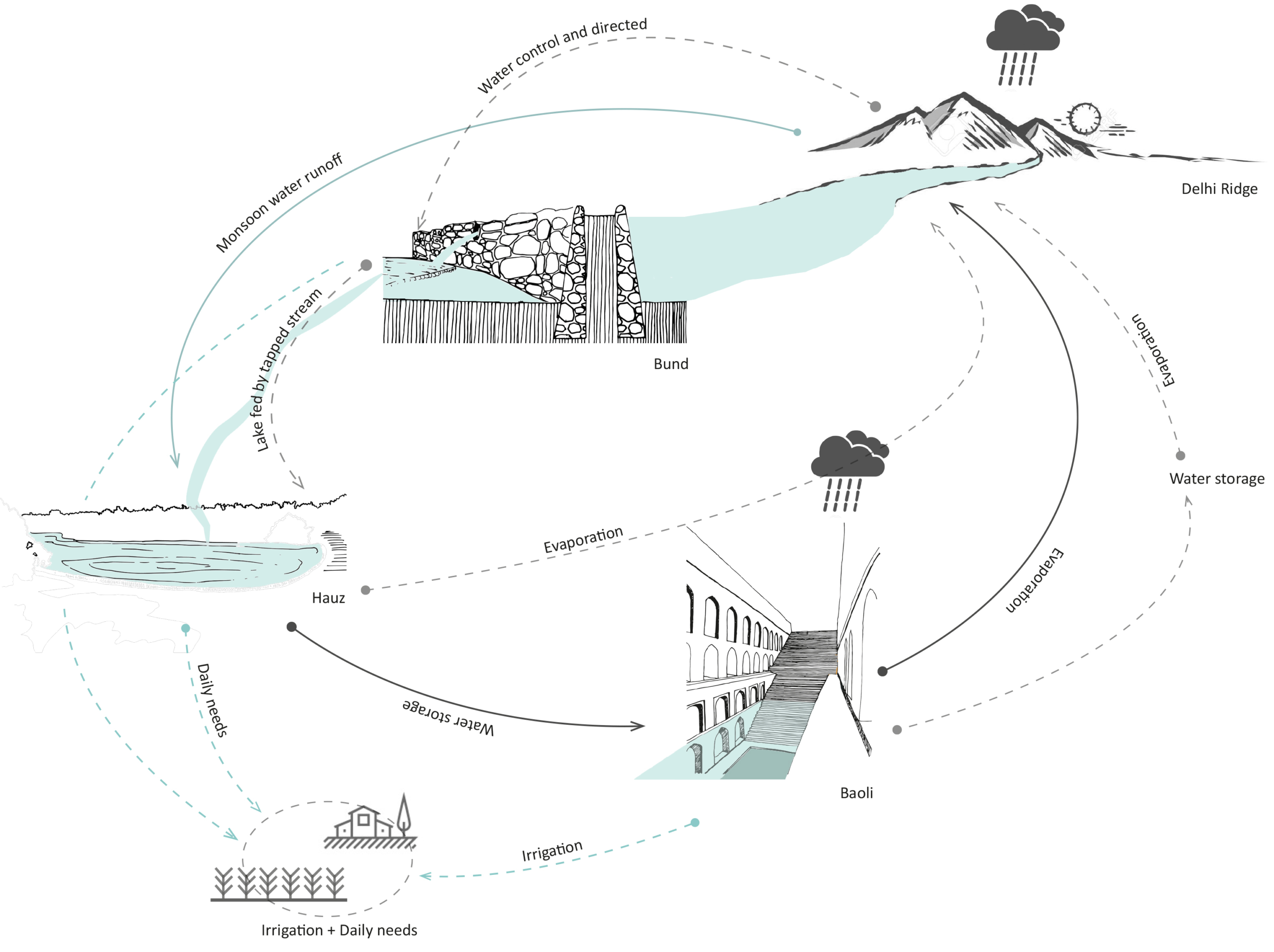
Bund network along Delhi Ridge.
Delhi sultanate waterworks developed during the early 13th century. They took three main forms – the bund network (embankment), hauz (water tank), and baoli (stepwell). These reflect the main strategies of the Delhi Sultanate water works – the bund network helps in directing and capturing the runoff from the ridge, the hauz stores the surplus monsoon surface water runoff and recharges groundwater while the baolis tap into the shallow groundwater along with storing rainwater.
Circular Stories
Circularity of the Delhi Sultanate Waterworks system.
Delhi Sultanate waterworks or harvesting structures were well coordinated with one another, each structure supporting the existence of the other. The bunds, the royal tanks called hauz and the baoli storage structures aided water evaporation and condensation into the atmosphere which again would be captured in the ridge landscape during monsoon.
Today, these water structures lie in a dilapidated state with some having been restored for heritage and tourism purposes. Thus, it is important to learn from past methods of harvesting water to overcome the hydrological problems Delhi is facing today.
Water as a driving force in the historical production of staple food: bread.
Gloria Rivero-Lamela 2019
The Sierra de Cádiz is located in the north-eastern end of the province of Cádiz; within Andalusia, in Spain. It comprises a large part of the Sierra de Grazalema Natural Park, declared a Biosphere Reserve in January 1977 and a Natural Park in December 1984.
It presents a rugged orography of steep slopes, which causes the Sierra de Cádiz to be the area where the provincial hydrographic network springs. The Majaceite, Guadalete, Guadalporcún and the Zahara and Hurones reservoirs stand out.
In addition to these physical issues, it is a cultural region, since it has been an isolated area (Hispanic-Muslim border during more than two centuries) that has generated among its inhabitants the awareness of sharing a common history and a cultural past.
Catchment area of Sierra de Cadiz.
They are, in addition, functional architectural interventions: for its industrial use and for the required productive profitability, water was necessary for its operation. Therefore, these mills were built with the precision and logic of the small hydraulic engineering works that, together with other minor and usual works in these places, such as ditches, canals, ponds, etc., make up a network of constructions aimed at control and management of hydrological resources that the artisan industries of the Sierra de Cádiz region require.
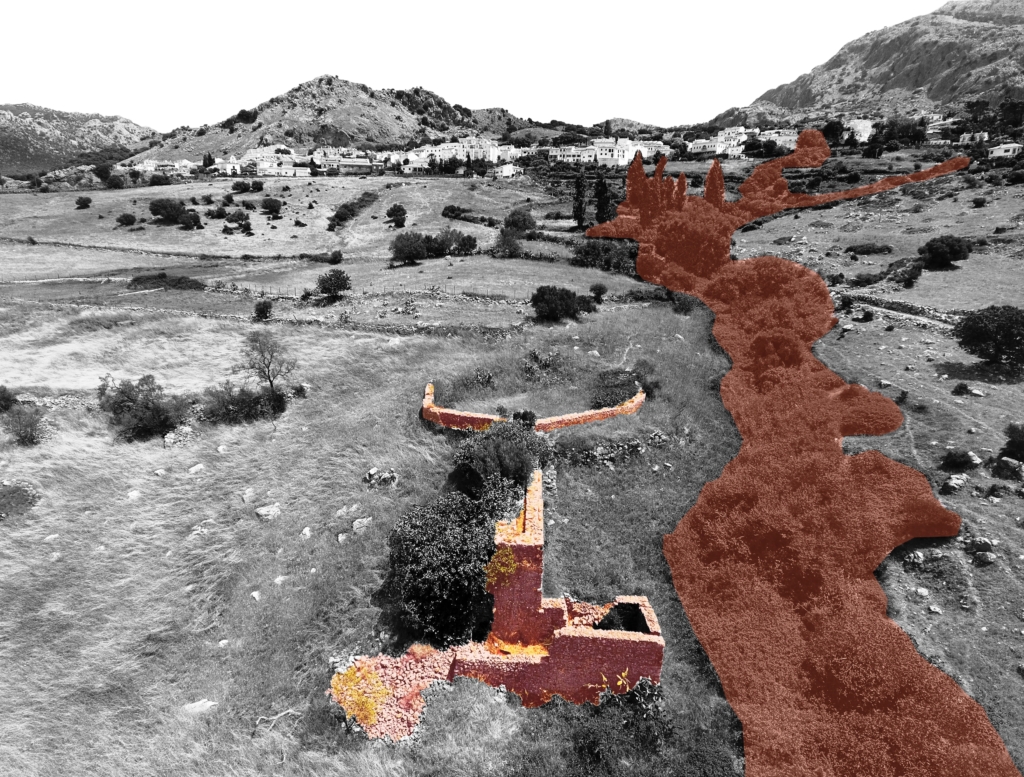
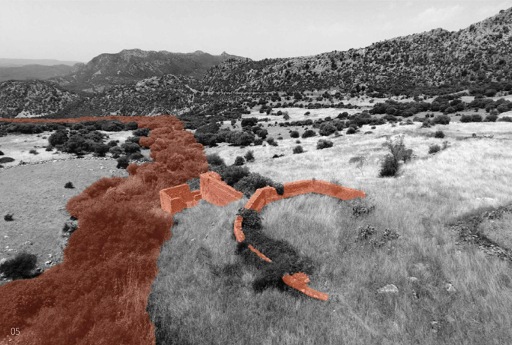
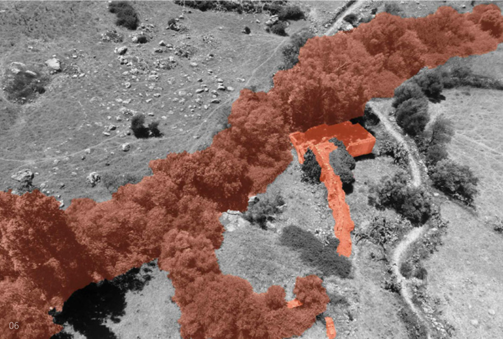
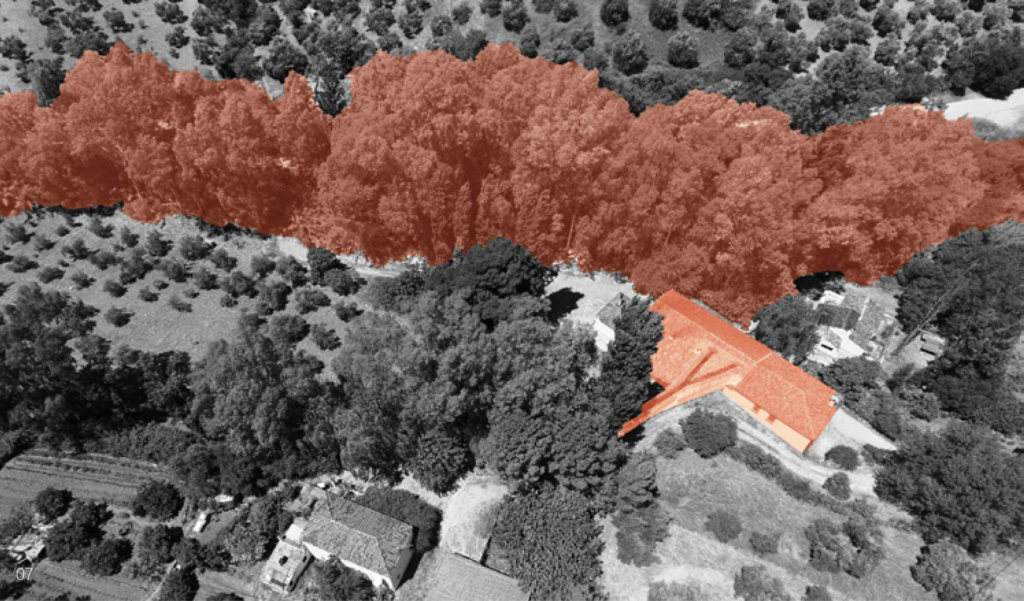
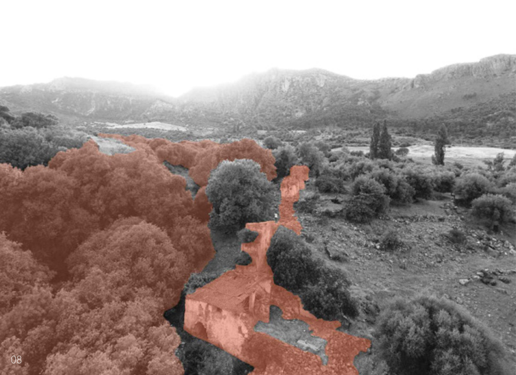
Clockwise. Water mill “Segundo”, riverside of Arroyo Seco, Benaocaz; Water mill “Primero”, riverside of Arroyo Seco, Benaocaz; Water mill “Alto”, riverside of Arroyomolinos, Zahara de la Sierra; Water mill “El Caballo”, riverside of Gaidovar, ZGrazalema.
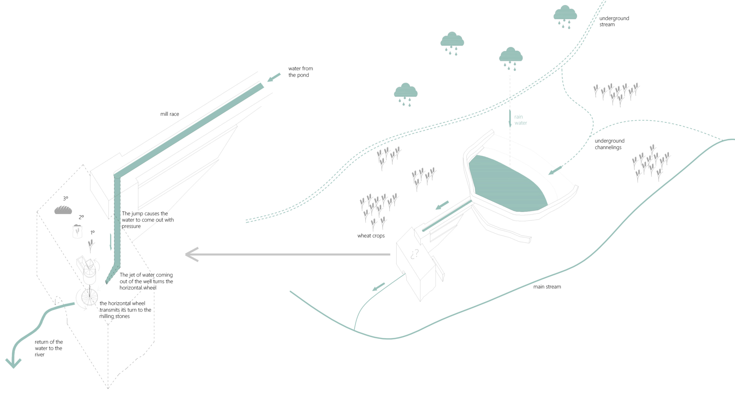
The function of the mills determines its design. On a small scale, the mill is distinguished by its location close to the rivers and by the external infrastructure works that channel the water to its interior: the millrace, the well and the wheelhouse.
All the water mills of the Sierra de Cádiz have a horizontal wheel and a well, one or two at most, and they may or may not have a pond. They were built when the watercourses had no speed or sufficient flow.
Almost all the mills had a mixed structure with masonry load-bearing walls of irregular stone, taken with mortar of sand and lime, 60-80 cm thick, plastered with lime and wooden beams. Most of the roofs had one or two water structures, also made with wooden structure, thatched and Arab tile. The main space that articulates the building is the grinding room, located above the wheelhouse.
If it exists, the pond is built where the slope of the land is not excessive to achieve, with minimal construction resources, store as much water as possible. The water is conducted from the pond to the well by the millrace, which bypasses the topography. The well is located in the area of the greatest slope so that the waterfall generates enough force to move the horizontal wheel. The position and length of the millrace result from the position of the pond and the well according to the topography. The system is further optimized with the mill’s proximity to the river for the immediate return of the water to the natural course.
Kamalir and Nandur Clearing waterways and planting rice
Kamalir is cleaning waterways from weeds and parasites. It is done by the men in Kampung Naga as part of regular community activities before the planting season. Nandur is the activity of planting rice in the fields. This includes regulating the amount of water collected in each parcel to suit the needs of rice seeds to grow properly.
In Kampung Naga, rice is pounded manually using traditional tools. This activity is carried out at the rice husking station which is built on a fishpond. Rice husks will be thrown into fishpond to feed the fish.
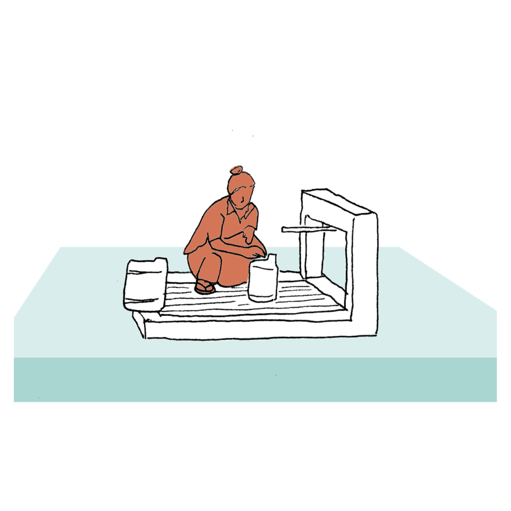
Nyusu air – spring water – is the only source of drinking water in Kampung Naga. The inhabitants collect the Nyusu water from the faucet at a platform on a fishpond.
Project: Kampung Naga
Climate: Tropical – Mild temperate humid
Year: Current
Water Type: Fresh water
Landscape: Plains
Meaning: Utilitarian
Water workers & users: Inhabitants
Material: Concrete & Bamboo
Period: Fixed construction for daily activities
Use or Function : Collect potable water from the spring
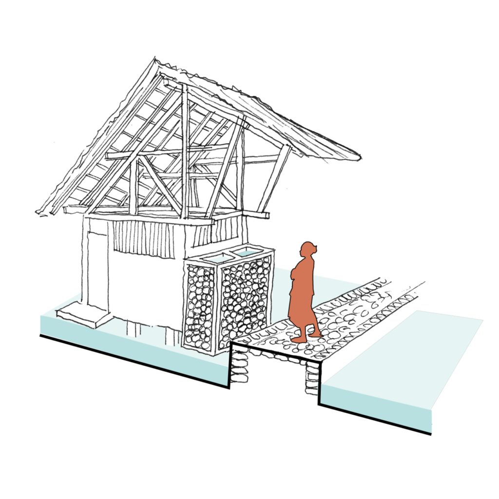
In Kampung Naga, toilet units were built above the fishponds in a communal area outside the settlement area. Each latrine has 2 water tanks that separate water from the river and the spring.